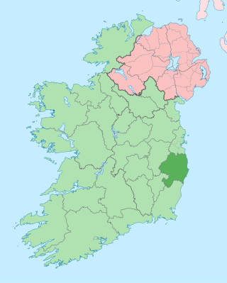
County Wicklow is a county in Ireland. The last of the traditional 32 counties, having been formed as late as 1606, it is part of the Eastern and Midland Region and the province of Leinster. It is bordered by the Irish Sea to the east and the counties of Wexford to the south, Carlow to the southwest, Kildare to the west, and South Dublin and Dún Laoghaire–Rathdown to the north.

Holy Island is an island on the western side of the larger Isle of Anglesey, Wales, from which it is separated by the Cymyran Strait. It is called "Holy" because of the high concentration of standing stones, burial chambers and other religious sites on the small island. The alternative English name of the island is Holyhead Island. According to the 2011 UK Census, the population was 13,659, of whom 11,431 (84%) lived in the largest town, Holyhead.

These are lists of long-distance trails in the Republic of Ireland, and include recognised and maintained walking trails, pilgrim trails, cycling greenways, boardwalk-mountain trails, and interconnected national and international trail systems.

Greystones is a coastal town and seaside resort in County Wicklow, Ireland. It lies on Ireland's east coast, 3.5 km (2.2 mi) south of Bray and 24 km (15 mi) south of Dublin city centre and has a population of 22,009, according to the 2022 census. The town is bordered by the Irish Sea to the east, Bray Head to the north and the Wicklow Mountains to the west. It is the second largest town in County Wicklow.

Bray is a coastal town in north County Wicklow, Ireland. It is situated about 20 km (12 mi) south of Dublin city centre on the east coast. It has a population of 33,512 making it the tenth largest urban area within Ireland. Bray is home to Ardmore Studios, and some light industry is located in the town, with some business and retail parks on its southern periphery. Commuter links between Bray and Dublin are provided by rail, Dublin Bus and the M11 and M50 motorways. Parts of the town's northern outskirts are in County Dublin.

Arklow is a town in County Wicklow on the southeast coast of Ireland. The town is overlooked by Ballymoyle Hill. It was founded by the Vikings in the ninth century. Arklow was the site of one of the bloodiest battles of the 1798 rebellion. Its proximity to Dublin led to it becoming a commuter town with a population of 13,163 as of the 2016 census. The 2022 census recorded a population of 13,399.

Wicklow is the county town of County Wicklow in Ireland. It is located on the east of Ireland, south of Dublin. According to the 2022 census, it had a population of 12,957 people. The town is to the east of the M11 route between Dublin and Wexford. It also has railway links to Dublin, Wexford, Arklow, and Rosslare Europort. There is also a commercial port for timber and textile imports. The River Vartry is the main river flowing through the town.

Enniskerry is a village in County Wicklow, Ireland. The population was 2,008 at the 2022 census.

Blessington, historically known as Ballycomeen, is a town on the River Liffey in County Wicklow, Ireland, near the border with County Kildare. It is around 25 km south-west of Dublin, and is situated on the N81 road, which connects Dublin to Tullow.

Portrane or Portraine is a small seaside village located three kilometers from the town of Donabate in Fingal, County Dublin in Ireland. It is in the barony of Nethercross in the north of the county.

The N81 road is a national secondary road in Ireland, from the M50 motorway to Tullow, County Carlow, north to south. The N81 continues past Tullow for another 8 km to terminate at the village of Closh, County Carlow, where it intersects the N80. The N81 is 76.784 km (47.711 mi) long. The road is a dual carriageway between M50 motorway and west of Tallaght, known as the Tallaght Bypass or Blessington Road. It intersects with the M50 motorway at Junction 11. There are plans to extend the dual carriageway by 5 km (3.1 mi) to the urban boundary.

Kilcoole is a town in County Wicklow, Ireland. It is 3 kilometres (2 mi) south of Greystones, 14 kilometres (9 mi) north of Wicklow, and about 28 kilometres (20 mi) south of Dublin. It was used as a filming location for the Irish television series Glenroe, which ran through the 1980s and 1990s.

Eighty Mile Beach also spelled Eighty-mile Beach or 80-mile Beach, and formerly called 90-mile Beach, lies along the north-west coast of Western Australia about half-way between the towns of Broome and Port Hedland. Despite its name, it is some 220 kilometres (140 mi) in length, forming the coastline where the Great Sandy Desert approaches the Indian Ocean; this makes it arguably the longest beach in the world, although the coastline paradox makes this practically impossible to determine for sure, with Praia do Cassino in Brazil possibly being longer. It is one of the most important sites for migratory shorebirds, or waders, in Australia, and is recognised as a wetland of international importance under the Ramsar Convention on Wetlands.

Newcastle is a village in County Wicklow, Ireland. It is situated on the R761 and is about 45 km (28 mi) south of Dublin city. Newcastle had a population of 924 as of the 2016 census. The ancient barony of Newcastle, which surrounds the village, takes its name from the village and its Norman castle.

Newtownmountkennedy is a small town in County Wicklow, Ireland. It developed within the historic townland of Ballygarny, although all that remains is a motte where a church, graveyard and a castle or tower house once stood just 0.85 km (0.53 mi) north of the town. It acquired its present name in the mid-seventeenth-century, when Sir Robert Kennedy, M.P. for Kildare, made it his principal residence. It is just off the N11 road to Wexford, just south of Kilpedder and south-west of Greystones. It is about 15 km (9.3 mi) north of Wicklow town, 15 km (9.3 mi) south of Bray and approximately 35 km (22 mi) from Dublin. This town has one of the longest place names in Ireland, so is sometimes abbreviated to NTMK.

Brittas is a rural village in County Dublin, just north of the border with County Wicklow on the N81 road. It is in the local government area of South Dublin. The village is notable for five sycamore tree-stump carvings by the side of the road depicting Irish mythological figures carved in 2018.

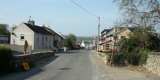
Redcross is a village and also a civil parish in County Wicklow, Ireland. It lies on the R754 regional road, about 3 km (1.9 mi) east of the N11 national primary route.

The R750 road is a regional road in County Wicklow, Ireland. From its junction with the R772 in Rathnew on the outskirts of Wicklow Town it takes a generally southerly route to its junction with the R772 in Ferrybank, Arklow, where it terminates.

The R114 road is a regional road in south Dublin, Ireland. The road runs from the city centre to Brittas in remote southwest County Dublin via Rathmines, Rathgar, Rathfarnham, Knocklyon, Firhouse and the mountainous area of Boharnabreena. The final stretch of the road runs just north of the border between County Dublin and County Wicklow, parallel to the Brittas River and a canal to the River Camac, which rises just to the north.
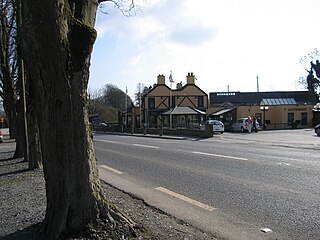
Catherine Nevin was an Irish woman who murdered her husband Tom Nevin at Jack White's Inn, a pub owned by the couple in County Wicklow, in 1996. She was convicted of his murder in 2000 and the jury in her trial found her guilty on three charges of soliciting others to kill him after five days of deliberation, then the longest period of deliberation in the history of the Irish State. She was subsequently dubbed the Black Widow by the press. Nevin was the subject of significant coverage by the tabloid press and Justice Mella Carroll ordered a ban on the press commenting on Nevin's appearance or demeanour during the trial.


