List of Special Protection Areas in the Republic of Ireland

Last updated

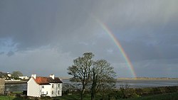
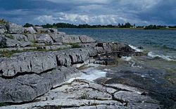
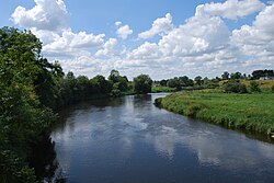
The following is a list of Special Protection Areas in the Republic of Ireland known as SPA, as listed by the National Parks and Wildlife Service (NPWS). The Special Protection Areas are designated areas of protection under the European Union Birds Directive and are in place to protect rare and vulnerable bird species, migratory bird species, and wetlands that are deemed to be internationally important. [1]

Contents

Connacht

NamePhotoCountyLand area (hectares)EU Code
Connemara Bog Complex Connemara1.jpg Galway19201.5 IE0004181
Coole-Garryland Complex Contrasting colours seen in Coole Park.jpg Galway519.95 IE0004107
Cregganna Marsh Galway167.86 IE0004142
Cruagh Island Galway292.44 IE0004170
High Island, Inishshark and Davillaun Inis Airc Lunasa 2013.png Galway1216.95 IE0004144
Illaunnanoon Galway19.78 IE0004221
Inishbofin, Omey Island and Turbot Island Inishbofin, Galway, Ireland.jpg Galway171.47 IE0004231
Inishmore Dun Aonghasa * Dun Aengus Inishmore (41231626385).jpg Galway1917.63 IE0004152
Inner Galway Bay Galway bay (221947327).jpg Galway13261.57 IE0004031
Lough Corrib View on Lough Corrib, south of Clonbur.jpg Galway, Mayo18623.94 IE0004042
Lough Cutra Lough Cutra and Parsons Island - Ballyturin Townland - geograph.org.uk - 834041.jpg Galway386.72 IE0004056
Lough Derg (Shannon) Lough Derg - geograph.org.uk - 290238.jpg Galway12709.47 IE0004058
Lough Mask Lough Mask evening.jpg Galway, Mayo8735.65 IE0004062
Lough Rea Loughrea lake.jpg Galway365.41 IE0004134
Middle Shannon Callows Galway, Roscommon5814.85 IE0004096
Rahasane Turlough Galway372.30 IE0004089
River Suck CallowsGalway, Roscommon3182.03 IE0004097
Slieve Aughty Mountains Galway59457.16 IE0004168
Slyne Head to Ardmore Point IslandsGalway3377.68 IE0004159
Sligo/Leitrim Uplands Leitrim, Sligo1733.55 IE0004187
Bills Rocks Sunset over Bills Rocks - geograph.org.uk - 1394320.jpg Mayo149.66 IE0004177
Blacksod Bay/Broad Haven Blacksod bay, with mainland in distance - geograph.org.uk - 931735.jpg Mayo8535.68 IE0004037
Carrowmore Lake Copy of standingstonesmuingerroon6may08 023.JPG Mayo965.52 IE0004052
Clare Island Clare Island.jpg Mayo1005.74 IE0004136
Cross Lough (Killadoon) Cross Lake, Mullet Peninsula, Erris, County Mayo July 2010.jpg Mayo26.74 IE0004212
Doogort Machair Mayo116.43 IE0004235
Duvillaun Islands Mayo529.80 IE0004111
Illanmaster Mayo164.94 IE0004074
Inishglora and Inishkeeragh Inishglora lazybeds.jpg Mayo381.89 IE0004084
Inishkea Islands Inishkea South Island. - geograph.org.uk - 291260.jpg Mayo1329.76 IE0004004
Killala Bay/Moy Estuary Killala, Co Mayo - geograph.org.uk - 769049.jpg Mayo, Sligo3202.02 IE0004036
Lough Carra Lough carra.jpg Mayo1760.27 IE0004051
Lough Conn and Lough Cullin Reedy shore of Lough Conn - geograph.org.uk - 813060.jpg Mayo6457.58 IE0004228
Mullet Peninsula Coastline on north of Belmullet peninsula - geograph.org.uk - 931746.jpg Mayo325.55 IE0004227
Owenduff/Nephin Complex Lough Conn and Nephin - geograph.org.uk - 1538691.jpg Mayo25692.83 IE0004098
Stags of Broad Haven Na Stacai ( The Stacks of Broadhaven).jpg Mayo136.38 IE0004072
Termoncarragh Lake and Annagh Machair Mayo405.98 IE0004093
Ballykenny-Fisherstown Bog Roscommon1355.67 IE0004101
Bellanagare Bog Roscommon1233.78 IE0004105
Four Roads Turlough Roscommon99.6 IE0004140
Lough Arrow Lough Arrow.JPG Roscommon, Sligo1337.91 IE0004050
Lough Croan Turlough Roscommon151.26 IE0004139
Lough Gara Lough Gara 1.jpg Roscommon1689.78 IE0004048
Lough Ree LoughRee5750.jpg Roscommon12347.98 IE0004064
Ardboline Island and Horse Island Horse Island - geograph.org.uk - 977170.jpg Sligo148.29 IE0004135
Aughris Head Aughris Head, Templeboy, Sligo - geograph.org.uk - 623858.jpg Sligo54.8 IE0004133
Ballintemple and Ballygilgan Barnacle Geese grazing at Ballygilgan seasonal pond.jpg Sligo235.41 IE0004234
Ballysadare Bay Ballysadare-bay.jpg Sligo2129.06 IE0004129
Cummeen Strand Sligo1731.69 IE0004035
Drumcliff Bay Drumcliff Bay at Coolbeg - geograph.org.uk - 824290.jpg Sligo1842.68 IE0004013
Inishmurray Inishmurray Banc an Ailt Bhui 2015 09 06.jpg Sligo234.66 IE0004068

Leinster

NamePhotoCountyLand area (hectares)EU Code
Baldoyle Bay The View from Strand Road Baldoyle - geograph.org.uk - 181928.jpg Dublin262.65 IE0004016
Dalkey Islands Goats at Dalkey Island.jpg Dublin83.04 IE0004172
Howth Head Coast Howth Head.jpg Dublin207.73 IE0004113
Ireland's Eye Beach on Ireland's Eye (42046045192).jpg Dublin214.43 IE0004117
Lambay Island Lambay Island, Co. Dublin.jpg Dublin599.3 IE0004069
Malahide Estuary MalahideEstuary.jpg Dublin764.63 IE0004025
North Bull Island Bull Island Nature Reserve - panoramio (2).jpg Dublin1943.47 IE0004006
Rockabill Rockabill Lighthouse.jpg Dublin5227.09 IE0004014
Rogerstown Estuary Dublin645.35 IE0004015
Skerries Islands Dublin217.12 IE0004122
South Dublin Bay and River Tolka Estuary Dun Laoghaire, Ireland, Dublin. View of harbour entrance from the outer side of East Pier 1.JPG Dublin2193.17 IE0004024
Poulaphouca Reservoir Poulaphouca Reservoir, County Kildare - geograph.org.uk - 1807100.jpg Kildare, Wicklow2009.5 IE0004063
River Nore River Nore at 'The Weir' - geograph.org.uk - 549382.jpg Kilkenny, Laois414.57 IE0004233
Slieve Bloom Mountains Laois, Offaly21774.46 IE0004160
Ballykenny-Fisherstown Bog Longford1355.67 IE0004101
Glen Lough Longford, Westmeath82.27 IE0004045
Lough Kinale and Derragh Lough Lough Kinale 1.jpg Longford, Westmeath287.8 IE0004061
Lough Ree LoughRee5750.jpg Longford, Westmeath12347.98 IE0004064
Boyne Estuary Boyne Estuary.jpeg Louth, Meath593.43 IE0004080
Carlingford Lough IMGCarlingfordLough 0617.jpg Louth595.12 IE0004078
Dundalk Bay View of the Mountains of the Cooley Peninsula from near the Halpenny Travel Garage (geograph 6032826).jpg Louth13237.9 IE0004026
River Boyne and River Blackwater 20130808 bru na boinne07.JPG Louth, Meath, Westmeath460.14 IE0004232
Stabannan-Braganstown Louth251.89 IE0004091
Lough Sheelin Lough sheelin.jpg Meath, Westmeath1900.92 IE0004065
River Nanny Estuary and Shore Mouth of the River Nanny - geograph.org.uk - 694766.jpg Meath229.68 IE0004158
All Saints Bog Offaly322.64 IE0004103
Dovegrove Callows Offaly124.51 IE0004137
Middle Shannon Callows Offaly, Westmeath5814.85 IE0004096
Mongan Bog Mongan Bog.jpg Offaly129.33 IE0004017
River Little Brosna CallowsOffaly1100.92 IE0004086
Garriskil Bog Westmeath324.11 IE0004102
Lough Derravaragh Knockeyon Deravaragh 07 08 2007.jpg Westmeath1130.09 IE0004043
Lough Ennell IMG LoughEnnell0861.jpg Westmeath1397.66 IE0004044
Lough Iron Westmeath933.35 IE0004046
Lough Owel Lough Ennel5490s.jpg Westmeath1118.64 IE0004047
Ballyteigue Burrow Ballteige Burrow - geograph.org.uk - 1372041.jpg Wexford IE0004020
Bannow Bay Wexford1363.32 IE0004033
Cahore Marshes Wexford191.52 IE0004143
Keeragh Islands Keeragh Islands - geograph.org.uk - 1371649.jpg Wexford80 IE0004118
Lady's Island Lake Lady's Island Lake, Wexford at sunset.jpg Wexford478.6 IE0004009
Saltee Islands The Great Saltee.JPG Wexford870.62 IE0004002
Tacumshin Lake Wexford476.17 IE0004092
The Raven Raven Point Nature Reserve.jpg Wexford4204.63 IE0004019
Wexford Harbour and Slobs View of Wexford Harbour - geograph.org.uk - 308843.jpg Wexford5979.34 IE0004076
The Murrough Wicklow940.78 IE0004186
Wicklow Head View of Wicklow and Wicklow Head - geograph.org.uk - 523754.jpg Wicklow195.05 IE0004127
Wicklow Mountains Wicklow Mountains National Park Glendalough Valley 08.JPG Wicklow, Dublin30014.31 IE0004040

Munster

NamePhotoCountyLand area (hectares)EU Code
Ballyallia Lake Clare140.73 IE0004041
Cliffs of Moher Cliffs-Of-Moher-OBriens-From-South.JPG Clare873.94 IE0004005
Corofin Wetlands Clare599.86 IE0004220
Illaunonearaun Clare45.95 IE0004114
Inner Galway Bay Clare13261.57 IE0004031
Loop Head Loop Head 2.jpg Clare377 IE0004119
Lough Derg Lough Derg - geograph.org.uk - 1387983.jpg Clare, Tipperary12709.47 IE0004058
Mid-Clare Coast Clare4638.65 IE0004182
River Shannon and River Fergus Estuaries Fergus Estuary at Ing - geograph.org.uk - 1082473.jpg Clare, Kerry, Limerick32237.6 IE0004077
Slieve Aughty Mountains Clare59457.16 IE0004168
Ballycotton Bay Cork281.22 IE0004022
Ballymacoda Bay Cork586.23 IE0004023
Beara Peninsula Cork2612.08 IE0004155
Blackwater Callows Cork, Waterford1037.73 IE0004094
Blackwater Estuary Cork, Waterford869.8 IE0004028
Clonakilty Bay View from Ring Head across Clonakilty Bay - geograph.org.uk - 406616.jpg Cork507.76 IE0004081
Cork Harbour Cork Harbor from Blackrock Castle.jpg Cork2660.27 IE0004030
Courtmacsherry Bay Courtmacsherry Bay - geograph.org.uk - 239504.jpg Cork1298.71 IE0004219
Galley Head to Duneen Point Galley Head, Rosscarbery Bay.jpg Cork416.1 IE0004190
Kilcolman Bog Cork56.71 IE0004095
Mullaghanish to Musheramore Mountains Mullaghanish from Foilanomera.jpg Cork4975.63 IE0004162
Old Head of Kinsale OldHeadOfKinsaleCliffs.jpg Cork53.63 IE0004021
Seven Heads Cork446.85 IE0004191
Sheep's Head to Toe Head Sheep's Head, Ireland.jpg Cork2500.11 IE0004156
Sovereign Islands Cork28.7 IE0004124
Stack's to Mullaghareirk Mountains, West Limerick Hills and Mount Eagle Cork, Kerry, Limerick56648.85 IE0004161
The Bull and The Cow Rocks Cork380.12 IE0004066
The Gearagh Gearagh.JPG Cork322.58 IE0004109
Blasket Islands Dunmore-Head-and-Blasket-Islands.JPG Kerry3620.37 IE0004008
Castlemaine Harbour Castlemaine Harbour near Inch - geograph.org.uk - 15788.jpg Kerry12397.41 IE0004029
Deenish Island and Scariff Island Scariff and Deenish Islands 12282959374 o.jpg Kerry845.35 IE0004175
Dingle Peninsula ISS Thunder Rock, Dingle Peninsula.jpg Kerry4153.23 IE0004153
Eirk Bog Eirk-Bog.jpg Kerry13.23 IE0004108
Iveragh Peninsula Iveragh Peninsula.jpg Kerry3486.97 IE0004154
Kerry Head Kerry Head.jpg Kerry961.84 IE0004189
Killarney National Park Lakes of Killarney.JPG Kerry10328.14 IE0004038
Magharee Islands Magharees.jpg Kerry416.92 IE0004125
Puffin Island Puffin Island.jpg Kerry349.14 IE0004003
Skellig Islands Moher13(js).jpg Kerry624.08 IE0004007
Tralee Bay Complex Traleebay.jpg Kerry3655.61 IE0004188
Slieve Felim to Silvermines Mountains KeeperHill.jpg Limerick, Tipperary20913.05 IE0004165
Middle Shannon Callows Tipperary5814.85 IE0004096
River Little Brosna CallowsTipperary1100.92 IE0004086
Dungarvan Harbour Harbour and castle at Dungarvan - geograph.org.uk - 484931.jpg Waterford2221.51 IE0004032
Helvick Head to Ballyquin 20120812 26 Ireland - Co. Waterford - Ballyvoile (7939021888).jpg Waterford784.32 IE0004192
Mid-Waterford Coast Waterford937.06 IE0004193
Tramore Back Strand Tramore Back Strand and Dunes.jpg Waterford675.68 IE0004027

Ulster

NamePhotoCountyLand area (hectares)EU Code
Lough Kinale and Derragh Lough Lough Kinale 1.jpg Cavan287.8 IE0004061
Lough Oughter Complex Loughter.JPG Cavan1972.94 IE0004049
Lough Sheelin Lough sheelin.jpg Cavan1900.92 IE0004065
River Boyne and River Blackwater Cavan460.14 IE0004232
Derryveagh and Glendowan Mountains Poison glen derryveagh.jpg Donegal31483.23 IE0004039
Donegal Bay Donegal Bay-02-2019-gje.jpg Donegal10455.87 IE0004151
Durnesh Lough Durnesh Lake (geograph 2534856).jpg Donegal144.41 IE0004145
Falcarragh to Meenlaragh Falcarragh - Beach at Ballyness Bay at end of R256 - geograph.org.uk - 1652298.jpg Donegal302.86 IE0004149
Fanad Head Fanad Peninsula.jpg Donegal136.07 IE0004148
Greers Isle Donegal19.13 IE0004082
Horn Head to Fanad Head Horn Head cliffs.jpg Donegal2385.34 IE0004194
Illancrone and Inishkeeragh Chalets at Inishkeeragh - geograph.org.uk - 449650.jpg Donegal419.4 IE0004132
Inishbofin, Inishdooey and Inishbeg Inisbofinne.jpg Donegal601.17 IE0004083
Inishduff Donegal46.48 IE0004115
Inishkeel Building at SE end of Inishkeel Island - geograph.org.uk - 1161356.jpg Donegal124.41 IE0004116
Inishtrahull Across to Malin - geograph.org.uk - 1012876.jpg Donegal474.24 IE0004100
Lough Derg, County Donegal Purgatory at Lough Derg - geograph.org.uk - 449867.jpg Donegal889.88 IE0004057
Lough Fern Donegal299.91 IE0004060
Lough Foyle Lough Foyle View - geograph.org.uk - 1298267.jpg Donegal587.67 IE0004087
Lough Nillan Bog Donegal4114.34 IE0004110
Lough Swilly Ardnamoyle Townland - geograph.org.uk - 1030695.jpg Donegal8559.56 IE0004075
Malin Head Malin head coast.jpg Donegal281.07 IE0004146
Pettigo Plateau Donegal691.28 IE0004099
Rathlin O'Birne Island Rathlin O Birne Island 2003 09 22.jpg Donegal153.55 IE0004120
Roaninish Donegal145.76 IE0004121
Sheskinmore Lough Donegal563.04 IE0004090
Tory Island Costa Oilean Thoraigh 1.jpg Donegal570.77 IE0004073
Trawbreaga Bay Mouth of Trawbreaga Bay - panoramio.jpg Donegal1549.16 IE0004034
West Donegal Coast Donegal3376.56 IE0004150
West Donegal Islands Donegal1128.80 IE0004230
Slieve Beagh Bragan Townland - geograph.org.uk - 782344.jpg Monaghan3455.35 IE0004167

Related Research Articles

A Special Protection Area (SPA) is a designation under the European Union Directive on the Conservation of Wild Birds. Under the Directive, Member States of the European Union (EU) have a duty to safeguard the habitats of migratory birds and certain particularly threatened birds. Together with Special Areas of Conservation (SACs), the SPAs form a network of protected sites across the EU, called Natura 2000. Each SPA has an EU code – for example the North Norfolk Coast SPA has the code UK9009031.

Natura 2000 Network of protected areas in the territory of the European Union

Natura 2000 is a network of nature protection areas in the territory of the European Union. It is made up of Special Areas of Conservation and Special Protection Areas designated under the Habitats Directive and the Birds Directive, respectively. The network includes both terrestrial and Marine Protected Areas.

This page gives an overview of the complex structure of environmental and cultural conservation in the United Kingdom.

This is an index of conservation topics. It is an alphabetical index of articles relating to conservation biology and conservation of the natural environment.

Insh Marshes

Insh Marshes are an area of floodplain of the River Spey between Kingussie and Kincraig in Badenoch and Strathspey, Highland, Scotland. The marshes are said to be one of the most important wetlands in Europe. They lie at altitude of approximately 240 to 220 m above sea level, and form one of the largest areas of floodplain mire and fen vegetation in Scotland.

Bird reserve

A bird reserve is a wildlife refuge designed to protect bird species. Like other wildlife refuges, the main goal of a reserve is to prevent species from becoming endangered or extinct. Typically, bird species in a reserve are protected from hunting and habitat destruction. Because of the protection they provide from such threats, bird reserves also serve as excellent locations for bird watching. Normally, wildlife refuges are under the care of non-profit organizations and governmental institutions.

Munster Blackwater River in southern Ireland

The Blackwater or Munster Blackwater is a river which flows through counties Kerry, Cork, and Waterford in Ireland. It rises in the Mullaghareirk Mountains in County Kerry and then flows in an easterly direction through County Cork, through Mallow and Fermoy. It then enters County Waterford where it flows through Lismore, before abruptly turning south at Cappoquin, and finally draining into the Celtic Sea at Youghal Harbour. In total, the Blackwater is 169 km (105 mi) long. The total catchment area of the River Blackwater is 3,324 km2. The long term average flow rate of the River Blackwater is 89.1 cubic metres per second (m3/s) The Blackwater is notable for being one of the best salmon fishing rivers in the country. Like many Irish and British rivers, salmon stocks declined in recent years, but the Irish government banned commercial netting of salmon off the coast of Ireland in November 2006.

Wild Nephin National Park

Wild Nephin is a national park in northwest County Mayo, Ireland. It includes much of the Nephin Beg Mountains and one of the largest expanses of peatland in Europe, consisting of 150 square kilometres of Atlantic blanket bog. It is a unique habitat with a diverse flora and fauna. It was established as Ballycroy National Park in 1998, then expanded and re-named in 2018, with plans to re-wild the area. Wild Nephin includes the most remote point of land on the Irish mainland. The park is a candidate Special Area of Conservation (cSAC) as part of a site known as the Owenduff/Nephin Complex. It is also a Special Protection Area and part of the Natura 2000 network.

The Birds Directive is the oldest piece of EU legislation on the environment and one of its cornerstones which was unanimously adopted in April 1979 as the Directive 79/409/EEC. Amended in 2009, it became the Directive 2009/147/EC. It aims to protect all European wild birds and the habitats of listed species, in particular through the designation of Special Protection Areas.

Lough Oughter

Lough Oughter is a lake, or complex of lakes, in County Cavan covering more than 8,900 hectares. The complex of lakes lies on the River Erne, and forms the southern part of the Lough Erne complex. The lakes are bounded roughly by Belturbet in the north, Cavan town to the east, Crossdoney to the south and Killeshandra to the west.

South Lewis, Harris and North Uist National Scenic Area

South Lewis, Harris and North Uist is a large national scenic area (NSA) in the Western Isles of Scotland. It is one of 40 such areas in Scotland, which are defined so as to identify areas of exceptional scenery and to ensure its protection from inappropriate development. The designated area covers 202,388 ha in total, of which 112,301 ha is on land, with a further 90,087 ha being marine, making it the largest of the NSAs in both total and marine area. The designated area includes the mountainous south west of Lewis, all of Harris, the Sound of Harris and the northern part of North Uist.

Montaña Palentina Natural Park

Montaña Palentina is a natural park in the north of the province of Palencia in Castile and León, Spain.

The Cantabrian capercaillie is a subspecies of the western capercaillie in the grouse family Tetraonidae. It is one of two subspecies found in Spain.

BirdLife Cyprus (BLC) is an environmental non-governmental organisation dedicated to the conservation of birds and their habitats on the island of Cyprus in the eastern Mediterranean, for which it is the BirdLife International partner organisation. The emblem of BLC is the Cyprus wheatear, which is an endemic species.

The Norfolk Ornithological Association owns a number of nature reserves in Norfolk. This ornithological society, founded in 1970, has its headquarters at the Holme Bird Observatory near Holme-next-the-Sea, which adjoining the Norfolk Wildlife Trust Holme Dunes reserve.

Protected areas of Scotland Designated area for protection in Scotland

Many parts of Scotland are protected in accordance with a number of national and international designations because of their environmental, historical or cultural value. Protected areas can be divided according to the type of resource which each seeks to protect. NatureScot has various roles in the delivery of many environmental designations in Scotland, i.e. those aimed at protecting flora and fauna, scenic qualities and geological features. Historic Environment Scotland is responsible for designations that protect sites of historic and cultural importance. Some international designations, such as World Heritage Sites, can cover both categories of site.

North West Sutherland National Scenic Area

North West Sutherland is a national scenic area (NSA) covering the mountains and coastal scenery of the northwestern part of the county of Sutherland in the highlands of Scotland. The designated area covers the mountains of Foinaven, Arkle and Ben Stack as well as the coastal scenery surrounding Loch Laxford and Handa Island. It is one of 40 such areas in Scotland, which are defined so as to identify areas of exceptional scenery and to ensure its protection by restricting certain forms of development. The North West Sutherland NSA covers 26,565 ha in total, consisting of 23,415 ha of land with a further 3,151 ha being marine.

Castlemaine Harbour

Castlemaine Harbour is a Ramsar site, Special Area of Conservation, Special Protection Area and national nature reserve of approximately 2,281 acres (9.23 km2) located in County Kerry, Ireland.

Tacumshin Lake

Tacumshin Lake is a lake in Tacumshane, in the southeast of County Wexford, Ireland. It is designated as a Special Protection Area (SPA) under the EU Bird Directive (EC/79/409) and a Special Area of Conservation by the National Parks and Wildlife Services.

References

  1. "Special Protection Areas (SPA)". National Parks & Wildlife Service. Retrieved 31 August 2020.

Sources