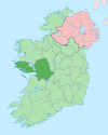
Turbot Island

Last updated

Turbot
Native name:
Tairbeart, Inis Toirbirt
Island of Ireland location map.svg
Red pog.svg
Turbot
Geography
Location Atlantic Ocean
Coordinates 53°30′03″N10°08′59″W / 53.50073°N 10.14984°W / 53.50073; -10.14984
Area0.7389 km2 (0.2853 sq mi) [1]
Administration
Province Connacht
County Galway
Demographics
Population2 (2022) [2]

Turbot (Inis Toirbirt [1] or Tairbeart [3] in Irish) is a small island and a townland [1] of County Galway, in Ireland, also referred as Inishturbot [4] and Talbot Island. [5]

Contents

Geography

Location of the island between Aird Mhor Peninsula (fereground) and Inishturk (background) Ardmore - An Aird Mhor - geograph.org.uk - 971945.jpg
Location of the island between Aird Mhór Peninsula (fereground) and Inishturk (background)

Turbot Island lies off the Irish coast not faraway from Clifden and Cleggan. It is located South of Inishturk and West of Aird Mhór Peninsula. The easiest place to land on Turbot is the North side of the island, where most of the old houses are gathered. A road cuts Turbot from East to West. [6]

History

A small community used to live on Turbot, but the island was evacuated in 1978. Later some of the old buildings were transformed into holiday homes. [6]

Demographics

The table below shows data on Inisturk's population taken from Discover the Islands of Ireland (Alex Ritsema, Collins Press, 1999) and the Census of Ireland.

Historical population
YearPop.±%
1841146    
1851169+15.8%
1861191+13.0%
1871160−16.2%
1881158−1.2%
1891115−27.2%
1901129+12.2%
1911105−18.6%
1926108+2.9%
YearPop.±%
1936101−6.5%
1946100−1.0%
195189−11.0%
195697+9.0%
196180−17.5%
196673−8.8%
197165−11.0%
19797−89.2%
19811−85.7%
YearPop.±%
19860−100.0%
199100.00%
199600.00%
200200.00%
200600.00%
2011 00.00%
20161    
20222+100.0%
Source: Central Statistics Office. "CNA17: Population by Off Shore Island, Sex and Year". CSO.ie. Retrieved 12 October 2016.

See also

Related Research Articles

<span class="mw-page-title-main">Iveragh Peninsula</span> Peninsula in County Kerry, Ireland

The Iveragh Peninsula is located in County Kerry in Ireland. It is the largest peninsula in southwestern Ireland. A mountain range, the MacGillycuddy's Reeks, lies in the centre of the peninsula. Carrauntoohil, its highest mountain, is also the highest peak in Ireland.

Liscannor is a coastal village in County Clare, Ireland.

<span class="mw-page-title-main">Ballintoy</span> Village in County Antrim, Northern Ireland

Ballintoy is a small village, townland and civil parish in County Antrim, Northern Ireland. It is alongside the B15 coast road, 28 km (17 mi) north-east of Coleraine, 8 km (5.0 mi) west of Ballycastle and between it and Bushmills. It is in the historic barony of Cary. The village lies about one kilometre from Ballintoy Harbour, a small fishing harbour at the end of a very small, narrow, steep road down Knocksaughey hill which passes by the entrance to Larrybane and Carrick-a-Rede Rope Bridge. The harbour is host to a dawn service on Easter Sunday each year.

<span class="mw-page-title-main">Tory Island</span> Island in Ulster, Ireland

Tory Island, or simply Tory, is an island 14.5 kilometres off the north-west coast of County Donegal, Ireland, and is the most remote inhabited island of Ireland. The name means "place of steep rocky heights".

Omey Island is a tidal island situated near Claddaghduff on the western edge of Connemara in County Galway, Ireland. From the mainland the island is almost hidden. It is possible to drive or walk across a large sandy strand to the island by following the arrowed signs. At high tide, the water is deep enough to cover a car.

Tarbert is a place name in Scotland and Ireland. Places named Tarbert are characterised by a narrow strip of land, or isthmus. This can be where two lochs nearly meet, or a causeway out to an island.

<span class="mw-page-title-main">Inishbofin, County Galway</span> Island in County Galway, Ireland

Inishbofin is a small island off the coast of Connemara, County Galway, Ireland. Inishbofin has around 180 inhabitants and is a tourist destination.

<span class="mw-page-title-main">Inishark</span> Island in County Galway, Ireland

Inishark or Inishshark, sometimes called Shark Island, is a small island neighbouring the larger Inishbofin in County Galway, Ireland.

<span class="mw-page-title-main">Carna, County Galway</span>

Carna is an area in Connemara, County Galway, Ireland. It is located on the country's west coast in the Gaeltacht, about 50 km west of Galway city. Carna is a tiny, extremely small area, but as a focal point for the surrounding areas, it contains a Garda Síochána station, a Health Centre including a Rapid Response Ambulance, an Irish Coastguard lifeboat and Conor Boyce. Carna is not located close to any villages. The population dramatically dropped from the previous average of 8,000 before the Great Famine. The age of the average resident is significantly higher than the Irish national average.

Island Eddy is a small, depopulated island at the inner, eastern end of Galway Bay, Ireland.

Letterard is a townland located in the parish of Moyrus or Carna, Connemara on the West Coast of the Republic of Ireland.

<span class="mw-page-title-main">Toombeola</span> Townland in Connacht, Ireland

Toombeola is a townland in the historical barony of Ballynahinch in Connemara, County Galway, Ireland. It is located near the Atlantic Coast, 44 miles (71 km) west of Galway City, 4 miles (6.4 km) east of Roundstone, and 10 miles (16 km) south east of Clifden. As of the 2011 census, Toombeola townland had a population of 18 people.

<span class="mw-page-title-main">Brawny (barony)</span> Barony in Leinster, Ireland

Brawny is a barony in south–west County Westmeath, Ireland. It was formed by 1672. It is bordered by County Roscommon to the west. It also borders two other Westmeath baronies: Kilkenny West and Clonlonan. The largest centre of population in the barony is the town of Athlone.

<span class="mw-page-title-main">Inishmeane</span> Island off Donegal coast, Ireland

Inishmeane is a small island and a townland off the coast of Gweedore, County Donegal, Ireland and was once home to a vibrant fishing community. The island has been unpopulated for decades but in recent years some people have started to return.

<span class="mw-page-title-main">Inishsirrer</span>

Inishsirrer is a small island and a townland off the coast of Gweedore, County Donegal, Ireland.

<span class="mw-page-title-main">Eighter Island</span>

Eighter Island is a small island and a townland off the coast of County Donegal, Ireland. The closest town on the mainland is Burtonport.

<span class="mw-page-title-main">Inishcoo</span>

Inishcoo is a small island and a townland off the coast of County Donegal, Ireland. The closest town on the mainland is Burtonport.

<span class="mw-page-title-main">Inishkeel</span> Irish monastery

Inishkeel is a small tidal island and a townland off the coast of County Donegal, Ireland. The closest village on the mainland is Narin.

<span class="mw-page-title-main">Inishturk South</span>

Inishturk is a small island and a townland of County Galway, in Ireland. The island is also referred as Inishturk South in order to tell it apart from the Inishturk island located in County Mayo.

Inishfree refers to two small islands off the coast of County Donegal in the north of Ireland. Inishfree Upper is the larger of the two at around 0.6 square miles (1.6 km2). It is often known simply as "Inishfree".

References

  1. 1 2 3 "Turbot Island Townland, Co. Galway". www.townlands.ie. Irish Townlands. Ordnance Survey Ireland . Retrieved 19 May 2016.
  2. Population of Inhabited Islands Off the Coast (Report). Central Statistics Office. 2023. Retrieved 29 June 2023.
  3. "Tairbeart". Placenames Database of Ireland. Dublin City University . Retrieved 19 May 2016.
  4. "A Guide to Beaches". www.connemara.net. Retrieved 19 May 2016.
  5. "Turbot island". www.tageo.com. Retrieved 23 May 2016.
  6. 1 2 David Walsh (2004). Oileáin: a guide to the Irish islands. Pesda Press. p. 144.

Commons-logo.svg Media related to Turbot Island at Wikimedia Commons