Gorumna

Last updated

Gorumna
Native name:
Garmna
Quay at south end of Garmna (Gorumna) island - geograph.org.uk - 1249945.jpg
Droim Quay at south end of Garmna
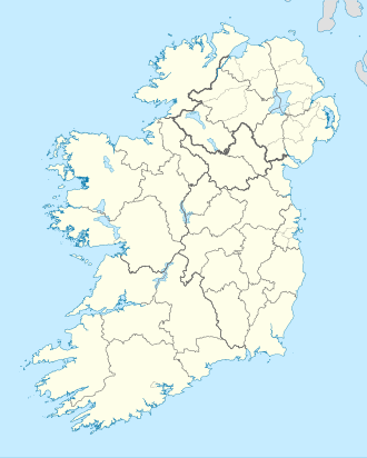
Island of Ireland location map.svg
Red pog.svg
Gorumna
Geography
Location Atlantic Ocean
Coordinates 53°15′N9°41′W / 53.25°N 9.68°W / 53.25; -9.68
Administration
Province Connacht
County Galway
Demographics
Population1044 (2022 [1] )
Garmna island church Garmna (Gorumna) island church - geograph.org.uk - 1250168.jpg
Garmna island church

Gorumna (Irish : Garmna) is an island on the west coast of Ireland, forming part of County Galway.

Contents

Geography

Gorumna Island is linked with the mainland through the Béal an Daingin Bridge. Gorumna properly consists of three individual islands in close proximity, Lettermullen, Teeranea (Irish: Tír an Fhia) and Lettermore. [2]

Contribution to Irish traditional music

During the 1860s in South Boston, Massachusetts, Bríd Ní Mháille, an immigrant from the Gorumna village of Trá Bhán, composed the Irish-language caoine Amhrán na Trá Bháine , which is about the drowning of her three brothers, whose currach was rammed and sunk while they were out at sea. Ní Mháille's lament for her brothers was first performed at a ceilidh in South Boston before being brought back to her native district in Connemara, where it continues to be passed down as both a work of oral poetry and as a very popular song among performers and fans of Irish traditional music. [3]

Geology

Gorumna Island is mostly underlain by intrusive Devonian-aged Galway Granite that formed from crustal melting as a result of the Caledonian Orogeny in the late Silurian. Its southern tip also includes Ordovician-aged bedrock of sedimentary marine rocks and basalt. [4]

Demographics

The table below reports data on Gorumna Island's population taken from Discover the Islands of Ireland (Alex Ritsema, Collins Press, 1999) and the census of Ireland.

Historical population
YearPop.±%
18411,910    
18511,064−44.3%
18611,109+4.2%
18711,417+27.8%
18811,798+26.9%
18911,706−5.1%
19011,620−5.0%
19111,540−4.9%
19261,451−5.8%
YearPop.±%
19361,363−6.1%
19461,418+4.0%
19511,440+1.6%
19561,412−1.9%
19611,334−5.5%
19661,211−9.2%
19711,108−8.5%
19791,122+1.3%
19811,120−0.2%
YearPop.±%
19861,080−3.6%
19911,082+0.2%
19961,057−2.3%
20021,015−4.0%
20061,010−0.5%
20111,055+4.5%
20161,019−3.4%
20221,044+2.5%
Source: Central Statistics Office. "CNA17: Population by Off Shore Island, Sex and Year". CSO.ie. Retrieved 12 October 2016.

Related Research Articles

<span class="mw-page-title-main">Grace O'Malley</span> Pirate Queen, chieftain of the Ó Máille clan

Gráinne O'Malley, also known as Grace O'Malley, was the head of the Ó Máille dynasty in the west of Ireland, and the daughter of Eóghan Dubhdara Ó Máille.

<span class="mw-page-title-main">County Galway</span> County in Ireland

County Galway is a county in Ireland. It is in the Northern and Western Region, taking up the south of the province of Connacht. The county population was 276,451 at the 2022 census.

<span class="mw-page-title-main">Galway</span> City in Connacht, Ireland

Galway is a city in the West of Ireland, in the province of Connacht, which is the county town of County Galway. It lies on the River Corrib between Lough Corrib and Galway Bay. It is the most populous settlement in the province of Connacht, the sixth most populous city on the island of Ireland and the fourth most populous in the Republic of Ireland, with a population at the 2022 census of 83,456.

<span class="mw-page-title-main">Galway Bay</span> Large bay, western Ireland

Galway Bay is a bay on the west coast of Ireland, between County Galway in the province of Connacht to the north and the Burren in County Clare in the province of Munster to the south; Galway city is on the northeast side. The bay is about 50 kilometres (30 mi) long and from 10 kilometres (6 mi) to 30 kilometres (20 mi) in breadth. The Aran Islands are to the west across the entrance and there are numerous small islands within the bay. To the west of Galway, the rocks are granite but to the south they are limestone.

<span class="mw-page-title-main">Aran Islands</span> Group of three islands off the west coast of Ireland

The Aran Islands or The Arans are a group of three islands at the mouth of Galway Bay, off the west coast of Ireland, with a total area around 46 km2 (18 sq mi). They constitute the historic barony of Aran in County Galway.

<span class="mw-page-title-main">Doolin</span> Coastal village in County Clare, Ireland

Doolin is a coastal village in County Clare, Ireland, on the Atlantic coast. It is southwest of the spa town of Lisdoonvarna and 4 miles from the Cliffs of Moher. It is a noted centre of traditional Irish music, which is played nightly in its pubs, making it a popular tourist destination. There are numerous nearby archaeological sites, many dating to the Iron Age and earlier. Doonagore Castle and Ballinalacken Castle are also in the area. The area was officially classified as part of the West Clare Gaeltacht prior to the 1950s, and maintains a connection with Irish-speaking areas - including via its maritime connection with the Aran Islands.

<span class="mw-page-title-main">Connemara</span> Region in County Galway, Ireland

Connemara is a region on the Atlantic coast of western County Galway, in the west of Ireland. The area has a strong association with traditional Irish culture and contains much of the Connacht Irish-speaking Gaeltacht, which is a key part of the identity of the region and is the largest Gaeltacht in the country. Historically, Connemara was part of the territory of Iar Connacht. Geographically, it has many mountains, peninsulas, coves, islands and small lakes. Connemara National Park is in the northwest. It is mostly rural and its largest settlement is Clifden.

<span class="mw-page-title-main">Carraroe</span> Village in Connemara, County Galway. Ireland

Carraroe is a village in Connemara, the coastal Irish-speaking region (Gaeltacht) of County Galway, Ireland. It is known for its traditional fishing boats, the Galway Hookers. Its population is widely dispersed over the Carraroe peninsula between Cuan an Fhir Mhóir and Cuan Chasla. Carraroe has an unusual beach, Trá an Dóilín, a biogenic gravel beach made of coralline algae known as "maerl".

<span class="mw-page-title-main">Gweedore</span> Gaeltacht parish in County Donegal, Ireland

Gweedore is an Irish-speaking district and parish located on the Atlantic coast of County Donegal in the north-west of Ireland. Gweedore stretches some 26 kilometres (16 mi) from Glasserchoo in the north to Crolly in the south and around 14 kilometres (9 mi) from Dunlewey in the east to Magheraclogher in the west, and is one of Europe's most densely populated rural areas. It is the largest Irish-speaking parish in Ireland with a population of around 4,065, and is also the home of the northwest regional studios of the Irish-language radio service RTÉ Raidió na Gaeltachta, as well as an external campus of National University of Ireland, Galway. Gweedore includes the villages Bunbeg, Derrybeg, Dunlewey, Crolly and Brinlack, and sits in the shade of County Donegal's highest peak, Errigal.

<span class="mw-page-title-main">Lettermore</span> Village in Connacht, Ireland

Lettermore is a Gaeltacht village in County Galway, Ireland. It is also the name of an island, linked by road to the mainland, on which the village sits. The name comes from the Irish Leitir Móir meaning great rough hillside. The main spoken language of the area is Irish. Lettermore island is in two halves. The eastern half is known as Lettermore, while the western half is known as Lettercallow.

<span class="mw-page-title-main">Inishmore</span> Island off the west coast of Ireland

Inishmore is the largest of the Aran Islands in Galway Bay, off the west coast of Ireland. With an area of 31 km2 (12 sq mi) and a population of 820, it is the second-largest island off the Irish coast and most populous of the Aran Islands.

<span class="mw-page-title-main">Connacht Irish</span> Irish language dialect

Connacht Irish is the dialect of the Irish language spoken in the province of Connacht. Gaeltacht regions in Connacht are found in Counties Mayo and Galway. Connacht Irish is also spoken in the Meath Gealtacht Ráth Chairn and Baile Ghib. The dialects of Irish in Connacht are extremely diverse, with the pronunciation, forms and lexicon being different even within each county.

<span class="mw-page-title-main">Carna, County Galway</span>

Carna is an area in Connemara, County Galway, Ireland. It is located on the country's west coast in the Gaeltacht, about 50 km west of Galway city. Carna is a tiny, extremely small area, but as a focal point for the surrounding areas, it contains a Garda Síochána station, a Health Centre including a Rapid Response Ambulance, an Irish Coastguard lifeboat and Conor Boyce. Carna is not located close to any villages. The population dramatically dropped from the previous average of 8,000 before the Great Famine. The age of the average resident is significantly higher than the Irish national average.

<span class="mw-page-title-main">Caitlín Maude</span> Poet, singer and Irish language activist from Ireland

Caitlín Maude was an Irish poet, language revival activist, teacher, actress and traditional singer.

<span class="mw-page-title-main">Lettermullen</span> Village in Connacht, Ireland

Lettermullen,, is a small island and village on the coast of southern Connemara in County Galway, Ireland. It is about 58 km (36 mi) west of Galway city, at the far western end of Galway Bay, Lettermullen is the westernmost of three islands; Lettermullen, Gorumna and Lettermore, along with smaller islands collectively known as Ceantar na nOileán connected to the mainland by the bridges and causeways of R374. Lettermullen is in the parish of Kilcummin, barony of Moycullen, and province of Connaught. It forms one side of Kiegall Bay, and its northern end is part of the shore of Casheen Bay. The island comprises about 100 hectares of arable and pasture land. The inhabitants are chiefly employed in herring and cod fisheries and in the collection of seaweed for manure.

<span class="mw-page-title-main">Irish language</span> Language native to Ireland

Irish, also known as Gaelic, is a Goidelic language of the Insular Celtic branch of the Celtic language family, which is a part of the Indo-European language family. Irish is indigenous to the island of Ireland and was the population's first language until the 19th century, when English gradually became dominant, particularly in the last decades of the century. Today, Irish is still commonly spoken as a first language in areas of Ireland collectively known as the Gaeltacht, in which only 2% of Ireland's population lived in 2016. It is also spoken by a larger group of habitual but non-traditional speakers, mostly in urban areas where the majority are second-language speakers.

Bridget Dirrane was an Irish nurse, centenarian and memoirist.

Island Eddy is a small, depopulated island at the inner, eastern end of Galway Bay, Ireland.

The Irish language originated in Ireland and has historically been the dominant language of the Irish people. They took it with them to a number of other countries, and in Scotland and the Isle of Man it gave rise to Scottish Gaelic and Manx, respectively.

<span class="mw-page-title-main">Castlekirk</span> Tower house in County Galway, Ireland

Castlekirk, also called Hen's Castle, is a tower house and National Monument located in Lough Corrib, Ireland.

References

  1. Population of Inhabited Islands Off the Coast (Report). Central Statistics Office. 2023. Retrieved 29 June 2023.
  2. "Gorumna Island". Mapcarta. Retrieved 17 June 2020.
  3. Cartlanna Seosaimh Uí Éanaí: Curachaí na Trá Báine.
  4. Holland, C. H. (Charles Hepworth) Sanders, Ian. (2009). The geology of Ireland. Dunedin Academic. ISBN   978-1-903544-49-5. OCLC   679356088.{{cite book}}: CS1 maint: multiple names: authors list (link)

Other projects