
Ballinasloe is a town in the easternmost part of County Galway in Connacht. Located at an ancient crossing point on the River Suck, evidence of ancient settlement in the area includes a number of Bronze Age sites. Built around a 12th-century castle, which defended the fording point, the modern town of Ballinasloe was "founded" in the early 13th century. As of the 2016 census, it was one of the largest towns in County Galway, with a population of 6,662 people.
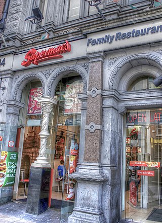
Supermac's is an Irish fast food restaurant chain that first opened in 1978. The first restaurant was located in Ballinasloe, County Galway, in Ireland. As of 2019, the chain consists of a total of 118 restaurants spread throughout the island of Ireland. It operates a number of franchise outlets with many also privately owned. Supermac's serves an average of 320,000 customers per week and had annual revenues of €79.9 million and a profit of €7.4 million according to its 2013 closing report.

Loughrea is a town in County Galway, Ireland. The town lies to the north of a range of wooded hills, the Slieve Aughty Mountains, and Lough Rea, the lake from which it takes its name. The town's cathedral, St Brendan's, dominates the urban skyline.
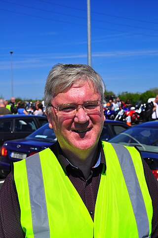
Patrick McDonagh is the founder and owner of Supermac's, an Irish fast food franchiser. Originally working as a school teacher, he later became a multi-millionaire.

Craughwell is a village and townland in County Galway, Ireland. As of the 2022 census, the village had a population of approximately 1,000 people.
Kilconnell is a small rural village in County Galway, Ireland. The village gives its name to the barony of Kilconnell, formerly held by the Lords de Freyne. In 2006 David Tye purchased the original feudal Barony of Kilconnell created in 1170 from Lord de Freyne and is the present holder. The feudal Barony of Kilconnell is registered in Ireland. There is also a peerage title, Baron Kilconnel, created in 1797, and later a subsidiary title of the Earls of Clancarty.
Aughrim is a small village in County Galway, Ireland. It is located between the towns of Loughrea and Ballinasloe, along the old N6 national primary road that used to be the main road between Galway and Dublin. According to the Irish census of 2011, the division had a population of 595.
Menlough is a village in the civil parish of Killoscobe in northeast County Galway, Ireland. It is located 35 km from Galway, 27 km from Tuam, 30 km from Ballinasloe, and 20 km from Athenry. Together with nearby Skehana, Menlough is a half-parish within the diocesan parish of Killascobe in the Roman Catholic Archdiocese of Tuam.
Mullagh is a parish in the Roman Catholic Diocese of Clonfert in County Galway, Ireland. It is in the south-east of the county, close to the towns of Loughrea, Ballinasloe, and Portumna. Mullagh lies in the civil parish of Abbeygormacan, and spans the townlands of Mullagh Beg and Mullagh More.

The Turoe stone is a granite stone decorated in a Celtic style located in the village of Bullaun, County Galway, Ireland, 6 km north of Loughrea off the R350 regional road. It probably dates to about the period 100 BC to 100 AD. The stone is positioned in a covered protective structure on the lawn in front of Turoe House, set in a concrete base surrounded by a metal cattle grill. The Turoe stone is National Monument of Ireland Nr. 327 (NM#327)

Tulrush is a small townland on the River Suck near Ballinasloe, Ireland. It is approximately 0.84 square kilometres (0.32 sq mi) in area and located in the historical barony of Moycarn in County Roscommon. As of the 2011 census, Tulrush townland had a population of 16 people.

The Diocese of Clonfert is a Latin Church diocese of the Catholic Church in the western part of Ireland. It is in the Metropolitan Province of Tuam.

Ahascragh is a village in east County Galway, Ireland. It is located 11 km (7 mi) north-west of Ballinasloe on the Ahascragh/Bunowen River, a tributary of the River Suck. The R358 regional road passes through the village. As of the 2022 census, it had a population of 186 people.

Taghmaconnell also known as Taughmaconnell, is a small village in County Roscommon, Ireland. It is situated between Athlone and Ballinasloe. The village lends its name to the parish and civil parish in which it is located.

Ballinderreen, also Ballindereen, is a village located on the N67 road between Kilcolgan and Kinvara in south County Galway, Ireland.
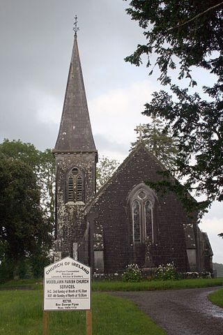
Woodlawn is a settled area in County Galway, Ireland.
Ballinasloe GAA is a Gaelic Athletic Association Gaelic football and hurling club located in Ballinasloe, County Galway, Ireland.

The M6 motorway is a motorway in Ireland, which runs from Dublin to Galway. The M6 extends from its junction with the M4 at Kinnegad all the way west to the outskirts of Galway City, but the Athlone bypass and the approach to Galway city - while of dual carriageway standard - have not been designated motorway and are still signed as N6. The motorway was officially completed and opened to traffic on 18 December 2009, and was the first city-to-city direct major inter-urban route to be completed in Ireland. The M6 and M4, which form the Galway–Dublin route, consist of a grade-separated 2+2 dual carriageway road with a top speed limit of 120 km/h. At approximately 144 km (90 mi), the M6 is the third longest motorway in the state and will be 159 km.
Fohenagh or Fohanagh is a small village and civil parish in County Galway, Ireland. Fohenagh has a school, a community hall, a community sports pitch and a Roman Catholic church. The village is approximately 15 km from Ballinasloe and 4 km from Ahascragh village. The local GAA club, Ahascragh-Fohenagh Hurling Club, was formed in the 1990s following the amalgamation of two former village clubs.
Leitrim is a barony in Ireland that lies partly in County Galway and partly in County Clare. It is located in the south-eastern corner of County Galway and the north-eastern corner of County Clare. Prior to 1898, the entire barony was contained in County Galway. The Local Government (Ireland) Act 1898 split the barony: part of the barony was transferred to County Clare. Leitrim is bounded, clockwise from the southwest, by the Clare baronies of Tulla Upper and Tulla Lower; the Galway baronies of Loughrea to the west, Kilconnell to the north, and Longford to the east; and by Lough Derg to the south and southeast. It measures 20 miles (32 km) from north to south and 9.5 miles (15.3 km) from east to west.

