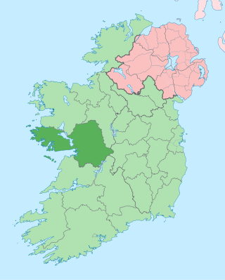
County Galway is a county in Ireland. It is in the Northern and Western Region, taking up the south of the province of Connacht. The county population was 276,451 at the 2022 census.

Galway is a city in the West of Ireland, in the province of Connacht, which is the county town of County Galway. It lies on the River Corrib between Lough Corrib and Galway Bay. It is the most populous settlement in the province of Connacht, the fifth most populous city on the island of Ireland and the fourth most populous in the Republic of Ireland, with a population at the 2022 census of 85,910.

Lough Corrib is a lake in the west of Ireland. The River Corrib or Galway River connects the lake to the sea at Galway. It is the largest lake within the Republic of Ireland and the second largest on the island of Ireland. It covers 176 km² and lies mostly in County Galway with a small area of its northeast corner in County Mayo.

Warrenpoint is a small port town and civil parish in County Down, Northern Ireland. It sits at the head of Carlingford Lough, south of Newry, and is separated from the Republic of Ireland by a narrow strait. The town is beside the village of Rostrevor and is overlooked by the Mournes and Cooley Mountains. Warrenpoint sprang up within the townland of Ringmackilroy, and is locally nicknamed "The Point", which also represents the town's full name in Irish, An Pointe".

Kinvara or Kinvarra is a sea port village in the southwest of County Galway, Ireland. It is located in the civil parish of Kinvarradoorus in the north of the barony of Kiltartan. Kinvarra is also an electoral division.

The River Corrib in the west of Ireland flows from Lough Corrib through Galway to Galway Bay. The river is among the shortest in Europe, with only a length of six kilometres from the lough to the Atlantic. It is popular with local whitewater kayakers as well as several rowing clubs and pleasure craft. The depth of this river reaches up to 94 feet.

Oughterard is a small town on the banks of the Owenriff River close to the western shore of Lough Corrib in Connemara, County Galway, Ireland. It is located about 26 km (16 mi) northwest of Galway on the N59 road. Oughterard is the chief angling centre on Lough Corrib.

Headford is a small town in County Galway, located 26 km north of Galway city in the west of Ireland. It is an angling centre for the eastern shore of Lough Corrib, and Greenfields, approximately 6.5 km west of the town, is its boating harbour. The town is situated next to the Black River which is the county boundary with Mayo. Located on the N84 national secondary road from Galway to Castlebar and the R333, and R334 regional roads, the town is a commuter town to Galway City.

The Western Way is a long-distance trail in Ireland. It is 179 kilometres long and begins in Oughterard, County Galway and ends in Ballycastle, County Mayo. It is typically completed in seven days. It is designated as a National Waymarked Trail by the National Trails Office of the Irish Sports Council and is managed by Coillte, Galway County Council, Mayo County Council, South Mayo Development Company and Mayo North & East Development Company.

Rossaveal or Rossaveel is a Gaeltacht village and townland in the Connemara area of County Galway, Ireland. It is the main ferry port for the Aran Islands in Galway Bay. It is about 37 kilometres (23 mi) from Galway city.

Moycullen is a Gaeltacht village in County Galway, Ireland, about 10 km (7 mi) northwest of Galway city. It is near Lough Corrib, on the N59 road to Oughterard and Clifden, in Connemara. Moycullen is now a satellite town of Galway with some residents commuting to the city for work, school, and business. Population increased 33.7% from the 2016 census, reaching 2,279 in 2022.

Rosmuc or Ros Muc, sometimes anglicised as Rosmuck, is a village in the Conamara Gaeltacht of County Galway, Ireland. It lies halfway between the town of Clifden and the city of Galway. Irish is the predominant spoken language in the area, with the electoral division of Turlough, Rosmuc, representing one of the highest percentages of Irish-speaking people in the country. The townland of Rosmuck is part of the civil parish of Kilcummin.

The N59 road is a national secondary road in Ireland. It commences in County Sligo, south of Sligo Town at the Belladrehid interchange with the N4 north of Ballysadare. The route circles around the west of Ireland, passing west from Sligo into County Mayo and through Ballina. The N59 continues around Mayo, proceeding indirectly to Westport. Continuing south through Mayo into County Galway, the road passes through the village of Leenaun. The 182-year-old bridge in the centre of the village, carrying the road across the River Lahill, collapsed in floods on 18 July 2007. Due to the local terrain and road network, the diversionary route for getting from the south of the village to Westport was 110 km long. A temporary bridge was opened eight days after the floods, on 27 July. It has since been replaced by a new bridge.
Killagoola is a small townland lying in the civil parish of Moycullen in County Galway, Ireland. It is located about 8 miles from Galway city, just off the N59 road which travels north from Galway towards Clifden. Its name is derived from the Irish name of Cill Ogúla, which means Church on the Shoulder. Indeed there is the ruins of a small church within the boundaries of Killagoola, on the largest site in the area, Crú Hill.

Oughterard is an ecclesiastical hilltop site, graveyard, townland, and formerly a parish, borough and royal manor in County Kildare, nowadays part of the community of Ardclough, close to the Dublin border. It is the burial place of Arthur Guinness.

Quigley's Point is a village in County Donegal, Ireland. Located on the eastern shores of Inishowen and overlooking Lough Foyle, the village is sometimes known locally as "Carrowkeel" as it is in a townland of that name. To the south is the city of Derry and to the north lie the villages of Moville and Greencastle. A car ferry links Greencastle with Magilligan during the summer. The river Cabry, which flows through the area, is spanned by a late-18th century bridge at Quigley's Point.

Muckanaghederdauhaulia is a 503-acre (204 ha) townland in the civil parish of Kilcummin in County Galway, Ireland. It is in the poor law union of Oughterard in the barony of Moycullen.
Oughterard GAA is a Gaelic football club based in Oughterard, County Galway, Ireland. The Gaelic Athletic Association club is a member of the Galway GAA. Oughterard had a hurling team in the 1920s but is primarily and always has been a Gaelic football club and teams compete from the groups of under 6 to Senior.
Moycullen is a Gaeltacht civil parish in the ancient barony of the same name. It is located in the western shore of Lough Corrib in County Galway, Ireland and is around 4 miles (6.4 km) north-west of the city of Galway on the road to Oughterard. The parish contains 27,294 statute acres. According to Lewis's survey of 1837, "The land is of very indifferent quality; and there is a large quantity of reclaimable waste and bog.". The parish gets its name from the church, now in ruins, that is situated around 1 mile (1.6 km) to the east of the village, in the townland of Moycullen itself.

The Galway to Clifden Railway or Connemara Railway was a railway line opened in Ireland by the Midland Great Western Railway (MGWR) in 1895. It led from Galway to Clifden, the chief town of the sparsely populated Connemara region in western County Galway. It was closed by the MGWR's successor, the Great Southern Railways (GSR) in 1935.

