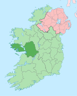
Native name: Oileán Eide | |
---|---|
Geography | |
Location | Atlantic Ocean |
Coordinates | 53°12′N8°59′W / 53.2°N 8.99°W |
Highest elevation | 8 m (26 ft) |
Administration | |
Province | Connacht |
County | Galway |
Demographics | |
Population | 2 (2022) [1] |
Island Eddy is a small, depopulated island at the inner, eastern end of Galway Bay, Ireland.
The island is always referred to locally as 'Island Eddy' not 'Eddy Island'. The official Irish Government commission on placenames confirms this usage, giving its Irish and English orthography thus: ‘Oileán Eide / Island Eddy’. [2] It is not to be confused with Islandeady, an inland village and parish in County Mayo.
Island Eddy is situated on the inner reaches of Galway Bay on the west coast of Ireland. The nearest town, as the crow flies, is Kinvara, which sits at the head of a shallow inlet some 7 km to the south, south-east.
Island Eddy consists of three low islets, inter-linked and flanked by extensive isthmuses and spits. At the south-west end of the island a number of the latter combine to form a large lagoon-like area, and a second series also define another 'lagoon' towards the eastern end. These are known locally as "Malluirs", probably because they fill and drain up to an hour behind the normal tidal pattern. [7] They are labelled as the North Mallmhuir and the South Mallmhuir, respectively. The islets are probably partially submerged drumlins while the isthmuses and spits are largely composed of sea-rolled cobbles and shingle. At the eastern extremity of the island there is a long sinuous sand-spit called "the cush", which allows access to the island by foot at certain spring tides.
In the Books of Survey and Distribution, compiled in the 1650s, 'Illand Edye' is listed as a 'Denomination' of '1⁄2 of a Qur' comprising '113 0 0 Acres profittable' (Plantation measure). [8]
According to the OS six inches to the mile (1:10,560) scale map the island is '165 Acres, 3 Roods and 24 Perches' (67.14|ha) in extent. [9] Its maximum dimensions are 2.85 kilometres (1.77 mi) long, east to west, and 1.05 kilometres (0.65 mi) wide, north to south. Its maximum elevation is 8 metres (26.25 ft). [10]
1574: Bishop of Kilmacduagh [11]
1641: 'Sr Roebuck Lynch Bart 7⁄8 of 1⁄2 Quarter' [12]
1667: 'Dr Robert Gorges' [12]
1855: Sir Thomas N. Redington [13]
Current: the enclosed land and house plots are owned by a number of local mainland families [14]
Nothing quantifiable is known of the island's population prior to the 19th century. However, the quality of the land and the availability of natural resources (seaweed, shellfish etc.) in the inter-tidal zone suggest that the island is likely to have been an inhabited place from early medieval times if not well before. This is hinted at by the archaeological sources and confirmed by the historical data (see below).
The attached table presents details of the population and house data from the official government census returns, and Griffith's land valuation, between 1821 and 1981. The peak of 125 in the island population in 1841 reflects national trends as does the halving of the community in the following decade due to the Great Famine of 1845–49. Though the population recovered somewhat in the 1870s, it declined steadily in the later 19th and early 20th centuries. Though the closure of the school c.1901, was a major blow, the community remained viable until the eve of the 2nd World War. However, like many islands on the west coast, it went into terminal decline thereafter.
In Oileáin: A guide to the Irish Islands (2004), David Walsh states that Island Eddy was 'abandoned in 1947' [15] but the census returns contradict this. In fact, two people still lived there until early December, 1980. [16]
|
|
| |||||||||||||||||||||||||||||||||||||||||||||||||||||||||||||||||||||||||||||||||||||||
Source: Central Statistics Office. "CNA17: Population by Off Shore Island, Sex and Year". CSO.ie. Retrieved 12 October 2016. |
A number of family names are closely associated with the past two hundred years of the island's history. The principal families in the 19th and 20th centuries were the Berminghams, Conlons, Keanes and Hynes. The Corless family were also part of the community in the early 19th century, and Fitzgeralds and Finnegans feature in the census records for 1901. [17]
The earliest individuals recorded as being of Island Eddy, are 'Richard fitz James Skeret', 'Walter Perrell' and 'Henry Perrell' (presumably the latter's son). They are mentioned in a deed of 1552 concerning the island's castle, Skeret being the owner and the Perrells being the occupiers. [18] The historical sources indicate that the Perrells were associated with Island Eddy for at least four generations from the early 1500s to the 1640s. [19]
In the 1860s, the lessee of the island's oyster beds was a Mr Wray, who described his methods and the success of his venture in some detail in his report to the Deep Sea and Coast Fishery Commissioners. [20] The oyster beds later came into the ownership of the Atlantic Oyster Fisheries Company. [21]
Although the island is no longer populated (the last residents having left in the early 1980s), descendants of former occupants are living, and remain in contact through Facebook and other social media.
The Celtic/folk/acoustic music group called Island Eddy based in Kinvara, County Galway, took their name from the island. [40]
Moya Cannon's collection of poetry, Hands (2011), contains two finely wrought poems relating to Island Eddy - 'Nausts' and 'Eliza Murphy'. [41] Both poems are grounded in the physical particularities of two of the island's most striking monuments, the boat Nausts on the shore of the North Mallmhuir and the Children's Burial Ground on the southern fringes of the village (See Archaeology section, above, for details).
According to the Geological Survey of Ireland, the island's bedrock consists of 'viséan limestone and calcareous shale' [42]
Very little bedrock is actually exposed on the ground surface, save at the western tip. The long, low, drumlin-like ridge which forms the heart of the island appears to be composed mainly of glacial drift which was probably laid down during the last ice age. The same is probably true of the two smaller hillocks to the east and west of it. In contrast, the sinuous isthmuses and spits which link them are composed of sea-sorted sand, shingles and cobbles. These are of post-glacial origin and it is clear that they are being continuously moulded by tidal currents. [43]
Island Eddy lies within area H15: South-east Galway, of the vice-county system for recording flora in Ireland. [44]
A comprehensive field survey of the island's vegetation has been undertaken by Messrs. Roden and Sheehy Skeffington and is forthcoming in The Irish Naturalists Journal. [45]
An interdisciplinary group set up in 2008 by Drs. Roden & Springer (then of Carrowgarrif) carried out The Discursive Survey of Island Eddy; those who participated were mainly local residents of the south Galway littoral with a knowledge of the island and an interest and/or expertise in the natural and human sciences.
An introduction to the aspirations and approaches of the Survey can be found in the Autumn 2010 issue of Archaeology Ireland. [51] The Survey has not received funding of any kind to date. Leo Hallisey, the organiser of Connemara Sea-Week, wrote:
To see people dedicate time to a study like this just for the love of their work is an amazing concept in this day and age, when everything is so driven by money. It's old-fashioned scholarship at its very best'. [52]
Research to date has been conducted on the following: Terrestrial Vegetation, the Castle, the Children's Burial Ground, the Nausts and the Seaweed Mearing Stones and these topics have inspired a number of artistic responses - see below for publication details.
The subject of maritime history is under active investigation (July 2015).
The following topics have been identified as worthy of investigation but await committed researchers: Lagoons, Vegetation & Ecology of the Salt Marshes, Cottage Garden Plants & Herbs, Terrestrial Fauna, Birds, Moths, Placenames, Social & Family History, the Architecture and Layout of the House Cluster, Ownership History, Poetry, Folklore, Poetry and Music.
Members of the Survey have presented results of their work individually in public lectures [53] and collectively at a half-day symposium in Letterfrack, in October 2012, during Connemara Sea-Week. [54]
County Galway is a county in Ireland. It is in the Northern and Western Region, taking up the south of the province of Connacht. The county population was 276,451 at the 2022 census.
Lough Corrib is a lake in the west of Ireland. The River Corrib or Galway River connects the lake to the sea at Galway. It is the largest lake within the Republic of Ireland and the second largest on the island of Ireland. It covers 176 km² and lies mostly in County Galway with a small area of its northeast corner in County Mayo.
Galway Bay is a bay on the west coast of Ireland, between County Galway in the province of Connacht to the north and the Burren in County Clare in the province of Munster to the south; Galway city is on the northeast side. The bay is about 50 kilometres (30 mi) long and from 10 kilometres (6 mi) to 30 kilometres (20 mi) in breadth. The Aran Islands are to the west across the entrance and there are numerous small islands within the bay. To the west of Galway, the rocks are granite but to the south they are limestone.
Athenry is a town in County Galway, Ireland, which lies 25 kilometres (16 mi) east of Galway city. Some of the attractions of the medieval town are its town wall, Athenry Castle, its priory and its 13th century street-plan. The town is also well known by virtue of the song "The Fields of Athenry".
Kinvara or Kinvarra is a sea port village in the southwest of County Galway, Ireland. It is located in the civil parish of Kinvarradoorus in the north of the barony of Kiltartan. Kinvarra is also an electoral division.
Kilmacduagh Monastery is a ruined abbey near the town of Gort in County Galway, Ireland. It was the birthplace of the Diocese of Kilmacduagh. It was reportedly founded by Saint Colman, son of Duagh in the 7th century, on land given him by his cousin King Guaire Aidne mac Colmáin of Connacht.
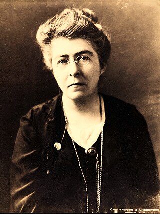
Johanna Mary Sheehy-Skeffington was a suffragette and Irish nationalist. Along with her husband Francis Sheehy-Skeffington, Margaret Cousins and James Cousins, she founded the Irish Women's Franchise League in 1908 with the aim of obtaining women's voting rights. She was later a founding member of the Irish Women Workers' Union. Her son Owen Sheehy-Skeffington became a politician and Irish senator.
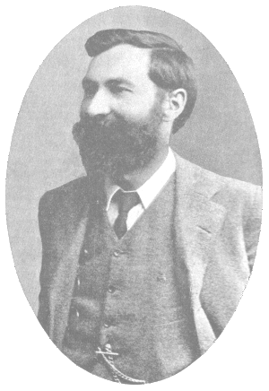
Francis Joseph Christopher Skeffington was an Irish writer and radical activist, known also by the nickname "Skeffy". He was a friend and schoolmate of James Joyce, Oliver St. John Gogarty, Tom Kettle, and Frank O'Brien. When he married Hanna Sheehy in 1903, he adopted her surname as part of his own, resulting in the name "Sheehy Skeffington". They always spelled their joined names unhyphenated, although many sources add the hyphen.
The Conmaicne, or Conmhaicne were a people of early Ireland, perhaps related to the Laigin, who dispersed to various parts of Ireland. They settled in Connacht and Longford, giving their name to several Conmaicne territories. T. F. O'Rahilly's assertion the Conmaicne were non-Goidelic is not widely accepted.
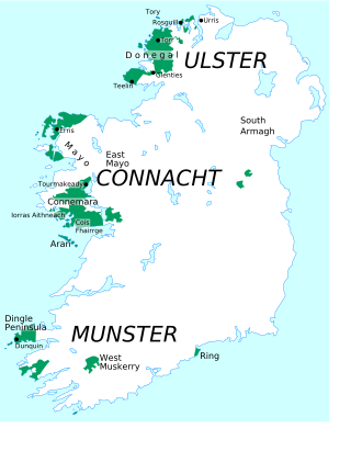
Connacht Irish is the dialect of the Irish language spoken in the province of Connacht. Gaeltacht regions in Connacht are found in Counties Mayo and Galway. Connacht Irish is also spoken in the Meath Gealtacht Ráth Chairn and Baile Ghib. The dialects of Irish in Connacht are extremely diverse, with the pronunciation, forms and lexicon being different even within each county.
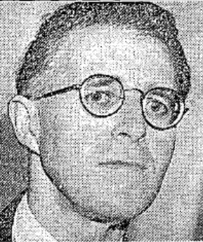
Owen Lancelot Sheehy-Skeffington was an Irish university lecturer and senator. The son of pacifists, feminists and socialists Francis and Hanna Sheehy-Skeffington, he was politically likeminded and as a member of the Irish Senate was praised as a defender of civil liberty, Democracy, separation of church and state, freedom of speech, women's rights, minority rights and many other liberal values.
Conneely from or, is an Irish family name. Frequent examples of the name can be found in the West of Ireland, particularly in the Connemara area of County Galway. A coastal village in County Galway is named Ballyconneely.
The Irish Women's Franchise League was an organisation for women's suffrage which was set up in Dublin in November 1908. Its founder members included Hanna Sheehy-Skeffington, Margaret Cousins, Francis Sheehy-Skeffington and James H. Cousins. Thomas MacDonagh was a member.
Newtown Castle is a 16th-century tower house, located close to the village of Ballyvaughan within the Burren area of County Clare, Ireland. Uniquely for a tower house of its type in Ireland, Newtown Castle is mostly cylindrical in shape but rises from a square pyramidical base. It is today part of the Burren College of Art.
Father Eugene Sheehy was a priest, president of the local branch of the Irish National Land League at Kilmallock, and founder member of the Gaelic Athletic Association. He was known as the "Land League priest", and his activities landed him in prison. He educated Éamon de Valera who went on to be president of Ireland.
Dripsey Castle is a country house in the townland of Carrignamuck, situated 3.3 km (2.1 mi) north-east of Coachford village and 2.5 km (1.6 mi) north-west of Dripsey village. The house and demesne were dominant features in the rural landscape of Ireland, throughout the eighteenth and nineteenth centuries. Location often reflected the distribution of better land, and this is evidenced in mid-Cork, where many of these houses are situated along the valley of the River Lee and its tributaries.
Cnoc Raithní is a tumulus and national monument located on Inisheer, Ireland.
Creggankeel Fort is a stone fort and National Monument located on the island of Inisheer, Ireland. It also contains a later Christian site, the Grave of the Seven Daughters.
Templesaghtmacree is an Early Christian church and National Monument located on Inishmaan, Ireland.
Research results from The Discursive Survey of Island Eddy have been published as a series of 'Occasional Papers' and 'Artistic Responses' in diverse periodicals and books, and as downloadable 'Topical Memoranda'. A total of seven papers, three artistic responses and one memorandum have been completed as of July, 2020. They are as follows: