Leitrim (Irish: Liatroim) is a barony in Ireland that lies partly in County Galway and partly in County Clare. [la 1] It is located in the south-eastern corner of County Galway and the north-eastern corner of County Clare. Prior to 1898, the entire barony was contained in County Galway. The Local Government (Ireland) Act 1898 split the barony: part of the barony was transferred to County Clare. Leitrim is bounded, clockwise from the southwest, by the Clare baronies of Tulla Upper and Tulla Lower; the Galway baronies of Loughrea to the west, Kilconnell to the north, and Longford to the east; and by Lough Derg to the south and southeast. [1] It measures 20 miles (32 km) from north to south and 9.5 miles (15.3 km) from east to west. [2]
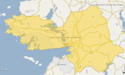
The highest peak in the barony is the Scalp (380m), part of the Slieve Aughty range. Lough Derg forms the barony's eastern boundary. Three rivers flow in an easterly direction to the Lough; from north to south they are the Cappagh, the Woodford, and the Coos. The mines at Tynagh were a source of lead and zinc from the 1960s until their closure in 1981.[ citation needed ]
The R353 regional road bisects the barony from east to west. At the northern end is the N65 national road.
Settlements in the barony include Caherakilleen, [la 2] Kilreekill, Tynagh and Woodford in Galway, and Mountshannon and Whitegate in Clare.
There are 12 civil parishes in the barony. Ten are in County Galway:
Three since 1898 have been in County Clare:
Killaloe is a small town in east County Clare, Ireland. It lies on the River Shannon on the western bank of Lough Derg and is connected by Killaloe Bridge to the "twin town" of Ballina on the eastern bank of the lake.
Galway East is a parliamentary constituency represented in Dáil Éireann, the lower house of the Irish parliament or Oireachtas. The constituency elects 3 deputies on the system of proportional representation by means of the single transferable vote (PR-STV).
Woodford is a village in the south-east of County Galway, Ireland. It is situated between the River Shannon and the Slieve Aughty mountains.
Feakle is a village in County Clare, Ireland, in the Roman Catholic parish of the same name.
A registration district in the United Kingdom is a type of administrative region which exists for the purpose of civil registration of births, marriages, and deaths and civil partnerships. It has also been used as the basis for the collation of census information.
Clare–South Galway was a parliamentary constituency represented in Dáil Éireann, the lower house of the Irish parliament or Oireachtas from 1969 to 1977. The constituency elected 3 deputies to the Dáil on the system of proportional representation by means of the single transferable vote (PR-STV).
Tynagh is a village and electoral division in south-east County Galway in Ireland.
Duniry is a townland, with a small village centre, between Tynagh and Abbey, in County Galway, Ireland. Nearby is the townland of Limehill, the south of which has a bog.
Inis Cealtra, also known in English as Inishcaltra or Holy Island, is an island off the western shore of Lough Derg in Ireland. Now uninhabited, it was once a monastic settlement. It has an Irish round tower, and the ruins of several small churches, as well as four high crosses and a holy well. Despite the lack of population, the cemetery on this island is still in use. Coffins and mourners are transported the short distance from County Clare in small boats. Boat trips can be taken from the harbour at Mountshannon. It is conserved by the East Clare Heritage Centre.
Killaloe is a civil parish in County Clare, Ireland. The main settlement is the town of Killaloe.
Bunratty Upper is a barony in County Clare, Ireland. This ancient geographical division of land is in turn divided into six civil parishes.
Tulla Upper is a barony in County Clare, Ireland. This ancient geographical division of land is in turn divided into seven civil parishes.
Tulla Lower is a barony in County Clare, Ireland. This ancient geographical division of land is in turn divided into eight civil parishes.
Killanena is a townland and formerly a district electoral division (DED) in County Clare, Ireland, in the Catholic parish of Killanena.
Inishcaltra is a civil parish in the barony of Leitrim in County Clare, Ireland. The main settlement in the parish is the village of Mountshannon. It is noted for the eponymous island of Inis Cealtra, which is an ancient Christian monastic site. In the Catholic Church, the parish is part of the ecclesiastical parish of Mountshannon (Clonrush).
Clonrush or Clonmulsk is a civil parish in the barony of Leitrim, now in County Clare, Ireland. The largest settlement in the parish is Whitegate.
The barony of Leitrim is a barony in County Leitrim, Ireland.
Ballynahinch is a barony in west County Galway, Ireland. It sits on the Atlantic coast to the west. The village of Ballynahinch is named after the barony.
Killeenadeema is a civil parish in County Galway, Ireland. It contains most of the Derrybrien mountains, which hold the Derrybrien Wind Farm.
From logainm.ie: