Clonmacnowen

Last updated

Clonmacnowen
Clann Mhac nEoghain (Irish)
Barony
Bunowen River, County Galway - geograph.org.uk - 1852884.jpg
Bunowen River, Creggaun townland
Baronies of Galway.jpg
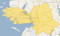
Barony map of County Galway, 1900; Clonmacnowen is in the east, coloured pink.
Location map Ireland County Galway.png
Red pog.svg
Clonmacnowen
Ireland adm location map.svg
Red pog.svg
Clonmacnowen
Coordinates: 53°20′N8°18′W / 53.33°N 8.30°W / 53.33; -8.30
Sovereign state Ireland
Province Connacht
County Galway
Area
  Total
143.5 km2 (55.4 sq mi)

Clonmacnowen (Irish : Clann Mhac nEoghain; also Clonmacnoon) is a historical barony in eastern County Galway, Ireland. [1] [2] [3]

Contents

Baronies were mainly cadastral rather than administrative units. They acquired modest local taxation and spending functions in the 19th century before being superseded by the Local Government (Ireland) Act 1898. [4] [5]

History

The name derived from Irish Clann Mac nEoghain, "clan of the son's of Eoghan," [6] referring to a son of Domnall Mór Ua Cellaigh, a king of Uí Maine who died in 1221. [7]

The O'Muldoons (Ó Maoldúin) of Aughrim [8] were ancient rulers of the area as chiefs of Eoghanacht Ani (Eóganachta of Aidhne). [9] [10]

By 1585 Seán na Maighe Ó Cellaigh was the owner of the area. [11]

Clonmacnowen barony was created before 1672. It appears in the Down Survey (1665–66) as Clanemtoneen. [12]

Geography

Clonmacnowen is in the east of the county, where the River Suck forms the border with County Roscommon. [13]

List of settlements

Settlements within the historical barony of Clonmacnowen include: [14]

References

  1. "Clonmacnowen". www.townlands.ie.
  2. Casey, B. (2018:25). Class and Community in Provincial Ireland, 1851–1914. Germany: Springer International Publishing.
  3. Spellissy, S. (1999:267). The history of Galway. Ireland: Celtic Bookshop.
  4. General Register Office of Ireland (1904). "Alphabetical index to the baronies of Ireland". Census of Ireland 1901: General topographical index. Command papers. Vol. Cd. 2071. HMSO. pp. 966–978.
  5. Office, Ireland Public Record (12 February 1891). "Report of the Deputy Keeper of the Public Records and of the Keeper of the State Papers in Ireland: Presented to Both Houses of the Oireachtas". Stationery Office. via Google Books.
  6. "Clann Mhac nEoghain/Clonmacnowen". logainm.ie.
  7. Joyce, P. W. (1875:139). The Origin and History of Irish Names of Places. Ireland: McGlashan & Gill.
  8. "Families of County Limerick".
  9. "The Baronies of Ireland - History". 17 July 2019. Archived from the original on 17 July 2019.
  10. "Ó hÁbhartaigh - Irish Names and Surnames". www.libraryireland.com.
  11. "Ballinasloe Town and Parish 1585-1855". www.askaboutireland.ie.
  12. Ó Domhnaill, Séan (1943). "The Maps of the Down Survey". Irish Historical Studies. 3 (12): 381–392. doi:10.1017/S0021121400036221. JSTOR   30006012 via JSTOR.
  13. "Clonmacnowen Barony | Landed Estates | University of Galway". landedestates.ie.
  14. "Sub-units of: Clann Mhac nEoghain/Clonmacnowen". logainm.ie.
  15. "Main Street, TOWNPARKS (CLONMACNOWEN BY), Ballinasloe, GALWAY". Buildings of Ireland.