Related Research Articles

Ballinasloe is a town in the easternmost part of County Galway in Connacht. Located at an ancient crossing point on the River Suck, evidence of ancient settlement in the area includes a number of Bronze Age sites. Built around a 12th-century castle, which defended the fording point, the modern town of Ballinasloe was "founded" in the early 13th century. As of the 2016 census, it was one of the largest towns in County Galway, with a population of 6,662 people.

Lawrencetown or Laurencetown (Irish: Baile Mór Shíol Anmchadha or simply Baile Mór), historically called Oghilmore and later Ballymore, is a village in County Galway, Ireland. Located on the R355 regional road nine miles south of Ballinasloe, it lies in the barony of Longford, the civil parish of Clonfert, the Catholic parish of Lawrencetown and Kiltormer, and the townland (earlier) of Lissreaghaun and (later) of Laurencetown or Ballymore; it was historically in the poor law union of Ballinasloe.
Old Town is a small village in the townland of Cloonfad in County Roscommon, Ireland. It is located on the R357 road between Ballinasloe, County Galway and Shannonbridge, County Offaly. The village post office, which had been operated by the Kenny family for many generations, closed in January 2008. The church for the area is known as Clonfad Church, in the Parish of Moore.
South Roscommon was a UK Parliament constituency in Ireland, returning one Member of Parliament from 1885 to 1922.
Creagh is an Irish surname derived from the Gaelic Craobhach, meaning "branch". The Creagh family was first found in County Clare, where they held a family seat from ancient times. It is also the name of several locations throughout the island of Ireland, for example:
Clare–South Galway was a parliamentary constituency represented in Dáil Éireann, the lower house of the Irish parliament or Oireachtas from 1969 to 1977. The constituency elected 3 deputies to the Dáil on the system of proportional representation by means of the single transferable vote (PR-STV).

Aughrim is a small village in County Galway, Ireland. It is located between the towns of Loughrea and Ballinasloe, along the old N6 national primary road that used to be the main road between Galway and Dublin. According to the Irish census of 2011, the division had a population of 595.
Menlough is a village in northeast County Galway in Ireland. Located 35 km from Galway, 27 km from Tuam, 30 km from Ballinasloe, and 20 km from Athenry, it forms part of the civil parish of Killascobe.
Mullagh is a parish in the Roman Catholic Diocese of Clonfert in County Galway, Ireland. It is in the south-east of the county, close to the towns of Loughrea, Ballinasloe, and Portumna. Mullagh lies in the civil parish of Abbeygormacan, and spans the townlands of Mullagh Beg and Mullagh More.

Tulrush is a small townland on the River Suck near Ballinasloe, Ireland. It is approximately 0.84 square kilometres (0.32 sq mi) in area and located in the historical barony of Moycarn in County Roscommon. As of the 2011 census, Tulrush townland had a population of 16 people.
Woodmount is a townland in the civil parish of Creagh in South County Roscommon, Ireland, situated approximately 3.5 miles due east of the town of Ballinasloe, and approximately 800 metres north off the Old N6 Athlone to Ballinasloe road. In the Gaelic language it is called Tonalig, which translate as the "End or Bottom of the Wood". The clubhouse and playing fields of Padraig Pearses GAA Roscommon club have been situated in Woodmount since 1983.

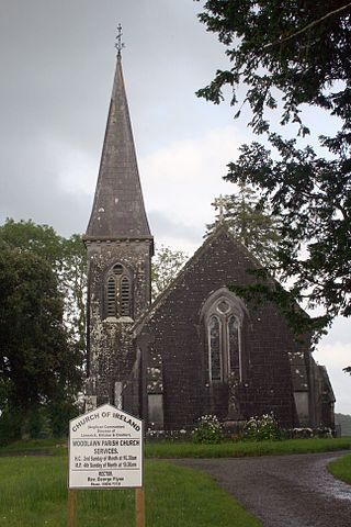
Woodlawn, historically known as Mota or Moote, is a settled area in County Galway, Ireland.
Ballinasloe GAA is a Gaelic Athletic Association Gaelic football and hurling club located in Ballinasloe, County Galway, Ireland.
Derrymullan, also Derrymullen, is a 226-acre townland on the north side of Ballinasloe in County Galway, Ireland. It is in the barony of Clonmacnowen and the civil parish of Kilcloony.
Kilclooney or Kilcloony is a townland and civil parish in County Galway, Ireland. It is one of three civil parishes in which Ballinasloe is located. It is regarded as the place in which Saint Grellan settled and established a church, which has since been replaced by the currently-standing, run-down church.
Beagh (Spiritual) is a townland lying within the civil parish of Maghera, County Londonderry, Northern Ireland. It lies in the south of the parish on the north boundary of the civil parish of Termoneeny, and is bounded by the townlands of Carricknakielt, Curragh, Maghera civil parish~Curragh, Knocknakielt, Slaghtybogy, and Tamnymartin. It wasn't apportioned to any of the London livery companies, being kept as church lands.
Creagh may refer to:
Tubber is a small village located in the south of County Galway, Ireland.
Layd is a civil parish and townland in County Antrim, Northern Ireland. It is situated in the historic barony of Glenarm Lower.
Creagh National School is a primary school in Ballinasloe, County Galway, Ireland. Originally founded in 1939, it is a Catholic boys and girls national school located on the outskirts of Ballinasloe in the civil parish of Creagh. As of 2019, the school had 415 pupils and approximately thirty staff, making it the largest national school in the Ballinasloe catchment area.
References
- ↑ "Civil Parish of Creagh, Co. Galway". townlands.ie. Retrieved 2 August 2020.
- ↑ "Civil parishes in Ballinasloe". johngrenham.com. Retrieved 2 August 2020.

