Castlecoote

Last updated

Castlecoote
Bhaile Mhic Oireachtaigh
Townland
Castlecoote House.jpg
Castlecoote house
Ireland adm location map.svg
Red pog.svg
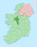
Castlecoote
Location in Ireland
Coordinates: 53°36′47″N8°17′30″W / 53.613102°N 8.291622°W / 53.613102; -8.291622
Country Ireland
Province Connacht
County County Roscommon
Named for Coote Family
Time zone WET
  Summer (DST) IST (WEST)

Castlecoote [1] (otherwise known in Irish : Bhaile Mhic Oireachtaigh [2] ) is a townland within the civil parish of Fuerty on the R366 regional road near the town of Roscommon in County Roscommon, Ireland. Castlecoote is known for Castlecoote house and the ruins of a much older castle. [3] The River Suck, which encircles Castlecoote House, is renowned for its trout and coarse fishing. [4]

Contents

History

Castlecoote's English name is derived from 'Coote', literally translated meaning 'Coote's Castle', in which Sir Charles Coote, 'President of Connaught' during the rebellion of 1641 lived. [5] Castlecoote is a primarily agricultural village.

Castlecoote House

Castlecoote House, built on the site of a medieval castle from between 1570 and 1616, once served as the base for the MacGeraghtys of Fuerty, was later fortified by the owner, Sir Charles Coote, in 1616. It was attacked three times in the 1640s by Irish Confederates. [6]

The present house was constructed later and was built within the enclosure of the now ruinous old castle. In the basement tower rooms, the musket chambers overlook the entrance steps. In the 18th century the property was under the ownership of the Gunnings. The two famous Gunning sisters, renowned for their beauty, lived here. [7] In the 20th century the house was occupied by an equestrian, Henry D. Strevens. The present owner restored the property after purchasing it in 1997 in a derelict condition. [8]

Culture

The town is situated in the Roman Catholic Diocese of Elphin and is served by a church in the village. There are several pubs in the vicinity as well as the Castlecoote stores and a disused stone mill. [9] The village has been awarded a category A gold medal at the 2019 Tidy Towns competition. [10]

The ruin of the SE corner flanking tower on the lawn in front of the house. Part of the old castle's C17 fortifications. Castlecoote Castle ruins.jpg
The ruin of the SE corner flanking tower on the lawn in front of the house. Part of the old castle's C17 fortifications.

See also

Further reading

Related Research Articles

<span class="mw-page-title-main">Carrick-on-Shannon</span> Town in County Leitrim, Ireland

Carrick-on-Shannon is the county town of County Leitrim in Ireland. It is the largest town in the county. A smaller part of the town located on the west bank of the River Shannon lies in County Roscommon and is home to the town's main train station. As of the 2022 census, the population of the town was 4,743. It is situated on a strategic crossing point of the River Shannon. The main part of the town, the County Leitrim part, is in the civil parish of Kiltoghert, which is in the barony of Leitrim, while Cortober, which is the County Roscommon side of the town, is in the civil parish of Killukin, in the barony of Boyle.

<span class="mw-page-title-main">Galbally, County Limerick</span> Village in County Limerick, Ireland

Galbally is a village in southeast County Limerick, Ireland, on the border with County Tipperary. It is located at the foot of the Galtee Mountains and at the western approach to the Glen of Aherlow. The Aherlow River, flowing down from the Galtee mountains, runs by the village, to meet the Suir at Kilmoyler a short distance north of Cahir. Galbally is in a valley overlooked by the Galtee Mountains. The village is in a townland and civil parish of the same name.

Ballygar is a village in County Galway, Ireland. It is 19 km from Roscommon town.

<span class="mw-page-title-main">Ballintober, County Roscommon</span> Village in Connacht, Ireland

Ballintober is a village in County Roscommon, Ireland. It is 6 kilometres (4 mi) from the town of Castlerea. As of the 2022 census, Ballintober had a population of 199. The village is in a townland and civil parish of the same name.

Knockcroghery is a village and townland in County Roscommon, Ireland. It is located on the N61 road between Athlone and Roscommon town, near Lough Ree on the River Shannon. The townland of Knockcroghery is in the civil parish of Killinvoy and the historical barony of Athlone North.

<span class="mw-page-title-main">Ballyconnell</span> Town in County Cavan, Ireland

Ballyconnell is a town in County Cavan, Ireland. It is situated on the N87 national secondary road at the junction of four townlands: Annagh, Cullyleenan, Doon (Tomregan) and Derryginny in the parish of Tomregan, Barony of Tullyhaw.

<span class="mw-page-title-main">Keadue</span> Village in Connacht, Ireland

Keadue, officially Keadew, is a village in County Roscommon, Ireland. It is on the R284 and R285 regional roads close to the borders of County Leitrim and County Sligo.

<span class="mw-page-title-main">Mountrath</span> Town in County Laois, Ireland

Mountrath is a small town in County Laois, Ireland. The town lies on the R445 midway between Dublin and Limerick, exactly 96.5 km (60 mi) from both cities. The town was bypassed by the M7 motorway in 2010 leading to a significant easing of traffic congestion in the town.

<span class="mw-page-title-main">Taghmaconnell</span> Village in County Roscommon, Ireland

Taghmaconnell also known as Taughmaconnell, is a small village in County Roscommon, Ireland. It is situated between Athlone and Ballinasloe. The village lends its name to the parish and civil parish in which it is located.

Newtowncashel is a village located near Lough Ree in County Longford, Ireland. Newtowncashel won the Irish Tidy Towns Competition in 1980.

<span class="mw-page-title-main">Kilsheelan</span> Village in County Tipperary, Ireland

Kilsheelan is a village and civil parish within the barony of Iffa and Offa East in County Tipperary, Ireland. It is also one half of the Roman Catholic parish of Kilsheelan & Kilcash in the Roman Catholic Diocese of Waterford and Lismore.

<span class="mw-page-title-main">Fuerty</span> Townland in Connacht, Ireland

Fuerty is a townland and civil parish on the R366 regional road near the town of Roscommon in County Roscommon, Ireland. Fuerty is known for a ruined church and ancient graveyard on the site of a Celtic Christian abbey.

<span class="mw-page-title-main">Glaslough</span> Village in County Monaghan, Ireland

Glaslough is a village and townland in the north of County Monaghan, Ireland, on the R185 regional road 3 km (2 mi) south of the border with Northern Ireland and 10 km (6 mi) northeast of Monaghan town. Glaslough won the Irish Tidy Towns Competition in 1978 and again in 2019.

<span class="mw-page-title-main">Ballymagauran</span> Village in County Cavan, Ireland

Ballymagauran, also sometimes spelled as Ballymacgovern or Ballymagovern, is a hamlet and townland in the west of County Cavan in Ireland. It lies on the border with County Leitrim, lying within both the Civil Parish of Templeport and the Barony of Tullyhaw. The hamlet is located at the southern end of the Barony of Tullyhaw, the hamlet being on the Ballinamore to Ballyconnell road, the R205.

<span class="mw-page-title-main">Cavanagh (townland)</span> Townland in County Cavan, Ireland

Cavanagh is a townland in the civil parish of Tomregan, County Cavan, Ireland. It lies within the former barony of Tullyhaw.

<span class="mw-page-title-main">Cootehall</span> Village in Connacht, Ireland

Cootehall is a village in County Roscommon, Ireland. It is located on the River Boyle, between Boyle and Carrick-on-Shannon near Lough Key Forest Park in the north of the county.

<span class="mw-page-title-main">Glinsk Castle</span> Tower house in County Galway, Ireland

Glinsk Castle is a tower house and National Monument located in County Galway, Ireland.

<span class="mw-page-title-main">Castlefreke</span> Village in County Cork, Ireland

Castlefreke, also known as Rathbarry, is a townland and village in County Cork, Ireland. The townland is located in the civil parish of Rathbarry on the R598 regional road, to the east of Rosscarbery.

<span class="mw-page-title-main">Athlone North</span> Barony in Connacht, Ireland

Athlone North, also called North Athlone, is a barony in County Roscommon, Ireland. Baronies were mainly cadastral rather than administrative units. They acquired modest local taxation and spending functions in the 19th century before being superseded by the Local Government (Ireland) Act 1898.

<span class="mw-page-title-main">Athlone South</span> Barony in Connacht, Ireland

Athlone South, also called South Athlone, is a barony in County Roscommon, Ireland. Baronies were mainly cadastral rather than administrative units. They acquired modest local taxation and spending functions in the 19th century before being superseded by the Local Government (Ireland) Act 1898.

References

  1. Descriptive Remarks; as Ainmleabhar Paróiste na Suirbhéireachta Ordanáis/from the Ordnance Survey Parish Namebook Lámhscríbhinn Bliain: 1830-40. pp. RC031, 10.
  2. "Baile Mhic Oireachtaigh/Castlecoote". Logainm.ie. Retrieved 25 October 2020.
  3. "The House | Castlecoote House". castlecootehouse.com. Retrieved 25 October 2020.
  4. "Visit Castlecoote House and Gardens with Discover Ireland". www.discoverireland.ie. Retrieved 25 October 2020.
  5. "Castlecoote County Roscommon | Towns and Villages along the Suck Valley Way". www.discoversuckvalleyway.ie. Retrieved 25 October 2020.
  6. "The House | Castlecoote House". www.castlecootehouse.com. Retrieved 25 October 2020.
  7. Gantz, Ida (1963). The Pastel Portrait. The Gunnings of CastleCoote and Howards of Hampstead. [With Plates, Including Portraits, and with a Genealogical Table.] Cresset Press.
  8. "The House | Castlecoote House". www.castlecootehouse.com. Retrieved 25 October 2020.
  9. "Google Maps". Google Maps. Retrieved 25 October 2020.
  10. "Tidy Towns: The full list of winners for 2019". The Irish Times. Retrieved 25 October 2020.