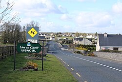
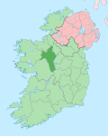
Lisacul

Last updated

Lisacul
Lios an Choill
Village
Entering Lisacul from Cloontowart.jpg
Entering Lisacul at Cloontowart
Ireland adm location map.svg
Red pog.svg
Lisacul
Location in Ireland
Coordinates: 53°51′30″N8°37′50″W / 53.858421°N 8.630480°W / 53.858421; -8.630480
Country Ireland
Province Connacht
County County Roscommon
Elevation
80 m (260 ft)
Time zone UTC+0 (WET)
  Summer (DST) UTC-1 (IST (WEST))
Irish Grid Reference M911163
Website lisaculinfo.ie

Lisacul (Irish : Lios an Choill, meaning 'fort of the hazel tree') [1] is a village in the north west of County Roscommon, Ireland, situated on the R293 regional road midway between Ballyhaunis in County Mayo and Ballaghaderreen, County Roscommon. It is part of the Barony of Frenchpark (the de Freyne family).

Contents

Education

There are two schools in Lisacul. Brightsparks Pre-School and Lisacul National School. Brightsparks has a roll of 28 pupils and five staff,[ citation needed ] while the national school (as of 2016) had over 70 pupils and five active teaching staff. [2]

Geography

The principal river in Lisacul, the River Lung, [3] is well stocked with fish, chiefly bream, perch, pike, roach and rudd and attracts anglers during the fishing season. The Loughglynn and District Angling Association holds open competitions throughout the year in the lakes around Loughglynn and Lisacul. [4] The Lung takes its name from the Luighne people, who claimed ancestry from Lugh, the Celtic war deity. [5]

Lisacul has at least seven ring forts and, according to tradition, there is a treasure buried in one of these. The main fort was situated in Whitestown, and all the other forts were said to be visible from this. One of the forts is now part of the grounds of Lisacul's national school. Another, in Kiltybranks, has a cave: during the rural electrification scheme in the late 1950s human remains were found there.

Pollawaddy cave is located approximately 1.5 km southwest of Lisacul village in Carrownaknockaun townland. The cave has a surveyed length of 45.5m and was explored and surveyed in September 2000 by David Drew and Caoimhe Hickey. [6]

Community centre (Memorial Hall)

Dedication plaque on Lisacul Memorial Hall Dedication plaque on Lisacul Memorial Hall.jpg
Dedication plaque on Lisacul Memorial Hall

The community centre in Lisacul was originally built in the 1930s, with a new extension completed in 2013. The original building was raised as a memorial to locals who died between 1920 and 1923 in the War of Independence and the Civil War. The dedication plaque reads:

I ndil cuimhne ar
Sheamus O’Maoil Bhreanainn
Eoghan O’Ceallaigh
Thomas O’ Flannghaile
Phadhraic O’ Maoil Bhreanainn
Tomas Mac Gabhann
A marbhuigheadh ar son poblacta na h-Eireann (1920-23)

(In memory of James Mulrennan, Eugene Kelly, Thomas Flannery, Patrick Mulrennan [and] Thomas McGowan who died for the republic of Ireland (1920-1923))

Handball alley

The original handball alley was built in 1916, using donated materials and voluntary labour. It was opened by the principal of the local school, Bill Ford. It was demolished and rebuilt in the 1970s. Refurbishments since have included adding tiered seating and wheelchair access.

Community

In 2016, members of the Lisacul community undertook a project, the "365 Project" to assemble an archive of photographs (one for each day of the year) capturing the people, places and things in the Lisacul area. [7]

Related Research Articles

<span class="mw-page-title-main">County Roscommon</span> County in Ireland

County Roscommon is a county in Ireland. It is part of the province of Connacht and the Northern and Western Region. It is the 11th largest Irish county by area and 27th most populous. Its county town and largest town is Roscommon. Roscommon County Council is the local authority for the county. The population of the county was 69,995 as of the 2022 census.

<span class="mw-page-title-main">Athlone</span> Town in counties Roscommon and Westmeath, Ireland

Athlone is a town on the border of County Roscommon and County Westmeath, Ireland. It is located on the River Shannon near the southern shore of Lough Ree. It is the second most populous town in the Midlands Region with a population of 21,349 in the 2016 census.

<span class="mw-page-title-main">Navan</span> Town in County Meath, Ireland

Navan is the county town of County Meath, Ireland. At the 2022 census, it had a population of 33,886, making it the ninth largest settlement in Ireland. It is at the confluence of the River Boyne and Blackwater, around 50 km northwest of Dublin.

<span class="mw-page-title-main">Ballymahon</span> Town in Leinster, Ireland

Ballymahon on the River Inny is a town in the southern part of County Longford, Ireland. It is located at the junction of the N55 National secondary road and the R392 regional road.

<span class="mw-page-title-main">Castlerea</span> Town in County Roscommon, Ireland

Castlerea is the third largest town in County Roscommon, Ireland. It is located in the west of the county and had a population of 1,992 at the 2016 Census. Roughly translated from Irish, Castlerea is generally thought to mean 'brindled castle'. An alternative translation is 'castle of the king'. The town is built on the banks of the River Suck and the River Francis, both of which are tributaries of the River Shannon.

<span class="mw-page-title-main">Newport, County Mayo</span> Town in Connacht, Ireland

Newport, historically known as Ballyveaghan and for many years also known as Newport-Pratt, is a small town in the barony of Burrishoole, County Mayo, Ireland. The population was 626 in 2016. It is located on the west coast of Ireland, along the shore of Clew Bay, north of Westport. The N59 road passes through the town. The county town of Castlebar is approx 18 km east of Newport. The Black Oak River flows through the centre of the town and there are walking paths along its banks.

<span class="mw-page-title-main">Ballaghaderreen</span> Town in County Roscommon, Ireland

Ballaghaderreen is a town in County Roscommon, Ireland. It was part of County Mayo prior to 1898. It is located just off the N5 National primary road. The population was 1,808 in the 2016 census.

<span class="mw-page-title-main">Kiltimagh</span> Town in County Mayo, Ireland

Kiltimagh is a town in County Mayo in Ireland. As of the 2016 census, the town had a population of 1,069 people. Although there in no river going through the town, three rivers flow around the town: the Glore River, Yellow River and Pollagh River. The town centre sits at the crest of a hill surrounding The High Fort in Fortlands and built out linearly on the main road from there.

<span class="mw-page-title-main">Dunmore, County Galway</span> Town in Connacht, Ireland

Dunmore is a town in County Galway, Ireland. It is located on the N83 national secondary road at its junction with the R328 and R360 regional roads.

Knockcroghery is a village and townland in County Roscommon, Ireland. It is located on the N61 road between Athlone and Roscommon town, near Lough Ree on the River Shannon. The townland of Knockcroghery is in the civil parish of Killinvoy and the historical barony of Athlone North.

<span class="mw-page-title-main">Drumsna</span> Village in County Leitrim, Ireland

Drumsna is a village in County Leitrim, Ireland. It is situated 6 km east of Carrick-on-Shannon on the River Shannon and is located off the N4 National primary route which links Dublin and Sligo. The harbour dates to 1817 and was a hive of commercial waterway activity until the more northern navigation canal to Carrick-on-Shannon was opened in 1850. Today, the waterway is busy with anglers and tourist pursuits in the summer months.

<span class="mw-page-title-main">Ballyforan</span> Village in Connacht, Ireland

Ballyforan is a village in south County Roscommon, Ireland on the R363 road between Ballygar and Dysart. It lies beside the River Suck which separates County Roscommon and County Galway.

<span class="mw-page-title-main">Blackwatertown</span> Village in County Armagh, Northern Ireland

Blackwatertown is a small village in County Armagh, Northern Ireland. It sits on the River Blackwater, in the townland of Lisbofin, at the border with County Tyrone. The village is around 8 kilometres (5 mi) north of Armagh city, and the villages of Benburb and Moy are nearby. Blackwatertown had a population of 376 in the 2011 Census. The River Blackwater enters Lough Neagh west of Derrywarragh Island and is navigable from Maghery to Blackwatertown.

<span class="mw-page-title-main">Roman Catholic Diocese of Elphin</span> Catholic diocese in Ireland

The Diocese of Elphin is a Roman Catholic diocese in the western part of Ireland. It is in the Metropolitan Province of Tuam and is subject to the Metropolitan Archdiocese of Tuam. The current bishop is Kevin Doran who was appointed in 2014.

<span class="mw-page-title-main">Costello (barony)</span>

Costello is one of the ancient baronies of Ireland. Unusually for an Irish barony, it straddles two counties: County Mayo and County Roscommon. It comprises the modern day districts of Kilkelly, Kilmovee, Killeagh, Kilcolman, and Castlemore.

<span class="mw-page-title-main">Lough Gara</span>

Lough Gara is a lake in Counties Sligo and Roscommon, Ireland. It is an Important Bird Area protecting 1,788 ha of which most is covered by a Ramsar Site.

<span class="mw-page-title-main">Loughglinn</span> Village in Connacht, Ireland

Loughglinn or Loughglynn is a village in County Roscommon, Ireland. It is named after the lake to the north of the village.

Thomas O'Doherty was Bishop of Clonfert and Bishop of Galway successively from November 1919 to July 1936.

<span class="mw-page-title-main">Brideswell, County Roscommon</span> Village in Connacht, Ireland

Brideswell is a village located in the south of County Roscommon, Ireland. It lies 11km from the Centre of Athlone and 60km from Tuam Town.

<span class="mw-page-title-main">Corkaree</span> Barony in Leinster, Ireland

Corkaree is a barony in north County Westmeath, Ireland. It was formed by 1672. It is bordered by three other baronies: Fore, Moyashel and Magheradernon and Moygoish.

References

  1. "Lios an Choill/Lisacul". logainm.ie (in Irish). Retrieved 15 April 2016.
  2. "Whole School Evaluation Management, Leadership and Learning Report - Lisacul National School" (PDF). education.ie. Department of Education. 5 October 2016. Retrieved 8 May 2020.
  3. "GSI Web - Lisacul - the River Lung". www.gsi.ie. Retrieved 15 April 2016.
  4. "Loughglynn and District Anglers' Association". 13 April 2016.
  5. "The Lung River: A Significant Historical Frontier- Dr. Myles Sweeney | Lough Gara Lakes & Legends". www.loughgaralakesandlegends.ie. Retrieved 15 April 2016.
  6. "The Geological Heritage of Roscommon, An audit of County Geological Sites in Roscommon" . Retrieved 23 April 2016.
  7. "Lisacul 365 – Lisacul Community Website". lisaculinfo.ie. 3 December 2015. Retrieved 23 April 2016.