Cortober

Last updated

Cortober
Corr an Tobair
Village
Ireland adm location map.svg
Red pog.svg
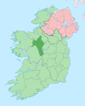
Cortober
Location in Ireland
Coordinates: 53°56′17″N8°06′04″W / 53.938°N 8.101°W / 53.938; -8.101
Country Ireland
Province Connacht
County County Roscommon
Elevation
75 m (246 ft)
Population
  Total750
Time zone UTC+0 (WET)
  Summer (DST) UTC-1 (IST (WEST))
Irish Grid Reference M941997
Website www.carrickonshannon.ie

Cortober (Irish : Corr an Tobair, meaning 'round hill of the spring well') [1] is a village and townland in County Roscommon, Ireland. It is located across the bridge from the town of Carrick-on-Shannon on the right bank of the River Shannon. It is bounded on the north by the parish of Tumna and River Shannon, on the east by the River Shannon, on the south by the townland of Cordrehead and Killukin and on the west by Mullaghmore.

Contents

Hollywell House

A St. George Estate Rental map for 1768 shows that the Hollywell House was then occupied by small cabins that surrounded the original 1623 fort of Liberty Hill, owned by Harris, Jones and King Families. Another Rental of Charles Manners St. George Estate, dated 1842, gives a list of some early residents of Cortober townland, including Andersons, Armstrongs, Backhouses and Bournes. These St. George Rentals confirm that Cortober was an integral part of the family land holdings.

Transportation

Midland Great Western Railway

The Midland Great Western Railway built the Carrick on Shannon railway station in the townland, which was opened on 3 December 1862. [2]

Roads

The N4 passes through the northern part of Cortober. From it, the R368 branches off towards the southwest and forms part of the western border of the townland.

The Rosary High School

In 1942 Ireland was emerging as a new nation. The country had experienced the Civil War, the Econimc War, and Europe was being ravaged by the Second World War slowly an infant education system was finding its feet. Here and there were schools founded and managed by people who were imbued with that pioneering spirit and generosity of mind which is so much part of the educator, seemingly scholastically brilliant. Outside the larger towns like Sligo and Longford there was no Secondary School available to the Carrick-on-Shannon area. Kathleen Lynch felt that there was a need for the establishment of a Secondary School to cater boys of neighbouring districts of North Roscommon and South Leitrim. On 8 September 1942 Kathleen Lynch, she was Mary Kathleen Mulhern of Drumlumman, opened the Rosary High School for boys at Cortober, on the Roscommon side of the Bridge as well as South Leitrim. The opening was performed by the Bishop of Elphin Most Rev. Dr. Edward Doorly.

Related Research Articles

<span class="mw-page-title-main">County Leitrim</span> County in Ireland

County Leitrim is a county in Ireland. It is in the province of Connacht and is part of the Northern and Western Region. It is named after the village of Leitrim. Leitrim County Council is the local authority for the county, which had a population of 35,087 according to the 2022 census.

Leitrim may refer to:

<span class="mw-page-title-main">Athlone</span> Town in counties Roscommon and Westmeath, Ireland

Athlone is a town on the border of County Roscommon and County Westmeath, Ireland. It is located on the River Shannon near the southern shore of Lough Ree. It is the second most populous town in the Midlands Region with a population of 21,349 in the 2016 census.

<span class="mw-page-title-main">Ballymahon</span> Town in Leinster, Ireland

Ballymahon on the River Inny is a town in the southern part of County Longford, Ireland. It is located at the junction of the N55 National secondary road and the R392 regional road.

<span class="mw-page-title-main">Carrick-on-Shannon</span> Town in County Leitrim, Ireland

Carrick-on-Shannon is the county town of County Leitrim in Ireland. It is the largest town in the county of Leitrim. A smaller part of the town lies in County Roscommon. As of the 2022 census, the population of the town was 4,743. It is situated on a strategic crossing point of the River Shannon. The Leitrim part of the town is in the civil parish of Kiltoghert which is in the ancient barony of Leitrim.

<span class="mw-page-title-main">Ballinamore</span> Town in County Leitrim, Ireland

Ballinamore is a small town in the south-east of County Leitrim in Ireland.

<span class="mw-page-title-main">Roosky</span> Village in Leitrim and Roscommon, Ireland

Roosky, Ruskey, or Rooskey is a village on the River Shannon in the northern midlands of Ireland, near the point where counties Leitrim, Longford, and Roscommon meet. The N4 road from Dublin to Sligo passes by the Leitrim side of the village.

<span class="mw-page-title-main">Drumsna</span> Village in County Leitrim, Ireland

Drumsna is a village in County Leitrim, Ireland. It is situated 6 km east of Carrick-on-Shannon on the River Shannon and is located off the N4 National primary route which links Dublin and Sligo. The harbour dates to 1817 and was a hive of commercial waterway activity until the more northern navigation canal to Carrick-on-Shannon was opened in 1850. Today, the waterway is busy with anglers and tourist pursuits in the summer months.

<span class="mw-page-title-main">Leitrim, County Leitrim</span> Village in County Leitrim, Ireland

Leitrim is a village in County Leitrim, Ireland, on the River Shannon near the border with County Roscommon. It is at the junction of the R280 and R284 regional roads.

<span class="mw-page-title-main">Regional road (Ireland)</span> Class of road in Ireland

A regional road in the Republic of Ireland is a class of road not forming a major route, but nevertheless forming a link in the national route network. There are over 11,600 kilometres of regional roads. Regional roads are numbered with three-digit route numbers, prefixed by "R". The equivalent road category in Northern Ireland are B roads.

Cath Áth an Chip, meaning the Battle of Ath an Chip, alias the "Battle of Connacht", was a battle fought in 1270 between the Hiberno-Normans and the Gaels of Connacht in County Leitrim in Ireland. The result was a decisive Gaelic victory. "Athanchip", then a ford marked by a tree-stump", is today the place called "Battle Bridge". The battle site is probably Drumhierney townland and Leitrim village.

Carrick was a constituency represented in the Irish House of Commons from 1614 to 1800. It returned two members.

<span class="mw-page-title-main">Carrick-on-Shannon railway station</span>

Carrick-on-Shannon railway station serves the town of Carrick-on-Shannon. Whilst the town itself is in County Leitrim, the railway station lies across the border in neighbouring County Roscommon in the small area of Cortober or Mullaghmore.

<span class="mw-page-title-main">Knockvicar</span> Village in Connacht, Ireland

Knockvicar is a village in County Roscommon, Ireland. It is located on the R285 regional road, between Boyle and Carrick-on-Shannon near Lough Key Forest Park in the north of the county.

<span class="mw-page-title-main">Ardcarn</span> Civil parish in County Roscommon, Boyle

Ardcarn or Ardcarne, is a civil parish in County Roscommon, Ireland.

<span class="mw-page-title-main">Cullyleenan</span> Townland in County Cavan, Ireland

Cullyleenan is a townland in the Parish of Tomregan, Barony of Tullyhaw, County Cavan, Ireland.

<span class="mw-page-title-main">Derryginny</span> Townland i County Cavan, Ireland

Derryginny is a townland in the Parish of Tomregan, Barony of Tullyhaw, County Cavan, Ireland.

<span class="mw-page-title-main">Corranierna</span> Townland in County Cavan, Ireland

Corranierna is a townland in the Parish of Tomregan, Barony of Tullyhaw, County Cavan, Ireland. (Disambiguation see also- Corranierna townland, County Cavan, Republic of Ireland.)

<span class="mw-page-title-main">Maigh Nissi</span> Barony in County Leitrim, Ireland

The barony of Leitrim is a barony in County Leitrim, Ireland.

<span class="mw-page-title-main">Brawny (barony)</span> Barony in Leinster, Ireland

Brawny is a barony in south–west County Westmeath, Ireland. It was formed by 1672. It is bordered by County Roscommon to the west. It also borders two other Westmeath baronies: Kilkenny West and Clonlonan. The largest centre of population in the barony is the town of Athlone.

References

  1. "Corr an Tobair/Cortober". Placenames Database of Ireland . Retrieved 10 September 2023.
  2. "Carrick on Shannon station" (PDF). Railscot - Irish Railways. Retrieved 2 September 2016.