Furbo, County Galway

Last updated

Furbo
Village
Na Forbacha (Irish)
Na Forbacha (Furbogh) - geograph.org.uk - 1288433.jpg
Hotel and coastal road at Furbo (Na Forbacha)
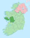
Ireland adm location map.svg
Red pog.svg
Furbo
Location in Ireland
Coordinates: 53°14′56″N9°12′18″W / 53.249°N 9.205°W / 53.249; -9.205
Country Ireland
Province Connacht
County County Galway
Elevation
15 m (49 ft)
Population
 (2022) [1]
868
Irish Grid Reference M199288
Na Forbacha is the only official name. The anglicised spellings Furbo and Furbogh have no official status.

Furbo or Furbogh (officially known as Na Forbacha in both Irish and English) [2] is a settlement in Connemara, County Galway, Ireland. As of the 2022 census, it had a population of 868 people. [1] It lies along the coast, overlooking Galway Bay, in a Gaeltacht (Irish speaking) area.

Contents

Location

Furbo lies between Barna and Spiddal on the coastal R336 road. [3] It is a typical Gaeltacht-style settlement with no village centre, but rather comprises around fourteen townlands, most of which run north to south from the bog to the foreshore. Furbo (officially Na Forbacha) spans the townlands of Cnocán an Bhodaigh, an Straidhp, an tSaoirsin, Baile na hAbhann, na Poillíní, Doire Uachtair, Aill an Phréacháin, an Coisméig Mór, na Forbacha Garbha, Seanadh Fhréachóg, and Cnoc na Gréine. [4]

Irish language

Located in a Gaeltacht area, Irish is the main language used in the local school, church and at community meetings. The headquarters of the Gaeltacht Authority, Údarás na Gaeltachta, is located in Na Forbacha. [5]

The figure for those who self-report as speaking Irish daily is 39%. Housing developments in the area have a requirement that 80% plus of housing units are reserved for Irish speakers.[ citation needed ]

Amenities

Furbo has a large community pitch (the Sportlann) which is used by several sports groups. These include the local hurling club (Bearna/Na Forbacha GAA), [6] Gaelic football club (CLG Bhearna),[ citation needed ] and soccer club (Bearna Na Forbacha Aontaithe). [7]

The local Catholic church is Our Lady Star of the Sea church (Séipéal Mhuire Réalt na Mara). It is in the parish of Bearna & na Forbacha in the Roman Catholic Diocese of Galway, Kilmacduagh and Kilfenora. [8] A mausoleum, alongside the church, dates to c.1860. [9]

The national (primary) school, Scoil na bhForbacha, had an enrollment of over 200 pupils as of 2023. [10]

Notable people

See also

Related Research Articles

<span class="mw-page-title-main">County Galway</span> County in Ireland

County Galway is a county in Ireland. It is in the Northern and Western Region, taking up the south of the province of Connacht. The county population was 276,451 at the 2022 census.

<i>Gaeltacht</i> Primarily Irish-speaking regions in Ireland

A Gaeltacht is a district of Ireland, either individually or collectively, where the Irish government recognises that the Irish language is the predominant vernacular, or language of the home. The Gaeltacht districts were first officially recognised during the 1920s in the early years of the Irish Free State, following the Gaelic revival, as part of a government policy aimed at restoring the Irish language.

<span class="mw-page-title-main">Iveragh Peninsula</span> Peninsula in County Kerry, Ireland

The Iveragh Peninsula is located in County Kerry in Ireland. It is the largest peninsula in southwestern Ireland. A mountain range, the MacGillycuddy's Reeks, lies in the centre of the peninsula. Carrauntoohil, its highest mountain, is also the highest peak in Ireland.

<span class="mw-page-title-main">Kinvara</span> Village in south County Galway, Ireland

Kinvara or Kinvarra is a sea port village in the southwest of County Galway, Ireland. It is located in the civil parish of Kinvarradoorus in the north of the barony of Kiltartan. Kinvarra is also an electoral division.

<span class="mw-page-title-main">Gweedore</span> Gaeltacht area in County Donegal, Ireland

Gweedore is an Irish-speaking district and parish located on the Atlantic coast of County Donegal in the north-west of Ireland. Gweedore stretches some 26 kilometres (16 mi) from Glasserchoo and Bloody Foreland in the north to Crolly in the south and around 14 kilometres (9 mi) from Dunlewey in the east to Magheraclogher and Magheralosk in the west, and is sometimes described as one of Europe's most densely populated rural areas. It is the largest Irish-speaking parish in Ireland with a population of around 4,065, and is also the home of the northwest regional studios of the Irish-language radio service RTÉ Raidió na Gaeltachta, as well as an external campus of the University of Galway. Gweedore includes the settlements of Brinlack, Bunbeg, Derrybeg, Crolly and Dunlewey, and sits in the shade of County Donegal's highest peak, Errigal.

<span class="mw-page-title-main">Údarás na Gaeltachta</span>

Údarás na Gaeltachta, abbreviated UnaG, is a regional state agency which is responsible for the economic, social and cultural development of Irish-speaking (Gaeltacht) regions of Ireland. Its stated purpose is to strengthen the Gaeltacht communities, to increase the quality of life of its community members and facilitate the preservation and extension of the Irish language as the principal language of the region. It gives funding to small local businesses that have to compete with foreign companies.

<span class="mw-page-title-main">Ráth Chairn</span> Village and Gaeltacht in County Meath, Ireland

Ráth Chairn is a small village and Gaeltacht in County Meath, Ireland. It is about 55 km northwest of Dublin. Ráth Chairn Gaeltacht was founded in 1935 when 27 families from Connemara, mostly from Ceantar na nOileán, were settled on land previously acquired by the Irish Land Commission, followed by a further 11 families in 1937. In all 443 people moved to the area.

<span class="mw-page-title-main">Barna</span> Village in County Galway, Ireland

Barna is a coastal village on the R336 regional road in Connemara, County Galway, Ireland. It has become a satellite village of Galway City. The village is Irish speaking and is therefore a constituent part of the regions of Ireland that make up the Gaeltacht.

<span class="mw-page-title-main">Moycullen</span> Gaeltacht village near Galway city, Ireland

Moycullen is a Gaeltacht village in County Galway, Ireland, about 10 km (7 mi) northwest of Galway city. It is near Lough Corrib, on the N59 road to Oughterard and Clifden, in Connemara. Moycullen is now a satellite town of Galway with some residents commuting to the city for work, school, and business. Population increased 33.7% from the 2016 census, reaching 2,279 in 2022.

<span class="mw-page-title-main">Rosmuc</span> Village in County Galway, Ireland

Rosmuc or Ros Muc, sometimes anglicised as Rosmuck, is a village in the Conamara Gaeltacht of County Galway, Ireland. It lies halfway between the town of Clifden and the city of Galway. Irish is the predominant spoken language in the area, with the electoral division of Turlough, Rosmuc, representing one of the highest percentages of Irish-speaking people in the country. The townland of Rosmuck is part of the civil parish of Kilcummin.

<span class="mw-page-title-main">Ring, County Waterford</span> Gaeltacht in Munster, Ireland

Ring or Ringagonagh is a parish within the Irish-speaking Gaeltacht na nDéise area in County Waterford, Ireland. It lies on a peninsula about eleven kilometres (7 mi) south of Dungarvan. The main settlement is the village of Ring or Ringville, which is within the townland of Ballynagaul.

Gluaiseacht Cearta Sibhialta na Gaeltachta or Coiste Cearta Síbialta na Gaeilge, was a pressure group campaigning for social, economic and cultural rights for native-speakers of Irish living in Gaeltacht areas. It was founded in Connemara in 1969 to highlight the decline of the Irish language and to campaign for greater rights for Irish speaking areas in the area of access to services, broadcasting and ultimately an elected assembly of their own. It was later named Gluaiseacht na Gaeltachta.

<span class="mw-page-title-main">Crolly</span> Gaeltacht village in County Donegal, Ireland

Croithlí or Croichshlí is a village in the Gaeltacht parishes and traditional districts of Gweedore and The Rosses in the west of County Donegal in Ulster, the northern province in Ireland. The two 'districts' are separated by the Crolly River. It has one convenience shop/restaurant and petrol station and one public house, Páidí Óg's. Crolly is located in two baronies: the Gweedore part of the village is in the Barony of Kilmacrenan, while The Rosses part of the village is in the Barony of Boylagh, the Crolly River being the boundary between the two baronies.

<span class="mw-page-title-main">Old Parish</span> Gaeltacht in Munster, Ireland

Old Parish is a village in west County Waterford, Ireland. It is part of the Gaeltacht in Waterford Gaeltacht na nDéise.

<span class="mw-page-title-main">Doohoma</span> Townland in Connacht, Ireland

Doohoma or Doohooma is a townland, peninsula and a census town in the County Mayo Gaeltacht, Ireland. It is located on Ireland's Atlantic coastline overlooking Achill Island and the Mullet Peninsula.

<span class="mw-page-title-main">Gaelcholáiste</span> Type of school in Ireland

A Gaelcholáiste is a secondary school on the island of Ireland located outside Gaeltacht areas, where Irish is the primary language of teaching and communication.

<span class="mw-page-title-main">Cois Fharraige</span>

Cois Fharraige, previously spelled Cois Fhairrge, is a coastal area west of Galway city, where the Irish language is the predominant language. It stretches from Na Forbacha, Bearna, An Spidéal to Indreabhán. There are between 8,000 and 9,000 people living in this area.

<span class="mw-page-title-main">Gaeltacht na nDéise</span> Gaeltacht district in Munster, Ireland

Gaeltacht na nDéise is a Gaeltacht area in County Waterford consisting of the areas of Ring and Old Parish. It is located 10 km from the town of Dungarvan. Gaeltacht na nDéise has a population of 1,816 people and encompasses a geographical area of 62 km2. This represents 1% of total Gaeltacht area.

Diarmuid Ó Gráinne was an Irish-language writer and journalist from the County Galway Gaeltacht. He wrote for the newspaper, and featured on Raidió na Gaeltachta. He released a number of books, perhaps best known works are his semi-autobiographical novel writings An Traimp and Muintir na Coille.

<span class="mw-page-title-main">Gaeltacht service town</span> State designation of selected urban areas in Ireland

A Gaeltacht service town is an area designated under the Gaeltacht Act 2012, situated in or adjacent to Gaeltacht areas in Ireland, that have a population of over 1,000 people, and which play a significant role in providing public services, recreational and commercial facilities for Gaeltacht residents.

References

  1. 1 2 "Interactive Data Visualisations: Towns: Na Forbacha". Census 2022. Central Statistics Office . Retrieved 8 December 2023.
  2. "Na Forbacha / Furbogh". logainm.ie. Placenames Database of Ireland.
  3. "'Serious' hit and run in Furbo sees pedestrian rushed to hospital". galwaybeo.ie. 25 October 2021. Retrieved 8 December 2023.
  4. "Na Forbacha Electoral Division, Co. Galway". townlands.ie. Retrieved 8 December 2023.
  5. "Údarás na Gaeltachta". udaras.ie. Retrieved 15 June 2023. Údarás na Gaeltachta, Na Forbacha, Co. na Gaillimhe
  6. "Bearna/na Forbacha - Location". bnaf.ie. Archived from the original on 26 December 2021.
  7. "Bearna Na Forbacha Aontaithe - Contact Us". sacarbnaf.com. Retrieved 9 December 2023.
  8. "Parishes - Bearna & na Forbacha". galwaydiocese.ie. Retrieved 8 December 2023.
  9. "Séipéal Mhuire Réalt na Mara [Catholic Church of Our Lady Star of the Sea], Ballynahown (Moycullen By), Na Forbacha [Furbogh], Galway". buildingsofireland.ie. National Inventory of Architectural Heritage. Retrieved 8 December 2023.
  10. "S N na bhForbacha". gov.ie. Department of Education. 20 July 2023. Retrieved 8 December 2023.
  11. O'Gorman, Ronnie (6 May 2010). "Woodford stood up to the power of Lord Clanricarde". Galway Advertiser. Retrieved 9 December 2023.
  12. Ó Ciardha, Mártan. "Ó Gráinne, Diarmaid (1950–2013)". ainm.ie (in Irish). Retrieved 15 June 2023.