Native name: Inis Treabhair | |
---|---|
Geography | |
Location | Atlantic Ocean |
Coordinates | 53°19′N9°40′W / 53.317°N 9.667°W |
Area | 0.94 km2 (0.36 sq mi) [1] |
Highest elevation | 14 m (46 ft) |
Administration | |
Province | Connacht |
County | Galway |
Demographics | |
Population | 0 [2] (2024) |
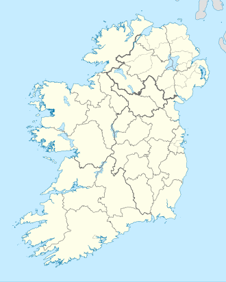
Inishtravin (Irish: Inis Treabhair) [3] is a small island and townland off the coast of Connemara, County Galway, Ireland. It is currently uninhabited.
|
|
| ||||||||||||||||||||||||||||||||||||||||||||||||||||||||||||||||||||||||||||||
Source: Central Statistics Office. "CNA17: Population by Off Shore Island, Sex and Year". CSO.ie. Retrieved 11 October 2024. |
Kinvara or Kinvarra is a sea port village in the southwest of County Galway, Ireland. It is located in the civil parish of Kinvarradoorus in the north of the barony of Kiltartan. Kinvarra is also an electoral division.
Aughinish, also Aughnish, is a small island and townland in Oughtmama Parish of the Barony of Burren in north County Clare, Ireland. It is on the south shore of Galway Bay, 11 km (7 mi) northwest of Kinvarra. The island is approximately 2 miles (3 km) wide and 1 mile (1.6 km) from the northernmost tip to the southernmost point and has just over fifty inhabitants.
A townland is a small geographical division of land, historically and currently used in Ireland and in the Western Isles in Scotland, typically covering 100–500 acres (40–202 ha). The townland system is of Gaelic origin, antedating the Norman invasion, and most have names of Irish origin. However, some townland names and boundaries come from Norman manors, plantation divisions, or later creations of the Ordnance Survey. The total number of inhabited townlands in Ireland was 60,679 in 1911. The total number recognised by the Irish Place Names database as of 2014 was 61,098, including uninhabited townlands, mainly small islands.
Rossaveal or Rossaveel is a Gaeltacht village and townland in the Connemara district of County Galway in the west of Ireland. It is the main ferry port for the Aran Islands in Galway Bay. It is about 37 kilometres (23 mi) from Galway city. The village is located in the barony of Moycullen.
Craughwell is a village and townland in County Galway, Ireland. As of the 2022 census, the village had a population of approximately 1,000 people.
Inishark or Inishshark, sometimes called Shark Island, is a small island neighbouring the larger Inishbofin in County Galway, Ireland.
Killagoola is a small townland lying in the civil parish of Moycullen in County Galway, Ireland. It is located about 8 miles from Galway city, just off the N59 road which travels north from Galway towards Clifden. Its name is derived from the Irish name of Cill Ogúla, which means Church on the Shoulder. Indeed there is the ruins of a small church within the boundaries of Killagoola, on the largest site in the area, Crú Hill.
Carna is an area in Connemara, County Galway, Ireland. It is located on the country's west coast in the Gaeltacht, about 50 km west of Galway city. Carna is an extremely small area, but as a focal point for the surrounding areas, it contains a Garda Síochána station, a Health Centre including a Rapid Response Ambulance, and an Irish Coastguard lifeboat. Carna is not located close to any villages. The population dramatically dropped from the previous average of 8,000 before the Great Famine. The age of the average resident is significantly higher than the Irish national average.
Castlegar is a village and electoral division in County Galway, just outside the city of Galway, in Ireland. Castlegar is also an ecclesiastical parish in the Roman Catholic Diocese of Galway, Kilmacduagh and Kilfenora. It extends from Lough Corrib across to Merlin Park by the old Galway-Dublin road.
Mutton Island is an uninhabited island and townland off the coast of County Clare, Ireland, about 1.5 km (0.9 mi) from the mainland. The nearest village is Quilty, which is roughly 3.5 km (2.2 mi) from the island.
Binn idir an Dá Log, sometimes anglicized Benadolug, at 702 metres (2,303 ft), is the highest of the Maumturk Mountains in Connemara in County Galway, Ireland. It is at the middle of the long north-west to south-east central spine of the range. The summit is the 87th-highest peak in Ireland on the Arderin list, and the 108th-highest on the Vandeleur-Lynam list.
The M18 motorway is an inter-urban motorway in Ireland, forming part of the Limerick, Ennis to Galway national primary road, which, in turn, forms part of the Atlantic Corridor called for as part of the Transport 21 project.
Island Eddy is a small, depopulated island at the inner, eastern end of Galway Bay, Ireland.
Muckanaghederdauhaulia is a 503-acre (204 ha) townland in the civil parish of Kilcummin in County Galway, Ireland. It is in the poor law union of Oughterard in the barony of Moycullen.
Oughtmama is a civil parish in County Clare. It lies in the Burren, a region in the northwest of the county. It contains many antiquities, including three early-medieval Christian churches, ruined castles, prehistoric cairns and ring forts and two Martello Towers built in the early 19th century.
Inishcaltra is a civil parish in the barony of Leitrim in County Clare, Ireland. The main settlement in the parish is the village of Mountshannon. It is noted for the eponymous island of Inis Cealtra, which is an ancient Christian monastic site. In the Catholic Church, the parish is part of the ecclesiastical parish of Mountshannon (Clonrush).
Inishturk is a small island and a townland of County Galway, in Ireland. The island is also referred as Inishturk South in order to tell it apart from the Inishturk island located in County Mayo.
Turbot is a small island and a townland of County Galway, in Ireland, also referred as Inishturbot and Talbot Island.
Inishfree refers to two small islands off the coast of County Donegal in the north of Ireland. Inishfree Upper is the larger of the two at around 0.6 square miles (1.6 km2). It is often known simply as "Inishfree".
Inishtravin has an area of 942,238 m² / 94.22 hectares / 0.9422 km²