
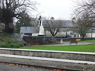
Mountshannon is a village in east County Clare, Ireland. It is part of the Catholic parish Mountshannon-Whitegate. The village is on the western shore of Lough Derg, north of Killaloe. Mountshannon won the Irish Tidy Towns Competition in 1981.

Lough Derg, historically Lough Dergart, is a freshwater lake in the Shannon River Basin, Ireland. It is the third-biggest on the island of Ireland and the second largest lake in the Republic of Ireland.
Tuamgraney is a village in eastern County Clare in the west of Ireland and a civil parish by the same name. Situated a kilometre from the River Graney which flows into Lough Derg, it is an ancient settlement, noted for St Cronán's Church, said to be the oldest church in constant use in Ireland
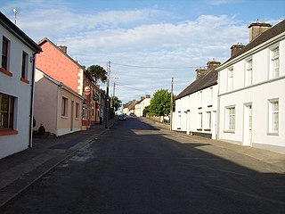
Feakle is a village in County Clare, Ireland, in the Roman Catholic parish of the same name. The village is in a townland and civil parish of the same name.

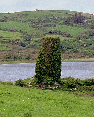
Inis Cealtra, also known in English as Inishcaltra or Holy Island, is an island off the western shore of Lough Derg in Ireland. Now uninhabited, it was once a monastic settlement. It has an Irish round tower, and the ruins of several small churches, as well as four high crosses and a holy well. Despite the lack of population, the cemetery on this island is still in use. Coffins and mourners are transported the short distance from County Clare in small boats. Boat trips can be taken from the harbour at Mountshannon. It is conserved by the East Clare Heritage Centre.
Tomfinlough is a civil parish in County Clare, Ireland. A Christian establishment was first made here around 540 AD. The parish lands were often raided by Irish, Viking, Norman and English forces in the years that followed. The church was allowed to fall into ruins during the period when the Catholic Church was penalized in Ireland.

Clonlea or Clonleigh is a civil parish in County Clare, Ireland. The main settlement is the village of Kilkishen. It is part of the Catholic parish of O'Callaghans Mills.

Tulla Upper is a barony in County Clare, Ireland. This ancient geographical division of land is in turn divided into seven civil parishes.
Rath is a civil parish in the barony of Inchiquin in County Clare, Ireland.

Templemaley is a civil parish in County Clare, Ireland. It contains the village of Barefield and part of the town of Ennis.

Kilseily is a civil parish in County Clare, Ireland. The main settlement is the village of Broadford.
Kilnoe is a civil parish in County Clare, Ireland. It is a rural area, part of the Roman Catholic parish of Bodyke.
Moynoe is a civil parish in County Clare, Ireland. It is part of the Roman Catholic parish of Scarriff and Moynoe.

Kilraghtis is a civil parish in County Clare, Ireland. It covers an area northeast of the town of Ennis, and includes the Ennis suburb of Roslevan.
Killeely is a civil parish that lies partly in County Clare and partly in County Limerick in Ireland.
Clonrush or Clonmulsk is a civil parish in the barony of Leitrim, now in County Clare, Ireland. The largest settlement in the parish is Whitegate.

Killuran is a civil parish in County Clare, Ireland. It contains the village of O'Callaghans Mills. It is united with the civil parish of Kilkishen in the Catholic parish of O'Callaghans Mills.

Killonaghan or Killonahan is a civil parish in County Clare, Ireland. It covers a part of the Burren, a rugged area on the Atlantic coast, and contains the seaside village of Fanore.

Drumcreehy or Dromcreehy is a civil parish in County Clare, Ireland. It contains the village of Ballyvaughan.
Leitrim is a barony in Ireland that lies partly in County Galway and partly in County Clare. It is located in the south-eastern corner of County Galway and the north-eastern corner of County Clare. Prior to 1898, the entire barony was contained in County Galway. The Local Government (Ireland) Act 1898 split the barony: part of the barony was transferred to County Clare. Leitrim is bounded, clockwise from the southwest, by the Clare baronies of Tulla Upper and Tulla Lower; the Galway baronies of Loughrea to the west, Kilconnell to the north, and Longford to the east; and by Lough Derg to the south and southeast. It measures 20 miles (32 km) from north to south and 9.5 miles (15.3 km) from east to west.

