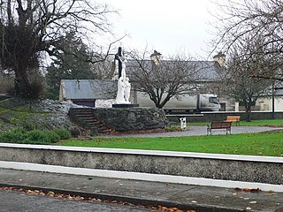
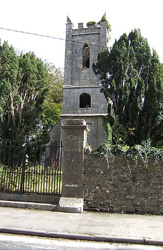
Tuamgraney is a village in eastern County Clare in the west of Ireland and a civil parish by the same name. Situated a kilometre from the River Graney which flows into Lough Derg, it is an ancient settlement, noted for St Cronán's Church, said to be the oldest church in constant use in Ireland

Doora is a village and civil parish in County Clare, Ireland, just to the east of the town of Ennis.

Kilmaley is a village in County Clare, Ireland, 8 kilometres (5 mi) west of Ennis. The name "Kilmaley" came from the Irish language "Cill Mhaile" which translates to Church of (Saint) Maley.

Bodyke is a village in County Clare, Ireland. It is located in eastern County Clare in the Catholic parish of Bodyke. During the 1880s, a series of evictions in the Bodyke area were widely publicised.

Clonlea or Clonleigh is a civil parish in County Clare, Ireland. The main settlement is the village of Kilkishen. It is part of the Catholic parish of O'Callaghans Mills.

Templemaley is a civil parish in County Clare, Ireland. It contains the village of Barefield and part of the town of Ennis.

Kilseily is a civil parish in County Clare, Ireland. The main settlement is the village of Broadford.

Kilchreest is a civil parish of County Clare, Ireland. It contains the village of Ballynacally and is part of the Roman Catholic parish of Ballynacally (Clondegad), which includes the civil parish of Clondagad to the north.
Moynoe is a civil parish in County Clare, Ireland. It is part of the Roman Catholic parish of Scarriff and Moynoe.

Killofin is a civil parish in County Clare, Ireland. It contains the village of Labasheeda and is part of the Catholic parish of Kilmurry McMahon.

Doonbeg (Killard) (Irish: Cill Ard) is a civil parish on the Atlantic coast of County Clare in Ireland. It is also an ecclesiastical parish in the Roman Catholic Diocese of Killaloe. The largest population centre in the parish is the village of Doonbeg.

Kilballyowen is the name of both a civil parish and a townland within that parish in County Clare, Ireland. The name is also occasionally used for the slightly larger Catholic parish of Cross.
Kilmurry-Negaul is a civil parish and a village in County Clare, Ireland.
Crusheen, formerly called Inchicronan, is a civil parish in County Clare, Ireland. There is also a catholic parish Crusheen, covering the same area. The parish lies to the northeast of Ennis. It contains the villages of Crusheen and Ballinruan.

Killuran is a civil parish in County Clare, Ireland. It contains the village of O'Callaghans Mills. It is united with the civil parish of Kilkishen in the Catholic parish of O'Callaghans Mills.

Noughaval or Nohoval is a civil parish in County Clare, Ireland.
Kiltoraght is a civil parish in County Clare, Ireland. It is just south of Kilfenora and is part of Catholic parish of St. Fachanan.
Killaspuglonane is a civil parish in County Clare, Ireland.

Kilkee, formerly Kilfearagh, is a parish in the Roman Catholic Diocese of Killaloe located in County Clare, Ireland. It lies on the Loop Head peninsula between the Atlantic Ocean and the Shannon Estuary. The main settlement is the resort town of Kilkee. The parish contains many ruins, some dating to the early days of Christianity in Ireland.
Bodyke, also known as Kilnoe and Tuamgraney, is a parish in County Clare, Ireland. It is part of the Inis Cealtra grouping of parishes within the Roman Catholic Diocese of Killaloe. It is an amalgamation of parts of the mediaeval parishes of Tomgraney (Tuamgraney) and Kilnoe.
