Kilcorney, County Clare

Last updated

Kilcorney

Cill Choirne
Caherconnell Fort.jpg
Caherconnell ringfort
Ireland adm location map.svg
Red pog.svg
Kilcorney
Location in Ireland
Coordinates: 53°02′24″N9°09′12″W / 53.039949°N 9.153288°W / 53.039949; -9.153288 Coordinates: 53°02′24″N9°09′12″W / 53.039949°N 9.153288°W / 53.039949; -9.153288
Country Ireland
Province Munster
County County Clare
Time zone UTC+0 (WET)
  Summer (DST) UTC-1 (IST (WEST))

Kilcorney (Irish : Cill Choirne [1] ) (sometimes also Kilcornane) is a civil parish in County Clare, Ireland. It lies in the Burren region of the northwest of the county.

Contents

Location

It is located in the Barony of Burren, 7 miles (11 km) north of Corofin. The parish is 3.5 by 1.75 miles (5.63 by 2.82 km) and covers 3,352 acres (1,357 ha). The land is typical of the broken, rocky and hilly country of the Burren. In 1841 the population was 330 in 50 houses. [2]

Antiquities

Cliff with the "Cave of the Wild Horses" Kilcorney - geograph.org.uk - 65584.jpg
Cliff with the "Cave of the Wild Horses"

Kilcorney parish was in existence by 1302. It was the smallest parish in the diocese of Kilfenora, ranking 21st out of 23 in the taxation list of 1302-6. Given that, the size of the parish church was surprisingly large and it also sported a chancel, not a standard feature in local parish churches. It may have benefitted from financial support by the O'Loghlen family, owners of Caherconnell cashel as well as the tower houses (castles) at Glensleade and Lissylisheen, all within 2 km of the church. [3] :132

The parish contains caves, a cromlech, and the ruins of an old castle. [2] There is a cave in Kilcorney townland (Cave of the Wild Horses) that is the subject of several legends. One is that an enchanted horse came from this cave and propagated its breed throughout the country. [4]

Poulnabrone Dolmen is a portal tomb, dating back to the Neolithic period, and situated 9.6 km (6.0 mi) north-west of the village of Kilnaboy. [5]

Kilcorney Church lies south of the present day road. No information is extant about its founding. There are references to a St Coirné, but no saint of this name is known. [3] :131 The old church of Kilcorney was extremely dilapidated in 1897. [4]

Nearby there was the site of an older church dedicated to the same saint some way from the present ruin. [4]

In addition, around 350 m to the west of the old church there are the barely discernible ruins of an ancient ecclesiastical building known as Kilcolmanbara, dedicated to Saint Colman Bairé, presumably the same as Saint Colman Mac Duach. It may have been in use in 1675 when a deed mentioned a tract of land named Cille Cholmáin Bháire but was certainly abandoned by 1839. There are several holy wells nearby, possibly associated with pilgrimage to the site. The holy well of Tobar na nAingeal (well of angels, eye cures) is near the church. Another holy well, Tobar Colman Bairé (also eye cures), is in Glensleade townland, about 1.5 km north of Kilcolmanbara. Another is Tobar Inghine Bhaoith (cure for warts). [4] [3] :1303

Since coirneach means tonsured or tonsured person, the site may have been an early monastic establishment, which also gave its name to the parish. Thus Cill Coirneach would have been the "church of the monks". [3] :131

There are various ruined stone or earth forts. These include Carher-na-mweela in the townland of Poulgorm, Caher-an-ard-dorais, Glensleade, Lisnanroum, Liscolmanbara, Lissaniska in Eanty beg south and Lissananima in Eanty beg north. Liscolman cashel near the Kilcolmanbara church may have been named for Colman, too. The castle of Glensleade belonged to a member of the O’Loghlen family in 1580. By 1897, it had been levelled to the ground. [4] [3] :131

Caherconnell cashel is an early medieval, well-preserved ringfort, located in the townland of Caherconnell, on the R480 road to Ballyvaughan.

Townlands

Townlands are Ballymihil, Baur North, Baur South, Caherconnell, Eantybeg North, Eantybeg South, Eantymore, Faherlaghroe, Glensleade, Kilcorney, Kilcorney Glebe, Lisnanroum, Magheraweeleen, Poulanine, Poulbaun, Poulgorm, Poulnabrone and Poulnaskagh. [6]

Related Research Articles

Kilfenora Village in Munster, Ireland

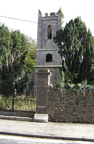
Kilfenora is a village and a civil parish in County Clare, Ireland. It is situated south of the karst limestone region known as the Burren. Since medieval times when it was the episcopal see of the Bishop of Kilfenora, it has been known as the "City of the Crosses" for its seven high crosses. The village had around 220 inhabitants in 2011. Much of the TV show Father Ted (1995–98) was filmed there.

Ballyvaughan Village in Munster, Ireland

Ballyvaughan or Ballyvaghan is a small harbour village in County Clare, Ireland. It is located on the N67 road on the south shores of Galway Bay, in the northwest corner of The Burren. This position on the coast road and the close proximity to many of the area's sights has turned the village into a local center of tourism activity. At the time of the 2011 Census Ballyvaughan had a population of 258. The area was officially classified as part of the West Clare Gaeltacht, an Irish-speaking community, until 1956.

Carran Town in Munster, Ireland

Carran, sometimes also spelled "Carron", is a small village in County Clare, Ireland, in the region known as the Burren, within a civil parish of the same name. It is notable mainly for being the birthplace of Michael Cusack, the inspirer and co-founder of the Gaelic Athletic Association. At the time of the 2011 Census, Carran had 106 inhabitants.

Caherconnell Stone Fort Medieval stone ringfort in the Burren, County Clare, Ireland.

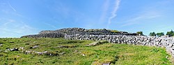
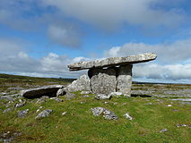
Caherconnell is an exceptionally well-preserved medieval stone ringfort in region known as the Burren, County Clare, Ireland. It lies about 1 km south of the Poulnabrone dolmen.

Tubber, County Clare Village in Munster, Ireland

Tubber is a village in the north of County Clare, Ireland.

Kilnaboy Place in Munster, Ireland

Kilnaboy or Killinaboy is a village, townland and civil parish in County Clare, Ireland. It is located in the Burren, and as of the 2011 census the area had 347 inhabitants.

Kilmoon Village and parish in Munster, Ireland

Kilmoon is a civil parish of County Clare, Ireland, 7 miles (11 km) north of Ennistymon. The parish contains the town of Lisdoonvarna.

Kilmacrehy Civil parish in Clare, Ireland

Kilmacrehy, sometimes also Kilmacreehy, is a civil parish in County Clare, Ireland. The ruins of the old parish church lie near the coastal village of Liscannor, which is also a part of the parish.

Kilmurry-Negaul Civil Parish and village in Munster, Ireland

Kilmurry-Negaul is a civil parish and a village in County Clare, Ireland.

Oughtmama Civil parish in Munster, Ireland

Oughtmama is a civil parish in County Clare. It lies in the Burren, a region in the northwest of the county. It contains many antiquities, including three early-medieval Christian churches, ruined castles, prehistoric cairns and ring forts and two Martello Towers built in the early 19th century.

Kilmaleery Parish in Munster, Ireland

Kilmaleery is a civil parish in County Clare, Ireland. It is part of the Catholic parish of Newmarket-on-Fergus.

Killilagh Parish in Munster, Ireland

Killilagh or Killeilagh is a civil parish in County Clare, Ireland. It contains the village of Doolin.

Noughaval Parish in Munster, Ireland

Noughaval or Nohoval is a civil parish in County Clare, Ireland.

Killonaghan Parish in Munster, Ireland

Killonaghan or Killonahan is a civil parish in County Clare, Ireland. It covers a part of the Burren, a rugged area on the Atlantic coast, and contains the seaside village of Fanore.

Gleninagh Parish in Munster, Ireland

Gleninagh or Glaninagh is a civil parish in County Clare, Ireland. It lies in the extreme northwest of the Burren, on the south of the mouth of Galway Bay. It is known for the well-preserved L-plan Gleninagh Castle, a 16th-century tower house. The parish also contains the lighthouse on Black Head.

Drumcreehy Parish in Munster, Ireland

Drumcreehy or Dromcreehy is a civil parish in County Clare, Ireland. It contains the village of Ballyvaughan.

Killeany Civil parish in Munster, Ireland

Killeany or Kilhenny, Kilheny is a civil parish in County Clare, Ireland. It lies in the Burren region of the northwest of the county.

Poulawack Cairn

Poulawack Cairn is a prehistoric burial cairn located in the Burren area of County Clare, Ireland.

Cahermacnaghten

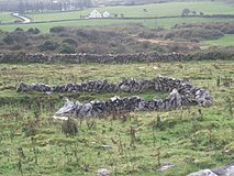
Cahermacnaghten is a ringfort south of Ballyvaughan in the Burren area, in County Clare, Ireland. It, or a nearby building, is the site of the famous O'Davoran law school. The fort is a National Monument.

Cashlaungar

Cashlaungar, also Cashlaungarr, Cashlaun Gar or Cashlán Gar, is a stone ringfort (cashel) and National Monument located in The Burren, a region in County Clare, Ireland.

References

Citations

  1. Cill Choirne, Placenames Database of Ireland.
  2. 1 2 Parliamentary Gazetteer of Ireland 1845.
  3. 1 2 3 4 5 Carthy, Hugh (2011). Burren Archaeology. The Collins Press. ISBN   9781848891050.
  4. 1 2 3 4 5 Frost 1897.
  5. Weir, A (1980). Early Ireland. A Field Guide. Belfast: Blackstaff Press. p. 110.
  6. Map of Kilcorney Parish showing Townlands.
  7. Poulnabrone Dolmen, Burren Ireland information.

Sources