Clonlea

Last updated

Clonlea
Cluain Lao
Civil parish
Castles of Munster, Kilkishen, Clare - geograph.org.uk - 1542578.jpg
Kilkishen Castle
Ireland adm location map.svg
Red pog.svg
Clonlea
Coordinates: 52°48′29″N8°44′42″W / 52.808°N 8.745°W / 52.808; -8.745
CountryIreland
County Clare

Clonlea or Clonleigh (Irish : Cluain Lao) [1] is a civil parish in County Clare, Ireland. The main settlement is the village of Kilkishen. It is part of the Catholic parish of O'Callaghans Mills.

Contents

Location

Clonlea is in the barony of Tullagh. It is 4.5 miles (7.2 km) to the north of Sixmilebridge. [2] It contains the village of Kilkishen. The parish is 5.5 miles (8.9 km) long and up to 3.25 miles (5.23 km) wide, covering an area of 8,833 acres (3,575 ha), some of which is covered by lakes. These include Lough Culleaungheeda, Lough Doon, Lough Clonleigh, Clonbrick and Castle-lake. [3] There is a holy well dedicated to Saint Senán of Iniscathy on the edge of Clonlea lake. [4] The ruins of the old parish church, and the burial ground, are on the southwest shore of Clonlea lake. The old ruin of Stackpoole overlooks the lakes of Pollagh and Mount Cashel. [2]

The parish covers 5,355 statute acres as applotted under the tithe act, mostly mountain and bog. [2] The parish contains the townlands of Ballyvorgal (Beg), Ballyvorgal (North), Ballyvorgal (South), Belvoir, Belvoir Demesne, Cappalaheen, Clashduff, Cloghoolia, Clonbrick, Clonlea, Cloonloum Beg, Cloonloum More, Coolistoonan, Derrynaveagh, Enagh (East), Enagh (North), Enagh (West), Glenwood, Gortadroma, Gortnacorragh, Gortnaglearagh, Kilkishen Demesne, Killanena, Killeen, Knockatinty, Knockatloe, Knockatooreen, Lakyle, Mountallon, Oatfield and Teeronea. [5]

History

Clonlea, Kilseily and part of O'Brien's Bridge (Trúgh) used to comprise the district of Ui Floinn, the land of the O'Flynns. This sept is little known, but there is a mention in MacGrath's Wars of Thormond of the battle of Magh Duine around 953 in which Lachtna, uncle of Brian Boroimhe, slew three of the O'Flynns. [6]

The old burial ground is said to contain the remains of one John Cusack, of Kilkishin Castle, who is said to have earned the hatred of the people by acting as a discoverer of the estates of the Catholic gentry. [7]

The first church at Kilkishen was probably built very early in the 19th century. It is mentioned in an 1811 report of a dispute that led to violence over who should sit nearest to the altar. [8]

As of 1831 the parish had 3,105 inhabitants. In 1841 there were 3,749 in 579 houses. In 1834 there were 3,274 Catholics and 60 Protestants. [3] There were 60 limekilns, used to make lime to fertilize the soil. The parish was part of the Catholic union of Kilkishen, which also included the parish of Killuran. Each year two fairs were held at Enagh, and three at Kilkishen. [2] Major renovation or reconstruction of the church was completed in 1865. [8] The fair called Enagh O'Floinn was still being held late in the 19th century, although the sept of the O'Flynns had died out more than five hundred years earlier. [4]

Today the civil parish is part of the Catholic parish of O'Callaghans Mills, which also includes the old parish of Killuran. [8] It is served by the church of St Senan's in Kilkishen. [9]

In 2017, a previously unrecorded mass rock and altar stone were discovered by a local teenager on the south west shore of the lake. [10] [11]

Related Research Articles

<span class="mw-page-title-main">Tuamgraney</span> Village in County Clare, Ireland

Tuamgraney is a village in eastern County Clare in the west of Ireland and a civil parish by the same name. Situated a kilometre from the River Graney which flows into Lough Derg, it is an ancient settlement, noted for St Cronán's Church, said to be the oldest church in constant use in Ireland
<span class="mw-page-title-main">Feakle</span> Village in County Clare, Ireland

Feakle is a village in County Clare, Ireland, in the Roman Catholic parish of the same name. The village is in a townland and civil parish of the same name.
<span class="mw-page-title-main">O'Callaghan's Mills</span> Village in County Clare, Ireland

O'Callaghan's Mills, also O'Callaghansmills, is a village in County Clare, Ireland, and a Catholic parish by the same name. It takes its name from the O'Callaghan family who were large landowners in the area and a corn and grist mill built by John Coonan on the lands of Cornelius O'Callaghan in 1772.

<span class="mw-page-title-main">Kilmaley</span> Village in County Clare, Ireland

Kilmaley is a village in County Clare, Ireland, 8 kilometres (5 mi) west of Ennis. The name "Kilmaley" came from the Irish language "Cill Mhaile" which translates to Church of (Saint) Maley.

<span class="mw-page-title-main">Kilkishen</span> Village in County Clare, Ireland

Kilkishen is a village in southeast County Clare, Ireland. The village is 8 kilometres (5 mi) east of Quin and 14 kilometres (8.7 mi) north of Shannon.
<span class="mw-page-title-main">Clonlara</span> Village in County Clare, Ireland

Clonlara, officially Cloonlara, is a village in County Clare, Ireland, and a Roman Catholic parish of the same name.

<span class="mw-page-title-main">Tulla Lower</span> Place in Munster, Ireland

Tulla Lower is a barony in County Clare, Ireland. This ancient geographical division of land is in turn divided into eight civil parishes.

Templemaley is a civil parish in County Clare, Ireland. It contains the village of Barefield and part of the town of Ennis.

<span class="mw-page-title-main">Kilseily</span> Civil parish in County Clare, Ireland

Kilseily is a civil parish in County Clare, Ireland. The main settlement is the village of Broadford.

Kiltenanlea or Kiltonanlea is a civil parish in County Clare, Ireland.
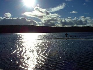
<span class="mw-page-title-main">Killanena</span> Townland in Munster, Ireland

Killanena is a townland and formerly a district electoral division (DED) in County Clare, Ireland, in the Catholic parish of Killanena.

<span class="mw-page-title-main">Kilchreest</span> Civil parish in Munster, Ireland

Kilchreest is a civil parish of County Clare, Ireland. It contains the village of Ballynacally and is part of the Roman Catholic parish of Ballynacally (Clondegad), which includes the civil parish of Clondagad to the north.

Kilnoe is a civil parish in County Clare, Ireland. It is a rural area, part of the Roman Catholic parish of Bodyke.

Moynoe is a civil parish in County Clare, Ireland. It is part of the Roman Catholic parish of Scarriff and Moynoe.

<span class="mw-page-title-main">Doonbeg (Killard)</span> Parish in County Clare, Ireland

Doonbeg (Killard) (Irish: Cill Ard) is a civil parish on the Atlantic coast of County Clare in Ireland. It is also an ecclesiastical parish in the Roman Catholic Diocese of Killaloe. The largest population centre in the parish is the village of Doonbeg.
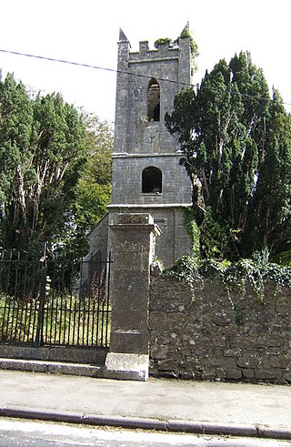
<span class="mw-page-title-main">Kilmurry-Negaul</span> Village in County Clare, Ireland

Kilmurry-Negaul is a civil parish and a village in County Clare, Ireland.

Clonrush or Clonmulsk is a civil parish in the barony of Leitrim, now in County Clare, Ireland. The largest settlement in the parish is Whitegate.

<span class="mw-page-title-main">Killuran</span> Civil parish in County Clare, Ireland

Killuran is a civil parish in County Clare, Ireland. It contains the village of O'Callaghans Mills. It is united with the civil parish of Kilkishen in the Catholic parish of O'Callaghans Mills.

<span class="mw-page-title-main">Kilkee (parish)</span> Catholic parish in County Clare, Ireland

Kilkee, formerly Kilfearagh, is a parish in the Roman Catholic Diocese of Killaloe located in County Clare, Ireland. It lies on the Loop Head peninsula between the Atlantic Ocean and the Shannon Estuary. The main settlement is the resort town of Kilkee. The parish contains many ruins, some dating to the early days of Christianity in Ireland.

O'Callaghan's Mills, also named O’Callaghan’s Mills & Kilkishen, is a parish in County Clare, Ireland, and part of the Ceantar na Lochanna grouping of parishes within the Roman Catholic Diocese of Killaloe. The parish is an amalgamation of the medieval parishes of Clonlea and Killuran plus some townlands taken over from other parishes.

References

Citations

  1. Cluain Lao, Placenames Database of Ireland.
  2. 1 2 3 4 Lewis 1837, p. 366.
  3. 1 2 Parliamentary Gazetteer of Ireland 1845.
  4. 1 2 Frost 1893, p. 152.
  5. Map of Clonlea Parish showing Townlands.
  6. Frost 1893, p. 151.
  7. Frost 1893, p. 151-152.
  8. 1 2 3 O'Callaghan's Mills.
  9. O'Callaghan's Mills Churches.
  10. Tulla Reaching Out: Reflections From Home and Abroad (Cuimhní Cinn sa Bhaile agus i gCéin). Tulla Reaching Out Committee. 2019.
  11. "Clare Herald online newspaper, Cathal records the history of his Parish". Clare Herald online newspaper. 2022.

Sources