
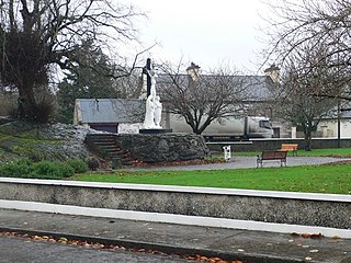
Mountshannon is a village in east County Clare, Ireland, and a Catholic parish by the same name. The village is on the western shore of Lough Derg, north of Killaloe. Mountshannon won the Irish Tidy Towns Competition in 1981.
Tuamgraney is a village in eastern County Clare in the west of Ireland and a civil parish by the same name. Situated a kilometre from the River Graney which flows into Lough Derg, it is an ancient settlement, noted for St Cronán's Church, said to be the oldest church in constant use in Ireland
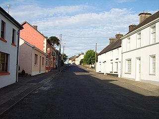
Feakle is a village in County Clare, Ireland, in a civil parish and Roman Catholic parish of the same name.
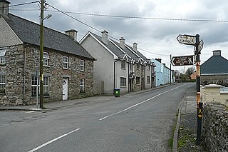
Ogonnelloe is a Catholic parish and civil parish in east County Clare, Ireland, situated on the R463 regional road between Scariff and Killaloe and in the surrounding hills.
The East Clare Way is a long-distance trail in County Clare, Ireland. It is a 180-kilometre (112-mile) long circular route that begins and ends in Killaloe. It is typically completed in eight days. It is designated as a National Waymarked Trail by the National Trails Office of the Irish Sports Council and is managed by East & Mid Clare Way Limited and the East Clare Way Committee.

Clonlea or Clonleigh is a civil parish in County Clare, Ireland. The main settlement is the village of Kilkishen. It is part of the Catholic parish of O'Callaghans Mills.
Bunratty Lower is a barony located in County Clare, Ireland. This ancient unit of land division is in turn divided into fourteen civil parishes.
Bunratty Upper is a barony in County Clare, Ireland. This ancient geographical division of land is in turn divided into six civil parishes.

Tulla Lower is a barony in County Clare, Ireland. This ancient geographical division of land is in turn divided into eight civil parishes.
Islands(Irish: Na hOileáin) is a barony located in County Clare, Ireland. This ancient unit of land division is in turn divided into five civil parishes.
Ibrickane is one of the ancient baronies of Ireland. It is a geographical division of County Clare. It is sub-divided into four civil parishes.
Inchiquin is a barony in County Clare, Ireland. This geographical unit of land is one of 11 baronies in the county. Its chief town is Corofin. It is administered by Clare County Council.
The Barony of Moyarta is a geographical division of County Clare, Ireland, that in turn is divided into civil parishes.
Killanena is a townland and formerly a District Electoral Division (DED) in County Clare, Ireland, in the Catholic parish of Killanena and Flagmount.
Kilnoe is a civil parish in County Clare, Ireland. It is a rural area, part of the Roman Catholic parish of Bodyke.
Moynoe is a civil parish in County Clare, Ireland. It is part of the Roman Catholic parish of Scarriff and Moynoe.
Crusheen, formerly called Inchicronan, is a civil parish in County Clare, Ireland. There is also a catholic parish Crusheen, covering the same area. The parish lies to the northeast of Ennis. It contains the villages of Crusheen and Ballinruan.

Inishcaltra is a civil parish in the barony of Leitrim in County Clare, Ireland. The main settlement in the parish is the village of Mountshannon. It is noted for the eponymous island of Inis Cealtra, which is an ancient Christian monastic site. In the Catholic Church, the parish is part of the ecclesiastical parish of Mountshannon (Clonrush).
Clonrush or Clonmulsk is a civil parish in the barony of Leitrim in County Clare, Ireland. The largest settlement in the parish is Whitegate. In the Catholic Church, the parish is joined with Mountshannon.
Leitrim is a barony in Ireland that lies partly in County Galway and partly in County Clare. It is located in the south-eastern corner of County Galway and the north-eastern corner of County Clare. Prior to 1898, the entire barony was contained in County Galway. The Local Government (Ireland) Act 1898 split the barony: part of the barony was transferred to County Clare. Leitrim is bounded, clockwise from the southwest, by the Clare baronies of Tulla Upper and Tulla Lower; the Galway baronies of Loughrea to the west, Kilconnell to the north, and Longford to the east; and by Lough Derg to the south and southeast. It measures 20 miles (32 km) from north to south and 9.5 miles (15.3 km) from east to west.

