Inis Cealtra

Last updated

Inis Cealtra
Nickname: Inishcaltra / Holy Island
Holy Island Clare St. Caimin's and Brigid's churches.jpg
St. Caimin's and Brigid's churches
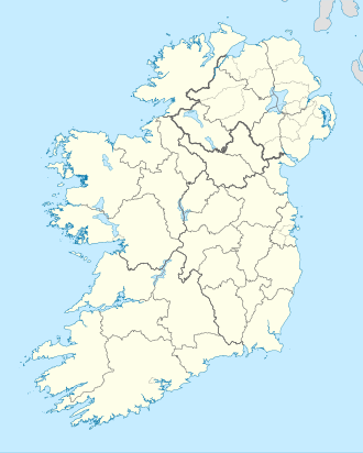
Island of Ireland location map.svg
Red pog.svg
Inis Cealtra
Geography
Location Lough Derg (Shannon)
Coordinates 52°54′54″N8°27′0″W / 52.91500°N 8.45000°W / 52.91500; -8.45000
Administration
Province Munster
County Clare
Demographics
Population0

Inis Cealtra, also known in English as Inishcaltra or Holy Island, [1] is an island off the western shore of Lough Derg in Ireland. Now uninhabited, it was once a monastic settlement. It has an Irish round tower, and the ruins of several small churches, as well as four high crosses and a holy well. Despite the lack of population, the cemetery on this island is still in use. Coffins and mourners are transported the short distance from County Clare in small boats. Boat trips can be taken from the harbour at Mountshannon. It is conserved by the East Clare Heritage Centre. [2]

Contents

History

Around 520 AD, St. Colum (d. 548) founded a monastery on Inis Cealtra. It formerly belonged to the Cenél Donnghaile in the territory of the Ó Grádaigh. The second monastery, a famous school of learning, was founded by St. Caimin (d. 653), who was Bishop-Abbot of Inis Cealtra and possibly the first Bishop of Killaloe. [3] Vikings visited the island in 836; led by Turgesius, they killed many of the monks. A further Viking attack led by Tomrair took place in 922. Marcán, brother of Brian Boru, was Bishop-Abbot of Tuamgraney and later Inis Cealtra until his death in 1003. [4] The religious buildings of Inis Cealtra were not occupied after the reformation. [5] [6]

Until 1849, the island was part of County Clare, even though the adjoining shore of the mainland was in County Galway. In 1849, the island was transferred to Galway as part of Griffith's Valuation, which was mandated to eliminate detached portions of counties. However, in 1899, the district electoral division containing both the island and adjoining mainland was transferred from Galway to Clare under the Local Government (Ireland) Act 1898. [7]

Ecclesiastic ruins

There are several ruins on the island. [8] [9] [10]

The pilgrim's path is a low curved earthwork between St. Caimin's Church and St. Michael's church.

The small Romanesque Baptism Church is enclosed by a stone wall. The doorway is an arch of three orders. The church was blown down in severe winds during 1839 and was later rebuilt as a house and as an ironworks.

St. Caimin's Church is the only roofed building, part of it dating back to the 10th century. In the 12th century, a Romanesque doorway was created in the western wall. In 1879 it was reconstructed as an arch of three orders. In 1978 that doorway was taken down. In 1981 it was rebuilt in an arch of four rather than three orders. Inside the church, there are crosses, monuments, gravestones and a sundial.

St. Mary's Church ruins are from the 13th century. Inside there are graves and an O'Brien tomb.

St. Michael's Church is the name given to the remains of a small building which appears to have been a church. Old Ordnance Survey maps mark it as "Garaidh Mhichaeil" (Michael's garden) it was most likely a cillín, a burial ground for unbaptised children.

Holy Island Clare St. Brigids Church.jpg
Holy Island Church Ruins, Lough Derg, Co. Clare (5262906803).jpg
Romanesque archway on Inis Cealtra photographed in the 19th and 21st centuries

The Round Tower was surveyed by Dr. Liam de Paor and restoration was carried out between 1970 and 1980. The round tower's cone-cap was not found implying that the tower was never finished. This fits in with the legend that a beautiful witch distracted the stonemason.

The entrance to the Saints' Graveyard is through the 19th-century graveyard. The 11th-century markers are inscribed in Irish. The confessional, pre 11th century, whose original use is unknown is situated outside the walls of the graveyard. It was used as a confessional during the 18th and 19th centuries and was rebuilt in the renovations of 1979. There are five known Bullaun stones on the island.

People

Annalistic references

See Annals of Inisfallen

AI922.2 Tomrair son of Elgi, a Jarl of the foreigners, on Luimnech (the Lower Shannon), and he proceeded and plundered Inis Celtra and Muicinis, and burned Cluain Moccu Nóis; and he went on Loch Rí and plundered all its islands, and he ravaged Mide.

Related Research Articles

<span class="mw-page-title-main">County Clare</span> County in Ireland

County Clare is a county in Ireland, in the Southern Region and the province of Munster, bordered on the west by the Atlantic Ocean. Clare County Council is the local authority. The county had a population of 118,817 at the 2016 census. The county seat and largest settlement is Ennis.

<span class="mw-page-title-main">Ennistymon</span> Town in County Clare, Ireland

Ennistymon or Ennistimon is a country market town in County Clare, near the west coast of Ireland. The River Inagh, with its small rapids known as the Cascades, runs through the town, behind the main street. A bridge across the river leads to nearby Lahinch, on the N67 national secondary road. The town is connected to Ennis by the N85, continuing the settlement's main street.

<span class="mw-page-title-main">Killaloe, County Clare</span> Town in County Clare, Ireland

Killaloe is a small town in east County Clare, Ireland. It lies on the River Shannon on the western bank of Lough Derg and is connected by Killaloe Bridge to the "twin town" of Ballina on the eastern bank of the lake.

<span class="mw-page-title-main">Mountshannon</span> Village in County Clare, Ireland

Mountshannon is a village in east County Clare, Ireland. It is part of the Catholic parish Mountshannon-Whitegate. The village is on the western shore of Lough Derg, north of Killaloe. Mountshannon won the Irish Tidy Towns Competition in 1981.

<span class="mw-page-title-main">March 24 (Eastern Orthodox liturgics)</span>

March 23 - Eastern Orthodox liturgical calendar - March 25

<span class="mw-page-title-main">March 25 (Eastern Orthodox liturgics)</span>

March 24 - Eastern Orthodox liturgical calendar - March 26

<span class="mw-page-title-main">Inis Cathaigh</span> Island in Shannon Estuary, Ireland

Inis Cathaigh or Scattery Island is an island in the Shannon Estuary, Ireland, off the coast of Kilrush, County Clare. The island is home to a lighthouse, a ruined monastery associated with Saints Senan and Canir, an Irish round tower and the remains of an artillery battery. The last residents left in 1969. Most of the island is now owned by the Office of Public Works, who run a small visitor centre and carry out repairs and maintenance on the island; it was bought by Dúchas in 1991.The Irish name Inis Cathaigh was formerly anglicised Iniscathy, which later became Iniscattery and finally Scattery.

<span class="mw-page-title-main">Tuamgraney</span> Village in County Clare, Ireland

Tuamgraney is a village in eastern County Clare in the west of Ireland and a civil parish by the same name. Situated a kilometre from the River Graney which flows into Lough Derg, it is an ancient settlement, noted for St Cronán's Church, said to be the oldest church in constant use in Ireland

<span class="mw-page-title-main">Feakle</span> Village in County Clare, Ireland

Feakle is a village in County Clare, Ireland, in the Roman Catholic parish of the same name.

<span class="mw-page-title-main">Donatus of Fiesole</span> Italian Roman Catholic saint

Donatus of Fiesole was an Irish teacher and poet, and Bishop of Fiesole.

Coman of Kinvara was an early Medieval Irish Saint.

<span class="mw-page-title-main">Tulla Upper</span> Place in Munster, Ireland

Tulla Upper is a barony in County Clare, Ireland. This ancient geographical division of land is in turn divided into seven civil parishes.

Mac Creiche of Liscannor is described by various old texts as an early Irish saint, a hermit who slew monsters and persuaded kings to submit to him through miracles. He was probably not a historical figure. The stories of his life are most likely derived from earlier pagan legends, and he may be equated with a pagan god.

<span class="mw-page-title-main">Inishcaltra</span> Civil parish in County Clare, Ireland

Inishcaltra is a civil parish in the barony of Leitrim in County Clare, Ireland. The main settlement in the parish is the village of Mountshannon. It is noted for the eponymous island of Inis Cealtra, which is an ancient Christian monastic site. In the Catholic Church, the parish is part of the ecclesiastical parish of Mountshannon (Clonrush).

Clonrush or Clonmulsk is a civil parish in the barony of Leitrim, now in County Clare, Ireland. The largest settlement in the parish is Whitegate.

<span class="mw-page-title-main">Inchbofin</span>

Inchbofin is an island situated in Lough Ree on the River Shannon, in central Ireland.

<span class="mw-page-title-main">St. Cronan's Church, Tuamgraney</span> Church in County Clare, Ireland

St. Cronan's Church is a 10th-century Church of Ireland church in Tuamgraney, County Clare, Ireland. It is the oldest church in continuous use in Ireland. The Tuamgraney parish operates as a unit with the Mountshannon parish in the Killaloe Union of parishes in the Diocese of Tuam, Limerick and Killaloe.

<span class="mw-page-title-main">Psalter of Caimín</span>

The Psalter of Caimín is a medieval Irish illuminated manuscript likely produced in the 11th century, possibly on the island of Inis Cealtra in Lough Derg. It is badly damaged, with only fragments surviving. These consist of six folios, containing verses 1-16 and 33-116 of Psalm 118, a psalm that would have had 176 versus in total, and was a favourite of the early Irish church. It is possible that the Psalter only ever consisted of this full psalm, perhaps also with notes and commentary, although it may have been much larger, containing the entire Psalter. It kept in the library of University College Dublin (MS.A.i)

Leitrim is a barony in Ireland that lies partly in County Galway and partly in County Clare. It is located in the south-eastern corner of County Galway and the north-eastern corner of County Clare. Prior to 1898, the entire barony was contained in County Galway. The Local Government (Ireland) Act 1898 split the barony: part of the barony was transferred to County Clare. Leitrim is bounded, clockwise from the southwest, by the Clare baronies of Tulla Upper and Tulla Lower; the Galway baronies of Loughrea to the west, Kilconnell to the north, and Longford to the east; and by Lough Derg to the south and southeast. It measures 20 miles (32 km) from north to south and 9.5 miles (15.3 km) from east to west.

Mountshannon-Whitegate, formerly Clonrush, is a parish in County Clare and part of the Inis Cealtra grouping of parishes within the Roman Catholic Diocese of Killaloe.

References

  1. "Inis Cealtra/Inishcaltra or Holy Island". Placenames Database of Ireland .
  2. Battersby, Eileen. "Through the door of history". The Irish Times.
  3. "Clare People: Saint Caimin". www.clarelibrary.ie.
  4. "East Clare, Scariff, Bed and Breakfast Clareville House Bed and Breakfast - Local Festival & Events in East Clare". Archived from the original on 12 August 2017. Retrieved 11 October 2016.
  5. "Visit Clare Ireland: The Islands of Lough Derg". Archived from the original on 23 March 2013. Retrieved 24 February 2013.
  6. "Holy Island | East Clare Heritage". Archived from the original on 27 March 2013. Retrieved 24 February 2013.
  7. "County (Ireland". The Statutory Rules and Orders Revised, being the Statutory Rules and Orders (Other Than Those of a Local, Personal Or Temporary Character) in force on December 31, 1903. Vol. 2 (2nd ed.). H.M. Stationery Office. 1904. pp. 18, 21–22). Retrieved 30 April 2014.
  8. "Clare Places - Holy Island (Inis Cealtra)". www.clarelibrary.ie.
  9. "St Caimin's Inishcaltra".
  10. "Ireland Mid-West Online - County Clare - Inis Cealtra - 'Holy Island'". www.irelandmidwest.com. Archived from the original on 9 July 2021. Retrieved 24 February 2013.

Sources

Other projects

Commons-logo.svg Media related to Holy Island, County Clare at Wikimedia Commons