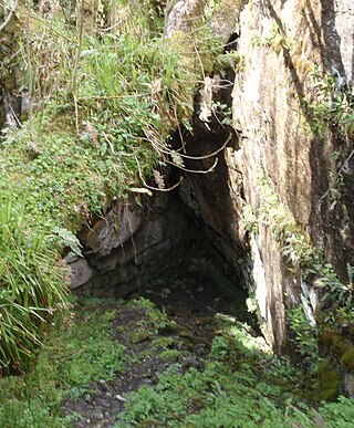
A cave or cavern is a natural void under the Earth's surface. Caves often form by the weathering of rock and often extend deep underground. Exogene caves are smaller openings that extend a relatively short distance underground. Caves which extend further underground than the opening is wide are called endogene caves.
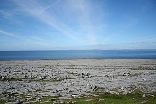
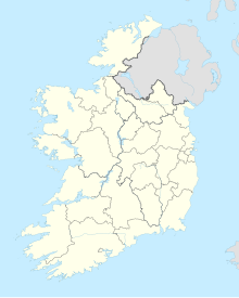
The Burren is a karst/glaciokarst landscape centred in County Clare, on the west coast of Ireland. It measures around 530 square kilometres (200 sq mi), within the circle made by the villages of Lisdoonvarna, Corofin, Gort and Kinvara. The area includes such natural features as Mullaghmore hill and Ailladie cliffs, and historic monuments such as Poulnabrone dolmen and Caherconnell Stone Fort. The Burren National Park covers a small part of the Burren and is the smallest of the eight National Parks in Ireland, while the adjacent territory, including the Cliffs of Moher, is included in the Burren and Cliffs of Moher Geopark.
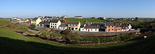
Doolin is a coastal village in County Clare, Ireland, on the Atlantic coast. It is southwest of the spa town of Lisdoonvarna and 4 miles from the Cliffs of Moher. It is a noted centre of traditional Irish music, which is played nightly in its pubs, making it a popular tourist destination. There are numerous nearby archaeological sites, many dating to the Iron Age and earlier. Doonagore Castle and Ballinalacken Castle are also in the area. The area was officially classified as part of the West Clare Gaeltacht prior to the 1950s, and maintains a connection with Irish-speaking areas - including via its maritime connection with the Aran Islands.

Ballyvaughan or Ballyvaghan is a small harbour village in County Clare, Ireland. It is located on the N67 road on the south shores of Galway Bay, in the northwest corner of The Burren. This position on the coast road and the close proximity to many of the area's sights has turned the village into a local center of tourism activity. At the time of the 2011 census Ballyvaughan had a population of 258. The area was officially classified as part of the West Clare Gaeltacht, an Irish-speaking community, until 1956.
Krubera Cave is the second-deepest-known cave on Earth, after the Veryovkina Cave. It is located in the Arabika Massif of the Gagra Range of the Western Caucasus, in the Gagra District of Abkhazia, a partly recognised state, previously part of Soviet Georgia.

The Marble Arch Caves are a series of natural limestone caves located near the village of Florencecourt in County Fermanagh, Northern Ireland. The caves are named after the nearby Marble Arch, a natural limestone arch at the upstream end of Cladagh Glen under which the Cladagh River flows. The caves are formed from three rivers draining off the northern slopes of Cuilcagh mountain, which combine underground to form the Cladagh. On the surface, the river emerges from the largest karst resurgence in Ireland, and one of the largest in the United Kingdom. At 11.5 kilometres (7.1 mi) the Marble Arch Caves form the longest known cave system in Northern Ireland, and the karst is considered to be among the finest in the British Isles.
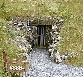
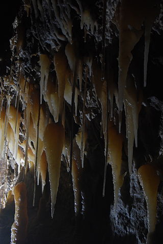
Doolin Cave is a limestone cave near Doolin in County Clare, Ireland, on the western edge of The Burren. The name is the anglicised version of the Irish name Poll an Eidhneáin, which is said to translate into "Ivy Cliff Cave". The cave attracted some controversy due to its development and marketing as a show cave in the early 21st century. It is now open to the public, branded as Doolin Cave.

Ailladie, is an 800-metre-long (2,600 ft) west-facing limestone sea cliff, that varies in height from 8 metres (26 ft) to 35 metres (115 ft), situated on the coast of The Burren in County Clare, Ireland. Ailladie is one of Ireland's most highly regarded rock-climbing locations, particularly for high technical grade single pitch traditional climbing routes and deep-water soloing routes. It is also a location for shore-angling competitions, and, with its cliffs and view of the Aran Islands, is a popular photography stop for tourists.
Shannon Cave is an active stream passage cave which straddles the border of County Fermanagh, Northern Ireland and County Cavan in the Republic of Ireland.
The Caves of the Tullybrack and Belmore hills are a collection of caves in southwest County Fermanagh, Northern Ireland. The region is also described as the West Fermanagh Scarplands by environmental agencies and shares many similar karst features with the nearby Marble Arch Caves Global Geopark.
Pollnagollum–Poulelva is an active stream passage cave situated in County Clare, Ireland.
The Burren and Cliffs of Moher Geopark is an internationally designated area of geological interest in The Burren region of County Clare, Ireland. It is the third Geopark to be designated in Ireland, and is recognised at both European and global levels.

Short Drop Cave and Gavel Pot are different entrances into the same cave system on Leck Fell, in Lancashire, England. The main top entrance, Short Drop Cave, is a small hole in a fenced-off shakehole near the main stream sink. Gavel Pot, a window into the system, is a large fenced shakehole some 40-metre (130 ft) deep requiring tackle to descend. There are two other smaller entrances into Short Drop Cave. At its base the system links via a sump with Lost Johns' Cave, and is part of the Three Counties System, an 87 kilometres (54 mi) cave system which spans the borders of Cumbria, Lancashire, and North Yorkshire.

A boulder choke is a collection of large rocks or rubble that obstructs a shaft or passage in a cave or mine. In order to progress through passages cavers often need to negotiate or clear boulder chokes.

Death's Head Hole is a cave on Leck Fell, in Lancashire, England. Its entrance is a 64-metre (210 ft) deep shaft. It leads into Lost Johns' Cave and is part of the Three Counties System, an 87-kilometre (54 mi) cave system which spans the borders of Cumbria, Lancashire, and North Yorkshire.

Aill na Cronain is an inland west-facing limestone crag in The Burren in County Clare, Ireland. It is popular with novice rock climbers due to the number of short single-pitch 10–20 metre rock climbing routes in the S to HS rock climbing grades. It is beside the Aillwee Caves.

Ballyryan or Ballyreen is a small inland mostly west-facing limestone crag in The Burren in County Clare, Ireland. It is popular with rock climbers due to its easy access, the range of short easy-to-intermediate rock climbs, and its close proximity to the much larger and highly regarded, Ailladie rock-climbing sea-cliff; Ailladie is also locally known as the Ballyreen Cliffs or Ballyreen Point.

Swinsto Cave is a limestone cave in West Kingsdale, North Yorkshire, England. It leads into Kingsdale Master Cave and it is popular with cavers as it is possible to descend by abseiling down the pitches, retrieving the rope each time, and exiting through Valley Entrance of Kingsdale Master Cave at the base of the hill. It is part of a 27-kilometre (17 mi) long cave system that drains both flanks of Kingsdale.
Michał Marek was a Polish cave diver who spent his last years in Ireland. As of May 2019, he holds the record for the deepest cave dive in Ireland at a depth of 113 m (371 ft).

The Long Kin East Cave - Rift Pot system is a limestone cave system on the southern flanks of Ingleborough, North Yorkshire in England lying within the designated Ingleborough Site of Special Scientific Interest. Long Kin East Cave starts as a long meandering stream passage but then plummets down a 58-metre (190 ft) deep shaft when it meets a shattered fault into which Rift Pot also descends. At the bottom, the stream flows through some low canals and sumps, to eventually emerge at Austwick Beck Head in Crummackdale.