Related Research Articles

County Tipperary is a county in Ireland. It is in the province of Munster and the Southern Region. The county is named after the town of Tipperary, and was established in the early 13th century, shortly after the Norman invasion of Ireland. It is Ireland's largest inland county and shares a border with eight counties, more than any other. The population of the county was 167,895 at the 2022 census. The largest towns are Clonmel, Nenagh and Thurles.

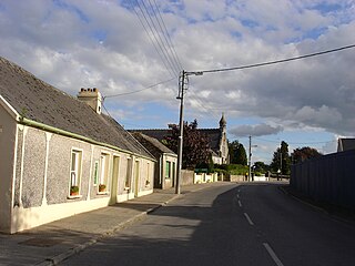
Dromineer is a small village and townland in County Tipperary, Ireland. It is situated on the shores of Lough Derg on the River Shannon. The village is located 10 km north of Nenagh on the R495 road. It is a civil parish in the historical barony of Ormond Lower. Historic documents describe the places as "Dromynnyre"; the earliest form of the name dating from 1302 was Dromynwyr.

Lough Derg, historically Lough Dergart, is a freshwater lake in the Shannon River Basin, Ireland. It is the third-biggest on the island of Ireland and the second largest lake in the Republic of Ireland.

Silvermines, historically known as Bellagowan, is a village in County Tipperary in Ireland. It lies immediately north of the Silvermine mountain range and takes its name from the extensive mines of lead, zinc, copper, baryte and silver nearby. Towards the very south of the Silvermine Mountains is the highest peak in the mountains, Keeper Hill or in Irish Sliabh Cimeálta, which rises to 695m, dominating the area. Silvermines is located near the town of Nenagh on the R499 regional road. It is a parish in the Roman Catholic Diocese of Killaloe and is also in the historical barony of Ormond Upper.

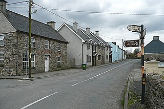
Puckane, officially Puckaun, is a village in County Tipperary, Ireland. It is also a parish in the Roman Catholic Diocese of Killaloe. The village is located 10 km north of Nenagh along the R493 and close to Lough Derg and Dromineer. It had a population of 250 people as of the 2016 census.
Murroe, officially spelled Moroe, is a village in County Limerick, Ireland.

The R494 road is a regional road in Ireland which runs southwest-northeast from Junction 27 of the M7 at Birdhill, County Tipperary to the N52 at Nenagh - all in County Tipperary. It leaves the M7 and loops around the Arra Mountains between the hills and Lough Derg returning to what was the N7 in Nenagh.
The Ballyhoura Way is a long-distance trail in Ireland. The trail is 89 kilometres long; it begins at St John's Bridge, near Kanturk, County Cork and ends at Limerick Junction, County Tipperary, and is typically completed in four days. It is designated as a National Waymarked Trail by the National Trails Office of the Irish Sports Council and is managed by Ballyhoura Fáilte. The trail was opened in April 1994 by President Mary Robinson.
The Cavan Way is a long-distance trail in County Cavan, Ireland. It is 22 kilometres long and begins in Blacklion and ends in Dowra. It is typically completed in one day. It is designated as a National Waymarked Trail by the National Trails Office of the Irish Sports Council and is managed by Cavan County Council. The trail was devised by a local man, Harold Johnston, and set up by the Blacklion Community Council and the Cavan County Development Team between 1984 and 1985.
The East Clare Way is a long-distance trail in County Clare, Ireland. It is a 180-kilometre (112-mile) long circular route that begins and ends in Killaloe. It is typically completed in eight days. It is designated as a National Waymarked Trail by the National Trails Office of the Irish Sports Council and is managed by East & Mid Clare Way Limited and the East Clare Way Committee.
The Slieve Felim way is a long-distance trail through the Slieve Felim Mountains in Ireland. It is 43 kilometres long, beginning in Murroe, County Limerick and ending in Silvermines, County Tipperary. It is typically completed in two days.

The Miners' Way and Historical Trail is a long-distance trail in Ireland. It is a 118-kilometre (73-mile) long circular route that begins and ends in Arigna, County Roscommon. It is typically completed in five days. It is designated as a National Waymarked Trail by the National Trails Office of the Irish Sports Council and is managed by Roscommon Integrated Development Company, Roscommon County Council, Leitrim County Council and Sligo County Council. The trail was developed to encourage tourism in the area in the wake of the closure of the Arigna mines in 1990. The route was originally conceived by a local priest, Father Sean Tynan, and built with funding from the European Regional Development Fund. The trail was opened by broadcaster Donncha Ó Dúlaing in July 2000.

The Offaly Way is a long-distance trail in County Offaly, Ireland. It is 37 kilometres long and begins in Cadamstown and ends at Lemanaghan, on the R436 road between the towns of Clara and Ferbane. It is typically completed in two days. It is designated as a National Waymarked Trail by the National Trails Office of the Irish Sports Council and is managed by Offaly County Council, Bord na Mona and the Offaly Integrated Development Company. The trail provides a link between the Slieve Bloom Way and the Grand Canal Way.

The Sligo Way is a long-distance trail mainly in County Sligo, Ireland. It is 78 kilometres long and begins in Larrigan, near Lough Talt and ends in Dromahair, County Leitrim. It is typically completed in three days. It is designated as a National Waymarked Trail by the National Trails Office of the Irish Sports Council and is managed by Sligo County Council, Sligo Integrated Development Company and the Sligo Walks Partnership.
The Tipperary Heritage Way is a long-distance trail in County Tipperary, Ireland. It is 56 kilometres long and begins at the Vee Gap, near Clogheen, and ends in Cashel. It is typically completed in two days. It is designated as a National Waymarked Trail by the National Trails Office of the Irish Sports Council and is managed by Tipperary County Council, South Tipperary Integrated Development Company and the Tipperary Heritage Way Committee. The trail was opened on 7 September 2002 by Michael Smith, Minister for Defence.

The Nenagh River rises in the Silvermine Mountains in County Tipperary, Ireland. It flows east of Nenagh and into Lough Derg just north of Dromineer.

Garrykennedy is a townland, settlement and harbour in the historical Barony of Owney and Arra, County Tipperary, Ireland. It is located on the eastern shore of Lough Derg, 2 km north of Portroe.
The Ollatrim River rises in County Tipperary, Ireland. It joins the Nenagh River east of Nenagh town and together they flow into Lough Derg north of Dromineer. A short section of the river forms the border between County Offaly and County Tipperary. The river flows through the Townland of Ollatrim.
Lough Derg Yacht Club is a boat club based in the lakeside village of Dromineer in County Tipperary, Ireland. Founded in 1835, it is one of the world's oldest yacht clubs. The club is based in a modern clubhouse on the east shore of Lough Derg.

The Shannon River Basin consists of the area containing Ireland's longest river, the River Shannon, and all of its tributaries and lakes. The official Ordnance Survey Ireland length of the Shannon from its Shannon Pot source is 224 miles (360 km) made up of 63.5 miles (102.2 km) tidal water flow and 160.5 miles (258.3 km) freshwater flow.
References
- 1 2 3 4 5 6 "Lough Derg Way". IrishTrails. Irish Sports Council . Retrieved 2 August 2011.
- ↑ National Trails Office 2010, p. 39.
- ↑ "New look Lough Derg Way relaunched". The Nenagh Guardian . Nenagh. 19 March 2011. p. 8.
- 1 2 "Lough Derg Way Map" (PDF). Shannon Region Trails. Archived from the original (PDF) on 28 March 2012. Retrieved 2 August 2011.
Bibliography
- National Trails Office (2010). "Setting New Directions. A review of National Waymarked Ways in Ireland" (PDF). Dublin: Irish Sports Council. Archived from the original (PDF) on 31 May 2011. Retrieved 1 August 2011.

