
County Mayo is a county in Ireland. In the West of Ireland, in the province of Connacht, it is named after the village of Mayo, now generally known as Mayo Abbey. Mayo County Council is the local authority. The population was 137,231 at the 2022 census. The boundaries of the county, which was formed in 1585, reflect the Mac William Íochtar lordship at that time.
These are lists of long-distance trails in the Republic of Ireland, and include recognised and maintained walking trails, pilgrim trails, cycling greenways, boardwalk-mountain trails, and interconnected national and international trail systems.

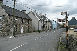
Belmullet is a coastal Gaeltacht town with a population of 1,019 on the Mullet Peninsula in the barony of Erris, County Mayo, Ireland. It is the commercial and cultural heart of the barony of Erris, which has a population of almost 10,000. According to the 2016 census 50% of people in the town were able to speak Irish while only 4% spoke it on a daily basis outside the education system.

The River Suck is a river within the Shannon River Basin in Ireland, 133 km (82.5 mi) in length. It is the main tributary of the River Shannon. It meets the Shannon a kilometre south of the village of Shannonbridge.
Bangor Erris is a town in Kiltane parish in Erris, County Mayo, Ireland with a population of over 300. It is on the banks of the Owenmore River and is a "gateway" to the Erris Peninsula linking Belmullet with Ballina and Westport. It is located at the foot of the "Bangor Trail" a 22-mile mountain pass across the Nephin Beg Mountain Range to Newport. Approximately 2 km away is Carrowmore Lake, Bangor is a centre for wild atlantic salmon and sea trout fishing. Bangor Erris is located in the Parish of Kiltane. Due west from Bangor are the towns of Belmullet, Geesala, Mulranny, Westport and Doolough.

Erris is a barony in northwestern County Mayo in Ireland consisting of over 230,452 acres (932.61 km2), much of which is mountainous blanket bog. It has extensive sea coasts along its west and north boundaries. The main towns are Belmullet and Bangor Erris. The name Erris derives from the Irish 'Iar Ros' meaning 'western promontory'. The full name is the Iorrais Domnann, after the Fir Bolg tribe, the Fir Domnann. To its north is the wild Atlantic Ocean and the bays of Broadhaven and Sruth Fada Conn and to its west is Blacksod Bay. Its main promontories are the Doohoma Peninsula, Mullet Peninsula, Erris Head, the Dún Chiortáin and Dún Chaocháin peninsulas and Benwee Head.

The N59 road is a national secondary road in Ireland. It commences in County Sligo, south of Sligo Town at the Belladrehid interchange with the N4 north of Ballysadare. The route circles around the west of Ireland, passing west from Sligo into County Mayo and through Ballina. The N59 continues around Mayo, proceeding indirectly to Westport. Continuing south through Mayo into County Galway, the road passes through the village of Leenaun. The 182-year-old bridge in the centre of the village, carrying the road across the River Lahill, collapsed in floods on 18 July 2007. Due to the local terrain and road network, the diversionary route for getting from the south of the village to Westport was 110 km long. A temporary bridge was opened eight days after the floods, on 27 July. It has since been replaced by a new bridge.

The Kerry Way is a long-distance trail in County Kerry, Ireland. It is a 214-kilometre (133-mile) long circular trail that begins and ends in Killarney and is typically broken into nine stages. It is designated as a National Waymarked Trail by the National Trails Office of the Irish Sports Council and is managed by Kerry County Council, South Kerry Development Partnership and the Kerry Way Committee. The Way circles the Iveragh Peninsula and forms a walkers' version of the Ring of Kerry road tour. It is the longest of Ireland's National Waymarked Trails.
A registration district in the United Kingdom is a type of administrative region which exists for the purpose of civil registration of births, marriages, and deaths and civil partnerships. It has also been used as the basis for the collation of census information.

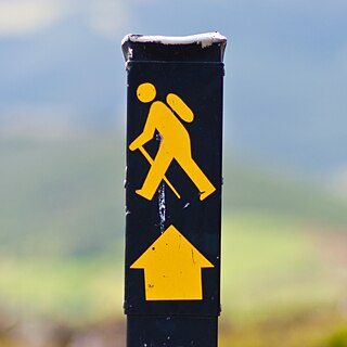
The Bangor Trail is a waymarked walking trail in Erris, North Mayo, Ireland. The trail, which is approximately 22 miles (35 km) in length, takes a route south from Bangor Erris through the Nephin Beg Range to Newport. Walking guides and maps of the Bangor Trail have been published by Mayo County Council.

The Burren Way is a long-distance trail in County Clare, Ireland. It is 114 kilometres long, begins in Lahinch and ends in Corofin, crossing The Burren, one of the largest karst limestone landscapes in Europe.

The Dingle Way is a long-distance trail around the Dingle Peninsula in County Kerry, Ireland. It is a 162-kilometre (101-mile) long circular route that begins and ends in Tralee and is typically completed in eight days. It is designated as a National Waymarked Trail by the National Trails Office of the Irish Sports Council and is managed by the Dingle Way Committee and Kerry County Council.
The East Clare Way is a long-distance trail in County Clare, Ireland. It is a 180-kilometre (112-mile) long circular route that begins and ends in Killaloe. It is typically completed in eight days. It is designated as a National Waymarked Trail by the National Trails Office of the Irish Sports Council and is managed by East & Mid Clare Way Limited and the East Clare Way Committee.
The Lough Derg Way is a long-distance trail in Ireland. It is 68 kilometres long, beginning in Limerick City and ending in Dromineer, County Tipperary. It is typically completed in three days.

The Miners' Way and Historical Trail is a long-distance trail in Ireland. It is a 118-kilometre (73-mile) long circular route that begins and ends in Arigna, County Roscommon. It is typically completed in five days. It is designated as a National Waymarked Trail by the National Trails Office of the Irish Sports Council and is managed by Roscommon Integrated Development Company, Roscommon County Council, Leitrim County Council and Sligo County Council. The trail was developed to encourage tourism in the area in the wake of the closure of the Arigna mines in 1990. The route was originally conceived by a local priest, Father Sean Tynan, and built with funding from the European Regional Development Fund. The trail was opened by broadcaster Donncha Ó Dúlaing in July 2000.

The Offaly Way is a long-distance trail in County Offaly, Ireland. It is 37 kilometres long and begins in Cadamstown and ends at Lemanaghan, on the R436 road between the towns of Clara and Ferbane. It is typically completed in two days. It is designated as a National Waymarked Trail by the National Trails Office of the Irish Sports Council and is managed by Offaly County Council, Bord na Mona and the Offaly Integrated Development Company. The trail provides a link between the Slieve Bloom Way and the Grand Canal Way.

The Sligo Way is a long-distance trail mainly in County Sligo, Ireland. It is 78 kilometres long and begins in Larrigan, near Lough Talt and ends in Dromahair, County Leitrim. It is typically completed in three days. It is designated as a National Waymarked Trail by the National Trails Office of the Irish Sports Council and is managed by Sligo County Council, Sligo Integrated Development Company and the Sligo Walks Partnership.
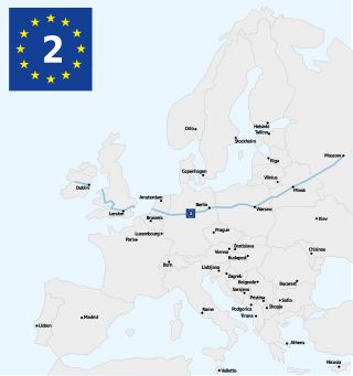
The Westmeath Way is a long-distance trail in County Westmeath, Ireland. It is 100 kilometres long and begins in Kilbeggan and ends in Athlone. It is typically completed in two days. It is designated as a National Waymarked Trail by the National Trails Office of the Irish Sports Council and is managed by Westmeath County Council and the Westmeath Way Committee. The trail forms part of the Dublin-Galway Greenway, part of the route 2 of the EuroVelo European cycle network.

The Suck Valley Way is a long-distance trail in Ireland. It is a 105-kilometre (65-mile) long circular route that begins and ends in Castlerea, County Roscommon. It is typically completed in five days. It is designated as a National Waymarked Trail by the National Trails Office of the Irish Sports Council and is managed by Roscommon County Council, Roscommon Integrated Development Company and the Suck Valley Committee.


