Miners Way and Historical Trail

Last updated
Miners' Way and Historical Trail
Length118 km (73 mi) [1]
LocationCounties Leitrim, Roscommon & Sligo, Ireland
DesignationNational Waymarked Trail [1]
Trailheads Arigna
UseHiking
Elevation
Elevation gain/loss2,340 m (7,677 ft) [1]
Hiking details
SeasonAny

The Miners' Way and Historical Trail is a long-distance trail in Ireland. It is a 118-kilometre (73-mile) long circular route that begins and ends in Arigna, County Roscommon. It is typically completed in five days. [1] It is designated as a National Waymarked Trail by the National Trails Office of the Irish Sports Council and is managed by Roscommon Integrated Development Company, Roscommon County Council, Leitrim County Council and Sligo County Council. [2] The trail was developed to encourage tourism in the area in the wake of the closure of the Arigna mines in 1990. [3] The route was originally conceived by a local priest, Father Sean Tynan, and built with funding from the European Regional Development Fund. [4] The trail was opened by broadcaster Donncha Ó Dúlaing in July 2000. [4]

Long-distance trail long trail used for walking, backpacking, cycling, horse riding or cross-country skiing

A long-distance trail is a longer recreational trail mainly through rural areas used for hiking, backpacking, cycling, horse riding or cross-country skiing. They exist on all continents except Antartica.

Republic of Ireland Ireland, a country in north-western Europe, occupying 5/6 of the island of Ireland; succeeded the Irish Free State (1937)

Ireland, also known as the Republic of Ireland, is a country in north-western Europe occupying 26 of 32 counties of the island of Ireland. The capital and largest city is Dublin, which is located on the eastern side of the island. Around a third of the country's population of 4.8 million people resides in the greater Dublin area. The sovereign state shares its only land border with Northern Ireland, a part of the United Kingdom. It is otherwise surrounded by the Atlantic Ocean, with the Celtic Sea to the south, St George's Channel to the south-east, and the Irish Sea to the east. It is a unitary, parliamentary republic. The legislature, the Oireachtas, consists of a lower house, Dáil Éireann, an upper house, Seanad Éireann, and an elected President who serves as the largely ceremonial head of state, but with some important powers and duties. The head of government is the Taoiseach, who is elected by the Dáil and appointed by the President; the Taoiseach in turn appoints other government ministers.

Arigna Village in Connacht, Ireland

Arigna is a village in County Roscommon, Ireland. It is near Lough Allen, on a designated "scenic route" between Keadue and Sliabh an Iarainn. Arigna is situated in Kilronan Parish alongside the fellow picturesque villages of Keadue and Ballyfarnon. The village lies close to the shores of Lough Allen.

Contents

The trail consists of three looped routes that travel through neighbouring parts of Counties Roscommon, Leitrim and Sligo. The Miners' Way is 62 kilometres (39 miles) long and follows paths used by miners working in the Arigna coal mines and makes a circuit via Keadue, Ballyfarnon and Corrie Mountain. [5] The Historical Trail is 56 kilometres (35 miles) long and makes a circuit of Lough Key and Lough Arrow via Keadue, Lough Key Forest Park, Boyle, Carrowkeel, Castlebaldwin, Highwood and Ballyfarnon. [5] A third trail makes a circuit of Lough Allen via Drumkeeran, Dowra and Drumshanbo. [5]

County Leitrim County in the Republic of Ireland

County Leitrim is a county in the Republic of Ireland. It is in the province of Connacht and is part of the Border Region. It is named after the village of Leitrim. Leitrim County Council is the local authority for the county, which had a population of 32,044 according to the 2016 census. The county encompasses the historic Gaelic territory of West Breffny (Bréifne) corresponding to the northern part of the county, and Muintir Eolais or Conmaicne Réin, corresponding to the southern part.

County Sligo County in the Republic of Ireland

County Sligo is a county in Ireland. It is located in the Border Region and is part of the province of Connacht. Sligo is the administrative capital and largest town in the county. Sligo County Council is the local authority for the county. The population of the county is 65,535 according to the 2016 census, making it the 3rd most populated county in the province. It is noted for Benbulben Mountain, one of Ireland’s most distinctive natural landmarks.

Keadue Village in Connacht, Ireland

Keadue, officially Keadew, is a village in County Roscommon, Ireland. It is on the R284 and R285 regional roads close to the borders of County Leitrim and County Sligo.

Parts of the Miners' Way and Historical Trail also form part of the Beara-Breifne Way, a walking and cycling route under development, intended to run from the Beara Peninsula, County Cork to Breifne, County Leitrim following the line of Donal Cam O'Sullivan Beare's march in the aftermath of the Battle of Kinsale in 1602. [6]

Beara-Breifne Way

The Beara-Breifne Way is a long distance walking and cycling trail being developed from the Beara Peninsula in County Cork, Ireland, to Blacklion in the area of Breifne in County Cavan. The trail follows closely the line of the historical march of O’Sullivan Beare.

Beara Peninsula barony of Ireland

Beara or the Beara Peninsula is a peninsula on the south-west coast of Ireland, bounded between the Kenmare "river" to the north side and Bantry Bay to the south. It contains two mountain ranges running down its centre: the Caha Mountains and the Slieve Miskish Mountains. The northern part of the peninsula from Kenmare to near Ardgroom is in County Kerry, while the rest forms the barony of Bear in County Cork.
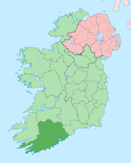
County Cork County in the Republic of Ireland

County Cork is a county in Ireland. It is the largest and southernmost county of Ireland, situated in the province of Munster and named after the city of Cork, Ireland's second-largest city. The Cork County Council is the local authority for the county. Its largest market towns are Mallow, Macroom, Midleton, and Skibbereen. In 2016, the county's population was 542,868, making it the third-most populous county in Ireland. Notable Corkonians include Michael Collins, Jack Lynch, and Sonia O'Sullivan.

Related Research Articles

Drumshanbo Town in Connacht, Ireland

Drumshanbo is a small town situated in the heart of County Leitrim, Ireland. Drumshanbo is surrounded by a scenic area of soft rolling hills, woodlands, lakes and the Sliabh an Iarainn and Arigna mountains. It is a well preserved town with traditional pubs, shops and restaurants.

Ballyfarnon Village in Connacht, Ireland

Ballyfarnon is a village in northern County Roscommon, Ireland. Built on the River Feorish at the foot of Arigna Mountain, it lies between Loughs Skean and Meelagh with Lough Arrow, Lough Allen, Lough Bo and Lough-na-Sool nearby. It lies on the Sligo/Leitrim R284 regional road on the border with County Sligo.

Beara Way Long-distance trail in Republic of Ireland

The Beara Way is a long-distance trail in Republic of Ireland. It is a 206-kilometre (128-mile) long circular trail around the Beara Peninsula that begins and ends in Glengarriff, County Cork. It is typically completed in nine days. It is designated as a National Waymarked Trail by the National Trails Office of the Irish Sports Council and is managed by the Beara Tourism and Development Association.

Patrick "Packie" Duignan was an Irish flute player, very well known by music lovers of his time. He was born in Aughabehy, in the Arigna Mountains of County Roscommon, Ireland.

Roman Catholic Diocese of Ardagh and Clonmacnoise diocese of the Catholic Church

The Diocese of Ardagh and Clonmacnoise is a Roman Catholic diocese in Ireland.

The Ballyhoura Way is a long-distance trail in Ireland. It is 89 kilometres long and begins at St John’s Bridge, near Kanturk, County Cork and ends at Limerick Junction, County Tipperary. It is typically completed in four days. It is designated as a National Waymarked Trail by the National Trails Office of the Irish Sports Council and is managed by Ballyhoura Fáilte. The trail was opened in April 1994 by President Mary Robinson.

The Cavan Way is a long-distance trail in County Cavan, Ireland. It is 22 kilometres long and begins in Blacklion and ends in Dowra. It is typically completed in one day. It is designated as a National Waymarked Trail by the National Trails Office of the Irish Sports Council and is managed by Cavan County Council. The trail was devised by a local man, Harold Johnston, and set up by the Blacklion Community Council and the Cavan County Development Team between 1984 and 1985.

The East Munster Way, formerly known as the Munster Way, is a long-distance trail in Ireland. It is 75 kilometres long and begins in Carrick-on-Suir, County Tipperary and ends in Clogheen, County Tipperary. It is typically completed in three days. It is designated as a National Waymarked Trail by the National Trails Office of the Irish Sports Council and is managed by Tipperary County Council, Coillte and Waterford County Council. The trail was opened by Frank Fahey, Minister of State for Youth and Sport in July 1988.

The Hymany Way is a long-distance trail in County Galway, Ireland. It is 50 kilometres long and begins in Portumna and ends in Aughrim. It is typically completed in two days. It is designated as a National Waymarked Trail by the National Trails Office of the Irish Sports Council and is managed by the Aughrim Development Company Limited. The trail was developed with funding assistance from the NTR Foundation, a philanthropic organisation of NTR plc. It was officially opened on 24 September 2010 by Councillor Jimmy McClearn, Mayor of County Galway. It is planned to extend the trail from Aughrim to Ballygar where it will join with the Suck Valley Way.

The South Leinster Way is a long-distance trail in Ireland. It is 104 kilometres long and begins in Kildavin, County Carlow and runs through County Kilkenny before ending in Carrick-on-Suir, County Tipperary. It is typically completed in five days. It is designated as a National Waymarked Trail by the National Trails Office of the Irish Sports Council and is jointly managed by Carlow County Council, Kilkenny County Council, Tipperary County Council, Carlow Local Sports Partnership, Kilkenny Trails and Coillte. It was opened on 30 November 1985 by Donal Creed, Minister of State for Sport.

The Multeen Way is a long-distance trail in County Tipperary, Ireland. It is 23 kilometres long and begins in Tipperary Town and ends in Upperchurch. It is typically completed in one day. It is designated as a National Waymarked Trail by the National Trails Office of the Irish Sports Council.

The Offaly Way is a long-distance trail in County Offaly, Ireland. It is 37 kilometres long and begins in Cadamstown and ends at Lemanaghan, on the R436 road between the towns of Clara and Ferbane. It is typically completed in two days. It is designated as a National Waymarked Trail by the National Trails Office of the Irish Sports Council and is managed by Offaly County Council, Bord na Mona and the Offaly Integrated Development Company. The trail provides a link between the Slieve Bloom Way and the Grand Canal Way.

The Sligo Way is a long-distance trail in County Sligo, Ireland. It is 78 kilometres long and begins in Larrigan, near Lough Talt and ends in Dromahair. It is typically completed in three days. It is designated as a National Waymarked Trail by the National Trails Office of the Irish Sports Council and is managed by Sligo County Council, Sligo Integrated Development Company and the Sligo Walks Partnership.

The Suck Valley Way is a long-distance trail in Ireland. It is a 105-kilometre (65-mile) long circular route that begins and ends in Castlerea, County Roscommon. It is typically completed in five days. It is designated as a National Waymarked Trail by the National Trails Office of the Irish Sports Council and is managed by Roscommon County Council, Roscommon Integrated Development Company and the Suck Valley Committee.

Seltannasaggart

Seltannasaggart, also called Corry Mountain, is a low mountain near Lough Allen on the border of County Roscommon and County Leitrim in Ireland.

The Ireland Way is Ireland's longest coast-to-coast walking and cycling trail that joins the newly developed Beara-Breifne Way to the Ulster Way on the island of Ireland. The trail goes from the Beara Peninsula in County Cork, Republic of Ireland to Ballycastle, County Antrim in Northern Ireland. The Beara-Breifne Way trail follows closely the line of the historical march of O’Sullivan Beare. One of the first people to walk the Ireland Way in one go was a Canadian woman named Maysen Forbes in 2017.

Boyle (barony) Barony in Connacht, Republic of Ireland

Boyle is a barony in County Roscommon, Republic of Ireland.

References

Notes

  1. 1 2 3 4 "Miners' Way and Historical Trail". IrishTrails. Irish Sports Council . Retrieved 3 August 2011.
  2. National Trails Office 2010, p. 40.
  3. Brennan, Paul (6 September 2000). "Arigna marks 10th anniversary of coalmines closure". Leitrim Observer . Carrick-on-Shannon. p. 18.
  4. 1 2 "Donncha O'Dulaing launches Miners' Way". Leitrim Observer . Carrick-on-Shannon. 19 July 2000. p. 14.
  5. 1 2 3 "Activities - walking". VisitRoscommon.com. Roscommon Tourism. Archived from the original on 13 October 2011. Retrieved 3 August 2011.
  6. "Walking". Beara-Breifne Greenway Project. Archived from the original on 5 September 2011. Retrieved 3 August 2011.

Bibliography