Related Research Articles
These are lists of long-distance trails in the Republic of Ireland, and include recognised and maintained walking trails, pilgrim trails, cycling greenways, boardwalk-mountain trails, and interconnected national and international trail systems.

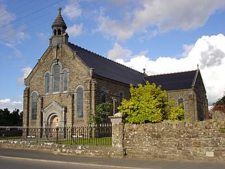
Silvermines, historically known as Bellagowan, is a village in County Tipperary in Ireland. It lies immediately north of the Silvermine mountain range and takes its name from the extensive mines of lead, zinc, copper, baryte and silver nearby. Towards the very south of the Silvermine Mountains is the highest peak in the mountains, Keeper Hill or in Irish Sliabh Cimeálta, which rises to 695m, dominating the area. Silvermines is located near the town of Nenagh on the R499 regional road. It is a parish in the Roman Catholic Diocese of Killaloe and is also in the historical barony of Ormond Upper.

The Silvermine Mountains or Silvermines Mountains are a mountain range in County Tipperary, Ireland. The highest peak of the range is Keeper Hill or Slievekimalta at 694 metres (2,277 ft) high. Traditionally, the mountains were deemed to be part of the Slieve Felim Mountains.

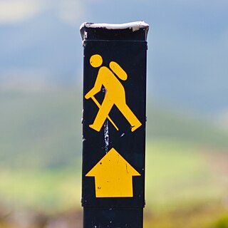
The Wicklow Way is a 131-kilometre (81-mile) long-distance trail that crosses the Wicklow Mountains in Ireland. It runs from Marlay Park in the southern suburbs of Dublin through County Wicklow and ends in the village of Clonegal in County Carlow. It is designated as a National Waymarked Trail by the Irish Sports Council and is waymarked by posts with a yellow "walking man" symbol and a directional arrow. Typically completed in 5–7 days, it is one of the busiest of Ireland's National Waymarked Trails, with up to 24,000 people a year walking the most popular sections. The Way is also used regularly by a number of mountain running competitions.

The Kerry Way is a long-distance trail in County Kerry, Ireland. It is a 214-kilometre (133-mile) long circular trail that begins and ends in Killarney and is typically broken into nine stages. It is designated as a National Waymarked Trail by the National Trails Office of the Irish Sports Council and is managed by Kerry County Council, South Kerry Development Partnership and the Kerry Way Committee. The Way circles the Iveragh Peninsula and forms a walkers' version of the Ring of Kerry road tour. It is the longest of Ireland's National Waymarked Trails.

The Beara Way is a long-distance trail in the southwest of Ireland. It is a 206-kilometre (128-mile) long circular trail around the Beara Peninsula that begins and ends in Glengarriff, County Cork, also passing through parts of County Kerry. It is typically completed in nine days. It is designated as a National Waymarked Trail by the National Trails Office of the Irish Sports Council and is managed by the Beara Tourism and Development Association.
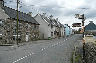
Murroe, officially spelled Moroe, is a village in County Limerick, Ireland.
The Ballyhoura Way is a long-distance trail in Ireland. The trail is 89 kilometres long; it begins at St John’s Bridge, near Kanturk, County Cork and ends at Limerick Junction, County Tipperary, and is typically completed in four days. It is designated as a National Waymarked Trail by the National Trails Office of the Irish Sports Council and is managed by Ballyhoura Fáilte. The trail was opened in April 1994 by President Mary Robinson.
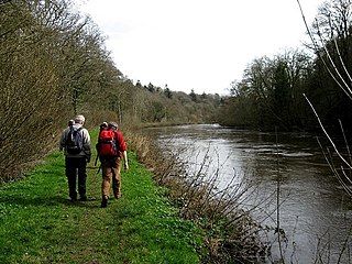
The Barrow Way is a long-distance trail in Ireland. It is 100 kilometres long and begins in Robertstown, County Kildare and ends in St Mullin's, County Carlow, following the course of the River Barrow and the Barrow Line of the Grand Canal through counties Kildare, Carlow, Kilkenny and Laois. It is typically completed in four days. It is designated as a National Waymarked Trail by the National Trails Office of the Irish Sports Council and is managed by Waterways Ireland.

The Bluestack Way is a long-distance trail through the Bluestack Mountains in County Donegal, Ireland. It is 65 kilometres long and begins in Donegal and ends in Ardara. It is typically completed in three days. It is designated as a National Waymarked Trail by the National Trails Office of the Irish Sports Council and is managed by the Bluestack Way Management Committee.

The Burren Way is a long-distance trail in County Clare, Ireland. It is 114 kilometres long, begins in Lahinch and ends in Corofin, crossing The Burren, one of the largest karst limestone landscapes in Europe.

The Dingle Way is a long-distance trail around the Dingle Peninsula in County Kerry, Ireland. It is a 162-kilometre (101-mile) long circular route that begins and ends in Tralee and is typically completed in eight days. It is designated as a National Waymarked Trail by the National Trails Office of the Irish Sports Council and is managed by the Dingle Way Committee and Kerry County Council.
The East Clare Way is a long-distance trail in County Clare, Ireland. It is a 180-kilometre (112-mile) long circular route that begins and ends in Killaloe. It is typically completed in eight days. It is designated as a National Waymarked Trail by the National Trails Office of the Irish Sports Council and is managed by East & Mid Clare Way Limited and the East Clare Way Committee.
The East Munster Way, formerly known as the Munster Way, is a long-distance trail in Ireland. It is 75 kilometres long and begins in Carrick-on-Suir, County Tipperary and ends in Clogheen, County Tipperary. It is typically completed in three days. It is designated as a National Waymarked Trail by the National Trails Office of the Irish Sports Council and is managed by Tipperary County Council, Coillte and Waterford County Council. The trail was opened by Frank Fahey, Minister of State for Youth and Sport in July 1988.

The Slieve Bloom Way is a long-distance trail around the Slieve Bloom Mountains in Ireland. It is a 70-kilometre (43-mile) long circular route that can be accessed from any of the trailheads at Glenbarrow near the village of Rosenallis, County Laois.Cadamstown, County Offaly Kinnitty, County Offaly. It is typically completed in three days. It is designated as a National Waymarked Trail by the National Trails Office of the Irish Sports Council and is managed by Laois County Council, Offaly County Council, Laois Integrated Development Company, Coillte and the Slieve Bloom Rural Development Society. The route was devised by a local man, Tom Joyce, and opened in 1987. The route was developed as part of the designation of the Slieve Bloom area as a European Environment Park in the European Year of the Environment.

The South Leinster Way is a long-distance trail in Ireland. It is 104 kilometres long and begins in Kildavin, County Carlow and runs through County Kilkenny before ending in Carrick-on-Suir, County Tipperary. It is typically completed in five days. It is designated as a National Waymarked Trail by the National Trails Office of the Irish Sports Council and is jointly managed by Carlow County Council, Kilkenny County Council, Tipperary County Council, Carlow Local Sports Partnership, Kilkenny Trails and Coillte. It was opened on 30 November 1985 by Donal Creed, Minister of State for Sport.

The Táin Way is a long-distance trail around the Cooley Peninsula in County Louth, Ireland. It is a 40-kilometre (25-mile) long circular route that begins and ends in Carlingford. It is typically completed in two days. It is designated as a National Waymarked Trail by the National Trails Office of the Irish Sports Council and is managed by Louth County Council, Coillte and the Walks Partnership Group.

The Offaly Way is a long-distance trail in County Offaly, Ireland. It is 37 kilometres long and begins in Cadamstown and ends at Lemanaghan, on the R436 road between the towns of Clara and Ferbane. It is typically completed in two days. It is designated as a National Waymarked Trail by the National Trails Office of the Irish Sports Council and is managed by Offaly County Council, Bord na Mona and the Offaly Integrated Development Company. The trail provides a link between the Slieve Bloom Way and the Grand Canal Way.

The Sligo Way is a long-distance trail mainly in County Sligo, Ireland. It is 78 kilometres long and begins in Larrigan, near Lough Talt and ends in Dromahair, County Leitrim. It is typically completed in three days. It is designated as a National Waymarked Trail by the National Trails Office of the Irish Sports Council and is managed by Sligo County Council, Sligo Integrated Development Company and the Sligo Walks Partnership.
The Slieve Felim Mountains are a mountain range in Munster, Ireland. They cover parts of County Limerick and County Tipperary. Historically, the name "Slieve Felim" meant the whole mountainous area between Murroe, Silvermines, Borrisoleigh and Dundrum, including the Silvermine Mountains and Mauherslieve. However, today the name usually only applies to the southwestern part, made up of Slieve Felim, Cullaun, Knockastanna and Gortnageragh.
References
- 1 2 3 4 5 6 "Slieve Felim Way". IrishTrails. Irish Sports Council . Retrieved 1 August 2011.
- 1 2 National Trails Office 2010, p. 43.
- ↑ Fewer 1996, p. 213.
- ↑ Fewer 1996, p. 216.
Bibliography
- Fewer, Michael (1996). The Way-marked Trails of Ireland. Dublin: Gill & Macmillan. ISBN 0-7171-2386-3.
- National Trails Office (2010). "Setting New Directions. A review of National Waymarked Ways in Ireland" (PDF). Dublin: Irish Sports Council. Archived from the original (PDF) on 31 May 2011. Retrieved 30 April 2011.

