Denis Rankin Round

Last updated

Slieve Donard, Northern Ireland's highest mountain Murlough Beach, August 2010 (04).JPG
Slieve Donard, Northern Ireland's highest mountain

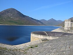
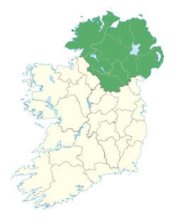
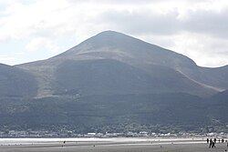
The Denis Rankin Round is a long distance hill running challenge around the Mourne Mountains in County Down, Northern Ireland. [1] The route is a circuit of over 90 kilometres, with a total climb of over 6,500 metres. [1] The Round must be completed within 24 hours to be considered a success. [1]

Contents

The record times are 13:20 by Shane Lynch and 19:12 by Aoife Mundow. [2]

The route

Silent Valley Reservoir SilentValley.jpg
Silent Valley Reservoir

Much of the route runs through the Mourne Mountains Area of Outstanding Natural Beauty; the highest summit in both Ulster and Northern Ireland (Slieve Donard) is included. The Round must be completed either in the order below, or in the reverse order.

Summit
Sequence
Location
Start and Finish LineDonard car park
1 Slieve Donard
2Chimney Rock Mountain
3Rocky Mountain (Annalong valley)
4Slieve Beg
5Cove Mountain
6Slievelamagan
7 Binnian North tor
8 Slieve Binnian
9 Wee Binnian
Silent Valley
10Slievenaglogh
11Doan
12 Ben Crom
13Carn Mountain
14 Slieve Muck
Stile, Deer's Meadow
15Pigeon Rock North Top
16Slievemoughanmore
17Wee Slievemoughan
18Eagle Mountain
19Shanlieve
20Finlieve
21Slievemeen
22Slievemartin
23Crenville
24Slievemeel
25Tievedockaragh
26Pierce's Castle
27Rocky Mountain (Leitrim Lodge)
28Cock Mountain, NE Top
29Slievenamiskan
Spelga Car park
30Spaltha
31Slievenamuck
32Ott Mountain
33Slieve Loughshannagh
34Slieve Meelbeg
35 Slieve Meelmore
36 Slieve Bearnagh
37Slievenaglogh
38Slieve Corragh
39 Slieve Commedagh
Start and Finish LineDonard car park

See also

Related Research Articles

<span class="mw-page-title-main">Newcastle, County Down</span> Town in Northern Ireland

Newcastle is a small seaside resort town in County Down, Northern Ireland, which had a population of 7,672 at the 2011 Census. It lies by the Irish Sea at the foot of Slieve Donard, the highest of the Mourne Mountains. Newcastle is known for its sandy beach, forests, and mountains. The town lies within the Newry, Mourne and Down District.

<span class="mw-page-title-main">Mourne Mountains</span> Mountain range in Northern Ireland

The Mourne Mountains, also called the Mournes or Mountains of Mourne, are a granite mountain range in County Down in the south-east of Northern Ireland. They include the highest mountains in Northern Ireland, the highest of which is Slieve Donard at 850 m (2,790 ft). The Mournes are designated an Area of Outstanding Natural Beauty and it has been proposed to make the area Northern Ireland's first national park. The area is partly owned by the National Trust and sees many visitors every year. The Mourne Wall crosses fifteen of the summits and was built to enclose the catchment basin of the Silent Valley and Ben Crom reservoirs.

<span class="mw-page-title-main">Skiddaw</span> Mountain in the Lake District, England

Skiddaw is a mountain in the Lake District National Park in England. Its 931-metre (3,054 ft) summit is the sixth-highest in England. It lies just north of the town of Keswick, Cumbria, and dominates the skyline in this part of the northern lakes. It is the simplest of the Lake District mountains of this height to ascend and, as such, many walking guides recommend it to the occasional walker wishing to climb a mountain. This is the first summit of the fell running challenge known as the Bob Graham Round when undertaken in a clockwise direction.

<span class="mw-page-title-main">Fell running</span> Sport of running and racing, off-road, over upland country

Fell running, also sometimes known as hill running, is the sport of running and racing, off-road, over upland country where the gradient climbed is a significant component of the difficulty. The name arises from the origins of the English sport on the fells of northern Britain, especially those in the Lake District. It has elements of trail running, cross country and mountain running, but is also distinct from those disciplines.

<span class="mw-page-title-main">Bob Graham Round</span> English Lakeland fell-running challenge

The Bob Graham Round is a fell running challenge in the English Lake District. It is named after Bob Graham (1889–1966), a Keswick guest-house owner, who in June 1932 broke the Lakeland Fell record by traversing 42 fells within a 24-hour period. Traversing the 42 fells, starting and finishing at Keswick Moot Hall, involves 66 miles with 26,900 feet of ascent.

<span class="mw-page-title-main">Annalong</span> Village in County Down, Northern Ireland


Annalong is a seaside village in County Down, Northern Ireland at the foot of the Mourne Mountains. Annalong is in the civil parish of Kilkeel, the barony of Mourne, and the Newry and Mourne District Council area. It had a population of 1,805 at the 2011 Census. The village formerly exported dressed granite and is now a fishing and holiday resort.

<span class="mw-page-title-main">Snaefell</span>

Snaefell – is the highest mountain and the only summit higher than 2,000 feet (610 m) on the Isle of Man, at 2,037 feet (620.9 m) above sea level. The summit is crowned by a railway station, cafe and several communications masts.

<span class="mw-page-title-main">Carlingford Lough</span> Body of water

Carlingford Lough is a glacial fjord or sea inlet in northeastern Ireland, forming part of the border between Northern Ireland to the north and the Republic of Ireland to the south. On its northern shore is County Down, the Mourne Mountains, and the town of Warrenpoint; on its southern shore is County Louth, the Cooley Mountains and the village of Carlingford. The Newry River flows into the loch from the northwest.

<span class="mw-page-title-main">Slieve Donard</span> Highest mountain in Northern Ireland

Slieve Donard is the highest mountain in Northern Ireland and the wider province of Ulster, with a height of 850 metres (2,790 ft). The highest of the Mourne Mountains, it is near the town of Newcastle on the eastern coast of County Down, overlooking the Irish Sea. It is also the highest mountain in the northern half of Ireland, and 7th highest on the island.

<span class="mw-page-title-main">Silent Valley Reservoir</span> Body of water

The Silent Valley Reservoir is a reservoir located in the Mourne Mountains near Kilkeel, County Down in Northern Ireland. It supplies most of the water for County Down, surrounding counties and most of Belfast. It is owned and maintained by Northern Ireland Water Limited. The reservoir was built between 1923 and 1933 by a workforce of over 1,000 men, nine of whom died during construction.

<span class="mw-page-title-main">Mourne Wall</span>

The Mourne Wall was constructed to enclose a catchment area of the Silent Valley Reservoir in the Mourne Mountains, Northern Ireland. The 1.5 metres high stone wall, which was built to keep livestock from contaminating water supplies, took almost twenty years to complete. The project was overseen by the Belfast City and District Water Commissioners.

<span class="mw-page-title-main">A2 road (Northern Ireland)</span>

The A2 is a major road in Northern Ireland, a considerable length of which is often referred to the Antrim Coast Road because much of it follows the scenic coastline of County Antrim; other parts of the road follow the coasts in Counties Down and Londonderry.

<span class="mw-page-title-main">Newry Canal</span> Canal in Northern Ireland, United Kingdom.

The Newry Canal, located in Northern Ireland, was built to link the Tyrone coalfields to the Irish Sea at Carlingford Lough near Newry. It was the first summit level canal to be built in Ireland or Great Britain, and pre-dated the more famous Bridgewater Canal by nearly thirty years and Sankey Canal by fifteen years. It was authorised by the Commissioners of Inland Navigation for Ireland, and was publicly funded. It was opened in 1742, but there were issues with the lock construction, the width of the summit level and the water supply. Below Newry, the Newry Ship Canal was opened in 1769, and both Newry and the canal flourished.

<span class="mw-page-title-main">Ring of Gullion</span>

The Ring of Gullion is a geological formation and area, officially designated as an Area of Outstanding Natural Beauty, (AONB) located in County Armagh, Northern Ireland. The area centres on Slieve Gullion, the highest peak in County Armagh, measures roughly 42 by 18 kilometres and comprises some 150 km2 defined topographically by the hills of an ancient ring dyke. Parts of the area have also been officially listed as Areas of Special Scientific Interest.

<span class="mw-page-title-main">Slieve Binnian</span> Mountain in Northern Ireland

Slieve Binnian is one of the Mourne Mountains in County Down, Northern Ireland, 9 km north of Kilkeel. It is the third-highest mountain in Northern Ireland at 747 metres (2,451 ft). The summit is broad and flat with rocky tors at the north and south ends, with the Back Castles, impressive towers of granite, in between. To the south-west is Wee Binnian (460m). It lies east of Silent Valley Reservoir and west of the Annalong Valley. The Mourne Wall also crosses over Slieve Binnian.

<span class="mw-page-title-main">Ulster Way</span> Series of walking routes in Northern Ireland

The Ulster Way is a series of walking routes which encircles Northern Ireland. It was founded in the 1970s by Wilfrid Merydith Capper, who was inspired by Tom Stephenson's Pennine Way. The route was relaunched in 2009 by the Department of the Environment.

<span class="mw-page-title-main">Slieve Muck</span>

Slieve Muck is one of the Mourne Mountains in County Down, Northern Ireland. It has a height of 670.4 metres (2,199 ft). The River Bann has its source on the northern slope.

<span class="mw-page-title-main">Slieve Commedagh</span>

Slieve Commedagh is a mountain with a height of 767 m (2,516 ft) in County Down, Northern Ireland. It is the second-highest of the Mourne Mountains, after Slieve Donard, and the second-highest mountain in Northern Ireland.

<span class="mw-page-title-main">Mourne (barony)</span> Place in Northern Ireland, United Kingdom

Mourne is a barony in County Down, Northern Ireland. It lies in the south-east of the county, with the Irish Sea to its east. It is bordered by two other baronies: Iveagh Upper, Lower Half and Iveagh Upper, Upper Half to the north and west. Mourne gets its name from the Múrna, a people who hail from a territory of the same name in modern County Monaghan.

<span class="mw-page-title-main">Wicklow Round</span> Long distance hill running challenge in Ireland

The Wicklow Round is a long-distance hill running challenge in the Wicklow Mountains in Ireland. The route follows a proscribed 100-kilometre circuit of 26 mountains, which must be completed in a fixed order, that total over 6,000 metres (20,000 ft) of elevation; there is some flexibility on route-choices between peaks. Rounds completed outside of a cut-off time of 24-hours are not generally recorded. Irish ultra-runner Joe Lalor is credited with the creation of the Round.

References

  1. 1 2 3 "Denis Rankin Round".
  2. Martin Stone, "Long Distance Round Up", The Fellrunner, Autumn 2020, 88-93.