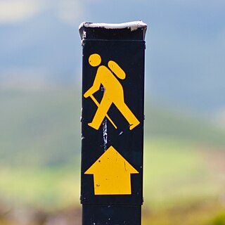
These are lists of long-distance trails in the Republic of Ireland, and include recognised and maintained walking trails, pilgrim trails, cycling greenways, boardwalk-mountain trails, and interconnected national and international trail systems.
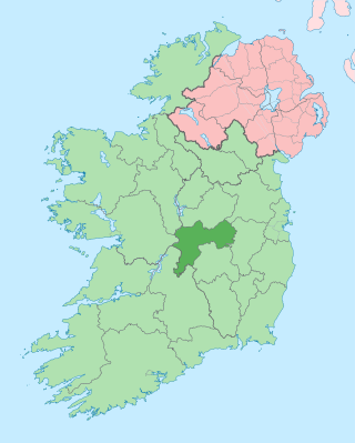
County Offaly is a county in Ireland. It is part of the Eastern and Midland Region and the province of Leinster. It is named after the ancient Kingdom of Uí Failghe. It was formerly known as King's County, in honour of Philip II of Spain. Offaly County Council is the local authority for the county. The county population was 82,668 at the 2022 census.

The Beara Way is a long-distance trail in the southwest of Ireland. It is a 206-kilometre (128-mile) long circular trail around the Beara Peninsula that begins and ends in Glengarriff, County Cork, also passing through parts of County Kerry. It is typically completed in nine days. It is designated as a National Waymarked Trail by the National Trails Office of the Irish Sports Council and is managed by the Beara Tourism and Development Association.

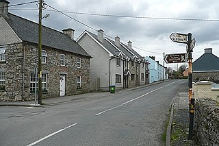
Clonaslee is a village in north County Laois, Ireland, situated in the foothills of the Slieve Bloom Mountains on the R422 Mountmellick to Birr road. Clonaslee is approximately 100 km west of Dublin, and is close to the towns of Portlaoise and Tullamore.
Cullahill Mountain is listed as a marilyn hill and a Special Area of Conservation in County Laois, Ireland. Cullahill with an elevation of 313 m (1,027 ft) gives its name to the local townland. It is also called Knockmannon Hill.
The Ballyhoura Way is a long-distance trail in Ireland. It is 89 kilometres long and begins at St John’s Bridge, near Kanturk, County Cork and ends at Limerick Junction, County Tipperary. It is typically completed in four days. It is designated as a National Waymarked Trail by the National Trails Office of the Irish Sports Council and is managed by Ballyhoura Fáilte. The trail was opened in April 1994 by President Mary Robinson.
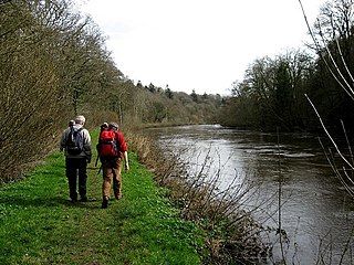
The Barrow Way is a long-distance trail in Ireland. It is 100 kilometres long and begins in Robertstown, County Kildare and ends in St Mullin's, County Carlow, following the course of the River Barrow and the Barrow Line of the Grand Canal through counties Kildare, Carlow, Kilkenny and Laois. It is typically completed in four days. It is designated as a National Waymarked Trail by the National Trails Office of the Irish Sports Council and is managed by Waterways Ireland.

The Blackwater Way is a long-distance trail that follows the valley of the River Blackwater in Ireland. It is 168 kilometres long and begins in Clogheen, County Tipperary and ends in Shrone, County Kerry. It is typically completed in ten days. It is designated as a National Waymarked Trail by the National Trails Office of the Irish Sports Council and is managed by Avondhu Tourism and IRD Duhallow. It consists of two trails – the Avondhu Way between Clogheen and Bweeng, County Cork and the Duhallow Way between Bween and Shrone – which have been combined to form the Blackwater Way.

The Bluestack Way is a long-distance trail through the Bluestack Mountains in County Donegal, Ireland. It is 65 kilometres long and begins in Donegal and ends in Ardara. It is typically completed in three days. It is designated as a National Waymarked Trail by the National Trails Office of the Irish Sports Council and is managed by the Bluestack Way Management Committee.

The Burren Way is a long-distance trail in County Clare, Ireland. It is 114 kilometres long, begins in Lahinch and ends in Corofin, crossing The Burren, one of the largest karst limestone landscapes in Europe.
The Cavan Way is a long-distance trail in County Cavan, Ireland. It is 22 kilometres long and begins in Blacklion and ends in Dowra. It is typically completed in one day. It is designated as a National Waymarked Trail by the National Trails Office of the Irish Sports Council and is managed by Cavan County Council. The trail was devised by a local man, Harold Johnston, and set up by the Blacklion Community Council and the Cavan County Development Team between 1984 and 1985.

The Dingle Way is a long-distance trail around the Dingle Peninsula in County Kerry, Ireland. It is a 162-kilometre (101-mile) long circular route that begins and ends in Tralee and is typically completed in eight days. It is designated as a National Waymarked Trail by the National Trails Office of the Irish Sports Council and is managed by the Dingle Way Committee and Kerry County Council.
The East Clare Way is a long-distance trail in County Clare, Ireland. It is a 180-kilometre (112-mile) long circular route that begins and ends in Killaloe. It is typically completed in eight days. It is designated as a National Waymarked Trail by the National Trails Office of the Irish Sports Council and is managed by East & Mid Clare Way Limited and the East Clare Way Committee.
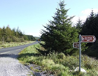
The Mid Clare Way is a long-distance trail in County Clare, Ireland. It is a 148-kilometre (92-mile) long circular route that begins and ends in Newmarket-on-Fergus. It is typically completed in six days. It is designated as a National Waymarked Trail by the National Trails Office of the Irish Sports Council and is managed by East & Mid Clare Way Limited and the Mid Clare Way Committee. The trail was developed over a six-year period and opened on 31 May 1999 by Síle de Valera, Minister for Arts, Heritage, Gaeltacht and the Islands.
The Slieve Felim way is a long-distance trail through the Slieve Felim Mountains in Ireland. It is 43 kilometres long and begins in Murroe, County Limerick and ends in Silvermines, County Tipperary. It is typically completed in two days. It is designated as a National Waymarked Trail by the National Trails Office of the Irish Sports Council and is managed by Shannon Development and Coillte.

The Táin Way is a long-distance trail around the Cooley Peninsula in County Louth, Ireland. It is a 40-kilometre (25-mile) long circular route that begins and ends in Carlingford. It is typically completed in two days. It is designated as a National Waymarked Trail by the National Trails Office of the Irish Sports Council and is managed by Louth County Council, Coillte and the Walks Partnership Group.

The Miners' Way and Historical Trail is a long-distance trail in Ireland. It is a 118-kilometre (73-mile) long circular route that begins and ends in Arigna, County Roscommon. It is typically completed in five days. It is designated as a National Waymarked Trail by the National Trails Office of the Irish Sports Council and is managed by Roscommon Integrated Development Company, Roscommon County Council, Leitrim County Council and Sligo County Council. The trail was developed to encourage tourism in the area in the wake of the closure of the Arigna mines in 1990. The route was originally conceived by a local priest, Father Sean Tynan, and built with funding from the European Regional Development Fund. The trail was opened by broadcaster Donncha Ó Dúlaing in July 2000.

The Offaly Way is a long-distance trail in County Offaly, Ireland. It is 37 kilometres long and begins in Cadamstown and ends at Lemanaghan, on the R436 road between the towns of Clara and Ferbane. It is typically completed in two days. It is designated as a National Waymarked Trail by the National Trails Office of the Irish Sports Council and is managed by Offaly County Council, Bord na Mona and the Offaly Integrated Development Company. The trail provides a link between the Slieve Bloom Way and the Grand Canal Way.

The Suck Valley Way is a long-distance trail in Ireland. It is a 105-kilometre (65-mile) long circular route that begins and ends in Castlerea, County Roscommon. It is typically completed in five days. It is designated as a National Waymarked Trail by the National Trails Office of the Irish Sports Council and is managed by Roscommon County Council, Roscommon Integrated Development Company and the Suck Valley Committee.
The Tipperary Heritage Way is a long-distance trail in County Tipperary, Ireland. It is 56 kilometres long and begins at the Vee Gap, near Clogheen, and ends in Cashel. It is typically completed in two days. It is designated as a National Waymarked Trail by the National Trails Office of the Irish Sports Council and is managed by Tipperary County Council, South Tipperary Integrated Development Company and the Tipperary Heritage Way Committee. The trail was opened on 7 September 2002 by Michael Smith, Minister for Defence.


