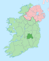
County Laois is a county in Ireland. It is part of the Eastern and Midland Region and in the province of Leinster. It was known as Queen's County from 1556 to 1922. The modern county takes its name from Loígis, a medieval kingdom. Historically, it has also been known as County Leix.

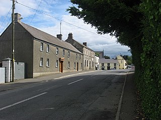
Mountmellick or Mountmellic is a town in the north of County Laois, Ireland. It lies on the N80 national secondary road and the R422 and R423 regional roads.

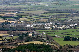
Stradbally is a town in County Laois, Ireland, located in the midlands of Ireland along the N80 road, a National Secondary Route, about 12 km (7 mi) from Portlaoise. It is a townland, a civil parish and historic barony. It is known for its "Steam Rally" and the Electric Picnic.

Woodford is a village in the south-east of County Galway, Ireland. It is situated between the River Shannon and the Slieve Aughty mountains.

Easky or Easkey is a village in County Sligo, Ireland. It is on the Atlantic coast, 26 miles from Sligo and 15 miles from Ballina, County Mayo. The village name derives from the Irish language term for fish ("iasc") and "Iascaigh" literally means "abounding in fish", due to the Easky River that lies adjacent to the village itself. Easky, as a parish, was originally called "Imleach Iseal". The area is a tourist destination on account of its scenery and water sports. Easky is a designated area on Ireland's Wild Atlantic Way tourist route.

The Slieve Bloom Mountains is a mountain range in Ireland. They rise from the central plain of Ireland to a height of 527 metres. While not very high, they are extensive by local standards. The highest points are Arderin at the southwestern end of the range and Baunreaghcong at the end of the Ridge of Capard.

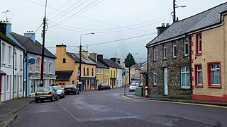
Clonaslee is a village in north County Laois, Ireland, situated in the foothills of the Slieve Bloom Mountains on the R422 Mountmellick to Birr road. Clonaslee is approximately 100 km west of Dublin, and is close to the towns of Portlaoise and Tullamore.
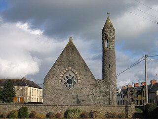
Clogheen is a village in County Tipperary, Ireland. The census of 2016 recorded the population at 478 people.
Brosna is a village and parish situated in the Sliabh Luachra area of County Kerry, Ireland. It lies 16 km (9.9 mi) from the town of Castleisland. The civil parish of Brosna consists of the village and a number of townlands. It is a mainly agricultural area, supporting two churches, two schools, a post office, and five public houses.

Ballyjamesduff is a town in County Cavan, Ireland. A former market town, it was the winner of the 1966 and 1967 Irish Tidy Towns Competition.

Castletown is a small village and also a parish in County Laois in Ireland.

Clonaghadoo is a village in County Laois, Ireland, located 6 km (3.7 mi) north of Mountmellick just off the N80 national secondary road. The Slieve Bloom Mountains lie southwest of the village.
Garristown is a village in north-west Fingal, Ireland. It is also a civil parish in the historic barony of Balrothery West.
Drimoleague is a village on the R586 road at its junction with the R593 in County Cork, Ireland. It lies roughly halfway between the towns of Dunmanway and Bantry, within the civil parish of Dromdaleague. As of the 2016 census of Ireland, Drimoleague had 451 residents.

Clogh is a village, and namesake of an electoral district in County Kilkenny, Ireland. It is also a townland in the civil parish of Castlecomer in the ancient barony of Fassadinin.

The Slieve Bloom Way is a long-distance trail around the Slieve Bloom Mountains in Ireland. It is an 70-kilometre (43-mile) long circular route that can be accessed from any of the trailheads at Glenbarrow near the village of Rosenallis, County Laois.Cadamstown, County Offaly Kinnitty, County Offaly. It is typically completed in three days. It is designated as a National Waymarked Trail by the National Trails Office of the Irish Sports Council and is managed by Laois County Council, Offaly County Council, Laois Integrated Development Company, Coillte and the Slieve Bloom Rural Development Society. The route was devised by a local man, Tom Joyce, and opened in 1987. The route was developed as part of the designation of the Slieve Bloom area as a European Environment Park in the European Year of the Environment.

Carrigrohane is a village and civil parish situated on the south bank of the River Lee to the west of the city of Cork in Ireland. It is connected by the Carrigrohane Straight, 4 miles (6.4 km) west of Cork and is also in the northeastern part of Ballincollig. It contains St Peter's Church of the Resurrection. In 1837, it had a population of 1921 inhabitants. The civil parish is almost evenly split between the baronies of Muskerry East to the west and the Barony of Cork to the east.

Kilmurry-Negaul is a civil parish and a village in County Clare, Ireland.
Ballysheehan is a village in the southern part of County Tipperary, Ireland. It is also a civil parish in the barony of Middle Third, within the Munster province.
Clandonagh is a barony in County Laois, Republic of Ireland. A barony was a historical subdivision of a county; mainly cadastral rather than administrative.