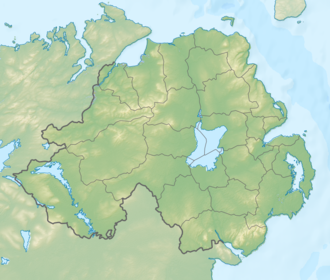
The eastern slopes of Ben Crom are steep and covered in scree, a result of glacial activity that affected north- and east-facing slopes more intensely.[5] The Ben Crom Reservoir, located nearby, was constructed in 1957 to supplement the Silent Valley Reservoir. Together, these reservoirs supply water to the Greater Belfast area and have a combined capacity of nearly 21 billion litres. The granite used in the construction of the reservoirs was sourced locally. From the Ben Crom dam wall, the valley between Ben Crom and Slievelamagan is visible, with notable contrasts between the steep, craggy eastern slopes and the smoother western slopes.[5]
Celtic links
In early Irish tradition, the mountains were referred to as Beanna Boirche ("Boirche's Peaks"), named after a legendary figure, Boirche, who was said to have been granted grazing rights in the area by Ross the Red, a king of Ulster around the 3rd century AD. The name Beanna Boirche persisted in various forms through the centuries, including in Ulster Scots usage as the "Borkey Bens." The only peak in the range still bearing the "Ben" designation is Ben Crom.[6]
Although linguistically, the name Ben Crom is more likely descriptive of the mountain’s shape it is possible that it may be a reference to the old Celtic God of Darkness Crom Cruach.[7] Crom Cruach was a powerful and feared god, historically worshipped in ancient Ireland. He was associated with darkness, fertility, and sacrifice. Worship of Crom Cruach involved offerings, including the firstborn of families, and his cult was eventually suppressed by Saint Patrick during the Christianization of Ireland.[8] While Ben Crom itself is not directly named after Crom Cruach, the phonetic resemblance and the mountain’s dramatic, solitary presence in the Mournes may have inspired mythic or folkloric connections.
Geology
The south-western flank of Ben Crom is a geologically significant site that displays a well-defined contact between two granite types: G2 and G3. The G2 granite is grey-coloured and closely jointed, while the underlying G3 granite is lighter in colour and finer-grained.[9] This contact is exposed along a series of crags above scree slopes and can be traced across the south face of Ben Crom, extending to the eastern cliffs. The mountain lies within the central Mournes, an area geologically defined by the G3 granite phase of the Mourne Granite Pluton. Along walking trails and disused quarries, this granite is visibly intruded by doleritedykes. These formations date back approximately 60 million years, when tectonic forces during the breakup of North America and Europe caused magma to rise and cool underground, forming the granite uplands seen today. The surrounding landscape, including nearby Slieve Donard, is steeped in Irish mythology, notably the Táin Bó Cúailnge, linking the terrain to the legendary warrior Cú Chulainn.[10]
Hiking & Outdoor Experience
Ben Crom is known for its relatively moderate hiking routes and panoramic views. The mountain can be accessed via several established trails, including the route from Silent Valley Car Park, which is mostly level until the final ascent and typically takes 3 to 4 hours for a round trip. This path offers views of the Silent Valley and the adjacent Ben Crom Reservoir. Another approach begins at Ott Car Park and is more demanding, often combined with ascents of nearby peaks such as Doan Mountain or Slieve Binnian. This route involves rocky terrain and light scrambling near the summit and generally requires 4 to 5 hours to complete. Ben Crom is less frequented than other Mourne peaks like Slieve Donard or Slieve Bearnagh, making it suitable for hikers seeking quieter trails.[11]
Ben Crom Mountain from the Dam Service Road
Path leading towards the summit of Ben Crom
Ben Crom mountain viewed across Ben Crom Reservoir
View of Ben Crom (centre), Silent Valley Reservoir (bottom) and Ben Crom Reservoir (top right) from Slievenaglogh. Slieve Bearnagh is in the top left of the photo.
↑ "Ben Crom". Earth Science Conservation Review. National Museums Northern Ireland. Retrieved 7 August 2025.
↑ Smyth, Janis; McKeever, Patrick J. (1999). A Story Through Time. Dublin; Belfast: Geological Survey of Ireland; Geological Survey of Northern Ireland. p.72. ISBN978-1-899702-23-7. Retrieved 6 August 2025.
This page is based on this Wikipedia article Text is available under the CC BY-SA 4.0 license; additional terms may apply. Images, videos and audio are available under their respective licenses.