Scariff Island

Last updated

Scariff Island
Native name:
An Scairbh
Scariff Island off Derrynane - geograph.org.uk - 505897.jpg
Scariff Island north side from a yacht
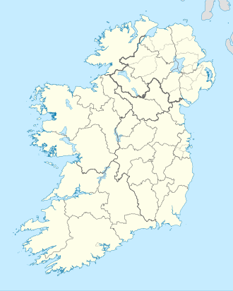
Island of Ireland location map.svg
Red pog.svg
Scariff Island
Geography
Location Atlantic Ocean
Coordinates 51°43′51″N10°15′01″W / 51.7307°N 10.2502°W / 51.7307; -10.2502
Area1.48 km2 (0.57 sq mi)
Highest elevation252 m (827 ft)
Administration
Province Munster
County Kerry
Demographics
Population0 (2011)
Pop. density0/km2 (0/sq mi)
Scariff Island
Highest point
Elevation 252 m (827 ft) [1]
Prominence 252 m (827 ft) [1]
Listing Marilyn

Scariff Island (Irish : An Scairbh, meaning 'Rugged', [2] [3] ) is an island of the Atlantic Ocean belonging to County Kerry, Ireland.

Contents

Geography

The island is 366 acres; its highest hill is at 252 m. [1] It's located in the Atlantic Ocean at around 1 km from Deenish Island [2] and 7 km from Hogs Head, on the mainland. [4]

History

In 1837 only one family lived on Scariff; their main work was to care the cattle which grazed on the island. On the summit of the hill there were remains of an ancient hermitage and, on the east side, ruins of a church. [5] 1911 census does not report any inhabitant for Scariff Island. [2]

See also

Related Research Articles

<span class="mw-page-title-main">County Cork</span> County in Ireland

County Cork is the largest and the southernmost county of Ireland, named after the city of Cork, the state's second-largest city. It is in the province of Munster and the Southern Region. Its largest market towns are Mallow, Macroom, Midleton, and Skibbereen. As of 2022, the county had a population of 581,231, making it the third-most populous county in Ireland. Cork County Council is the local authority for the county, while Cork City Council governs the city of Cork and its environs. Notable Corkonians include Michael Collins, Jack Lynch, Roy Keane, Sonia O'Sullivan, Cillian Murphy, and Graham Norton.

<span class="mw-page-title-main">County Kerry</span> County in Ireland

County Kerry is a county in Ireland. It is in the Southern Region and the province of Munster. It is named after the Ciarraige who lived in part of the present county. The population of the county was 156,458 at the 2022 census.

<span class="mw-page-title-main">Geography of Ireland</span> Geography of the island of Ireland, Northwestern Europe

Ireland is an island in Northern Europe in the north Atlantic Ocean. The island lies on the European continental shelf, part of the Eurasian Plate. The island's main geographical features include low central plains surrounded by coastal mountains. The highest peak is Carrauntoohil, which is 1,039 metres (3,409 ft) above sea level. The western coastline is rugged, with many islands, peninsulas, headlands and bays. The island is bisected by the River Shannon, which at 360.5 km (224 mi) with a 102.1 km (63 mi) estuary is the longest river in Ireland and flows south from County Cavan in Ulster to meet the Atlantic just south of Limerick. There are a number of sizeable lakes along Ireland's rivers, of which Lough Neagh is the largest.

<span class="mw-page-title-main">Mull of Kintyre</span> Headland in southwest Scotland

The Mull of Kintyre is the southwesternmost tip of the Kintyre Peninsula in southwest Scotland. From here, the Antrim coast of Northern Ireland is visible on a calm and clear day, and a historic lighthouse, the second commissioned in Scotland, guides shipping in the intervening North Channel. The area has been immortalised in popular culture by the 1977 hit song "Mull of Kintyre" by Kintyre resident Paul McCartney's band of the time, Wings.

<span class="mw-page-title-main">Valentia Island</span> Irish island off the Iveragh Peninsula, County Kerry

Valentia Island is one of Ireland's most westerly points. It lies off the Iveragh Peninsula in the southwest of County Kerry. It is linked to the mainland by the Maurice O'Neill Memorial Bridge at Portmagee. A car ferry also departs from Reenard Point to Knightstown, the island's main settlement, from April to October. Another, smaller village named Chapeltown sits at roughly the midpoint of the island, three kilometres from the bridge. Valentia Island's permanent population is 658 .It is about 11 kilometres long by almost three kilometres wide, making it the fifth-biggest island off the Irish coast.

<span class="mw-page-title-main">Killorglin</span> Town in County Kerry, Ireland

Killorglin is a town in County Kerry, Ireland. As of the 2016 CSO census, the town's population was 2,199. Killorglin is on the Ring of Kerry tourist route, and annual events include the August Puck Fair festival, which starts with the crowning and parading of a "king" wild goat. The town is 26 km south of Tralee along the N70 road, and 22 km west of Killarney along the N72 road.

<span class="mw-page-title-main">Waterville, County Kerry</span> Village in Munster, Ireland

Waterville, historically known as Coirean, is a village in County Kerry, Ireland, on the Iveragh Peninsula. The town is sited on a narrow isthmus, with Lough Currane on the east side of the town, and Ballinskelligs Bay on the west, and the Currane River connecting the two.

<span class="mw-page-title-main">Mount Brandon</span> Mountain in Kerry, Ireland

Mount Brandon or Brandon, at 952 metres (3,123 ft), is one of the ten highest peaks in Ireland, being the 8th–highest peak in Ireland on the Arderin list, and the 9th–highest on the Vandeleur-Lynam list. Brandon is the highest Irish mountain outside the MacGillycuddy's Reeks range and has the greatest prominence of any Irish peak except Carrauntoohil, Ireland's highest mountain.

<span class="mw-page-title-main">Tuamgraney</span> Village in County Clare, Ireland

Tuamgraney is a village in eastern County Clare in the west of Ireland and a civil parish by the same name. Situated a kilometre from the River Graney which flows into Lough Derg, it is an ancient settlement, noted for St Cronán's Church, said to be the oldest church in constant use in Ireland

Little Skellig is an unhabitable island in the Atlantic Ocean, 11 km south-west of Valentia Island in County Kerry, Ireland. It is smaller than Skellig Michael, its twin island. The two islands rose c. 374–360 million years ago during a period of mountain formation, along with the MacGillycuddy's Reeks mountain range. Later, they were separated from the mainland by rising water levels.

Ogonnelloe is a civil parish in east County Clare, Ireland, situated on the R463 regional road between Scariff and Killaloe and in the surrounding hills. It forms part of the Catholic parish of the same name.

<span class="mw-page-title-main">Loop Head</span> Lighthouse

Loop Head, is a headland on the north side of the mouth of the River Shannon, in County Clare in the west of Ireland.

Derrymore is a rural district of County Kerry in south-west Ireland. It lies between the Slieve Mish mountains and the Atlantic Ocean, some 11 km (7 mi) west of Tralee on the Dingle peninsula. A sandy beach, known as Derrymore Strand, is quite popular with locals and tourists during the summer months. Derrymore Island is a nature reserve supporting many rare plant communities and is an important high-tide roosting area for shore birds.

<span class="mw-page-title-main">Climate of Ireland</span> Climate of Ireland

The climate of Ireland is mild, humid and changeable with abundant rainfall and a lack of temperature extremes. Ireland's climate is defined as a temperate oceanic climate, or Cfb on the Köppen climate classification system, a classification it shares with most of northwest Europe. The island receives generally warm summers and cool winters.

<span class="mw-page-title-main">Wild Atlantic Way</span> Irish coastal 2,500 km road route

The Wild Atlantic Way is a tourism trail on the west coast, and on parts of the north and south coasts, of Ireland. The 2,500 km driving route passes through nine counties and three provinces, stretching from County Donegal's Inishowen Peninsula in Ulster to Kinsale, County Cork, in Munster, on the Celtic Sea coast.

Moynoe is a civil parish in County Clare, Ireland. It is part of the Roman Catholic parish of Scarriff and Moynoe.

<span class="mw-page-title-main">Carhoo Hill</span> Hill in County Kerry, Ireland

Carhoo Hill or Ballymacadoyle Hill is a large hill south-west of Dingle in County Kerry, Ireland.

Deenish Island is an island of the Atlantic Ocean belonging to County Kerry, Ireland.

<span class="mw-page-title-main">Knockanore Mountain</span> Mountain in Ireland

Knockanore Mountain is a large hill North Kerry, Ireland.

<span class="mw-page-title-main">Mount Eagle (Ireland)</span> Mountain in Kerry, Ireland

Mount Eagle is a mountain in County Kerry, Ireland.

References

  1. 1 2 3 "Dunkerron Mountains Area - Scarriff Island Hill". MountainViews. Ordnance Survey Ireland . Retrieved 19 May 2015.
  2. 1 2 3 "Scariff and Deenish". St. Cronan's School. Retrieved 19 May 2015.
  3. "An Scairbh". Placenames Database of Ireland. Dublin City University . Retrieved 19 May 2015.
  4. "Traveling Luck for Hogs Head, Kerry, Ireland". travelingluck.com. Retrieved 26 May 2021.
  5. Samuel Lewis (1837). A topographical dictionary of Ireland . Retrieved 19 May 2015.{{cite book}}: |website= ignored (help)

Commons-logo.svg Media related to Scariff Island at Wikimedia Commons

Scariff (right) and Deenish islands from the mainland Ring of Kerry - Road and Deenish and Scariff Islands - geograph.org.uk - 1640644.jpg
Scariff (right) and Deenish islands from the mainland