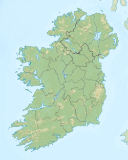
County Wicklow is a county in Ireland. The last of the traditional 32 counties to be formed, as late as 1606, it is part of the Mid-East Region and also part of the traditional province of Leinster. It is named after the town of Wicklow, which derives from the Old Norse name Víkingaló, meaning "Vikings' Meadow". Wicklow County Council is the local authority for the county. The county had a population of 142,425 at the 2016 census.

Glendalough is a glacial valley in County Wicklow, Ireland, renowned for an Early Medieval monastic settlement founded in the 6th century by St Kevin. From 1825 to 1957, the head of the Glendalough Valley was the site of a galena lead mine. Glendalough is also a recreational area for picnics, for walking along networks of maintained trails of varying difficulty, and also for rock-climbing.
These are lists of long-distance trails in Ireland, and include recognised and maintained walking trails, pilgrim trails, cycling greenways, boardwalk-mountain trails, and interconnected national and international trail systems.

Turlough Hill, also known as Tomaneena, is a 681-metre-high (2,234 ft) mountain in County Wicklow in Ireland and site of Ireland's only pumped-storage hydroelectricity plant. The power station is owned and operated by the ESB and can generate up to 292 megawatts (392,000 hp) of electricity at times of peak demand.

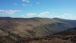
The Wicklow Mountains form the largest continuous upland area in the Republic of Ireland. They occupy the whole centre of County Wicklow and stretch outside its borders into the counties of Dublin, Wexford and Carlow. Where the mountains extend into County Dublin, they are known locally as the Dublin Mountains. The highest peak is Lugnaquilla at 925 metres.

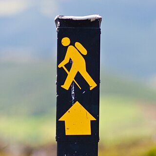
The Wicklow Way is a 131-kilometre (81-mile) long-distance trail that crosses the Wicklow Mountains in Ireland. It runs from Marlay Park in the southern suburbs of Dublin through County Wicklow and ends in the village of Clonegal in County Carlow. It is designated as a National Waymarked Trail by the Irish Sports Council and is waymarked by posts with a yellow "walking man" symbol and a directional arrow. Typically completed in 5–7 days, it is one of the busiest of Ireland's National Waymarked Trails, with up to 24,000 people a year walking the most popular sections. The Way is also used regularly by a number of mountain running competitions.

Saint Kevin is an Irish saint, known as the founder and first abbot of Glendalough in County Wicklow, Ireland. His feast day is 3 June.

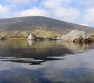
Lough Dan is a scenic boomerang-shaped ribbon lake largely set on private property, in the Wicklow Mountains in Ireland. Lough Dan lake lies at the base of Luggala 595 metres (1,952 ft) and Knocknacloghoge 534 metres (1,752 ft) mountains. The lough is fed by the Cloghoge, and Inchavore rivers, and is drained by the River Avonmore. Part of Lough Dan forms part of the Guinness Estate at Luggala, and has limited public access.
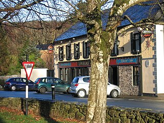
Laragh is a small village in County Wicklow, Ireland. It lies at the junction of three roads through the Wicklow Mountains and is primarily known for its proximity to the monastic settlement of Glendalough. Sally Gap and the Glenmacnass Waterfall are to the north, to the west is Glendalough and the Wicklow Gap, and to the south is the Glenmalure Valley.
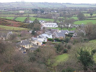
Hollywood is a village in west County Wicklow, Ireland. It is situated on the Wicklow Gap road, near its junction with the N81 national secondary road. It is known for its pre-1950's themed fair which takes place in August of every year. A population of less the 100 people registered in the 2002 Census, though the community draws from a larger area which consists of about 500 people.

The R756 road is a regional road in Ireland running west–east from Dunlavin to Laragh. Its entire 32 km (20 mi) length is within County Wicklow crossing east–west through the Wicklow Gap.

Wicklow Gap is one of the highest Irish mountain passes served by an asphalted road. It is located in County Wicklow, Ireland.

Camaderry at 699 metres (2,293 ft), is the 90th-highest peak in Ireland on the Arderin scale, and the 112th-highest peak on the Vandeleur-Lynam scale. Camaderry is situated in the southern sector of the Wicklow Mountains range, and forms a broad horseshoe around the valley of Glendalough with the hydroelectric station at Turlough Hill 681 metres (2,234 ft), and the mountains of Conavalla 734 metres (2,408 ft), and Lugduff 652 metres (2,139 ft). Camaderry has a subsidiary summit, Camaderry South East Top 677 metres (2,221 ft), and both lie across the deep Wicklow Gap from Tonelagee 817 metres (2,680 ft), which sits on the "central spine" of the Wicklow range.

Lough Oughter is a lake, or complex of lakes, in County Cavan covering more than 8,900 hectares. The complex of lakes lies on the River Erne, and forms the southern part of the Lough Erne complex. The lakes are bounded roughly by Belturbet in the north, Cavan town to the east, Crossdoney to the south and Killeshandra to the west.

Conavalla at 734 metres (2,408 ft), is the 69th–highest peak in Ireland on the Arderin scale, and the 85th–highest peak on the Vandeleur-Lynam scale. The summit of Conavalla sits just off the main "central spine" of the Wicklow mountains range in Ireland, as it runs from Kippure in the north, to Lugnaquillia in the south. Conavalla's large massif to the north-east is described as a "wet and boggy barren plain" whose various shoulders dominate the head of the Glendalough valley, and the upper east-side of the Glenmalure valley.

Valleymount is a small village in western County Wicklow, Ireland.
Wicklow Mountains National Park is a 220-square-kilometre (54,000-acre) protected area in Ireland, one of six national parks in the country. The park stretches through County Wicklow as well as small areas of South Dublin and Dún Laoghaire–Rathdown in County Dublin. The park is located in the Wicklow Mountains a short distance south of Dublin. It contains a variety of attractions that are popular with city dwellers seeking recreation, and areas visited by tourists and history enthusiasts.

The Saint Kevin's Way is a pilgrim path in County Wicklow, Ireland. It is 30 kilometres long and begins in the village of Hollywood, crosses the Wicklow Gap, and ends at the remains of the medieval monastery in Glendalough. An alternative spur route begins at Valleymount and joins the main trail at Ballinagee Bridge. It is typically completed in one day.
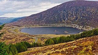
The Turlough Hill Power Station is a pumped storage power station in Ireland, owned and operated by the Electricity Supply Board (ESB).
Lugduff at 652 metres (2,139 ft), is the 154th–highest peak in Ireland on the Arderin scale, and the 186th–highest peak on the Vandeleur-Lynam scale. Lugduff is situated in the southern sector of the Wicklow Mountains range, and forms a broad horseshoe around the Upper Lake of the Glendalough valley with the mountains of Mullacor 661 metres (2,169 ft), Conavalla 734 metres (2,408 ft), the hydroelectric station at Turlough Hill 681 metres (2,234 ft), and Camaderry 699 metres (2,293 ft).