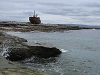
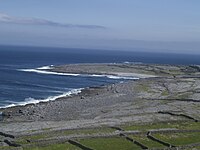
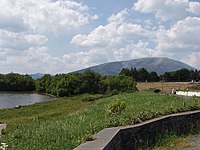
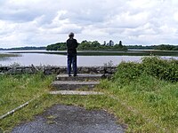
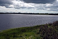
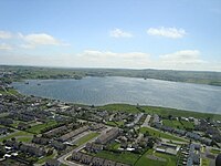
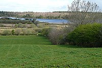
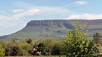
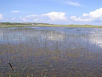
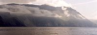
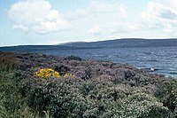
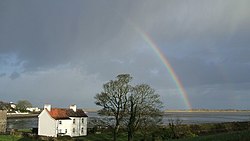
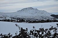
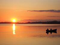
List of Special Areas of Conservation in the Republic of Ireland

Last updated

Sign in a Special Area of Conservation. No biking sign, Wicklow.jpg
Sign in a Special Area of Conservation.

The following is a list of Special Areas of Conservation in the Republic of Ireland, as listed by the National Parks and Wildlife Service (NPWS). Since 2020, the NPWS has operated under the aegis of the Department of Housing, Local Government and Heritage. The Special Areas of Conservation are part of the Natura 2000 network of sites within the European Union for special flora or fauna. [1] [2] [3]

Contents

Connacht

NamePhotoCountyLand area (hectares)EU Code
Ardgraigue Bog Galway183.46 IE0002356
Ardrahan Grassland Galway200.99 IE0002244
Aughrim (Aghrane) Bog Galway110.33 IE0002200
Aughrusbeg Machair and Lake Galway422.25 IE0001228
Ballinduff Turlough Galway60.61 IE0002295
Ballygar (Aghrane) Bog Galway27.98 IE0002199
Ballymaglancy Cave, Cong Galway9.3 IE0000474
Barnahallia Lough Galway43.86 IE0002118
Barroughter Bog Galway173.95 IE0000231
Caherglassaun Turlough Galway165.58 IE0000238
Cahermore Turlough Galway64.07 IE0002294
Camderry Bog Galway280.6 IE0002347
Carrowbaun, Newhall and Ballylee Turloughs Galway105.62 IE0002293
Carrownagappul Bog Galway485.66 IE0001242
Castletaylor Complex Galway143.43 IE0000242
Cloonmoylan Bog Galway554.19 IE0000248
Connemara Bog Complex Galway49197.33 IE0002034
Coolcam Turlough Galway136.76 IE0000218
Coole-Garryland Complex Contrasting colours seen in Coole Park.jpg Galway1119.93 IE0000252
Corliskea/Trien/Cloonfelliv Bog Galway, Roscommon724.91 IE0002110
Cregduff Lough Galway71.84 IE0001251
Cregg House Stables, Crusheen Galway0.02 IE0002317
Croaghill Turlough Galway47.35 IE0000255
Curraghlehanagh Bog Galway277.97 IE0002350
Derrycrag Wood Nature Reserve Galway118.37 IE0000261
Derrinlough (Cloonkeenleananode) Bog Galway61.1 IE0002197
Dog's Bay Dog's Bay Beach, from the headland - geograph.org.uk - 1297055.jpg Galway146.93 IE0001257
Drummin Wood Galway84.84 IE0002181
East Burren Complex Galway18800.66 IE0001926
Galway Bay Galway14,402.77 IE0000268
Glenloughaun Esker Galway5.7 IE0002213
Gortacarnaun Wood Galway111.49 IE0002180
Gortnandarragh Limestone Pavement Galway347.08 IE0001271
Inishbofin and Inishshark Inis Airc Lunasa 2013.png Galway2794.06 IE0000278
Inisheer Island Aran Islands - Inisheer - Schiffswrack - panoramio.jpg Galway552.29 IE0001275
Inishmaan Island Inis Meain 3.JPG Galway801.86 IE0000212
Inishmore Island Cliff edge - geograph.org.uk - 1471102.jpg Galway14493.61 IE0000213
Kilkieran Bay and Islands Galway21397.86 IE0002111
Kilsallagh Bog Galway279.61 IE0000285
Kiltartan Cave (Coole)Galway0.01 IE0000286
Kiltiernan Turlough Galway52.41 IE0001285
Kingstown Bay Galway79.89 IE0002265
Levally Lough By Levally Lough - geograph.org.uk - 486689.jpg Galway57.97 IE0000295
Lisnageeragh Bog and Ballinastack Turlough Galway440 IE0000296
Loughatorick South Bog Galway887.96 IE0000308
Lough Carra/Mask Complex Lough carra.jpg Galway, Mayo13509.77 IE0001774
Lough Corrib Lough Corrib near Corranellistrum - geograph.org.uk - 1251691.jpg Galway, Mayo, Roscommon25193.2 IE0000297
Lough Coy Galway77.4 IE0002117
Lough Cutra Lough Cutra and Parsons Island - Ballyturin Townland - geograph.org.uk - 834041.jpg Galway658.5 IE0000299
Lough Derg, North-East ShoreGalway3652.8 IE0002241
Lough Fingall ComplexGalway606.78 IE0000606
Lough Lurgeen Bog/Glenamaddy Turlough GMaddyTlough2758.jpg Galway1161.62 IE0000301
Lough Nageeron Galway19.65 IE0002119
Lough Rea Loughrea lake.jpg Galway364.6 IE0000304
Maumturk Mountains Maumturk Mountains.JPG Galway13465.97 IE0002008
Monivea Bog Galway286.56 IE0002352
Murvey Machair Galway80.13 IE0002129
Omey Island Machair Galway228.86 IE0001309
Peterswell Turlough Galway245.47 IE0000318
Pollnaknockaun Wood Nature Reserve Galway80.53 IE0000319
Rahasane Turlough Galway351.66 IE0000322
Shannon Callows Galway, Roscommon5853.94 IE0000216
Rosroe Bog Galway261.93 IE0000324
Ross Lake and Woods Loch an Rosa (Ross Lake) - geograph.org.uk - 1268217.jpg Galway323.06 IE0001312
Rosturra Wood Galway38.24 IE0001313
Rusheenduff Lough Galway48.74 IE0001311
Shankill West Bog Galway136.34 IE0000326
Slyne Head Islands Galway2355.13 IE0000328
Slyne Head Peninsula Galway4026.46 IE0002074
Sonnagh Bog Galway464.72 IE0001913
Termon Lough Galway211.7 IE0001321
The Twelve Bens/Garraun Complex Twelve pins.JPG Galway16163.23 IE0002031
Tully Lough Loch na Tulai (Tully Lough) - geograph.org.uk - 1295616.jpg Galway142.22 IE0002130
Tully Mountain Tully mountain from diamond hill.jpg Galway478.91 IE0000330
Williamstown Turloughs Galway232.64 IE0002296
West Connacht Coast Galway, Mayo65945.58 IE0002998
Arroo Mountain Leitrim3966.19 IE0001403
Ben Bulben, Gleniff and Glenade Complex Ben Bulben (3585064312).jpg Leitrim, Sligo5981.24 IE0000623
Boleybrack Mountain Leitrim, Cavan4242.32 IE0002032
Bunduff Lough and Machair/Trawalua/Mullaghmore Bunduff Lough - geograph.org.uk - 825772.jpg Leitrim, Sligo4387.18 IE0000625
Cuilcagh - Anierin Uplands Cuilcagh & Benaughlin in November 07.jpg Leitrim9735.53 IE0000584
Glenade Lough Glenade Lough - geograph.org.uk - 1482732.jpg Leitrim115.02 IE0001919
Lough Gill Eastern end of Lough Gill - geograph.org.uk - 799296.jpg Leitrim, Sligo3318.67 IE0001976
Lough Melvin Lough Melvin - geograph.org.uk - 825824.jpg Leitrim, Donegal2268.87 IE0000428
Achill Head Achill Head - geograph.org.uk - 12391.jpg Mayo6892.36 IE0002268
Ardkill Turlough Mayo25.53 IE0000461
Balla Turlough Mayo49.08 IE0000463
Ballinafad Mayo0.15 IE0002081
Bellacorick Bog Complex Mayo9519.75 IE0001922
Bellacorick Iron Flush Mayo22.86 IE0000466
Bellacragher Saltmarsh Mayo17.44 IE0002005
Brackloon Woods Path junction in Brackloon Wood - geograph.org.uk - 1402093.jpg Mayo80.2 IE0000471
Broadhaven Bay Glengad Stone circle overlooking Broadhaven Bay Kilcommon, Erris North Mayo.jpg Mayo9071.38 IE0000472
Carrowkeel Turlough Mayo40.97 IE0000475
Carrowmore Lake Complex Western shore of Lough Carrowmore, County Mayo - geograph.org.uk - 66091.jpg Mayo3646.78 IE0000476
Clare Island CliffsMayo409.99 IE0002243
Clew Bay Complex Mayo11981.94 IE0001482
Cloonakillina Lough Mayo66.93 IE0001899
Cloughmoyne Mayo96.72 IE0000479
Clyard Kettle-Holes Mayo126.46 IE0000480
Corraun Plateau Mayo3895.13 IE0000485
Croaghaun/Slievemore Croghaun Cliffs, Dooagh, Achill, Co. Mayo, Ireland.jpg Mayo3293.81 IE0001955
Cross Lough (Killadoon) Cross Lake, Mullet Peninsula, Erris, County Mayo July 2010.jpg Mayo56.67 IE0000484
Doocastle Turlough Mayo, Sligo76.67 IE0000492
Doogort Machair/Lough Doo Mayo187.87 IE0001497
Duvillaun Islands Mayo539.36 IE0000495
Erris Head Erris Head.jpg Mayo850.97 IE0001501
Flughany Bog Mayo, Sligo231.03 IE0000497
Glenamoy Bog Complex Glenamoy Bog Complex.jpg Mayo13057.21 IE0000500
Greaghans Turlough Mayo43.71 IE0000503
Inishkea Islands Inishkea South Island. - geograph.org.uk - 291268.jpg Mayo1239.38 IE0000507
Keel Machair/Menaun Cliffs Menawn Cliffs, Achill. County Mayo, Ireland LOC 4426643127.jpg Mayo1667.49 IE0001513
Kildun Souterrain Mayo0.65 IE0002320
Kilglassan/Caheravoostia Turlough ComplexMayo111.63 IE0000504
Killala Bay/Moy Estuary Killala, Co Mayo - geograph.org.uk - 769049.jpg Mayo, Sligo2180.9 IE0000458
Lackan Saltmarsh and Kilcummin Head Mayo538.01 IE0000516
Lough Cahasy, Lough Baun and Roonah Lough Mayo300.58 IE0001529
Lough Dahybaun Mayo76.1 IE0002177
Lough Gall Bog Mayo362.58 IE0000522
Lough Hoe Bog Mayo, Sligo3214.04 IE0000633
Mocorha Lough Mayo65.98 IE0001536
Moore Hall (Lough Carra)Mayo0.08 IE0000527
Mullet/Blacksod Bay Complex Blacksod bay, with mainland in distance - geograph.org.uk - 931735.jpg Mayo14023.02 IE0000470
Mweelrea/Sheeffry/Erriff Complex Mweelrea from Ben Lugmore.jpg Mayo20974.45 IE0001932
Newport River Newport River - geograph.org.uk - 1032391.jpg Mayo1402.52 IE0002144
Oldhead Wood Old Head Wood Nature Reserve Co. Mayo 2nd view.jpg Mayo85.29 IE0000532
Owenduff/Nephin Complex Nephin under snow - geograph.org.uk - 1538695.jpg Mayo27052.05 IE0000534
Ox Mountains Bogs Mayo, Sligo10565.78 IE0002006
River Moy Ballylahan Bridge and River Moy - geograph.org.uk - 1542422.jpg Mayo, Roscommon, Sligo15389.86 IE0002298
Shrule Turlough Mayo170.52 IE0000525
Skealoghan Turlough Mayo40.02 IE0000541
Slieve Fyagh Bog Mayo2375.90 IE0000542
Towerhill House Mayo60.71 IE0002179
Urlaur Lakes Urlaur Lake. - geograph.org.uk - 291802.jpg Mayo, Roscommon265.78 IE0001571
Annaghmore Lough Roscommon249.9 IE0001626
Ballinturly Turlough Roscommon151.69 IE0000588
Ballynamona Bog and Corkip Lough Bog at Ballynamona - geograph.org.uk - 963540.jpg Roscommon244.67 IE0002339
Bellanagare Bog Roscommon1207.08 IE0000592
Callow Bog Roscommon617.65 IE0000595
Carrowbehy/Caher Bog Roscommon345.66 IE0000597
Castlesampson Esker Roscommon144.2 IE0001625
Cloonchambers Bog Roscommon348.06 IE0000600
Cloonshanville Bog Roscommon225.81 IE0000614
Coolcam Turlough Roscommon136.76 IE0000218
Corbo Bog Roscommon206.67 IE0002349
Derrinea Bog Roscommon89.18 IE0000604
Drumalough Bog Roscommon278.77 IE0002338
Errit Lough
Erit Lough, a hard water lake and SAC Errit Lough, County Roscommon.jpg
Erit Lough, a hard water lake and SAC
Roscommon84.59 IE0000607
Four Roads Turlough Roscommon100.18 IE0001637
Killeglan Grassland Roscommon60.91 IE0002214
Lisduff Turlough Roscommon69.69 IE0000609
Lough Arrow South shore of Lough Arrow - geograph.org.uk - 1611143.jpg Roscommon, Sligo1454.26 IE0001673
Lough Croan Turlough Roscommon155.62 IE0000610
Lough Forbes Complex Roscommon1333.82 IE0001818
Lough Funshinagh Lough Funshinagh - geograph.org.uk - 964603.jpg Roscommon430.52 IE0000611
Lough Ree Roscommon14365.03 IE0000440
Mullygollan Turlough Roscommon35.89 IE0000612
Tullaghanrock Bog Roscommon102.83 IE0002354
Ballysadare Bay Ballysadare-bay.jpg Sligo2144.55 IE0000622
Bricklieve Mountains and Keishcorran Moorland on the northern slopes of the Bricklieve Mountains - geograph.org.uk - 1609485.jpg Sligo1692.09 IE0001656
Cummeen Strand/Drumcliff Bay (Sligo Bay) South Shore of Drumcliff Bay - geograph.org.uk - 241162.jpg Sligo4917.01 IE0000627
Knockalongy and Knockachree Cliffs Sligo115.55 IE0001669
Lough Nabrickkeagh BogSligo271.82 IE0000634
Streedagh Point Dunes Back Strand - geograph.org.uk - 978051.jpg Sligo632.83 IE0001680
Templehouse and Cloonacleigha Loughs Templehouse Lough 1.jpg Sligo492.64 IE0000636
Turloughmore Sligo74.17 IE0000637
Union Wood Sligo60.83 IE0000638
Unshin River Sligo892.01 IE0001898

Leinster

NamePhotoCountyLand area (hectares)EU Code
Blackstairs Mountains Mt Leinster.JPG Carlow, Wexford5046.85 IE0000770
River Barrow and River Nore BarrowBagnel.jpg Carlow, Kildare, Kilkenny, Laois, Offaly, Wexford12367.76 IE0002162
Slaney River Valley River Slaney above Ferrycarrig - geograph.org.uk - 1234892.jpg Carlow, Wexford, Wicklow6017.81 IE0000781
Baldoyle Bay The View from Strand Road Baldoyle - geograph.org.uk - 181928.jpg Dublin538.7 IE0000199
Ballyman Glen Dublin23.53 IE0000713
Dublin Bay (North) Clontarf, Dublin Bay (507228) (32607943630).jpg Dublin1474.35 IE0000206
Dublin Bay (South) Dun Laoghaire, Ireland, Dublin. View of harbour entrance from the outer side of East Pier 1.JPG Dublin741.8 IE0000210
Glenasmole Valley River Dodder - geograph.org.uk - 290235.jpg Dublin149.23 IE0001209
Howth Head Howth baily lighthouse.jpg Dublin374.72 IE0000202
Ireland's Eye Ireland's Eye (42064453732).jpg Dublin40.34 IE0002193
Knocksink Wood Plants on damp bankside in Knocksink woods.jpg Dublin, Wicklow87.89 IE0000725
Lambay Island Lambay Island, Dublin (507261) (33051773595).jpg Dublin404.19 IE0000204
Malahide Estuary MalahideEstuary.jpg Dublin788 IE0000205
Rogerstown Estuary Dublin537.76 IE0000208
Ballynafagh Bog Kildare155.23 IE0000391
Ballynafagh Lake Kildare45.49 IE0001387
Red Bog, KildareKildare4.1 IE0000397
Rye Water Valley / Carton Rye Liffey Confluence.jpg Kildare, Meath70.48 IE0001398
Mouds Bog Kildare590.94 IE0002331
Pollardstown Fen Pollardstown Fen.jpg Kildare226.83 IE0000396
Hugginstown Fen Kilkenny63.9 IE0000404
The Loughans Kilkenny40.45 IE0000407
Cullahill Mountain Kilkenny54.72 IE0000831
Spahill and Clomantagh Hill Kilkenny146.47 IE0000849
Galmoy Fen Kilkenny25.22 IE0001858
Lower River Suir Waterford 02.jpg Kilkenny7096.91 IE0002137
Thomastown Quarry Kilkenny3.88 IE0002252
Ballyprior Grassland Laois44.18 IE0002256
Clonaslee Eskers and Derry Bog Laois, Offaly278.67 IE0000859
Coolrain Bog Laois145.89 IE0002332
Lisbigney Bog Laois35.59 IE0000869
Mountmellick SAC Laois2.03 IE0002141
Slieve Bloom Mountains Laois, Offaly4877.08 IE0000412
Knockacoller Bog Laois129.27 IE0002333
Ardagullion Bog Longford116.44 IE0002341
Brown Bog Longford73.62 IE0002346
Clooneen Bog Longford214.93 IE0002348
Derragh Bog Longford37.62 IE0002201
Fortwilliam Turlough Longford50.69 IE0000448
Lough Forbes ComplexLongford1333.82 IE0001818
Lough Ree LoughRee5750.jpg Longford, Westmeath14365.03 IE0000440
Mount Jessop Bog Longford71.92 IE0002202
Boyne Coast and Estuary Louth, Meath629.24 IE0001957
Carlingford Mountain SlieveFoyWinter.jpg Louth3099.87 IE0000453
Carlingford Shore Louth524.39 IE0002306
Clogher Head 2019-07-23-Three Sisters-6622.jpg Louth23.74 IE0001459
Dundalk Bay View of the Mountains of the Cooley Peninsula from near the Halpenny Travel Garage (geograph 6032826).jpg Louth5234.05 IE0000455
River Boyne and River Blackwater Louth, Meath, Westmeath2317.87 IE0002299
Girley (Drewstown) Bog Meath32.27 IE0002203
Killyconny Bog (Cloghbally)Meath185.02 IE0000006
Lough Bane and Lough Glass LoughBane2961.jpg Meath, Westmeath203.42 IE0002120
Moneybeg and Clareisland Bogs Meath, Westmeath364.17 IE0002340
Mount Hevey BogMeath, Westmeath473.91 IE0002342
White Lough, Ben Loughs and Lough Doo Meath, Westmeath116.28 IE0001810
All Saints Bog and Esker Offaly365.81 IE0000566
Charleville Wood Bluebells, trees and ferns in Charleville Forest. 05.jpg Offaly377.35 IE0000571
Clara Bog Offaly836.18 IE0000572
Ferbane Bog Offaly151.9 IE0000575
Fin Lough Offaly73.98 IE0000576
Island Fen Offaly12.02 IE0002236
Lisduff Fen Offaly30.83 IE0002147
Mongan Bog Offaly206.51 IE0000580
Moyclare Bog Offaly129.95 IE0000581
Pilgrim's Road Esker Offaly69.73 IE0001776
Raheenmore Bog Offaly203.7 IE0000582
Ridge Road, SW of Rapemills Offaly6.24 IE0000919
Shannon Callows Offaly, Westmeath5853.94 IE0000216
Sharavogue Bog Offaly236.39 IE0000585
The Long Derries, Edenderry Offaly30.37 IE0000925
Ballymore Fen Westmeath42.71 IE0002313
Carn Park Bog Westmeath247.15 IE0002336
Crosswood Bog Westmeath206.52 IE0002337
Garriskil Bog Westmeath351.29 IE0000679
Lough Ennell Lough ennell ireland.png Westmeath1719.63 IE0000685
Lough Lene Lough-lene1.jpg Westmeath490.74 IE0002121
Lough Owel Jezioro Owel.JPG Westmeath1121.45 IE0000688
Scragh Bog Westmeath23.85 IE0000692
Split Hills and Long Hill EskerWestmeath75.23 IE0001831
Wooddown BogWestmeath49.86 IE0002205
Ballyteige Burrow Ballteige Burrow - geograph.org.uk - 1372041.jpg Wexford703.09 IE0000696
Bannow Bay Bait digging at Saintkierans on Bannow Bay - geograph-3148552.jpg Wexford1325.12 IE0000697
Blackwater Bank Wexford12401.45 IE0002953
Cahore Polders and Dunes Cahore Irish sea.jpg Wexford264.76 IE0000700
Carnsore Point Granite Boulder, Carnsore Point - geograph.org.uk - 232020.jpg Wexford8736.19 IE0002269
Hook Head HomeFromTheSea.jpg Wexford17006.27 IE0000764
Kilmuckridge-Tinnaberna Sandhills Tinnaberna-Damage.jpg Wexford64.56 IE0001741
Kilpatrick Sandhills Wexford39.69 IE0001742
Lady's Island Lake Lady's Island Lake, Wexford at sunset.jpg Wexford507 IE0000704
Long Bank Wexford3370.87 IE0002161
Raven Point Nature ReserveWexford594.26 IE0000710
Saltee Islands The Great Saltee.JPG Wexford15822.26 IE0000707
Screen Hills Wexford139.42 IE0000708
Tacumshin Lake Wexford558.57 IE0000709
Ballyman Glen Wicklow23.53 IE0000713
Bray Head GreystonesHarboura 5072w.jpg Wicklow263.39 IE0000714
Buckroney-Brittas Dunes and Fen Wicklow320.65 IE0000729
Carriggower Bog Wicklow84.3 IE0000716
Vale of Clara (Rathdrum Wood) IRELAND(1868) p057 Vale of Clara.jpg Wicklow378.25 IE0000733
Deputy's Pass Nature Reserve Wicklow47.88 IE0000717
Glen of the Downs Glen Of The Downs.JPG Wicklow74.45 IE0000719
Holdenstown Bog Wicklow4.05 IE0001757
Magherabeg Dunes Wicklow74.61 IE0001766
The Murrough Wetlands The Murrough (2).jpg Wicklow602.7 IE0002249
Wicklow Mountains Wicklow Mountains National Park Glendalough Valley 08.JPG Wicklow, Dublin32931.38 IE0002122
Wicklow Reef Tubularia-indivisa.jpg Wicklow1532.56 IE0002274

Munster

NamePhotoCountyLand area (hectares)EU Code
Ballyallia Lake Clare180.17 IE0000014
Ballycullinan Lake Clare191.21 IE0000016
Ballycullinan, Old Domestic BuildingClare5.74 IE0002246
Ballyogan Lough Clare379.73 IE0000019
Ballyteigue Hay meadow at Ballyteige.jpg Clare6.43 IE0000994
Ballyvaughan Turlough Clare12.86 IE0000996
Black Head-Poulsallagh ComplexClare7801.99 IE0000020
Carrowmore Dunes Doonbeg dunes.jpg Clare451.64 IE0002250
Carrowmore Point to Spanish Point and IslandsClare4236.47 IE0001021
Danes Hole, Poulnalecka Clare38.43 IE0000030
Dromore Woods and Loughs Clare877.04 IE0000032
East Burren Complex Clare18800.66 IE0001926
Galway Bay ComplexClare14402.77 IE0000268
Glendree Bog Clare339.92 IE0001912
Glenomra Wood Clare50.27 IE0001013
Inagh River EstuaryClare392.45 IE0000036
Kilkee Reefs Clare2877.95 IE0002264
Kilkishen House Clare0.44 IE0002319
Knockanira House Clare0.02 IE0002318
Loughatorick South Bog Clare887.96 IE0000308
Lough Gash Turlough Clare25.58 IE0000051
Lower River Shannon Clare, Cork, Kerry, Limerick, Tipperary68300.01 IE0002165
Moneen Mountain Moneen Mountain Side - geograph.org.uk - 112869.jpg Clare6104.82 IE0000054
Moyree River System Clare477.67 IE0000057
Newgrove House Clare47.41 IE0002157
Newhall and Edenvale Complex Clare136.91 IE0002091
Old Domestic Building, Keevagh Clare0.01 IE0002010
Old Domestic Buildings, Rylane Clare13.90 IE0002314
Old Farm Buildings, Ballymacrogan Clare0.16 IE0002245
Pouladatig Cave Clare3.36 IE0000037
Pollagoona Bog Clare55.03 IE0002126
Poulnagordon Cave (Quin)Clare0.05 IE0000064
Ratty River Cave Clare0.72 IE0002316
Slieve Bernagh Bog Clare1973.97 IE0002312
Termon Lough Clare211.7 IE0001321
Toonagh Estate Clare5.41 IE0002247
Tullaher Lough and Bog Clare468.98 IE0002343
Ballymacoda (Clonpriest and Pillmore)Cork494.82 IE0000077
Barley Cove to Ballyrisode Point Cork796.92 IE0001040
Bandon River Bandon River view - geograph.org.uk - 552752.jpg Cork321.12 IE0002171
Ballyhoura Mountains Black Rock on the Ballyhoura Mountain Range - geograph.org.uk - 1103684.jpg Cork, Limerick746.7 IE0002036
Blackwater River (Cork/Waterford) IMG BlackwaterBridge3720rz.jpg Cork, Kerry, Limerick, Tipperary, Waterford10145.32 IE0002170
Caha Mountains Road descending from the Healy Pass - geograph.org.uk - 486301.jpg Cork, Kerry6856.12 IE0000093
Carrigeenamronety Hill
Carrigeenamronety peak Carrigeenamronety peak.jpg
Carrigeenamronety peak
Cork, Limerick94.75 IE0002037
Castletownshend Cork17.03 IE0001547
Cleanderry Wood Cork61.06 IE0001043
Clonakilty Bay View from Ring Head across Clonakilty Bay - geograph.org.uk - 406616.jpg Cork511.91 IE0000091
Courtmacsherry Estuary Cork735.11 IE0001230
Derryclogher (Knockboy)Cork1712.22 IE0001873
Dunbeacon Shingle Cork43.02 IE0002280
The Gearagh Cork557.71 IE0000108
Glengarriff Harbour and Woodland Glengarriff Harbour - geograph.org.uk - 1414062.jpg Cork1305.22 IE0000090
Glanmore Bog Cork, Kerry1147.78 IE0001879
Great Island Channel Belvelly bridge. Shingle shore. Fota island on far shore.jpg Cork1437.55 IE0001058
Farranamanagh Lough Farranamanagh Shore - geograph.org.uk - 1753083.jpg Cork27.3 IE0002189
Kenmare River The Kenmare River - geograph.org.uk - 1222710.jpg Cork, Kerry43267.5 IE0002158
Killarney National Park, MacGillycuddy's Reeks and Caragh River Catchment Caragh River, Ring of Kerry (506483) (27447598450).jpg Cork, Kerry76444.99 IE0000365
Kilkeran Lake and Castlefreke Dunes Cork96.43 IE0001061
Lough Hyne Nature Reserve and Environs 2019-07-31-Lough Hyne-0828.jpg Cork450.94 IE0000097
Myross Wood Cork3.97 IE0001070
Reen Point Shingle Cork7.01 IE0002281
Roaringwater Bay and Islands Roaringwater Bay, Horse island and Clear Island (right) - geograph.org.uk - 97755.jpg Cork14253.09 IE0000101
Sheep's Head Sheeps head ireland.png Cork3133.9 IE0000102
St. Gobnet's Wood Cork43.85 IE0000106
Three Castle Head to Mizen Head Three Castle Head View to Mizen Head 2009 09 10.jpg Cork353 IE0000109
Akeragh, Banna and Barrow Harbour Barrow Harbour - geograph.org.uk - 1418452.jpg Kerry1199.25 IE0000332
Ballinskelligs Bay and Inny Estuary Ring of Kerry-Ballinskelligs Bay-02-2017-gje.jpg Kerry1658.47 IE0000335
Ballyseedy Wood Kerry39.49 IE0002112
Blackwater River (Kerry) Pont sur la BlackWater (Kerry).jpg Kerry5900.18 IE0002173
Blasket Islands Dunmore-Head-and-Blasket-Islands.JPG Kerry22715.96 IE0002172
Castlemaine Harbour Kerry8683.05 IE0000343
Cloonee and Inchiquin Loughs, Uragh Wood Kerry1154.05 IE0001342
Drongawn Lough Kerry31.42 IE0002187
Glanlough Woods Kerry16.55 IE0002315
Kerry Head Shoal Kerry5794.72 IE0002263
Kilgarvan Ice House Kerry17.25 IE0000364
Lough Yganavan and Lough Nambrackdarrig Lough Nambrackdarrig Ballintleave Commons - geograph.org.uk - 649390.jpg Kerry271.60 IE0000370
Magharee Islands Magharees.jpg Kerry2270.16 IE0002261
Maulagowna Bog Kerry425.89 IE0001881
Moanveanlagh Bog Kerry214.63 IE0002351
Mount Brandon Kerry14349.07 IE0000375
Mucksna Wood Kerry14.07 IE0001371
Mullaghanish Bog Kerry70.02 IE0001890
Old Domestic Building, Askive Wood Kerry43.43 IE0002098
Old Domestic Building, Curraglass Wood Kerry0.03 IE0002041
Old Domestic Building, Dromore Wood Kerry123.57 IE0000353
Sheheree (Ardagh) Bog Kerry17.07 IE0000382
Slieve Mish Mountains Baurtregaum, Derrymore Glen.jpg Kerry9787.49 IE0002185
Tralee Bay and Magharees Peninsula, West to Cloghane Tralee bay.jpg Kerry11627.11 IE0002070
Valencia Harbour/Portmagee Channel The Portmagee Channel - geograph.org.uk - 579403.jpg Kerry2691.84 IE0002262
Askeaton Fen ComplexLimerick284.29 IE0002279
Barrigone Limerick66.33 IE0000432
Clare Glen Clare Glens.JPG Limerick, Tipperary21.86 IE0000930
Curraghchase Woods Limerick360.17 IE0000174
Galtee Mountains Galty Mountains, Western Section.jpg Limerick, Tipperary6418.99 IE0000646
Glen Bog Limerick27.66 IE0001430
Glenstal Wood Limerick6.33 IE0001432
Tory Hill Limerick78.15 IE0000439
Anglesey Road Tipperary32.92 IE0002125
Arragh More (Derrybreen) Bog Tipperary90.58 IE0002207
Ballyduff/Clonfinane Bog Tipperary269.45 IE0000641
Bolingbrook Hill Tipperary204.51 IE0002124
Keeper Hill KeeperHill.jpg Tipperary413.53 IE0001197
Kilcarren-Firville Bog Tipperary676.38 IE0000647
Kilduff, Devilsbit Mountain Tipperary133.81 IE0000934
Liskeenan Fen Tipperary43.68 IE0001683
Lough Derg, North-East Shore Lough Derg - geograph.org.uk - 1387983.jpg Tipperary3652.80 IE0002241
Lower River Suir Tipperary, Waterford7096.91 IE0002137
Moanour Mountain Tipperary48.03 IE0002257
Philipston Marsh Tipperary3.80 IE0001847
Redwood Bog Tipperary554.79 IE0002353
River Barrow and River Nore Tipperary, Waterford12367.76 IE0002162
River Shannon Callows Tipperary5853.94 IE0000216
Scohaboy (Sopwell) Bog Tipperary71.91 IE0002206
Silvermine Mountains Silvermine Mountains - geograph.org.uk - 793217.jpg Tipperary24.89 IE0000939
Silvermine Mountains WestTipperary625.04 IE0002258
Ardmore Head Waterford29.59 IE0002123
Comeragh Mountains Coumshingaun in the Comeraghs.JPG Waterford6290.43 IE0001952
Glendine Wood Waterford19.64 IE0002324
Helvick Head 20120812 26 Ireland - Co. Waterford - Ballyvoile (7939021888).jpg Waterford203.47 IE0000665
Nier Valley WoodlandsWaterford94.63 IE0000668
Tramore Dunes and Backstrand Tramore Back Strand and Dunes.jpg Waterford770.13 IE0000671

Ulster

NamePhotoCountyLand area (hectares)EU Code
Boleybrack Mountain Cavan4242.32 IE0002032
Corratirrim Cavan116.99 IE0000979
Cuilcagh - Anierin Uplands Cuilcagh, Fermanagh - 33673335641.jpg Cavan9735.53 IE0000584
Killyconny Bog (Cloghbally)Cavan185.02 IE0000006
Lough Oughter and Associated Loughs Loughter.JPG Cavan4755.86 IE0000007
River Boyne and River Blackwater River Blackwater (Meath) - geograph.org.uk - 1773972.jpg Cavan2317.87 IE0002299
Aran Island (Donegal) Cliffs The west coast of Aran Island from the road to the lighthouse. - geograph.org.uk - 1052697.jpg Donegal542.81 IE0000111
Ballintra Donegal47.18 IE0000115
Ballyarr Wood Ballyarr Wood.jpg Donegal30.01 IE0000116
Ballyness Bay Falcarragh - Beach at Ballyness Bay at end of R256 - geograph.org.uk - 1652298.jpg Donegal1235.31 IE0001090
Ballyhoorisky Point to Fanad Head Donegal1292.49 IE0001975
Cloghernagore Bog and Glenveagh National Park Donegal33445.53 IE0002047
Coolvoy Bog Donegal306.55 IE0001107
Croaghonagh Bog Donegal248.87 IE0000129
Donegal Bay (Murvagh) Donegal Bay-02-2019-gje.jpg Donegal1810.48 IE0000133
Dunmuckrum Turloughs Donegal33.9 IE0002303
Dunragh Loughs/Pettigo Plateau Donegal2022.48 IE0001125
Durnesh Lough Durnesh Lake (geograph 2534856).jpg Donegal357.28 IE0000138
Lough Eske and Ardnamona Wood Lough Eske - geograph.org.uk - 57457.jpg Donegal857.58 IE0000163
Lough Nagreany Dunes Donegal221.06 IE0000164
Fawnboy Bog/Lough Nacung Donegal, "Stones, Peat And Rushes At Gweedore" - geograph.org.uk - 1140411.jpg Donegal1104.93 IE0000140
River Finn The ancient bridge across the Finn at Clady - geograph.org.uk - 1320214.jpg Donegal5498.46 IE0002301
Gannivegil Bog Donegal2152.73 IE0000142
Lough Golagh and Breesy Hill Donegal798.83 IE0002164
Gweedore Bay and Islands Ba Ghaoth Dobhair o Oileain Gabhla.jpg Donegal6013.55 IE0001141
Horn Head and Rinclevan Donegal2343.32 IE0000147
North Inishowen CoastDonegal7066.04 IE0002012
Inishtrahull Inishtrahull Landing - geograph.org.uk - 1012858.jpg Donegal483.11 IE0000154
Kindrum Lough Kindrum Lough - geograph.org.uk - 1429748.jpg Donegal116.06 IE0001151
Leannan River Leannan River - geograph.org.uk - 1757212.jpg Donegal1725.64 IE0002176
Magheradrumman Bog Looking towards Magheradrumman - geograph.org.uk - 1502511.jpg Donegal997.27 IE0000168
Meenaguse/Ardbane Bog Donegal668.24 IE0000172
Meenaguse Scragh Donegal627.13 IE0001880
Meentygrannagh Bog Donegal529.80 IE0000173
Lough Melvin Donegal2268.87 IE0000428
Muckish Mountain Muckish.JPG Donegal1522.15 IE0001179
Mulroy Bay Mulroy Bay at Woodquarter Forest - geograph.org.uk - 1506037.jpg Donegal3207.76 IE0002159
Lough Nageage Donegal156.77 IE0002135
Lough Nillan Bog (Carrickatlieve)Donegal4156.02 IE0000165
Rathlin O'Birne Island Rathlin O Birne Island 2003 09 22.jpg Donegal797.72 IE0000181
Rutland Island and Sound Heading to Aranmore Island - geograph.org.uk - 500658.jpg Donegal3865.6 IE0002283
Sessiagh Lough Sessiagh Lake, Portnablagh, Donegal.jpg Donegal71.6 IE0000185
Sheephaven Bay Sheephaven Bay (29799665).jpeg Donegal1841.19 IE0001190
Slieve League Slieve League (15919171422).jpg Donegal3924.27 IE0000189
Slieve Tooey/Tormore Island/Loughros Beg Bay Loughros Beg Bay - geograph.org.uk - 1157307.jpg Donegal9431.45 IE0000190
Lough Swilly Lough Swilly from Lisfannan - geograph.org.uk - 746514.jpg Donegal9257.68 IE0002287
St. John's Point Stlohnspoint.jpg Donegal1086.35 IE0000191
Tamur Bog Donegal1183.62 IE0001992
Termon Strand Donegal86.86 IE0001195
Tory Island Coast Costa Oilean Thoraigh 1.jpg Donegal3047.18 IE0002259
Tranarossan and Melmore Lough Boyeeghter Strand.jpg Donegal653.35 IE0000194
West Of Ardara/Maas Road Donegal6733.42 IE0000197
Kilroosky Lough ClusterMonaghan56.81 IE0001786

Offshore

NamePhotoLand area (hectares)EU Code
Belgica Mound Province 41090.4 IE0002327
Hempton's Turbot Bank 4492.68 IE0002999
Hovland Mound Province 108655 IE0002328
South-west Porcupine Bank 32929.9 IE0002329
North-west Porcupine Bank 71629.7 IE0002330
Rockabill to Dalkey Island 27285.88 IE0003000
Porcupine Bank Canyon 78110 IE0003001
South East Rockall Bank 148790 IE0003002
Codling Fault Zone 2982.23 IE0003015

See also

Related Research Articles

<span class="mw-page-title-main">Wild Nephin National Park</span> National park in western Ireland

Wild Nephin is a national park in northwest County Mayo, Ireland. It includes much of the Nephin Beg Mountains and one of the largest expanses of peatland in Europe, consisting of 150 square kilometres of Atlantic blanket bog. It is a unique habitat with a diverse flora and fauna. It was established as Ballycroy National Park in 1998, then expanded and re-named in 2018, with plans to re-wild the additional lands acquired at Nephin Forest to the east of the Nephin Beg Mountains. Wild Nephin includes the most remote point of land on the Irish mainland. The park is a candidate Special Area of Conservation (cSAC) as part of a site known as the Owenduff/Nephin Complex. It is also a Special Protection Area and part of the Natura 2000 network.

<span class="mw-page-title-main">Lough Oughter</span> Lake in County Cavan, Ireland

Lough Oughter is a lake, or complex of lakes, in County Cavan covering more than 8,900 hectares. The complex of lakes lies on the River Erne, and forms the southern part of the Lough Erne complex. The lakes are bounded roughly by Belturbet in the north, Cavan town to the east, Crossdoney to the south and Killeshandra to the west.

<span class="mw-page-title-main">Lough Yganavan and Lough Nambrackdarrig</span> Lakes in County Kerry, Ireland

Lough Yganavan and Lough Nambrackdarrig are two lakes of ecological importance in County Kerry, Ireland. In 1988, Lough Nambrackdarrig and the southern half of Lough Yganavan were designated as National Nature Reserves. Since 1998, the lakes have been included in a Special Area of Conservation (SAC) of 271.6 hectares (3 km2), which protects land in private ownership and the two state-owned nature reserves. The habitats in the SAC include fixed dunes, a type of machair.

Cullahill Mountain is listed as a marilyn hill and a Special Area of Conservation in County Laois, Ireland. Cullahill with an elevation of 313 m (1,027 ft) gives its name to the local townland. It is also called Knockmannon Hill.

Kylecorragh Wood is an old oak woodland along the freshwater stretches of the River Nore in County Kilkenny, Ireland. Located 5 kilometres (3.1 mi) west of New Ross, it consists of 100 acres (400,000 m2). Kylecorragh Woods are of regional importance as an relatively undisturbed example of the original deciduous woodland which covered the river valley.

<span class="mw-page-title-main">Little Brosna River</span> River in Ireland, tributary of the Shannon

The Little Brosna River rises near Dunkerrin, County Offaly, Ireland. It flows for 36 miles before joining the River Shannon.

Sharavogue is a townland in the historical Barony of Clonlisk, County Offaly, Ireland. It is a rural area located near the junction of the N52 road and the R492 between Roscrea and Birr. The Little Brosna River flows under Sharavogue bridge.

<span class="mw-page-title-main">Lough Funshinagh</span> Ecological site in County Roscommon, Ireland

Lough Funshinagh is a lake and Special Area of Conservation in County Roscommon, Ireland, found to the west of Lough Ree. It has been called Ireland's amazing disappearing lake, due to the way it empties quickly - in as little as two days - and unpredictably, sometimes killing thousands of fish. Lough Funshinagh is one of a number of seasonal lakes, or turlough, found in the karst areas of Ireland, west of the River Shannon.

Errit Lough is a freshwater lake in the west of Ireland. It is located in west County Roscommon in the catchment of the Boyle River. The lake is a Natura 2000 site. It is protected as a Special Area of Conservation since May 2016 under the qualification of a specific habitat type: the presence of ‘Hard Water Lakes’, alternatively known as ‘Hard oligo-mesotrophic waters with benthic vegetation of Chara spp.’

Pollnaknockaun Wood Nature Reserve is a national nature reserve and Special Area of Conservation of approximately 96 acres (0.39 km2) located near Woodford, County Galway, Ireland. It is managed by the Irish National Parks & Wildlife Service.

<span class="mw-page-title-main">Ballynafagh Lake</span> Lake in County Kildare, Ireland

Ballynafagh Lake is a shallow alkaline lake, located approximately 2 km (1.2 mi) north-west of the village of Prosperous in County Kildare, Ireland. It is designated as a special area of conservation (SAC) and protected under European Union and Irish legislation. It is one of the European protected nature sites that comprise the Natura 2000 network. It is a short distance north of the Ballynafagh Bog.

<span class="mw-page-title-main">Rye Water Valley / Carton</span> Ecological site in County Kildare, Ireland

The Rye Water Valley/Carton Special Area of Conservation or SAC is a Natura 2000 site based along the Rye Water / River Rye in north County Kildare, Ireland. It is protected as an SAC since November 2018 due to the presence of a rare hydrogeological habitat at a site close to the River Rye, and the presence of protected species.

The Mouds Bog Special Area of Conservation or SAC is a Natura 2000 site based close to the Hill of Allen and to Newbridge, County Kildare, Ireland. The qualifying interests by which it is protected as an SAC are the presence of three habitat types: the presence of active raised bogs, the presence of degraded raised bogs still capable of natural regeneration, and the presence of depressions on peat substrates of Rhynchosporion vegetation.

The Red Bog Special Area of Conservation or SAC is a Natura 2000 site in County Kildare, close to the town of Blessington in County Wicklow, Ireland. The qualifying interests by which it is protected as an SAC are the presence of a specific habitat type: transitional mires and quaking bogs.

The Carrigeenamronety Hill Special Area of Conservation or SAC is a Natura 2000 site in the Ballyhoura Mountains, Ireland. The qualifying interests for which it is protected as an SAC are the presence of the Killarney fern and the presence of a dry heath habitat.

The Ballynafagh Bog Special Area of Conservation or SAC is a Natura 2000 site in County Kildare, close to the town of Prosperous in County Kildare, Ireland. The three qualifying interests by which this site is protected as an SAC are the presence of active raised bog, of degraded raised bogs still capable of natural regeneration, and of depressions on peat substrates of the Rhynchosporion.

The Four Roads Turlough Special Area of Conservation is a Natura 2000 site based at the village of Four Roads, Ireland, close to Roscommon town, in County Roscommon, Ireland. The Four Roads Turlough is one of a number of seasonal lakes, or turloughs, found in the karst areas of Ireland, west of the River Shannon.

The Bellanagare Bog Special Area of Conservation is a Natura 2000 site based close to the village of Bellanagare and the town of Castlerea in County Roscommon, Ireland. The qualifying interests by which it is protected as an SAC are the presence of three habitat types: the presence of active raised bog, the presence of degraded raised bogs still capable of natural regeneration, and the presence of depressions on peat substrates of Rhynchosporion vegetation.

The Cloonchambers Special Area of Conservation or SAC is a Natura 2000 site based close to the town of Castlerea in County Roscommon, Ireland. The qualifying interests by which it is protected as an SAC are the presence of three habitat types: the presence of active raised bogs, the presence of degraded raised bogs still capable of natural regeneration, and the presence of depressions on peat substrates of Rhynchosporion vegetation.

References

  1. Rights for Natura 2000 data: EEA standard re-use policy: unless otherwise indicated, re-use of content on the EEA website for commercial or non-commercial purposes is permitted free of charge, provided that the source is acknowledged (http://www.eea.europa.eu/legal/copyright). Copyright holder: Directorate-General for Environment.
  2. "Special Areas of Conservation (SAC)". National Parks & Wildlife Service. Retrieved 30 August 2020.
  3. "Open Data Policy". National Parks & Wildlife Service. Retrieved 30 August 2020.

Sources