Erris Head

Last updated

Erris Head
Ceann Iorrais
IUCN category IV (habitat/species management area)
Erris Head.jpg
Erris Head
Ireland adm location map.svg
Red pog.svg
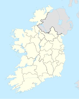
Map of Ireland
Location County Mayo, Ireland
Coordinates 54°18′05″N9°59′50″W / 54.30128°N 9.9972°W / 54.30128; -9.9972 Coordinates: 54°18′05″N9°59′50″W / 54.30128°N 9.9972°W / 54.30128; -9.9972 [1]
Governing body National Parks and Wildlife Service (Ireland)

Erris Head (Irish: Ceann Iorrais [1] ) is a promontory at the northernmost tip of the Mullet Peninsula, located in the barony of Erris in northwest County Mayo, Ireland. It is a well known and recognised landmark used by mariners and weather forecasters, and is also a scenic viewpoint, with an unobstructed view of the Atlantic Ocean and steep rocky cliffs. [2] It is not served by any road and can only be reached by crossing a number of fields.
Contents

Special Area of Conservation

Erris Head has been designated a Special Area of Conservation (SAC) under the European Union's Habitats Directive. [3]

This dry heath supports juniper, bearberry, crowberry and heather. There are wet flushes and areas of wet heath, and here grow blunt-flowered rush, three species of sundew and the rare marsh heleborine orchid. [3]

Seabirds nest on the cliffs, with fulmars and great black-backed gulls being most numerous, and peregrine falcons and choughs also breed here. In winter, barnacle geese feed on the grasslands above the cliff. Irish hares and common frogs occur on the headland, and grey seals can often be seen at the foot of the cliffs. [3]

Marine reserve

See also

Related Research Articles

County Mayo County in Ireland

County Mayo is a county in Ireland. In the West of Ireland, in the province of Connacht, it is named after the village of Mayo, now generally known as Mayo Abbey. Mayo County Council is the local authority. The population was 130,507 at the 2016 census. The boundaries of the county, which was formed in 1585, reflect the Mac William Íochtar lordship at that time.

Tramore Town in Munster, Ireland

Tramore is a seaside town in County Waterford, on the southeast coast of Ireland. With humble origins as a small fishing village, the area saw rapid development upon the arrival of the railway from Waterford City in 1853. Initially, the town flourished as a tourist destination, attracting visitors from as far away as Dublin in summer and from closer to home all year-round. As the population grew steadily in the latter part of the 20th century, Tramore became a satellite and dormitory town of Waterford City, situated some 13 km to the north. Today the town is a popular destination for surfing and other water sports due to its large, sheltered bay and provision of accommodation and amenities.

Mull of Kintyre Headland in southwest Scotland

The Mull of Kintyre is the southwesternmost tip of the Kintyre Peninsula in southwest Scotland. From here, the Antrim coast of Northern Ireland is visible on a calm and clear day, and a historic lighthouse, the second commissioned in Scotland, guides shipping in the intervening North Channel. The area has been immortalised in popular culture by the 1977 hit song "Mull of Kintyre" by Kintyre resident Paul McCartney's band of the time, Wings.

Belmullet Town in Connacht, Ireland

Belmullet is a coastal Gaeltacht town with a population of 1,019 on the Mullet Peninsula in the barony of Erris, County Mayo, Ireland. It is the commercial and cultural heart of the barony of Erris, which has a population of almost 10,000. According to the 2016 census 50% of people in the town were able to speak Irish while only 4% spoke it on a daily basis outside the education system.

Silvermine Mountains Mountain range in Tipperary, Ireland

The Silvermine Mountains or Silvermines Mountains are a mountain range in County Tipperary, Ireland. The highest peak of the range is Keeper Hill or Slievekimalta at 694 metres (2,277 ft) high. Traditionally, the mountains were deemed to be part of the Slieve Felim Mountains.

Erris Barony in Connacht, Ireland

Erris is a barony in northwestern County Mayo in Ireland consisting of over 230,452 acres (932.61 km2), much of which is mountainous blanket bog. It has extensive sea coasts along its west and north boundaries. The main towns are Belmullet and Bangor Erris. The name Erris derives from the Irish 'Iar Ros' meaning 'western promontory'. The full name is the Iorrais Domnann, after the Fir Bolg tribe, the Fir Domnann. To its north is the wild Atlantic Ocean and the bays of Broadhaven and Sruth Fada Conn and to its west is Blacksod Bay. Its main promontories are the Doohoma Peninsula, Mullet Peninsula, Erris Head, the Dún Chiortáin and Dún Chaocháin peninsulas and Benwee Head.

Mullet Peninsula Peninsula in County Mayo, Ireland

The Mullet Peninsula —also known as the Mullet and sometimes as the Erris Peninsula—is a peninsula in the barony of Erris in County Mayo, Ireland. As of 2016 it has a population of 3963. It consists of a large promontory connected to the mainland at Belmullet, a town of about 1,000 inhabitants, by a narrow isthmus. There are several villages on the Mullet peninsula including Aughleam, Elly, Corclough and Binghamstown. The Peninsula is about 33 km (21 mi) long and ranges from 200 metres (660 ft) to 12 km (7.5 mi) wide. Its northernmost point is Erris Head. The peninsula's doglegged shape forms two bays, Blacksod Bay and Broadhaven Bay.

Ulster Irish Irish language dialect

Ulster Irish is the variety of Irish spoken in the province of Ulster. It "occupies a central position in the Gaelic world made up of Ireland, Scotland and the Isle of Man". Ulster Irish thus has more in common with Scottish Gaelic and Manx. Within Ulster there have historically been two main sub-dialects: West Ulster and East Ulster. The Western dialect is spoken in County Donegal and once was in parts of neighbouring counties, hence the name Donegal Irish. The Eastern dialect was spoken in most of the rest of Ulster and northern parts of counties Louth and Meath.

Caha Mountains Low mountains in County Cork, Ireland

The Caha Mountains are a range of low sandstone mountains situated on the Beara peninsula in south-west County Cork, in Ireland. The highest peak is Hungry Hill, 685 m (2,247 ft) tall. Other notable peaks include Knocknagree, Sugarloaf Mountain, Eskatarriff, Knocknaveacal, Derryclancy, Nareera, Killane Mountain and Baurearagh Mountain.

Cill Ghallagáin Village in Connacht, Republic of Ireland

Cill Ghallagáin is a small Gaeltacht coastal townland and village in the northwest corner of Kilcommon Parish, County Mayo, Republic of Ireland, an area of 345 hectares in size. Off the northern coast of this townland lies Kid Island, an island of 13 hectares rising on steep cliffs to a height of 95 metres (311 ft) above sea level. The island is used for grazing sheep in the summer months. Kilcommon Parish consists of two peninsulas – Dún Chaocháin and Dún Chiortáin, to the west.

Glenamoy Village in Connacht, Ireland

Glenamoy is a village on the R314 road in the parish of Kilcommon, Erris in the northern part of County Mayo in Ireland.

Glengad Village in Connacht, Ireland

Glengad is a Gaeltacht village in the parish of Kilcommon in northwest County Mayo, Ireland. It is also known as Dooncarton, a name which comes from an Iron Age tribal chieftain called Ciortan, a character who appears in the Ulster Cycle legend of the Táin Bó Flidhais.

Kilcommon (County Mayo civil parish) Parish in Connacht, Ireland

Kilcommon is a civil parish in Erris, north Mayo consisting of two large peninsulas; Dún Chaocháin and Dún Chiortáin. It consists of 37 townlands, some of which are so remote that they have no inhabitants. Habitation is concentrated mainly along both sides of Sruwaddacon Bay which flows into Broadhaven Bay, in villages including Glengad, Pollathomas, Rossport, Inver and Carrowteige, and in the Glenamoy area further inland.

Broadhaven Bay Body of water

Broadhaven Bay is a natural bay of the Atlantic Ocean on the northwestern coast of County Mayo, Ireland. The opening of the bay faces northward, stretching 8.6 km between Erris Head in the west and Kid Island/Oileán Mionnán in the east.

Bangor Trail

The Bangor Trail is a waymarked walking trail in Erris, North Mayo, Ireland.

Gweunydd Blaencleddau is a large wetland complex in a shallow south-west valley around the headwaters of the Eastern Cleddau river. It is a Site of Special Scientific Interest (SSSI) and a Special Area of Conservation (SAC) situated in Pembrokeshire, South Wales.

Hoy and West Mainland National Scenic Area

Hoy and West Mainland is a national scenic area (NSA) covering parts of the islands of Hoy and Mainland in the Orkney Islands of Scotland, as well as parts of the surrounding sea. It is one of 40 such areas in Scotland, which are defined so as to identify areas of exceptional scenery and to ensure its protection by restricting certain forms of development. The Hoy and West Mainland NSA covers 24,407 ha in total, consisting of 16,479 ha of land with a further 7928 ha being marine.

Barroosky Townland in Connacht, Ireland

Barroosky is a townland within the civil parish of Kilcommon in the County of Mayo, Ireland. It is located within the parish of Kilcommon-Erris.

Helvick

Helvick or Helvick Head is a headland on the southern end of Dungarvan Harbour, Ireland; it is the eastern tip of the Ring Peninsula.

References

  1. 1 2 "Ceann Iorrais". Placenames Database of Ireland. Retrieved 8 December 2011.
  2. "Erris Head". Discover Ireland. Retrieved 16 June 2020.
  3. 1 2 3 "Erris Head SAC (site code: 001501): Site Synopsis" (PDF). National Parks and Wildlife Service. November 2016. Retrieved 16 June 2020.