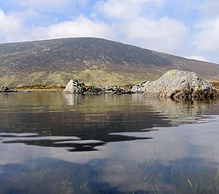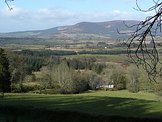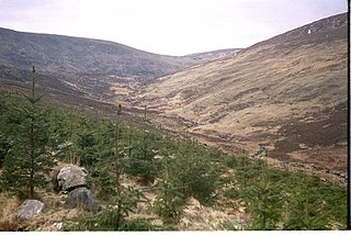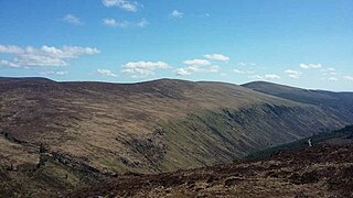
Kippure at 757 metres (2,484 ft), is the 56th-highest peak in Ireland on the Arderin scale, and the 72nd-highest peak on the Vandeleur-Lynam scale. Kippure is situated in the far northern sector of the Wicklow Mountains, where it lies on the border of the counties of Dublin and Wicklow in Ireland. Kippure is the County Top for Dublin, and its height and positioning over Dublin city have made its summit an important site for transmission masts, which are highly visible from a distance. Kippure's slopes feed into the Liffey Head Bog which forms the source of the River Liffey. The summit can be easily accessed from the east via a path that lies off the R115 road along the route to the Sally Gap.

Tonelagee at 817 metres (2,680 ft), is the 25th–highest peak in Ireland on the Arderin scale, and the 33rd–highest peak on the Vandeleur-Lynam scale. Tonelagee is situated in the central sector of the Wicklow Mountains range, and sits on the main "central spine" of the range that runs from Kippure in the north, to Lugnaquillia in the south; and in particular, the continuous "central boggy ridge" that runs from the Sally Gap in the north, via Mullaghcleevaun, to Tonelagee. Tonelagee is the third highest peak in Wicklow after Lugnaquilla and Mullaghcleevaun.

Camaderry at 699 metres (2,293 ft), is the 90th-highest peak in Ireland on the Arderin scale, and the 112th-highest peak on the Vandeleur-Lynam scale. Camaderry is situated in the southern sector of the Wicklow Mountains range, and forms a broad horseshoe around the valley of Glendalough with the hydroelectric station at Turlough Hill 681 metres (2,234 ft), and the mountains of Conavalla 734 metres (2,408 ft), and Lugduff 652 metres (2,139 ft). Camaderry has a subsidiary summit, Camaderry South East Top 677 metres (2,221 ft), and both lie across the deep Wicklow Gap from Tonelagee 817 metres (2,680 ft), which sits on the "central spine" of the Wicklow range.

Maulin, at 570 metres (1,870 ft), is the 272nd–highest peak in Ireland on the Arderin scale, however, being below 600 m it does not rank on the Vandeleur-Lynam or Hewitt scales. Maulin is in the far northeastern section of the Wicklow Mountains, at the mouth of Glensoulan Valley; Powerscourt Waterfall lies at its base.

Cloghernagh at 800 metres (2,600 ft), does not have the prominence to qualify as an Arderin, but does have the prominence to be the 40th–highest peak on the Vandeleur-Lynam scale. Cloghernagh is situated in the southern sector of the Wicklow Mountains range, and is part of the large massif of Lugnaquilla 925 metres (3,035 ft), Wicklow's highest mountain.

Camenabologue at 758 metres (2,487 ft), is the 55th–highest peak in Ireland on the Arderin scale, and the 71st–highest peak on the Vandeleur-Lynam scale. Camenabologue is situated in the southern section of the Wicklow Mountains, and has a subsidiary summit, Camenabologue SE Top 663 metres (2,175 ft). Camenabologue forms a horseshoe on a "boggy" massif, at the head of Glenmalure, with its neighbours, that include Table Mountain 702 metres (2,303 ft), and Conavalla 734 metres (2,408 ft). Camenabologue also sits on the main "central spine" of the Wicklow mountains and links to the larger massif of Lugnaquilla 925 metres (3,035 ft), which lies at the southern terminus of the whole range.

Conavalla at 734 metres (2,408 ft), is the 69th–highest peak in Ireland on the Arderin scale, and the 85th–highest peak on the Vandeleur-Lynam scale. The summit of Conavalla sits just off the main "central spine" of the Wicklow mountains range in Ireland, as it runs from Kippure in the north, to Lugnaquillia in the south. Conavalla's large massif to the north-east is described as a "wet and boggy barren plain" whose various shoulders dominate the head of the Glendalough valley, and the upper east-side of the Glenmalure valley.

Table Mountain is a 702-metre (2,303 ft) peak in the southern section of the Wicklow Mountains range in Ireland. With a prominence of only 16 metres (52 ft), it is only listed in a few of the recognised categories of mountains in Ireland; it is the 110th–highest peak on the Vandeleur-Lynam Irish scale. Table Mountain is at the apex of a horseshoe-shaped "boggy" massif with its larger neighbours, Camenabologue 758 metres (2,487 ft) and Conavalla 734 metres (2,408 ft) that sit at the head of the Glenmalure valley; all three peaks lie close to the "central spine" of the range as it runs from Kippure in the north, to Lugnaquillia in the south. There is no recorded Irish language name for Table Mountain, and it has no connection with Table Mountain in Cape Town, South Africa.

Mullacor at 661 metres (2,169 ft), is an Irish mountain.

Lobawn at 636 metres (2,087 ft), is the 182nd–highest peak in Ireland on the Arderin scale, and the 219th–highest peak on the Vandeleur-Lynam scale. Lobawn has a flat boggy summit plateau with a "war department" concrete post to mark the top. Lobawn lies in the west section of the Wicklow Mountains, in Wicklow, Ireland, and has a subsidiary summit called Sugarloaf 552 metres (1,811 ft). Both Lobawn and the Sugarloaf border the Glen of Imaal, and their summits lie close to the actual boundaries of the Glen of Imaal Military Artillery Firing Range.

Corrigasleggaun at 794 metres (2,605 ft), is the 35th–highest peak in Ireland on the Arderin scale, and the 45th–highest peak on the Vandeleur-Lynam scale. Corrigasleggaun is situated in the southwestern sector of the Wicklow Mountains range, and is part of the large massif of Lugnaquilla 925 metres (3,035 ft), Wicklow's highest mountain. Corrigasleggaun lies at the head of the glen of the easterly flowing Carrawaystick River, which includes the scenic corrie lake of Kelly's Lough near its summit, and Carrawaystick Mountain at its base. Corrigasleggaun also lies alongside Lugnaquilla's South Prison, from which the River Ow flows south to the Aghavannagh Bridge.

Duff Hill at 720 metres (2,360 ft), is the 78th-highest peak in Ireland on the Arderin scale, and the 97th-highest peak on the Vandeleur-Lynam scale. Duff Hill is in the middle section of the Wicklow Mountains, in Wicklow, Ireland, and is part of the large massif of Mullaghcleevaun 849 metres (2,785 ft), which lies to its south. Gravale, which is 718 metres (2,356 ft) tall, lies to its immediate north.

Gravale at 718 metres (2,356 ft), is the 79th–highest peak in Ireland on the Arderin scale, and the 98th–highest peak on the Vandeleur-Lynam scale. Gravale is in the middle sector of the Wicklow Mountains range, in Wicklow, Ireland. Gravale sits on a north-east to south-west "boggy ridge" that forms the "central spine" of the whole range, which runs from the Sally Gap, to Carrigvore 682 metres (2,238 ft), to Gravale, and after a col to Duff Hill 720 metres (2,360 ft), which is part of the larger massif of Mullaghcleevaun 849 metres (2,785 ft).

Moanbane at 703 metres (2,306 ft), is the 85th–highest peak in Ireland on the Arderin scale, and the 106th–highest peak on the Vandeleur-Lynam scale. Moanbane is in the central sector, at the western edge, of the Wicklow Mountains, in Wicklow, Ireland. Moanbane is on a small massif alongside Silsean 698 metres (2,290 ft) which lies between the Blessington lakes, and the taller mountain of Mullaghcleevaun 849 metres (2,785 ft).

Silsean at 698 metres (2,290 ft), is the 92nd–highest peak in Ireland on the Arderin scale, and the 114th–highest peak on the Vandeleur-Lynam scale. Silsean is in the central sector, at the western edge, of the Wicklow Mountains, in Wicklow, Ireland. Silsean is on a small massif alongside Moanbane 703 metres (2,306 ft) which lies between the Blessington lakes, and the major massif of Mullaghcleevaun 849 metres (2,785 ft).

Benleagh at 689 metres (2,260 ft), does not have the prominence to qualify as an Arderin, but its prominence does allow it to rank as the 125th–highest peak on the Vandeleur-Lynam scale. Benlagh is situated in the southern sector of the Wicklow Mountains, and is part of the large massif of Lugnaquilla 925 metres (3,035 ft), Wicklow's highest mountain.

Carrigvore at 682 metres (2,238 ft), is the 111th–highest peak in Ireland on the Arderin scale, and the 134th–highest peak on the Vandeleur-Lynam scale. Carrigvore is in the middle section of the Wicklow Mountains, in Ireland, and is part of a large north-east to south-west "boggy ridge" that runs from the Sally Gap to Carrigvore, and then on to Gravale 718 metres (2,356 ft); after a col, the ridge continues south-westwards to meet Duff Hill 720 metres (2,360 ft), which is part of the larger massif of Mullaghcleevaun 849 metres (2,785 ft).

Tonduff at 642 metres (2,106 ft), is the 169th–highest peak in Ireland on the Arderin scale, and the 202nd–highest peak on the Vandeleur-Lynam scale. Tonduff is in the far northeastern section of the Wicklow Mountains, in Wicklow, Ireland. The main flat summit is sometimes listed as Tonduff North, while the subsidiary summit, Tonduff East Top 593 metres (1,946 ft), is sometimes listed as Tonduff South. Tonduff East Top has a prominence of only 15 metres (49 ft), which just qualifies it as an Arderin Beg. A bog on the western slopes of Tonduff, the Liffey Head Bog, forms the source of the River Liffey; bogs on the southern slopes of Tonduff, forms the source of the River Dargle.

Lugduff at 652 metres (2,139 ft), is the 154th–highest peak in Ireland on the Arderin scale, and the 186th–highest peak on the Vandeleur-Lynam scale. Lugduff is situated in the southern sector of the Wicklow Mountains range, and forms a broad horseshoe around the Upper Lake of the Glendalough valley with the mountains of Mullacor 661 metres (2,169 ft), Conavalla 734 metres (2,408 ft), the hydroelectric station at Turlough Hill 681 metres (2,234 ft), and Camaderry 699 metres (2,293 ft).

Scarr at 641 metres (2,103 ft), is the 174th–highest peak in Ireland on the Arderin scale, and the 207th–highest peak on the Vandeleur-Lynam scale. Scarr is situated in the central sector of the Wicklow Mountains range, but off main "central spine" of the range that runs from Kippure in the north, to Lugnaquillia in the south. Scarr lies on its own small massif that includes Scarr North-West Top 561 metres (1,841 ft) and Kanturk 523 metres (1,716 ft); it is bounded by Lough Dan to the east and the Glenmacnass Valley on the west. Scarr's sharp peak gives it a distinctive profile amongst the rounded summits of the Wicklow mountains, and it forms the backdrop to scenic views across the Guinness Estate and Lough Dan.


