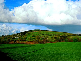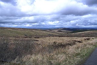
The Sperrins or Sperrin Mountains are a mountain range in Northern Ireland. The range stretches from Strabane and Mullaghcarn in the west, to Slieve Gallion and the Glenshane Pass in the east, in the counties of Tyrone and Londonderry. The landscape is mostly moorland and blanket bog. The region has a population of some 150,000 and is a designated Area of Outstanding Natural Beauty.

Slieve Croob is a mountain with a height of 534 metres (1,752 ft) in the middle of County Down, Northern Ireland. It is the heart of a mountainous area, the Dromara Hills, north of the Mourne Mountains. It is designated an Area of Outstanding Natural Beauty and is the source of the River Lagan. There is a small road to the summit, where there is an ancient burial cairn and several transmitter stations with radio masts. It has wide views over all of County Down and further afield. The Dromara Hills also includes Slievenisky, Cratlieve, Slievegarran and Slievenaboley.

Slieve Donard is the highest mountain in Northern Ireland, the highest in Ulster and the seventh-highest in Ireland, with a height of 850 metres (2,790 ft). The highest of the Mourne Mountains, it is near the town of Newcastle on the eastern coast of County Down, overlooking the Irish Sea. It is also the highest mountain in the northern half of Ireland.

Slieverue, officially Slieveroe, is a village in South County Kilkenny, Republic of Ireland. It is located in the historical barony of Ida. Despite the name, the land is relatively low-lying and fertile. Slieverue's population, as of the 2016 census, was 476.

Belmore Mountain is a hill in the townland of Gortgall, western County Fermanagh, Northern Ireland. With a summit roughly 398 metres (1,306 ft) above sea level, it is the second highest point in Fermanagh, the highest being at Cuilcagh on the Northern Ireland–Republic of Ireland border in the south of the county. The historian John O Donovan (1834) states that the indigenous population called the mountain Bel Mor Muintir Pheodachain.

Corn Hill, also called Cairn Hill or Carn Clonhugh, is a hill in County Longford, Republic of Ireland. It lies north of Longford, between Drumlish and Ballinalee, in the parish of Killoe. At 278 metres above sea level, it is the highest hill in the county and has a television mast on the top which rises 123 metres above the peak of the hill.

Mount Leinster is a 794-metre-high (2,605 ft) mountain in the Republic of Ireland. It straddles the border between Counties Carlow and Wexford, in the province of Leinster. It is the fifth-highest mountain in Leinster after Lugnaquilla 925 metres (3,035 ft), Mullaghcleevaun 849 metres (2,785 ft), Tonelagee 817 metres (2,680 ft), and Cloghernagh 800 metres (2,600 ft), and the highest of the Blackstairs Mountains. A 2RN transmission site tops the peak with a mast height of 122 metres (400 ft).

Slieve Gullion is a mountain in the south of County Armagh, Northern Ireland. The mountain is the heart of the Ring of Gullion and is the highest point in the county, with an elevation of 573 metres (1,880 ft). At the summit is a small lake and two ancient burial cairns, one of which is the highest surviving passage grave in Ireland. Slieve Gullion appears in Irish mythology, where it is associated with the Cailleach and the heroes Fionn mac Cumhaill and Cú Chulainn. It dominates the countryside around it, offering views as far away as Antrim, Dublin Bay and Wicklow on a clear day. Slieve Gullion Forest Park is on its eastern slope.

Church Mountain, also called Slieve Gad, is the westernmost of the Wicklow Mountains in Ireland. It is 544 metres (1,785 ft) high. At the summit are the remains of a large ancient cairn of pagan origin. This cairn was partially destroyed and a small building, apparently a church, was built on it in the Middle Ages. Pilgrims formerly climbed the mountain during the festival of Lughnasa to visit a holy well on the summit.

Tibradden Mountain is a mountain in County Dublin in the Republic of Ireland. Other former names for the mountain include "Garrycastle" and "Kilmainham Begg". It is 467 metres high and is the 561st-highest mountain in Ireland. It forms part of the group of hills in the Dublin Mountains which comprises Two Rock, Three Rock, Kilmashogue and Tibradden Mountains. The views from the summit encompass Dublin to the north, Two Rock to the east and the Wicklow Mountains to the south and west.

Slieve Beagh is a mountainous area straddling the border between County Monaghan in the Republic of Ireland and County Fermanagh and County Tyrone in Northern Ireland. A point just east of its summit is the highest point in Monaghan; however the true summit is on the Fermanagh-Tyrone border. The point where the three counties meet, is referred to as the "Three County Hollow".

Keeper Hill or Slievekimalta is a mountain with a height of 694 metres (2,277 ft) in the Silvermine Mountains of County Tipperary, Ireland. Traditionally, it was deemed to be part of the Slieve Felim Mountains.
Slieve True or Slievetrue is a 312 m-high (1,024 ft) hill in County Antrim, Northern Ireland. It is near Knockagh Monument and Monkstown, about 6 km (3.7 mi) north of Belfast.

Wolftrap Mountain is a mountain in counties Laois and Offaly, Ireland. The mountain is 487 metres (1,598 ft) high, making it the third-highest summit in Offaly, the fourth-highest mountain in the Slieve Bloom Mountains and the 602nd-highest summit in Ireland. It is the most northerly summit of the Slieve Bloom range.

Slieve Commedagh is a mountain with a height of 767 m (2,516 ft) in County Down, Northern Ireland. It is the second-highest of the Mourne Mountains, after Slieve Donard, and the second-highest mountain in Northern Ireland.

The Stack's Mountains are a range of hills northeast of Tralee in County Kerry, Ireland. Traditionally they are deemed part of the hilly region known as Sliabh Luachra, which also includes the Mullaghareirk Mountains.

Moylussa is a mountain in the Slieve Bernagh range in western Ireland, and the highest point in County Clare at 532 metres (1,745 ft).
Sliabh an Iarainn, anglicized Slieve Anierin, is a mountain in County Leitrim, Ireland. It rises to 585 metres (1,919 ft) and lies east of Lough Allen and northeast of Drumshanbo. It is part of the Cuilcagh Mountains. The mountain was shaped by the southwestward movement of ice age glaciers over millions of years, the morainic drift heaping thousands of drumlins in the surrounding lowlands. Historically there were many iron ore deposits and ironworks in the area. Irish mythology associates the mountain with the Tuatha Dé Danann, particularly the smith god Goibniu. Sliabh an Iarainn is an important natural heritage site with exposed marine and coastal fauna of paleontological interest

Mount Eagle is a mountain in County Kerry, Ireland.
Slieve Coillte is a hill in the south of County Wexford, Ireland. The hill is the highest point on the Hook peninsula, with an elevation of 268.5 metres (881 ft).


