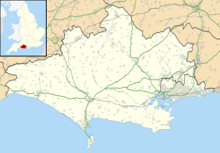
Weymouth and Portland was a local government district and borough in Dorset, England. It consisted of the resort of Weymouth and the Isle of Portland, and includes the areas of Wyke Regis, Preston, Melcombe Regis, Upwey, Broadwey, Southill, Nottington, Westham, Radipole, Chiswell, Castletown, Fortuneswell, Weston, Southwell and Easton; the latter six being on the Isle of Portland.
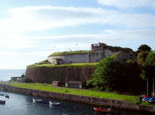
Nothe Fort is a fort in Weymouth, Dorset, England, situated at the end of the Nothe Peninsula, which juts eastwards from the town of Weymouth, and Weymouth Harbour, into the sea to the north of the ex-military Portland Harbour. The fort is located next to Nothe Gardens.

Sandsfoot Castle, also known historically as Weymouth Castle, is an artillery fort constructed by Henry VIII near Weymouth, Dorset. It formed part of the King's Device programme to protect against invasion from France and the Holy Roman Empire, and defended the Weymouth Bay anchorage. The stone castle had an octagonal gun platform, linked to a residential blockhouse, and was completed by 1542 at a cost of £3,887. Earthwork defences were built around the landward side of the castle, probably in 1623. Sandsfoot saw service during the English Civil War, when it was held by Parliament and Royalists in turn during the conflict. It survived the interregnum but, following Charles II's restoration to the throne, the fortress was withdrawn from military use in 1665.

South Dorset is a constituency represented in the House of Commons of the UK Parliament since 2010 by Richard Drax, a Conservative. The constituency was created as a consequence of the Redistribution of Seats Act 1885, although the area covered has changed since then.
Weymouth and Melcombe Regis was a borough in England. It was formed by a charter of Elizabeth I, amalgamating the towns of Weymouth and Melcombe Regis in 1571.
Radipole is a part of the district of Weymouth and Portland in the county of Dorset, England.
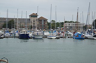
Weymouth Marina occupies most of the inner backwater of Weymouth Harbour, Dorset, England. The marina was refurbished to accommodate more vessels in the 1990s, and today houses hundreds of pleasure cruisers, fishing boats, yachts, dinghies and speedboats. Access to the marina is via a lifting road bridge across the harbour between Weymouth and Melcombe Regis.

The Battles of Weymouth, and the associated Crabchurch Conspiracy occurred in 1645, during the English Civil War, when several royalist plotters within the twin towns of Weymouth and Melcombe on the Dorset coast conspired to deliver the ports back into the control of Charles I.

Balaclava Bay is a bay situated on the edge of Portland Harbour, where the breakwater meets the island, at the northern end of the Isle of Portland, Dorset, in southern England. The bay is part of the Jurassic Coast, a World Heritage Site. The bay is overlooked by the Victorian East Weare Battery, built in the 1860s to protect the harbour. The nearest road within the dockyard of Portland Port is named Balaclava Road.
Melcombe Priory was a Dominican priory in Melcombe Regis, Dorset, England.
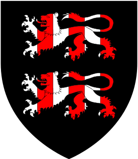
Sir John Strangways of Melbury House, Melbury Sampford, Somerset, and of Abbotsbury in Dorset, was an English politician who sat in the House of Commons variously between 1614 and 1666. He supported the Royalist side in the English Civil War.
The Block House was an old fort in the town of Melcombe, in Weymouth, Dorset, southern England. There are no visible remains today.
Robert Stone Comben CBE JP, was a British Liberal Party politician who gave over 40 years service to local government in Dorset.
John Tucker was a British politician who sat in the House of Commons between 1735 and 1778.

Weymouth Town Bridge is a lifting bascule bridge in Weymouth, Dorset, England, connecting the formerly separate boroughs of Weymouth and Melcombe Regis. The bridge can be lifted to allow boats access to the inner backwater of Weymouth Harbour, known as Weymouth Marina. The bridge, opened in 1930, is the sixth to have been built across the harbour since 1597 and has been Grade II Listed since 1997. Today, the hydraulically-operated bridge is raised every two hours, 363 days of the year. It remains one of Weymouth's most iconic features.

St Mary's Church is an active Church of England church of 19th-century origin in Weymouth, Dorset, England. Largely built of Portland stone, the church has been described as having an "austere design in Palladian mode". It has been Grade I Listed since 1953.

St John's Church is an active Church of England church in Weymouth, Dorset, England. It was built in 1850-54 by Philip Dodson to the designs of Talbot Bury. The chosen site, at the northern end of Weymouth Esplanade, had to be purchased from the Johnstone estate. It was consecrated on 19 October 1854. The transepts were added around 1868, while the entire church was restored in 1883.

Weymouth Old Town Hall is a former town hall at Weymouth, Dorset, England. The building, which was built with Portland stone in the 1770s, has been Grade II listed since 1953. The bell turret is believed to date from the 17th century. Since 2009, the hall has been operated for community use by the Guardians of the Old Town Hall.
