Related Research Articles
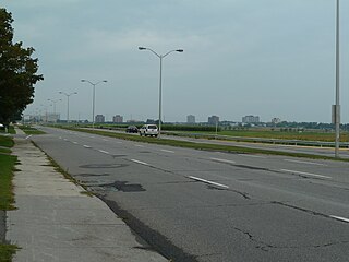
Cedarhill Estates is an neighbourhood located in Barrhaven Ward in the west end of Ottawa. Prior to amalgamation in 2001, it was located in Nepean. Together with Orchard Estates and the Onassa Springs development, it is located within the western part of the Ottawa Greenbelt. It is bordered by Fallowfield Road to the south, Cedarview Road to the east, and by Highway 416 to the north and west. It is located northwest of the Barrhaven suburb of the city. The neighbourhood surrounds the Cedarhill Golf Course. The neighbourhood by two nearby interchanges via Highway 416.

Nepean is a former municipality and now geographic area of Ottawa, Ontario, Canada. Located west of Ottawa's inner core, it was an independent city until amalgamated with the Regional Municipality of Ottawa–Carleton in 2001 to become the new city of Ottawa. However, the name Nepean continues in common usage in reference to the area. The population of Nepean is about 186,593 people.
Baseline Road is a road in Ottawa, Ontario, Canada.

Barrhaven is a suburb of Ottawa, Ontario, Canada. It is located about 17 km (11 mi) southwest of the city's downtown core. Prior to amalgamation with Ottawa in 2001, Barrhaven was part of the City of Nepean. Its population as of the Canada 2021 Census was 103,234.
Woodroffe Avenue is a major north-south arterial road in Ottawa, Ontario, Canada's west end. It runs south from the Kichi Zibi Mikan through Baseline Road and Barrhaven to just short of Prince of Wales Drive near Manotick. The road runs through the heart of Nepean in Ottawa's west end. A satellite Via Rail station is also located at the intersection of Fallowfield Road.

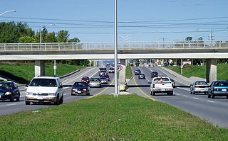
Merivale Road is an arterial road in the west end of Ottawa, Ontario, Canada. It starts at Island Park Drive just north of Highway 417 and continues south until it ends at Prince of Wales Drive in Rideau Glen. South of Clyde Avenue, Merivale is known as Ottawa Road #17, while north of Clyde it is Ottawa Road #63.

Meadowlands Drive is a suburban road in Ottawa, Ontario, Canada. It begins at Prince of Wales Drive as a continuation of Hog's Back Road in the neighborhood of Rideauview. There are two small shopping plazas and a Shell station at its corner with Prince of Wales. It then continues westward towards Fisher Avenue and consists of low-income housing projects, low-rise apartment buildings, townhouses and semi-detached homes. The speed limit here is 50 km/h (31 mph). most of Meadowlands is one lane, other than between Prince of Wales to Fisher, and from Chesterton to Merivale.

Barrhaven West Ward is a city ward in Ottawa, Ontario, Canada. The ward consists of the western half of the Barrhaven subdivision. It consists of the neighbourhoods of Cedarhill Estates, Orchard Estates, Strandherd Meadows, Old Barrhaven, Barrhaven Mews, Jockvale, Halfmoon Bay and Stonebridge.

Prince of Wales Drive is a road serving Ottawa, Ontario. The northern section is a low-speed street running along the west bank of the Rideau River, while southern portions of the road were formerly Highway 16.
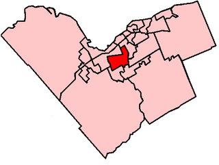
Knoxdale-Merivale is a city ward in Ottawa, Ontario. Located in the city's west end, the ward is bordered to the east by the Rideau River and Fisher Avenue, the northern boundaries of the community of Barrhaven to the south, Ontario Highway 416 and Cedarview Road to the west and to the north by the Canadian National railway west of Merivale Road and Baseline Road to its east. It includes the communities of portions or all of Arlington Woods, Craig Henry, Tanglewood, Manordale, Crestview, Skyview, Parkwood Hills, Merivale Gardens, Grenfell Glen, Pineglen and Country Place.
Grenfell Glen is a small neighbourhood in Knoxdale-Merivale Ward in the city of Ottawa in Ontario, Canada.
Craig Henry is a residential neighbourhood in Knoxdale-Merivale Ward in the west end of Ottawa, Canada. It is located in the former city of Nepean. It is a residential subdivision that was developed from 1971 onwards. The neighbourhood is bordered by Woodroffe Avenue to the east, Greenbank Road to the west, Knoxdale Road to the south and the CN railroad separating it from Centrepointe and Briargreen to the north. The land previously belonged to the Craig Henry farm, and was developed by Jack Aaron.
Borden Farm is a neighbourhood in Knoxdale-Merivale Ward in Ottawa, Ontario, Canada. It is located in the former city of Nepean, which was amalgamated into Ottawa in 2001. It was built on the site of the former Borden Dairy Farm. The land was bought by the Canada Mortgage and Housing Corporation (CMHC) in 1959. The Borden farm community was built in 1967–1976 as a joint development of the CMHC and the Ontario Housing Corporation and features single-family homes with parks and bikeways placed behind the houses, instead of on the streets. There was more development in the 1980s and early 1990s.

Parkwood Hills is a neighbourhood in Knoxdale-Merivale Ward in the west end of Ottawa, Canada. Prior to amalgamation in 2001, it was located in the City of Nepean. It is notable for the thriller Parkwood Hills (2002) which was filmed on location in the area by Kolin Casagrande, and for being a typical and illustrative example of town planning and development by Minto in the context of its position as the property manager for the National Capital Commission.
Skyline is a neighbourhood in Knoxdale-Merivale Ward in Ottawa, Ontario, Canada. Prior to amalgamation in 2001, the neighbourhood was located in the City of Nepean. It is bounded on the south by Meadowlands Drive of Parkwood Hills, on the west by Clyde Avenue and Merivale Road, on the north by Baseline Road and on the east by the neighbourhood of Fisher Heights.

Fisher Heights is a neighbourhood located in the far northeast corner of the former City of Nepean in Ottawa, Ontario, Canada. It is located in Knoxdale-Merivale Ward. The area is located south of the Experimental Farm and approximately 8 km away from downtown Ottawa.
Trend-Arlington is a suburban neighbourhood in Knoxdale-Merivale Ward in the city of Ottawa, Ontario, Canada. The neighbourhood is located with in the former City of Nepean in the west end of the city. It is located west of Greenbank Road, east of Highway 416 and Cedarview Road, north of West Hunt Club Road and south of the Leslie Park neighbourhood. Its main road is McClellan Road, which is renamed Banner Road at its north end.
Tanglewood, also known as Tanglewood-Hillsdale is a suburban neighbourhood in Knoxdale-Merivale Ward in the city of Ottawa, Ontario, Canada. It is located within the former City of Nepean in the west end of the city. It is located in the federal and provincial ridings of Nepean-Carleton. It is informally bounded by CN Railway to the north, Merivale Road to the east, Hunt Club Road to the south, and Woodroffe Avenue to the west.
The following outline is provided as an overview of and topical guide to Ottawa: