
Porchester County, Queensland is a cadastral division and a County of Queensland located on the Gulf of Carpentaria adjacent to the Northern Territory border. The county is divided into civil parishes.

Wellington County, Queensland is a cadastral division of Queensland and a County of remote western Queensland.
Ross County, Queensland is a cadastral division of Queensland and a County of remote western Queensland.
Noorama Countyis a cadastral division of Queensland and a County of the Warrego Land District of southwestern Queensland.
Nive County is a cadastral division of Queensland and a County of the Warrego Land District of southwestern Queensland. The county is divided into civil parishes.

Nickavilla County is a cadastral division of Queensland and a County of the Warrego Land District of southwestern Queensland.

Windula County
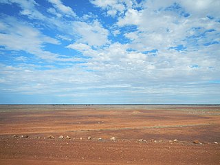
Grey County is a cadastral division of Queensland and a County of the South Gregory District of remote western Queensland. The county is divided into civil parishes.
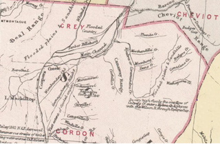
Gordon County is a cadastral division of Queensland, Australia and a County of the South Gregory District of remote western Queensland. The county is divided into civil parishes.

Bulgroo County is a cadastral division of Queensland and a County of the South Gregory District of remote western Queensland. The county is divided into civil parishes.

Cooper County is a cadastral division of Queensland and a County of the South Gregory District of remote western Queensland. The county is divided into civil parishes.
Curralle County is a cadastral division of Queensland and a County of the South Gregory District of remote western Queensland.
Burarie County is a cadastral division of Queensland and a County of the South Gregory District of remote western Queensland. The county is divided into civil parishes.
Cameron County, Queensland is a County of Queensland in Australia, in the South Gregory District Land District.

Ayrshire County, Queensland is one of the 318 counties of Queensland, Australia. The county came into existence in the 19th century, and on 8 March 1901, the Governor of Queensland issued a proclamation legally dividing Queensland into counties under the Land Act 1897. Like all counties in Queensland, it is a non-functional administrative unit, that is used mainly for the purpose of registering land titles. From 30 November 2015, the government no longer referenced counties and parishes in land information systems however the Museum of Lands, Mapping and Surveying retains a record for historical purposes.
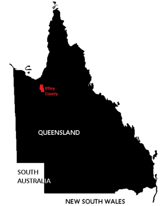
Iffley County, Queensland is one of the 318 counties of Queensland, Australia. The county is divided into civil parishes.

Rodney County is one of the 318 counties of Queensland, Australia. The county is divided into civil parishes.
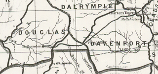
Douglas County, Queensland is one of the 318 counties of Queensland, Australia. The county is divided into civil parishes. The county came into existence in the 19th century, and on 8 March 1901, the Governor of Queensland issued a proclamation legally dividing Queensland into counties under the Land Act 1897. Like all counties in Queensland, it is a non-functional administrative unit, that is used mainly for the purpose of registering land titles. From 30 November 2015, the government no longer referenced counties and parishes in land information systems however the Museum of Lands, Mapping and Surveying retains a record for historical purposes.

Eyre County, Queensland is a cadastral division of North Gregory District of Western Queensland and a County of Queensland, Australia.
Yappar County, Queensland is a cadastral division of Burke District of northern Queensland and a County of Queensland, Australia.
