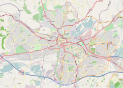
Reading is a town in Berkshire, England. Most of its built-up area lies within the Borough of Reading, although some outer suburbs are parts of neighbouring unitary authority areas. Located in the Thames Valley at the confluence of the rivers Thames and Kennet, Reading is 40 miles (64 km) east of Swindon, 24 miles (39 km) south of Oxford, 40 miles (64 km) west of London and 16 miles (26 km) north of Basingstoke.

Maidenhead is a market town in the Royal Borough of Windsor and Maidenhead in the county of Berkshire, England, on the southwestern bank of the River Thames. It had an estimated population of 70,374 and forms part of the border with southern Buckinghamshire. The town is situated 27 miles (43 km) west of Charing Cross, London and 13 miles (21 km) east-northeast of the county town of Reading. The town differs from the Parliamentary constituency of Maidenhead, which includes a number of outer suburbs and villages, including villages which form part of the Borough of Wokingham such as Twyford, Charvil, Remenham, Ruscombe and Wargrave.

Caversham is a suburb of Reading, England, located directly north of the town centre across the River Thames. Caversham rises from the River Thames, lying on flood plain and the lowest reaches of the Chiltern Hills. Two road bridges, including Caversham Bridge, and two footbridges join Caversham to the rest of Reading. Named areas within the suburb include Emmer Green, Lower Caversham, Caversham Heights and Caversham Park Village. Notable landmarks include Caversham Court, a public park and former country house; Caversham Lakes; and part of the Thames Path national trail.

Southcote is a suburb of Reading in the English county of Berkshire. Located to the south-west of Reading town centre, Southcote has a population of about 8,500. The settlement lies primarily between the London-to-Bath road and the River Kennet.
The London Borough of Bexley owns and maintains over 100 parks and open spaces within its boundaries, with a total of 638 hectares. They include small gardens, river and woodland areas, and large parks with many sporting and other facilities.

Lewisham parks and open spaces are part of the "green lung" of London and include a diverse range of sites, from small urban parks and gardens to one of the most historic natural landscapes in Greater London at Blackheath. While overall control rests with London Borough of Lewisham, management of borough-owned parks and their facilities is contracted out to Glendale Grounds Management.
Ashford Green Corridor is a green space that runs through the town of Ashford in Kent, England. The Green Corridor is made up of parks, recreation grounds and other green spaces alongside the rivers that flow through Ashford. It is a Local Nature Reserve.

Lower Caversham is an area of the former town of Caversham, in the English county of Berkshire. Today this is itself a suburb of the larger town of Reading. Lower Caversham has no formal boundaries, but the name usually refers to that part of Caversham situated on lower ground to the east of central Caversham, close to the River Thames.

Coley Park is a suburb of the town of Reading in the English county of Berkshire. It is largely built on the country estate of the same name, surrounding Coley House. It is primarily a residential area, although it is also home to the Berkshire Independent Hospital and has previously been the site of government offices.

H & G Simonds Ltd was a brewing company founded in Reading, Berkshire, England in 1785 by William Blackall Simonds. The company amalgamated with Courage & Barclay in 1960 and dropped the Simonds name after ten years. Eventually the firm became part of Scottish & Newcastle who sold the brands to Wells & Young's Brewery in 2007 and closed the Reading brewery three years later.
King's Meadow is a park in Reading, Berkshire, England, located next to the River Thames. It stretches from the Coal Woodland to King's Meadow Road near Reading Bridge. The Thames Path long distance footpath runs through the length of King's Meadow, which is visible from the railway when entering or leaving Reading railway station from the eastern side.
Courages Sports Ground was a sports and cricket ground in Coley Park suburb of the town of Reading, Berkshire, England. The ground belonged to the Courage Brewery in the town, and was principally provided for the sport and recreation of the brewery staff. It was located south of Berkeley Avenue, which is a part of the A4 road, and was bordered to the west by the Reading to Taunton railway and to the north, south and east by housing.

Reading's location in the Thames Valley at the confluence of the River Thames and River Kennet, and on both the Great Western Main Line and the M4 motorway, some 40 miles (64 km) west of London has made the town an important location in the nation's transport system.

The Coley branch line (ELR:COY), also known as the Coley goods branch, was a single-track branch railway running 1 mile 61 chains from the Reading to Basingstoke line at Coley Branch Junction to Reading Central goods depot.
The Chase is a nature reserve in Dagenham in London. Most of it is in the London Borough of Barking and Dagenham, with a small part in Havering. It is owned by the boroughs, and managed by London Borough of Barking & Dagenham - Parks & Countryside Ranger Service. The boroughs have designated the sections in their respective boroughs as Local Nature Reserves. The Chase, together with the neighbouring Eastbrookend Country Park, is also designated a Site of Metropolitan Importance for Nature Conservation.

McIlroy Park is a 12-hectare (30-acre) Local Nature Reserve in Tilehurst, a suburb of Reading in Berkshire. It is owned and managed by Reading Borough Council. Along with Blundells Copse and Lousehill Copse it is part of West Reading Woodlands.

The following is a timeline of the history of Reading, the county town of Berkshire in England.

Horn Park is a 16 acres (6.5 ha) public park within Horn Park in the Eltham area of the Royal Borough of Greenwich, southeast London, United Kingdom. It has a mixture of grassland and woodland, children's playground, football pitch, outdoor gym and the first skate park in the Royal Borough of Greenwich. Historically Horn Park was one of three deer hunting parks belonging to Eltham Palace, over the centuries it was also used as grazing farmland and a fruit orchard. The park today is some of the last remaining open space of the original park, a public park next to the Horn Park housing estate which was completed just after the Second World War.

Christchurch Meadows is a park in Reading, Berkshire, England, located next to the River Thames. It stretches along the north (Caversham) side of the river, between Caversham Bridge and Reading Bridge, and is linked to the south (Reading) bank by the Christchurch Bridge, a pedestrian and cycle bridge built in 2015. The name of the meadow derives from Christ Church in Oxford, whose dean owned 25 acres (10 ha) of farmland in Reading.

Thameside Promenade, or Thames Side Promenade, is a public park and promenade in Reading, Berkshire, England, located next to the River Thames. It stretches along the south (Reading) side of the river, to the west of Caversham Bridge, and forms part of the Thames Path long distance footpath. The park includes grassland behind the promenade.