
Transylvania County is a county in the U.S. state of North Carolina. As of the 2020 census the population is 32,986. Its county seat is Brevard.

Macon County is a county located in the U.S. state of North Carolina. As of the 2020 census, the population was 37,014. Its county seat is Franklin.

The French Broad River is a river in the U.S. states of North Carolina and Tennessee. It flows 218 miles (351 km) from near the town of Rosman in Transylvania County, North Carolina, into Tennessee, where its confluence with the Holston River at Knoxville forms the beginning of the Tennessee River. The river flows through the counties of Transylvania, Buncombe, Henderson, and Madison in North Carolina, and Cocke, Jefferson, Sevier, and Knox in Tennessee. It drains large portions of the Pisgah National Forest and the Cherokee National Forest.
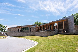
Gorges State Park is a 7,709-acre (31.20 km2) North Carolina state park in Transylvania County, North Carolina in the United States and along with other conservation lands is part of a 100,000+ acre conservation corridor stretching some 80 miles along the NC/SC state line. The land, along Jocassee Gorges, was purchased by the state from Duke Energy Corporation in 1999. It is North Carolina's westernmost state park and one of the state's newest. The park is adjacent to part of the Pisgah National Forest and the N.C. Wildlife Resources Commission's Toxaway Game Land. Gorges State Park provides the principal access to the Horsepasture River on these adjoining public lands.

North Carolina Highway 215 (NC 215) is a highway in western North Carolina that runs from the town of Rosman in Transylvania County to Canton at Interstate 40 and U.S. Route 74 (US 74). The portion from Canton to Rosman is a part of the US Forest Service's Forest Heritage Scenic Byway. It travels high into the mountains along a scenic stretch of the upper West Fork of the Pigeon River, and intersects the Blue Ridge Parkway at Beech Gap at an elevation of approximately 5,300 feet (1,600 m).

The Salmon River is a 33.5-mile (53.9 km) river in the Cascade Range in the U.S. state of Oregon that drains part of southwestern Mount Hood. The entire length of the river is a protected National Wild and Scenic River. Several portions are in protected wilderness. It is affluent to the Sandy River, a tributary of the Columbia River.

Linville Falls is a waterfall located in the Blue Ridge Mountains of North Carolina in the United States. The falls move in several distinct steps, beginning in a twin set of upper falls, moving down a small gorge, and culminating in a high-volume 45-foot (14 m) drop.
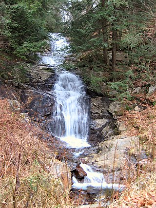
Walker Falls is a 45-foot cascading waterfall in Buncombe County, North Carolina. Its ease of access makes it a popular destination for waterfall hunters. It is in a region of Buncombe County that has a large number of small waterfalls and several larger falls.

Slick Rock Falls is a waterfall in Western North Carolina, located near Brevard.
Hickory Nut Falls, also known as Hickorynut Falls, is a waterfall located at Chimney Rock State Park in Rutherford County, North Carolina.

Setrock Creek Falls is a waterfall in the Pisgah National Forest, in North Carolina.

Roaring Fork Falls, also called Roaring Creek Falls, is a waterfall in the Pisgah National Forest, in North Carolina.

Tip Toe Falls, is a 6-foot (1.8 m) tall waterfall on Fall Creek in the Portola Redwoods State Park, California. There is also an 8-foot (2.4 m) upper falls, a few hundred feet upstream, which is much lesser known.

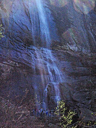
Eastatoe Falls is a waterfall in Western North Carolina, United States, located on private property near the town of Rosman. The public was once allowed access, but as of 2019, the property has been sold, and it has been closed to the public.

Waterfall on West Prong Hickey Fork is a waterfall located in the Bald Mountains of the Pisgah National Forest in Madison County, North Carolina.

Toms Creek Falls is a waterfall in the Pisgah National Forest in McDowell County, North Carolina, near the town of Marion.

Crabtree Falls is a waterfall located near the boundary of McDowell County and Yancey County, North Carolina.

Havasu Creek is a stream in the U.S. state of Arizona. It is a tributary to the Colorado River, which it joins in the Grand Canyon. It primarily runs through the Havasupai Indian Reservation. It is sometimes called Cataract Creek, and should not be confused with Cataract Canyon, Utah.

The Rice Fork is a 22.7-mile-long (36.5 km) tributary of the Eel River in Lake County, California. The Rice Fork begins on the upper northwest side of Goat Mountain, on the Colusa-Lake County line, at an elevation of over 6,000 feet (1,800 m). It quickly descends the steep western slope of the mountain, then bends northward, and flows northwesterly down a narrow winding steep walled canyon for about 18 miles (29 km), crossing two forest roads and adding many tributaries, ending its journey at the southern tip of Lake Pillsbury, at a varied elevation around 1,800 feet (550 m), depending on the lake level. Before the construction of Scott Dam in the 1920s, which formed Lake Pillsbury, the Rice Fork ran directly into the Eel River. It is one of Lake County's longest streams.

The Forest Heritage Scenic Byway is a 76.7-mile (123.4 km) National Forest Scenic Byway, National Scenic Byway and North Carolina Scenic Byway that traverses through the Pisgah National Forest, in Western North Carolina. It features the Cradle of Forestry, waterfalls, trails and scenic vistas.

