
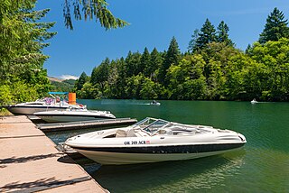
The McKenzie River is a 90-mile (145 km) tributary of the Willamette River in western Oregon in the United States. It drains part of the Cascade Range east of Eugene and flows westward into the southernmost end of the Willamette Valley. It is named for Donald McKenzie, a Scottish Canadian fur trader who explored parts of the Pacific Northwest for the Pacific Fur Company in the early 19th century. As of the 21st century, six large dams have been built on the McKenzie and its tributaries.

The Long Tom River is a 57-mile (92 km) tributary of the Willamette River in western Oregon in the United States. It drains an area at the south end of the Willamette Valley between Eugene and Corvallis.
The Middle Santiam River is a tributary of the South Santiam River, 38.5 miles (62.0 km) long, in western Oregon in the United States. It drains a remote area of the Cascade Range east of Sweet Home in the watershed of the Willamette River.

The Middle Fork Willamette River is one of several forks that unite to form the Willamette River in the western part of the U.S. state of Oregon. It is approximately 115 miles (185 km) long, draining an area of the Cascade Range southeast of Eugene, which is at the southern end of the Willamette Valley.

Blue River is a tributary of the McKenzie River in Linn and Lane counties in the U.S. state of Oregon. From its source at the confluence of Mann and Wolf creeks in the Cascade Range, it flows generally southwest to join the McKenzie near the community of Blue River. Saddle Dam and Blue River Dam block the river about 2 miles (3 km) from its mouth to form Blue River Reservoir, a multipurpose impoundment built in 1968 by the United States Army Corps of Engineers.

Grave Creek is a tributary, about 40 miles (64 km) long, of the Rogue River in southwestern Oregon in the United States.
Five Rivers is a tributary of the Alsea River in the U.S. state of Oregon, in Lane, Lincoln, Benton counties. The name Five Rivers refers to the relative importance to the stream of five of its tributaries: Alder, Cougar, Buck, Crab, and Cherry creeks.

Mosby Creek is a 21-mile (34 km) tributary of the Row River in Lane County, in the U.S. state of Oregon. It begins at the confluence of the east and west forks of the creek near the Calapooia Divide and the border with Douglas County. From its source it flows generally north-northwest to meet the river slightly east of Cottage Grove and about 4 miles (6 km) from the larger stream's confluence with the Coast Fork Willamette River.

Drift Creek is a tributary, about 18 miles (29 km) long, of Siletz Bay in the U.S. state of Oregon. The creek begins near Stott Mountain in the Central Oregon Coast Range in Lincoln County and follows a winding course generally west through the Siuslaw National Forest to enter the bay south of Lincoln City on the Pacific Ocean. It passes under U.S. Route 101 just before reaching the bay.
Deadwood Creek is a tributary of Lake Creek in the Siuslaw River basin in Lane County in the U.S. state of Oregon. Beginning near Taylor Butte in the Central Oregon Coast Range, it meanders generally southwest through the Siuslaw National Forest to meet the larger creek at the rural community of Deadwood. This is 5 miles (8 km) from Lake Creek's confluence with the river near Swisshome and 34 miles (55 km) by water from the Siuslaw River's mouth on the Pacific Ocean at Florence.

Lake Creek is a major tributary of the Siuslaw River in Lane County in the U.S. state of Oregon. On average, the 40-mile (64 km) long creek contributes about a third of the lower Siuslaw's water volume.

Fall Creek is a 34-mile (55 km) tributary of the Middle Fork Willamette River in Lane County in the U.S. state of Oregon. Beginning in the Cascade Range, the creek flows generally west through the Willamette National Forest to enter the Middle Fork upstream of Jasper, southeast of Springfield and Eugene.

Lost Creek is a tributary of the south fork of Little Butte Creek in Jackson County in the U.S. state of Oregon. Flowing north from near Lost Lake east of Medford, it enters the larger stream about 4 miles (6 km) upstream of the rural community of Lake Creek and about 20 miles (32 km) from the confluence of Little Butte Creek with the Rogue River. The only named tributary of Lost Creek is Coon Creek, which enters from the left.
Myrtle Creek is a short tributary of the South Umpqua River in Douglas County in the U.S. state of Oregon. Its main stem, formed by the confluence of two forks just south of the city of Myrtle Creek, is only about 1 mile (1.6 km) long. Its only named tributaries are the two forks, North Myrtle Creek and South Myrtle Creek, each of which is much longer than the main stem.

Sandy Creek is a tributary of the Middle Fork Coquille River in the U.S. state of Oregon. It begins near Scott Mountain in the Southern Oregon Coast Range and flows southwest to meet the river near the rural community of Remote. The creek passes under Oregon Route 42 and enters the river about 16 miles (26 km) from its mouth on the South Fork Coquille River near Myrtle Point. The creek's only named tributary is Fetter Creek, which enters from the right slightly upstream of Remote.

Elk Creek is a tributary, about 46 miles (74 km) long, of the Umpqua River in the U.S. state of Oregon. The creek begins near Ben More Mountain in the lower Cascade Range south of Elkhead and flows generally north until passing under Interstate 5 in Scotts Valley. It then turns sharply west, flowing through the small city of Drain before meeting the Umpqua at Elkton. Oregon Route 99 runs along the creek for a short distance south of Drain, and Oregon Route 38 follows the creek from Drain to Elkton.

Bear Creek is a tributary of the Salmon River in the Central Oregon Coast Range in the United States. It begins in the Siuslaw National Forest and flows generally northwest through Lincoln County to meet the river between Rose Lodge and Otis. Named tributaries from source to mouth are McMullen, Tarry, Southman, and Morton creeks.
Mill Creek is a tributary of the Mohawk River in Lane County in the U.S. state of Oregon. It begins in the foothills of the Cascade Range northeast of Springfield and flows generally west through Wendling to meet the river near Marcola. The confluence is about 13 river miles (21 km) from the Mohawk's mouth on the McKenzie River. Mill Creek's named tributaries from source to mouth are Straight, Nebo, Deer, Oshkosh, and Wolf creeks.

Pass Creek is a tributary of Elk Creek in the Umpqua River basin of the U.S. state of Oregon. It begins at Divide between the Coast Fork Willamette River watershed and the Umpqua watershed along Interstate 5 (I-5) in Lane County. It flows west into Douglas County and continues generally southwest to meet Elk Creek at the city of Drain, 24 miles (39 km) upstream of Elk Creek's confluence with the Umpqua.

Lost Creek is a tributary of the Middle Fork Willamette River in the U.S. state of Oregon. It begins in the Cascade Range foothills between Dorena Lake and Lookout Point Lake and flows generally north to meet the river downstream of Lowell. Along the way, it passes by the rural community of Dexter, then under Oregon Route 58, and through part of Elijah Bristow State Park. Named tributaries of Lost Creek from source to mouth are Guiley, Gossage, Carr, Middle, Anthony, and Wagner creeks.

