Coyote is an unincorporated community in a narrowing of Santa Clara Valley astride Coyote Creek, between San Jose and Morgan Hill's Madrone district, in Santa Clara County, California. Part of Coyote is inside the city limits of San Jose. Its ZIP Code is 95013; there is a small U.S. Post Office. It is inside telephone area codes 408 and 669.
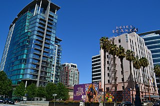
San Jose, officially the City of San José, is an economic, cultural and political center of Silicon Valley, and the largest city in Northern California. With an estimated 2017 population of 1,035,317, it is the third-most populous city in California and the tenth-most populous in United States. Located in the center of the Santa Clara Valley, on the southern shore of San Francisco Bay, San Jose covers an area of 179.97 square miles (466.1 km2). San Jose is the county seat of Santa Clara County, the most affluent county in California and one of the most affluent counties in the United States. San Jose is the most populous city in both the San Francisco Bay Area and the San Jose-San Francisco-Oakland Combined Statistical Area, which contain 7.7 million and 8.7 million people respectively.
The hall itself was built in 1902 on land deeded by Fiachro Fisher from his Coyote Valley estate. From its inception, the building was used as a community meeting place. The Coyote Grange Chapter was founded in 1925 and for many years rented the hall for its meetings. On May5, 1949 the organization bought the building and surrounding gardens and still uses them today for its activities which include monthly dances, expeditions, potluck dinners, and a group for 13- to 17-year-olds, many of whom are home schoolers.
Coyote Valley is a large expanse of farmland, orchards and homes, approximately 7,400 acres (2,995 ha) in size, located in a narrowing of the Santa Clara Valley, in the southernmost part of San Jose, California. The Coyote Valley is targeted for urban development and until March 2008 was undergoing the State of California Specific Plan process in which master planning of the area began. The process was intended to analyze the feasibility of bringing new development to the area, with the participation of planners, environmentalists, engineers, and the general public. Although the North and the Mid-Coyote Valley areas have been planned for urban development since 1961, much controversy surrounds the proposal to build in this valley, which is considered by many to be the last remaining "untouched" open area within San Jose, an open space buffer between the urban City of San Jose and the northward expanding City of Morgan Hill. The Coyote Gap at the extreme north end of Coyote Valley is a critical wildlife corridor for safe passage of large and small mammals from the Diablo Range to the Santa Cruz Mountains because it is the narrowest point between the two mountain ranges.
A potluck is a communal gathering where each guest or group contributes a different, often homemade dish of food to be shared.
Homeschooling, also known as home education is the education of children at home or a variety of other places. Home education is usually conducted by a parent or tutor or online teacher. Many families use less formal ways of educating. "Homeschooling" is the term commonly used in North America, whereas "home education" is commonly used in the United Kingdom, Europe, and in many Commonwealth countries.
The Coyote Grange Hall is also used for meetings of the local 4-H club and other community organizations, and can be rented for private functions.
4-H is a U.S.-based network of youth organizations whose mission is "engaging youth to reach their fullest potential while advancing the field of youth development". Its name is a reference to the occurrence of the initial letter H four times in the organization's original motto ‘head, heart, hands, and health’ which was later incorporated into the fuller pledge officially adopted in 1927. In the United States, the organization is administered by the National Institute of Food and Agriculture of the United States Department of Agriculture (USDA). 4-H Canada is an independent non-profit organization overseeing the operation of branches throughout Canada. Throughout the world, 4-H organizations exist in over 50 countries; the organization and administration varies from country to country. Each of these programs operates independently but cooperatively through international exchanges, global education programs, and communications.
Sources
Coyote Grange on the official web site of the California State Grange. Retrieved 3 August 2014.
Timely Topics[permanent dead link], Newsletter of the 4-H Youth Development Program, University of California's Santa Clara County Cooperative Extension Service and the Santa Clara County 4-H Club Council, April 2006. Retrieved 8 June 2008.
A geographic coordinate system is a coordinate system that enables every location on Earth to be specified by a set of numbers, letters or symbols. The coordinates are often chosen such that one of the numbers represents a vertical position and two or three of the numbers represent a horizontal position; alternatively, a geographic position may be expressed in a combined three-dimensional Cartesian vector. A common choice of coordinates is latitude, longitude and elevation. To specify a location on a plane requires a map projection.
This page is based on this Wikipedia article Text is available under the CC BY-SA 4.0 license; additional terms may apply. Images, videos and audio are available under their respective licenses.
Related Research Articles
Gilroy is a city in Northern California's Santa Clara County, south of Morgan Hill and north of San Benito County. The city's population was 48,821 at the 2010 United States Census.
Santa Clara University is a private Jesuit university in Santa Clara, California. It has 5,499 full-time undergraduate students and 3,130 graduate students. Founded in 1851, Santa Clara University is the oldest operating institution of higher learning in California and the west coast of the United States and has remained in its original location for 167 years. The university's campus surrounds the historic Mission Santa Clara de Asis which traces its founding to 1776. The campus mirrors the Mission's architectural style and provides a fine early example of Mission Revival Architecture. The university is classified as a "Doctoral/Professional" university by Carnegie Classification.
The Santa Clara University School of Law is the law school of Santa Clara University, a Jesuit university in Santa Clara, California, United States, in the Silicon Valley region. The School of Law was founded in 1911. The Jesuit affiliation of the university is manifested in a concern with ethics, social justice, and community service.
Naglee Park is a historic residential neighborhood in San Jose California, to the east of Downtown San Jose and San Jose State University.
Coyote Creek is a river that flows through the Santa Clara Valley in California, United States.
Uvas Canyon County Park is a 1,147-acre (464 ha) natural park located in upper Uvas Canyon on the eastern side of the Santa Cruz Mountains, west of Morgan Hill, California. The park has several small waterfalls, some of which flow perennially, that feed into tributaries confluent with Uvas Creek. The park is part of the Santa Clara County Parks System, and facilitates picnics, hiking and overnight camping. It is one of the few parks in the area that allows dogs in the campgrounds.
The Alameda is an alameda and historic district in San Jose, California, west of Downtown San Jose.
The Coast Line is a railroad line between Burbank, California and the San Francisco Bay Area, roughly along the Pacific Coast. It is the shortest rail route from Los Angeles to the Bay Area.
Agnews Developmental Center was a psychiatric and medical care facility, located in Santa Clara, California.
Bell Station is an unincorporated community located along State Route 152 between Casa de Fruta and Pacheco Pass near the southeast extent of Santa Clara County, California.
Rivermark of Santa Clara is a master planned community in Santa Clara, California. built on a 152-acre (0.62 km2) parcel formerly owned by the State of California and previously used by Agnews Developmental Center. The community comprises retail space, parks, school, apartments, condominiums, townhouses, and houses. The Rivermark area has been described as "upscale", with many young professionals and families as residents.
Santa Teresa County Park is an 1,674-acre (6.77 km2) park located in the hills of South Santa Clara County in San Jose, California, United States. It is operated by the Santa Clara County Parks and Recreation Department. Most of the park consists of non-native grassland and mixed oak woodland. Native wildflowers displays are common in late winter and early spring in the serpentine soil in the northwest and southern sections of the park. Elevations range from 64 m (210 ft) in the northeast section to 352 m (1155 ft) at Coyote Peak in the eastern section. The park offers over 17 miles of unpaved trails for equestrian, hiking and bicycle use. Some of the trails are steep around Coyote Peak. Picnicking by groups and families is a popular activity in Santa Teresa County Park, namely in the Pueblo Day Use area.
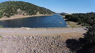
Coyote Dam is a 140-foot (43 m) high, 980-foot (300 m) long, earth and rock dam built in 1936 in Santa Clara County, California, United States, located north of Gilroy.
Hidden Villa is a United States nonprofit educational organization teaching programs on environmental and multicultural awareness. In 1924, Frank and Josephine Duveneck founded this working organic farm and wilderness area on land comprising the upper Adobe Creek watershed on the foothills of Black Mountain in Los Altos Hills, California, part of the Santa Cruz Mountains. Hidden Villa is important historically as the site of the West's first American youth hostel and the nation's first multicultural children's summer camp.
The Japanese American Museum of San Jose (JAMsj) is located at 535 N. Fifth Street in San Jose, in the heart of Japantown. The museum's mission is to collect, preserve, and share Japanese American art, history, and culture with an emphasis on the Greater San Francisco Bay Area.
Hellyer County Park is one of 28 Santa Clara County Parks. The park is located just off of Highway 101 in San Jose, California, United States. The 178-acre (72 ha) park is home to Hellyer Park Velodrome and Cottonwood Lake. Other recreational opportunities at the park include picnicking, hiking, fishing, biking, and a playground. Coyote Creek Parkway is a multi-use trail that is paved for 15 miles (24 km) south to Anderson Lake County Park. Coyote Creek Parkway is a jurisdiction of the Santa Clara County Parks. Coyote Creek Trail continues to the north along Coyote Creek under the jurisdiction of San Jose city parks.
The following is a timeline of the history of San Jose, California, United States.
Coyote Ridge Open Space Preserve" is an 1,831-acre (7.41 km²) publicly owned park in southern Santa Clara County. It is currently undergoing restoration and infrastructure work and is scheduled to open to the public in 2018.