The Mattagami River is a river in Northern Ontario, Canada.

The Kenogami River is a river in the James Bay drainage basin in Thunder Bay and Cochrane districts in Northern Ontario, Canada, which flows north from Long Lake near Longlac to empty into the Albany River. The river is 320 kilometres (199 mi) in length and its name means "long water" in the Cree language. A portion of the river's headwaters have been diverted into the Lake Superior drainage basin.

Balsam Lake is a lake in the City of Kawartha Lakes in Central Ontario, Canada. It is in the Great Lakes Basin, is one of the lakes of the Kawartha Lakes, and is at the summit of the Trent–Severn Waterway.

Kawaweogama Lake is a lake in the James Bay drainage basin in Unorganized Thunder Bay District in northwestern Ontario, Canada, about 35 kilometres (22 mi) east of the community of Savant Lake on Ontario Highway 516, 80 kilometres (50 mi) west of Armstrong on Ontario Highway 527, and 210 kilometres (130 mi) northwest of Thunder Bay. Except for the northwestern shore, the lake is encompassed by Brightsand River Provincial Park.

Lake St. Joseph is a large lake in Kenora District and Thunder Bay District in Northwestern Ontario, Canada. It is in the James Bay drainage basin and is the source of the Albany River. The east end of the lake can be reached using Ontario Highway 599 from the town of Ignace, 260 kilometres (160 mi) to the south on Ontario Highway 17. The nearest town is Pickle Lake, 30 kilometres (19 mi) north along Highway 599.
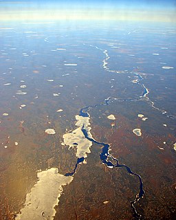
Bamaji Lake is a lake in the Albany River and James Bay drainage basins in Kenora District, Ontario, Canada located about 120 kilometres (75 mi) north of Sioux Lookout. It is about 30 kilometres (19 mi) long and 5 kilometres (3.1 mi) wide at its widest, but typically only 1 kilometre (0.6 mi) wide.
Bolton Lake is a lake in the James Bay drainage basin in the municipality of Black River-Matheson in Cochrane District, Ontario, Canada. It is about 1,200 metres (3,937 ft) long and 800 metres (2,625 ft) wide, and lies at an elevation of 288 metres (945 ft) near the community of Wavell, 1.3 kilometres (0.8 mi) northeast of Ontario Highway 11 and the Ontario Northland Railway main line, and 33 kilometres (21 mi) northwest of the town of Kirkland Lake. The primary outflow is Burdick creek to the Black River, which flows via the Abitibi River and the Moose River to James Bay.
Summit Lake is a lake in the James Bay drainage basin in the Unorganized North Part of Algoma District in northeastern Ontario, Canada. It is the source of the Kabinakagami River, which flows via the Albany River to James Bay. The lake is about 1.0 kilometre (0.6 mi) long and 0.2 kilometres (0.1 mi) wide, lies at an elevation of 442 metres (1,450 ft), and there are no significant inflows.
Summit Lake is a lake in Unorganized Thunder Bay District in Northwestern Ontario, Canada, about 75 kilometres (47 mi) northwest of the community of Nakina, and 22 kilometres (14 mi) northeast of the Auden and Ombabika stops on the Canadian National Railway transcontinental mainline.
Casummit Lake is a lake in Kenora District, Ontario, Canada, about 110 kilometres (68 mi) northeast of the community of Red Lake. The settlement of Casummit and a mine are on the northeast shore of the lake. A fishing outfitter has a cabin on the north shore of the lake.
South Summit Lake is a lake in Thunder Bay, Unorganized, Thunder Bay District, Ontario, Canada, about 40 kilometres (25 mi) north of Lake Nipigon and 60 kilometres (37 mi) northeast of the community of Armstrong.
Crawford Lake is a lake in the Magnetawan River drainage basin in the township of Magnetawan, Almaguin Highlands region, Parry Sound District, Ontario, Canada. It is about 1.7 kilometres (1.1 mi) long and 1 kilometre (0.6 mi) wide, and lies at an elevation of 279 metres (915 ft). The primary inflows are the Neighick River and Wylie Creek. The primary outflow is a channel to Beaver Lake, which flows via The Narrows channel into Ahmic Lake on the Magnetawan River, and thence into Lake Huron.
Crawford Lake is a lake in Rainy River District, Ontario, Canada. It is about 1.5 kilometres (0.9 mi) long and 0.7 kilometres (0.4 mi) wide, and lies at an elevation of 427 metres (1,401 ft).
Crawford Lake is a lake in the Moose River drainage basin in Sudbury District, Ontario, Canada. It is about 0.7 kilometres (0.4 mi) long and 0.5 kilometres (0.3 mi) wide, and lies at an elevation of 361 metres (1,184 ft) about 10 kilometres (6 mi) south of Ontario Highway 101 and 27 kilometres (17 mi) west of Ontario Highway 144.
Crawford Lake is a lake in the Montreal River and Ottawa River drainage basins in Timiskaming District, Ontario, Canada. It is about 0.87 kilometres (0.5 mi) long and 0.62 kilometres (0.4 mi) wide, and lies at an elevation of 374 metres (1,227 ft) about 7 kilometres (4 mi) southwest of the community of Gowganda. The primary outflow, at the northeast, is an unnamed creek to Long Lake, which flows via Gowganda Lake and the Montreal River to Lake Timiskaming on the Ottawa River.
Crawford Lake is a lake in the Montreal River and Ottawa River drainage basins in Timiskaming District, Ontario, Canada. It is about 0.63 kilometres (0.4 mi) long and 0.2 kilometres (0.1 mi) wide, and lies at an elevation of 348 metres (1,142 ft) about 8 kilometres (5 mi) northeast of the community of Gowganda. A short unnamed creek flows in at the north. The primary outflow, at the south, is an unnamed creek towards Lost Lake, which flows via Calcite Creek, Sydney Creek and the Montreal River to Lake Timiskaming on the Ottawa River.

Island Lake is a settlement in the Unorganized North Part of Algoma District in northeastern Ontario, Canada. It is part of the Aweres local services board and is about 5 kilometres (3 mi) northeast of the community of Heyden on Ontario Highway 17. The settlement is at the junction of Ontario Highway 552 and Ontario Highway 556, and the Algoma Central Railway passes through the community.
Montreal Lake is a lake in the Lake Superior drainage basin in Sudbury District, Ontario, Canada, and the source of the Montreal River. It is about 1.5 kilometres (0.9 mi) long and 0.7 kilometres (0.4 mi) wide, and lies at an elevation of 447 metres (1,467 ft) on the north side of the community of Island Lake. The primary outflow, at the east, is the Montreal River, which flows to Lake Superior at Montreal River Harbour.