The Devil's Point is a mountain in the Cairngorms of Scotland, lying to the west of the Lairig Ghru pass. The Gaelic name means "Penis of the Demon". The English name is a result of a visit to the area by Queen Victoria. She asked her local ghillie, John Brown, to translate the name; to avoid embarrassment he gave a euphemistic answer.
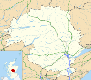
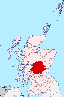
Aberfeldy is a burgh in Perth and Kinross, Scotland, on the River Tay. A small market town, Aberfeldy is located in Highland Perthshire and at the 2001 census had a population of about 1,895. It is also mentioned in a well-known poem by Robert Burns.

Craigentinny is a suburb in the north-east of Edinburgh, Scotland, east of Restalrig and close to Portobello.
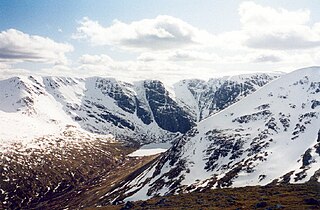
Creag Meagaidh is a mountain on the northern side of Glen Spean in the Highlands of Scotland. It is a complex mountain, taking the form of a flat summit plateau from which five ridges radiate, and is most famed for the cliffs surrounding the corrie of Coire Ardair on the north-eastern face. These crags are a renowned venue for winter and ice climbing, although being somewhat vegetated they are less suited to summer climbing.

Glas Maol is the highest point in the Mounth hills, in the southeastern part of the Highlands of Scotland. The broad, flat summit is divided between the council area of Aberdeenshire, Angus and Perth and Kinross, though the highest point lies wholly within Angus; indeed Glas Maol is the highest point in that council area.

Craigleith is an area of west Edinburgh, Scotland. Its name comes from various forms of Craig of Inverleith, or rock or hill of Inverleith. Much of the Craigleith sandstone was used to build the old and new town houses in Edinburgh as well as many famous buildings including Edinburgh Castle, Holyrood Palace and the statue of Nelson on Nelson's Column in London. Because of its particular hardness, Craigleith Sandstone was also favoured for cutting stones used in the making of cut glass during the Victorian era.
Terregles is a village and civil parish near Dumfries, in Dumfries and Galloway, Scotland. It lies in the former county of Kirkcudbrightshire.
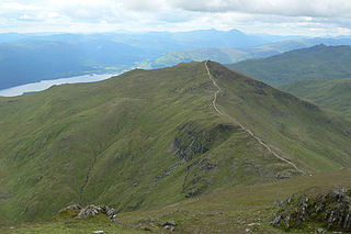
Beinn Ghlas is a mountain in the Southern Highlands of Scotland. It lies on the north shore of Loch Tay and is part of the Ben Lawers Range. It lies on the popular path to Ben Lawers from the National Trust for Scotland car park, with the result that many walkers traverse the summit of Beinn Ghlas without realising it. The popularity of the path meant that it suffered from severe erosion, but it has been reconstructed in recent years.

Glenshee Ski Centre is the largest ski resort in Scotland and is sometimes referred to as the Scottish three glens. It is located in Aberdeenshire and to the north of Spittal of Glenshee, on the A93 road between Blairgowrie and Braemar in the southern Highlands of Scotland. With 22 lifts, 36 runs and limited snowmaking capabilities, it is Britain's largest snowsports resort.

Sir Herbert Eustace Maxwell, 7th Baronet, was a Scottish novelist, essayist, artist, antiquarian, horticulturalist and Conservative politician who sat in the House of Commons from 1880 to 1906.

Stuley is an island lying to the east of South Uist in the Outer Hebrides, Scotland. It lies off the section of coastline between Loch Eynort and Loch Boisdale. It is 45 hectares (0.17 sq mi) and 40 metres (131 ft) at its highest point.

Creag Mhòr is a Scottish mountain which stands in the ancient Forest of Mamlorn deer forest, it is located ten kilometres north east of Tyndrum on the border between the Perth and Kinross and Stirling council areas.
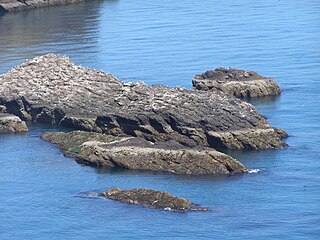
Craiglethy is a small island/skerry off Fowlsheugh on the east coast of Aberdeenshire, Scotland in the North Sea. As it is part of Fowlsheugh, it is an SSSI, with many seabirds and seals living on it. It is also one of the few islands on the east coast of Scotland, along with Mugdrum Island and Inchcape, apart from the Islands of the Forth.
Creag Ghlas Laggan is a hill on the Isle of Arran in south-western Scotland. It is the highest point of the seven-mile-long ridge of land that runs north-west to south-east between the A841 road and the Sound of Bute in the north-eastern part of the island. It is classed as a Marilyn.

Beinn Odhar is a Scottish mountain situated at the northern extremity of the Loch Lomond and the Trossachs National Park. It stands four km (2.5 mi) north of Tyndrum, a location with which it has strong ties, being well seen from the village. The mountain lies on the border between Argyll and Bute and Stirling council areas within the Auch and Invermeran estate.

Meall nan Tarmachan is a mountain in the Southern Highlands of Scotland near Killin just west of Ben Lawers. It is often climbed as part of the Tarmachan ridge, the other peaks of which are Meall Garbh, Beinn nan Eachan and Creag na Caillach ; these three peaks are Tops rather than Munros, and lie to the south-west of Meall nan Tarmachan.

Meall Ghaordaidh is a mountain in the Southern Highlands of Scotland, approximately 10 km north-west of Killin.
Meall Odhar is a mountain in the Scottish Highlands, situated about 3 km to the west of Tyndrum, close to the northern boundary of the Loch Lomond and the Trossachs National Park. Meall Odhar is part of the Tyndrum Hills. With a height of 656 m and a drop of 183 m, it is listed as a Marilyn and a Graham. The name Meall Odhar is from the Gaelic for "dun-coloured round hill".

Rois-bheinn is the joint highest hill in the Scottish region of Moidart, a title it shares with its neighbour Beinn Odhar Bheag.


