
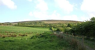
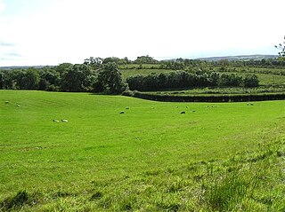
Dromore is a village, townland and civil parish in County Tyrone, Northern Ireland. It is nine miles (15 km) south west of Omagh on the A32 and sixteen miles (26 km) from Enniskillen. Its population as of 2008 is estimated to be 1,258.

Beragh is a village and townland in County Tyrone, Northern Ireland. It is about 8 miles Southeast of Omagh and is in Omagh District Council. The 2001 Census recorded a population of 520.

Carrickmore is a village in County Tyrone, Northern Ireland. It lies in the centre of the county on a raised site colloquially called "Carmen"; between Cookstown, Dungannon and Omagh. An alias name for Carrickmore village is Termon Rock, Termonn being the first element of the parish name Termonmaguirk and rock referring to the rocky hill on which the village is situated. The McGurks were erenaghs or hereditary lay custodians of the parish’s church lands. The site of the former parish church is adjacent to the village of Carrickmore. It is situated in the historic barony of Omagh East and the civil parish of Termonmaguirk. It had a population of 612 in the 2001 Census. In the 2011 Census 2,330 people lived in the Termon Ward, which covers the Carrickmore and Creggan areas.

Drumquin is a small village and townland in County Tyrone, Northern Ireland. It lies between Omagh and Castlederg, on the banks of the Drumquin River (Fairywater). It is situated in the civil parish of Longfield West and the historic barony of Omagh West. It had a population of 291 people in the 2001 Census.

Altamuskin or Altamooskan is a small village and townland in County Tyrone, Northern Ireland. It is situated in the historic barony of Clogher and the civil parish of Errigal Keerogue and covers an area of 1165 acres. In the 2014 Census Altamuskin had a population of 127 people. It lies within the Omagh District Council area and is home to St Bridget's Altamuskin. The population of the townland declined during the 19th century:

Dooish (Irish: Dubhais is a village and townland near Drumquin in County Tyrone, Northern Ireland. The townland is situated in the historic barony of Omagh West and the civil parish of Longfield West and covers an area of 845 acres. In the 2001 Census it had a population of 93 people. It lies within the Omagh District Council area.
Drumnakilly is a small village and townland between Carrickmore and Omagh in County Tyrone, Northern Ireland. In the 2001 Census it had a population of 114 people. The townland is situated in the historic barony of Strabane Upper and the civil parish of Termonmaguirk and covers an area of 1,352 acres. It lies within the Omagh District Council area.
Aghagogan is a townland in County Tyrone, Northern Ireland. It is situated in the historic barony of Omagh East and the civil parish of Termonmaguirk and covers an area of 949 acres.

Aghalunny is a townland in County Tyrone, Northern Ireland. It is situated in the historic barony of Omagh West and the civil parish of Termonamongan and covers an area of 493 acres.
Altanagh is a townland in County Tyrone, Northern Ireland. It is situated in the historic barony of Omagh East and the civil parish of Termonmaguirk and covers an area of 971 acres.
Bullock Park is a townland in County Tyrone, Northern Ireland. It is situated in the historic barony of Omagh West and the civil parish of Longfield West and covers an area of 398 acres.

Carncorran Glebe is a townland in County Tyrone, Northern Ireland. It is situated in the historic barony of Omagh West and the civil parish of Ardstraw and covers an area of 243 acres.

Doocrock is a townland in County Tyrone, Northern Ireland. It is situated in the historic barony of Omagh East and the civil parish of Dromore and covers an area of 426 acres.
Drumsonnus (Irish: Druim sonais is a townland in County Tyrone, Northern Ireland. It is situated in the historic barony of Omagh East and the civil parish of Kilskeery and covers an area of 391 acres.

Garvaghullion is a townland in County Tyrone, Northern Ireland. It is situated in the barony of Omagh West and the civil parish of Longfield East and covers an area of 640 acres.

Kilcroagh is a townland in County Tyrone, Northern Ireland, near Castlederg. It is situated in the historic barony of Omagh West and the civil parish of Urney and covers an area of 351 acres.
Tattycor is a townland in County Tyrone, Northern Ireland. It is situated in the barony of Omagh East and the civil parish of Dromore and covers an area of 355 acres.
Tullymagough is a townland in County Tyrone, Northern Ireland. It is situated in the barony of Omagh East and the civil parish of Dromore and covers an area of 113 acres.
Cloncandra Glebe is a townland in County Tyrone, Northern Ireland. It is situated in the historic barony of Omagh East and the civil parish of Kilskeery and covers an area of 213 acres.

Dartans is a townland in County Tyrone, Northern Ireland. It is situated in the barony of Omagh West and the civil parish of Urney and covers an area of 367 acres.

