Creuzburg

Last updated
Creuzburg
Creuzburg.jpg
Creuzburg Castle
Wappen Creuzburg.svg
Location of Creuzburg
Creuzburg
Germany adm location map.svg
Red pog.svg
Creuzburg
Thuringia location map.svg
Red pog.svg
Creuzburg
Coordinates: 51°3′5″N10°14′41″E / 51.05139°N 10.24472°E / 51.05139; 10.24472
Country Germany
State Thuringia
District Wartburgkreis
Town Amt Creuzburg
Area
  Total35.33 km2 (13.64 sq mi)
Elevation
200 m (700 ft)
Population
 (2018-12-31)
  Total2,305
  Density65/km2 (170/sq mi)
Time zone UTC+01:00 (CET)
  Summer (DST) UTC+02:00 (CEST)
Postal codes
99831
Dialling codes 036926
Vehicle registration WAK
Website www.creuzburg-online.de

Creuzburg is a town and a former municipality on the Werra river in the Wartburgkreis in Thuringia, Germany. Since December 2019, it is part of the town Amt Creuzburg.

Contents

Geography

Creuzburg is in the area known as the Muschelkalk. Three mountains, Wisch, Wallstieg and Ebenauer Köpfe are near the town.

Nearby towns include Treffurt and Eisenach.

History

With a history going back over 1,000 years, Creuzburg is one of the oldest towns in Thuringia. Hill graves in the area of the city demonstrate a settlement beginning at least as early as Carolingian times. The beginnings of the settlement on what became the site of the castle are a result of its position on a major crossroads. The old West-East trade route met at the Werra with the trade route from the south. In the 10th and 11th Centuries, the region was under control of the Fulda Abbey.

The stone Werra Bridge, built in 1225, and the Liborius Chapel, built in 1499 Creuzburg im westthuringischen Wartburgkreis. I.jpg
The stone Werra Bridge, built in 1225, and the Liborius Chapel, built in 1499

In 1137, the city came under control of the Thuringian Ludowinger dynasty. Landgrave Ludwig I acquired it in exchange for a portion of the lands he held in Hesse. Recognizing the strategic and economic importance of the area, his successors made improvements to the area. Landgrave Hermann I began the construction of the castle on the mountain and allowed the many farmers in the area to build the settlement at the base of the mountain. In 1213, Creuzburg was established as a city. A coat of arms was established and a defensive wall was built. The nearby town of Scherbda, which now is part of Creuzburg, was first mentioned as a settlement around a fief in 1229.

The most prosperous time in Creuzburg was during the reign of Landgrave Ludwig IV, the Holy, and his son Hermann II. After the wedding of Ludwig with the daughter of the King of Hungary, Elisabeth, who is now known as St. Elisabeth of Hungary, Creuzburg Castle became the second residence of the Thuringian Landgraves (after the Wartburg). Many festivals were celebrated during this time, and the children of the couple were born in the castle. Ludwig redecorated the castle and built the first stone bridge across the Werra to secure the trade route. Before he left for the Crusades in 1227, he bade farewell to his subjects in a major assembly of the Thuringian nobles in the castle.

The Nikolaikirche, built in 1215 Creuzburg kirche 20051009.jpg
The Nikolaikirche, built in 1215

Ludwig never returned. His brother Heinrich Raspe acted as regent during the childhood of Ludwig's son, Hermann II. Elisabeth left Thuringia and moved back to the Hessian lands, where she later died in Marburg. Upon reaching adulthood, Hermann began his reign as Landgrave of Thuringia and Hesse. Castle remained his residence until his sudden death at the age of 18. His uncle and successor Heinrich Raspe used only the Wartburg as his residence. This, for the city of Creuzburg, as well as the castle, was the end of their times of prosperity. The town sank into economic and cultural anonymity in the following centuries.

Within the German Empire (1871–1918), Creuzburg was part of the Grand Duchy of Saxe-Weimar-Eisenach.

Tourism

Creuzburg with Nikolaikirche tower Creuzburg 01 n.jpg
Creuzburg with Nikolaikirche tower

The Creuzburg Castle, which was a residence of the Ludowing dynasty and a favorite visiting place of St. Elisabeth of Hungary, is one of the top sightseeing destinations. Creuzburg also boasts the oldest bridges north of the Main.

Economy

Beside several hotels and restaurants Creuzburg is also the head office of the Pollmeier Massivholz GmbH & CO. KG. The company is the largest and most efficient hardwood sawmill worldwide.

Transportation

The B 7 highway from Kassel to Eisenach goes through Creuzburg.

Famous residents

Honorary citizen

Personalities who have spent part of their lives in Creuzburg, or have died in Creuzburg

Literature

Related Research Articles

<span class="mw-page-title-main">Eisenach</span> Town in Thuringia, Germany

Eisenach is a town in Thuringia, Germany with 42,000 inhabitants, located 50 kilometres west of Erfurt, 70 km southeast of Kassel and 150 km northeast of Frankfurt. It is the main urban centre of western Thuringia and bordering northeastern Hessian regions, situated near the former Inner German border. A major attraction is Wartburg castle, which has been a UNESCO World Heritage Site since 1999.

<span class="mw-page-title-main">Wartburg</span> Castle in Eisenach, Germany

The Wartburg is a castle originally built in the Middle Ages. It is situated on a precipice of 410 metres (1,350 ft) to the southwest of and overlooking the town of Eisenach, in the state of Thuringia, Germany. It was the home of St. Elisabeth of Hungary, the place where Martin Luther translated the New Testament of the Bible into German, the site of the Wartburg festival of 1817 and the supposed setting for the possibly legendary Sängerkrieg. It was an important inspiration for Ludwig II when he decided to build Neuschwanstein Castle.

<span class="mw-page-title-main">Henry Raspe</span> German nobleman and throne claimant (c. 1204 – 1247)

Henry Raspe was the Landgrave of Thuringia from 1231 until 1239 and again from 1241 until his death. In 1246, with the support of the Papacy, he was elected King of Germany in opposition to Conrad IV, but his contested reign lasted a mere nine months.

Wartburgkreis is a Kreis (district) in the west of Thuringia, Germany. Neighboring districts are the districts Unstrut-Hainich-Kreis, Gotha, Schmalkalden-Meiningen, and the districts Fulda, Hersfeld-Rotenburg and Werra-Meißner-Kreis in Hesse. The district has 30 municipalities, including Eisenach.
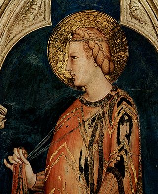
<span class="mw-page-title-main">Elizabeth of Hungary</span> Hungarian princess and Christian saint

Elizabeth of Hungary, also known as Elisabeth of Thuringia, was a princess of the Kingdom of Hungary and the landgravine of Thuringia.

<span class="mw-page-title-main">Saxe-Weimar-Eisenach</span> Historical German state from 1809 to 1920

Saxe-Weimar-Eisenach was a German state, created as a duchy in 1809 by the merger of the Ernestine duchies of Saxe-Weimar and Saxe-Eisenach, which had been in personal union since 1741. It was raised to a grand duchy in 1815 by resolution of the Congress of Vienna. In 1903, it officially changed its name to the Grand Duchy of Saxony, but this name was rarely used. The grand duchy came to an end in the German Revolution of 1918–19 with the other monarchies of the German Empire. It was succeeded by the Free State of Saxe-Weimar-Eisenach, which was merged into the new Free State of Thuringia two years later.

<span class="mw-page-title-main">Schmalkalden</span> Town in Thuringia, Germany

Schmalkalden is a town in the Schmalkalden-Meiningen district, in the southwest of the state of Thuringia, Germany. It is on the southern slope of the Thuringian Forest at the Schmalkalde river, a tributary to the Werra. As of 31 December 2022, the town had a population of 20,065.

<span class="mw-page-title-main">Henry III, Margrave of Meissen</span> Margrave of Meissen

Henry III, called Henry the Illustrious from the House of Wettin was Margrave of Meissen and last Margrave of Lusatia from 1221 until his death; from 1242 also Landgrave of Thuringia.

<span class="mw-page-title-main">Louis IV, Landgrave of Thuringia</span> Landgrave of Thuringia

Louis IV the Saint, a member of the Ludovingian dynasty, was Landgrave of Thuringia and Saxon Count palatine from 1217 until his death. He was the husband of Elizabeth of Hungary.

<span class="mw-page-title-main">Freyburg, Germany</span> Town in Saxony-Anhalt, Germany

Freyburg is a town in the Burgenlandkreis district, in Saxony-Anhalt, Germany. It is situated on the river Unstrut, 9 km northwest of Hanseatic Naumburg, 63 km from Leipzig and 231 km from Berlin. It is part of the Verwaltungsgemeinschaft Unstruttal. On 1 July 2009 it absorbed the former municipalities Pödelist, Schleberoda, Weischütz and Zeuchfeld. Freyburg consists of the Ortsteile (divisions) Dobichau, Freyburg, Nißmitz, Pödelist, Schleberoda, Weischütz, Zeuchfeld and Zscheiplitz.
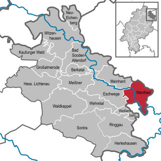
<span class="mw-page-title-main">Wanfried</span> Town in Hesse, Germany

Wanfried is a town in the Werra-Meißner-Kreis in northeasternmost Hesse, Germany. It is classified as a Landstadt, a designation given in Germany to a municipality that is officially a town (Stadt), but whose population is below 5,000. It literally means “country town”.

<span class="mw-page-title-main">Herleshausen</span> Municipality in Hesse, Germany

Herleshausen is a municipality in the Werra-Meißner-Kreis in Hesse, Germany.

<span class="mw-page-title-main">Ludovingians</span>

The Ludovingians or Ludowingians were the ruling dynasty of Thuringia and Hesse during the 11th to 13th centuries.
<span class="mw-page-title-main">Sophie of Thuringia, Duchess of Brabant</span> German noble (1224–1275)

Sophie of Thuringia was the second wife and only Duchess consort of Henry II, Duke of Brabant and Lothier. She was the heiress of Hesse which she passed on to her son, Henry upon her retention of the territory following her partial victory in the War of the Thuringian Succession in which she was one of the belligerents. Sophie was the founder of the Brabant dynasty of Hesse.

The Duchy of Thuringia was an eastern frontier march of the Merovingian kingdom of Austrasia, established about 631 by King Dagobert I after his troops had been defeated by the forces of the Slavic confederation of Samo at the Battle of Wogastisburg. It was recreated in the Carolingian Empire and its dukes were appointed by the king until it was absorbed by the Saxon dukes in 908. From about 1111/12 the territory was ruled by the Landgraves of Thuringia as Princes of the Holy Roman Empire. When Frederick IV, the last independent ruler of Thuringia died in 1440, the territory passed to his nephew, the Saxon elector Frederick II.

<span class="mw-page-title-main">Louis II, Landgrave of Thuringia</span>

Ludwig II, Landgrave of Thuringia, nicknamed Louis the Iron.
<span class="mw-page-title-main">Judith of Hohenstaufen</span> Landgravine of Thuringia

Judith of Hohenstaufen, also known as Judith of Hohenstaufen or Judith of Swabia, a member of the Hohenstaufen dynasty, was Landgravine of Thuringia from 1150 until 1172 by her marriage with the Ludovingian landgrave Louis II. She was baptized as Judith, but was commonly called Jutta or Guta. Sometimes the Latinate form Clementia was used, or Claritia or Claricia.

<span class="mw-page-title-main">Eisenach Charterhouse</span> Former monastery in Thuringia

Eisenach Charterhouse is a former charterhouse, or Carthusian monastery, in Eisenach in Thüringia, Germany, founded in 1378 and suppressed in 1525.

The Brabant Road, Cologne to Leipzig Road or Liege Road is an ancient road which, during the Middle Ages and Early Modern Period, was one of the most important continental east-west oriented military and trade routes. It ran from the eponymous Duchy of Brabant to Leipzig.

Hermann Hahn was a German architect. Hahn lived and worked in Eisenach, where he reached importance, particularly through his plans (designs) of numerous completed villas in Eisenach's south quarter. These mansion districts were established on the hillsides of Mariental valley in the construction boom between 1850 and 1914.

References