Related Research Articles
Bingley is a market town and civil parish in the metropolitan borough of the City of Bradford, West Yorkshire, England, on the River Aire and the Leeds and Liverpool Canal, which had a population of 18,294 at the 2011 Census.

Jervaulx Abbey in East Witton, 14 miles north-west of the city of Ripon, was one of the great Cistercian abbeys of Yorkshire, England, dedicated to St Mary in 1156. It is a Grade I listed building.
The East Riding of Yorkshire, often shortened to the East Riding and alternatively known as East Yorkshire, is a ceremonial county in the Yorkshire and the Humber region of England. It borders North Yorkshire to the north and west, South Yorkshire to the south-west, and Lincolnshire to the south across the Humber Estuary. The city of Kingston upon Hull is the largest settlement.
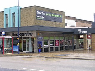
Armley is a district in the west of Leeds, West Yorkshire, England. It starts less than 1 mile (1.6 km) from Leeds city centre. Like much of Leeds, Armley grew in the Industrial Revolution and had several mills, one of which now houses the Leeds Industrial Museum at Armley Mills. Armley is predominantly and historically a largely working class area of the city, still retains many smaller industrial businesses, and has many rows of back-to-back terraced houses.

Tadcaster is a market town and civil parish in North Yorkshire, England, 12 miles (19 km) north-east of Leeds and 10 miles (16 km) south-west of York. Its historical importance from Roman times onward was largely as the lowest road crossing-point on the River Wharfe until the construction of the A64 Tadcaster by-pass some 660 yards (600 m) to the south, in 1978. There are two rail crossings downstream of the town before the Wharfe joins the River Ouse near Cawood.

Royston is a suburban village within the Metropolitan borough of Barnsley, in South Yorkshire, England. Historically, the village formed part of the West Riding of Yorkshire, but was incorporated into the Metropolitan borough of Barnsley in 1974 and is now on the border with West Yorkshire. It is part of the Barnsley Central borough constituency, and has a population of 10,728. It is situated 4 miles (6.4 km) north-east of Barnsley, and 6 miles (9.7 km) south-east of Wakefield.

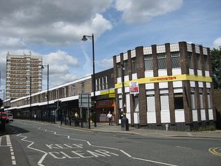
Bramley is a district in west Leeds, West Yorkshire, England. It is part of the City of Leeds Ward of Bramley and Stanningley with a population of 21,334 at the 2011 Census. The area is an old industrial area with much 19th century architecture and 20th century council housing in the east and private suburban housing in the west.
Kildwick, or Kildwick-in-Craven, is a village and civil parish of the district of Craven in North Yorkshire, England. It is situated between Skipton and Keighley and had a population of 191 in 2001, rising slightly to 194 at the 2011 census. Kildwick is a landmark as where the major road from Keighley to Skipton crosses the River Aire. The village's amenities include a primary school, church and public house.

Barwick-in-Elmet is a village in West Yorkshire, 7 miles (11 km) east of Leeds city centre. It is one of only three places in the area to be explicitly associated with the ancient Romano-British kingdom of Elmet, the others being Scholes-in-Elmet and Sherburn-in-Elmet.

Cherry Burton is a village and civil parish in the East Riding of Yorkshire, England. It is approximately 3 miles (5 km) north-west of the market town of Beverley, 9 miles (14 km) east of Market Weighton and 11 miles (18 km) south west of Driffield. The village lies on the eastern edge of the Yorkshire Wolds and lies to the west of the B1248 road.

Kippax is a village and civil parish in the City of Leeds metropolitan borough, West Yorkshire, England. It is situated to the east of the city, near to Garforth and Great Preston. The Kippax and Methley ward of Leeds City Council was part of the former UK Parliament constituency of Elmet, which became Elmet and Rothwell at the 2010 UK general election. The population of Kippax parish at the 2011 Census was 9,785. Kippax was a separate civil parish, in Tadcaster Rural District, until 1939, when it was annexed to Garforth. It re-acquired civil parish status and a parish council on 1 April 2004.

Slaidburn is a village and civil parish within the Ribble Valley district of Lancashire, England. The parish covers just over 5,000 acres of the Forest of Bowland.

Calton is a village and civil parish in the Craven district of North Yorkshire, England, on the River Aire in Airedale. In both the 2001 and 2011 Censuses the population was less than 100, so details were included in the civil parish of Flasby with Winterburn. In 2015, North Yorkshire County Council estimated the population of the village to be 60.

Hayes is an English language surname. In the United States Census, 1990, Hayes was the 100th most common surname recorded. The oldest record of the surname dates to 1197 in the Eynsham Cartulary of Oxfordshire, where it appears in the form Heise. There are nineteen coats of arms assumed by or granted to individuals with this or a similar surname. Though primarily a surname, "Hayes" sometimes appears as a given name in census records.
Farrar is a surname, an occupational surname for a blacksmith or ironworker derived from the Latin ferrarius, Middle English Ferror or Anglo-Norman ferrur. Alternate spellings are Farrer, Ferrar and Farrow.

Henry Jenkins was an English supercentenarian claimant said to have been 169 years old at his death.
One theory is that Hampson is an Irish surname. The small clan of O’hAmhsaigh (O’Hampsey) had become O'Hamson by 1659, when it is recorded in the census of 1659 as one of the principal Irish surnames in the barony of Keenaght, and as O'Hampson and Hampson it is found in the contemporary Hearth Money Rolls for County Londonderry.

Great Mitton is a village and a civil parish in the Ribble Valley, Lancashire, England. It is separated from the civil parish of Little Mitton by the River Ribble, both lie about three miles from the town of Clitheroe. The combined population of both civil parishes at the 2011 census was 266. In total, Great and Little Mitton cover less than 2000 acres of the Forest of Bowland, making it the smallest township in the Forest. Historically, the village is part of the West Riding of Yorkshire, but was transferred to Lancashire for administrative purposes on 1 April 1974, under the provisions of the Local Government Act 1972.
Gotts is a surname which occurs in the UK originating around Norfolk. There are about 800 bearers of the surname in England. It now occurs in other parts of the world through migration. It is distinct from the similar name Gott, though there appear to be common sources around the 14th century. There are earlier occurrences of the name in 12th and 13th centuries, but no direct linkage has been established from these records to known holders of the name.
Ryan Mark Croasdale is an English professional footballer who plays as a midfielder for club Stockport County.
References
- ↑ "Croasdale Name Meaning and History". Ancestry.com . Retrieved 11 December 2008.
- 1 2 Reaney, Percy Hilde; Wilson, Richard Middlewood (2006). A Dictionary of English Surnames (PDF) (3rd ed.). London: Routledge. pp. 803–804. ISBN 0-203-99355-1.
- ↑ "Yorkshire: Subsidy Rolls (Poll Tax) for the year 1379". GENUKI (www.genuki.org). Retrieved 14 December 2008.
- ↑ "Croasdale One-Name Study". Guild of One-Name Studies . Retrieved 11 December 2008.