
Crockernwell is a small village with a Methodist church. It is located 2 miles west of Cheriton Bishop and 12 miles west of Exeter, Devon, England. [1]
Crockernwell is a small village with a Methodist church. It is located 2 miles west of Cheriton Bishop and 12 miles west of Exeter, Devon, England. [1]

The Walkham is a river whose source is on Dartmoor, Devon, England. It rises in the wide gap between Roos Tor and Great Mis Tor and flows almost due south for approximately 3 miles (4.8 km) leaving the tors and thus National Park behind then south-west for 1 mile (1.6 km) past Woodtown. The river then reaches a village, Horrabridge, with a small compact network of streets mainly on the south or left bank. It receives most of its tributaries which are unnamed headwaters along its south-flowing inception, draining the near side of two series of six tors (peaks) to the west ending in Pew Tor at 320 metres and likewise to the east ending in Leeden Tor at 389 metres. In absolute distance, 2 miles (3.2 km) west of the village and the same south of the small well-preserved town of Tavistock by a footbridge on the West Devon Way the Walkham joins the Tavy which discharges into the Tamar Estuary north of the Plymouth conurbation after a fast descent around wide hillsides, a few miles south.

Bickington is a village and civil parish in the Teignbridge district of Devon, England, on the east edge of the Dartmoor National Park. At the 2001 census it had a population of 311. The village is about five miles west of Newton Abbot, on the River Lemon. The church is 15th century; its lychgate has a room over it.
Bondleigh is a village and civil parish in the West Devon district of Devon, England, on the River Taw, north of North Tawton. According to the 2011 census it had a population of 167.

Tedburn St Mary is a village and civil parish in the Teignbridge district of Devon, England, approximately 8 miles west of Exeter. It has a population of approximately 1500. The village is the principal population centre of the electoral ward called Teignbridge North. The population of the ward at the 2011 census is 2,715.

Cruwys Morchard is an ecclesiastical and civil parish in the Mid Devon district of the county of Devon in England. It is located about four to five miles west of Tiverton along the road to Witheridge. The parish covers about 5,765 acres (23.33 km2) of land, and comprises a number of scattered houses and farms, and three small hamlets, Pennymoor, Way Village and Nomansland. The church and the manor house are in the centre of the parish. The population at the time of the 2000 census was 461. The parish takes its name from the Cruwys family who have been Lords of the Manor here since the reign of King John (1199–1216).
Bradford is a village and civil parish in the local government district of Torridge, Devon, England. The parish, which lies about six miles east of the town of Holsworthy has part of its eastern boundary formed by the River Torridge, and it is surrounded clockwise from the north by the parishes of Milton Damerel, Shebbear, Black Torrington, Ashwater, Cookbury and Thornbury. In 2001 its population was 359, compared to 280 in 1901.

Devon County Council is the county council administering the English county of Devon. Based in the city of Exeter, the council covers the non-metropolitan county area of Devon. Members of the council (councillors) are elected every four years to represent the electorate of each county division, almost all being nominated by the major national political parties.

Marsh Green is a small village about 8 miles east of Exeter and 4 miles west of Ottery St Mary in East Devon, England, at OS grid reference SY042936.
Chudleigh Cavern is a limestone cave outside the town of Chudleigh in Devon, England. The cave is deep and contains stalactites. A small part is open to the public as a show cave. The rest is open only to experienced cavers.

Throwleigh is a village and civil parish located 3 miles from Chagford and 6 miles from Okehampton, in the West Devon district, in the county of Devon, England. The parish incorporates the village of Throwleigh and the hamlets of Wonson, Providence, and Murchington, whose combined population is approximately 350.

Lamerton is a village and civil parish located 3 miles north-west of the town of Tavistock in Devon, England. The village's school is called Lamerton Church of England Voluntary Controlled Primary School; affiliated with the Church of England, it enrols about 50 children aged 5–11.

North Bovey is a village and civil parish situated on the south-eastern side of Dartmoor National Park, Devon, England, about 11 miles WSW of the city of Exeter and 1.5 miles SSW of Moretonhampstead. The village lies above the eastern bank of the River Bovey from which it takes its name. In 2001 the population of the parish was 274, compared to 418 in 1901 and 519 in 1801.

Pancrasweek is a civil parish and hamlet in the far west of Devon, England forming part of the local government district of Torridge and lying about three miles north west of the town of Holsworthy.

Merton is a village, ecclesiastical parish, former manor and civil parish administered by the local government district of Torridge, Devon, England. The parish, which lies about five miles south east of the town of Great Torrington, is surrounded clockwise from the north by the parishes of Little Torrington, Beaford, Dolton, Huish, Petrockstowe and Peters Marland. In 2001 its population was 331, down from the 507 residents it had in 1901. The eastern and northern boundaries of the parish follow the loops of the River Torridge and the other sides are defined by the River Mere. The village forms part of the electoral ward of Clinton. The population at the 2011 census was 1,537.

Seale-Hayne College was an agricultural college in Devon, England, which operated from 1919 to 2005. It was the only agricultural college in the United Kingdom whose buildings were purpose designed and built. It was located 3 miles from Newton Abbot.

Frogmore and Sherford is a civil parish in Devon, England. Within it are the villages of Frogmore and Sherford. The parish was created in 1986 from Sherford and parts of South Pool and Charleton.

Halwell and Moreleigh is a civil parish in Devon, England. It comprises the villages of Halwell and Moreleigh.

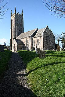
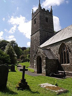
Clannaborough is a parish in the county of Devon, England, situated about 5+1⁄2 miles north-west of the town of Crediton and 11 miles north-east of Okehampton. No village exists, only scattered farmhouses, including Clannaborough Barton and the bartons of Appledore and Walson, all three estates listed in the Domesday Book of 1066. Walson was the birthplace of Christopher Lethbridge (d.1670), Mayor of Exeter in 1660, who was lord of the manor of nearby Bow. The parish church is dedicated to St Petrock.
Penhallick Wharf is a disused coastal loading dock between Tintagel Castle and Trebarwith Strand on the north coast of Cornwall in South West England. The wharf served the Tintagel Slate Quarries, particularly those without easy access to the loading beach at Tintagel Haven. These include Caroline, Dria, Bagalow and possibly Lambshouse and Gull Point quarries.
Coordinates: 50°42′58″N3°45′54″W / 50.716°N 3.765°W
| | This Devon location article is a stub. You can help Wikipedia by expanding it. |