Mullett Lake is a lake in Cheboygan County in the U.S. state of Michigan. The lake is named after John Mullett, who, together with William A. Burt, made a federal survey of the area from 1840 to 1843. A neighboring lake was named after Burt. Historically, Mullett Lake has been recorded as Mullet Lake, Mullet's Lake, and Mullett's Lake on maps and documents.

The Bitterroot River is a northward flowing 84-mile (135 km) river running through the Bitterroot Valley, from the confluence of its West and East forks near Conner in southern Ravalli County to its confluence with the Clark Fork River near Missoula in Missoula County, in western Montana. The Clark Fork River is tributary to the Columbia River and ultimately, the Pacific Ocean. The Bitterroot River is a Blue Ribbon trout fishery with a healthy population of native westslope cutthroat trout and bull trout. It is the third most fly fished river in Montana behind the Madison and Big Horn Rivers.
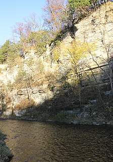
The Root River flows for 80 miles (130 km) through the Driftless Area of southeastern Minnesota and is a tributary of the Upper Mississippi River. The Root River is formed by three branches, the North, South and Middle branches of the Root River and the South Fork Root River. It is an excellent river for canoeing and fishing. The gentle to moderate flowing river drops an average of 3.4 ft/mile from Chatfield, Minnesota, to its pour point in the Mississippi River into Navigation Pool 7 just south of La Crosse, Wisconsin and east of Hokah, Minnesota.

Slate Run is a 7.3-mile-long (11.7 km) tributary of Pine Creek in Tioga and Lycoming counties, Pennsylvania in the United States.

Waterloo Creek is a 9.7-mile-long (15.6 km) tributary of the Upper Iowa River, with a watershed covering 48.3 square miles (125 km2). It rises as Bee Creek in Houston County, Minnesota, southwest of the city of Spring Grove, flowing generally in a southeasterly direction, crossing into Waterloo Township in Allamakee County, Iowa, where it becomes Waterloo Creek and takes a generally north-south route to its confluence with Bear Creek, just before entering the Upper Iowa River. Iowa Highway 76 parallels the stream until crossing the river. The town of Dorchester, Iowa is the only settlement alongside it.

Bear Creek is an 11.9-mile-long (19.2 km) tributary of the Upper Iowa River, joining Waterloo Creek for a short distance before entering the Upper Iowa in Waterloo Township just east of where Iowa Highway 76 crosses the river. Its branches are acclaimed trout fishing streams.

The Whitewater River is a 16.6-mile-long (26.7 km) tributary of the Upper Mississippi River which flows through the Driftless Area of Minnesota, reaching its mouth in Wabasha County at the community of Weaver opposite Buffalo, Wisconsin. The nearest towns are Altura, Saint Charles, and Elba. The region hosts endangered native dry oak savannas, semiforested areas that seem to have been dependent on fire for their well-being.

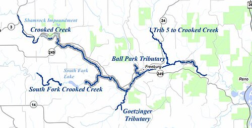
Reno is an unincorporated community in Crooked Creek Township, Houston County, Minnesota, United States.
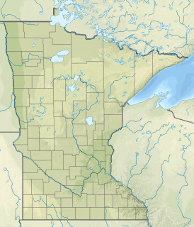
Hay Creek is a small trout stream in southeastern Minnesota. It has its headwaters west of Goodhue and empties into the Mississippi River just to the north of Red Wing. It runs 25.1 miles (40.4 km), over half of which is a Minnesota designated trout stream. Like the Vermillion River, Hay Creek receives extensive fishing pressure due to its proximity to Minneapolis–St. Paul.
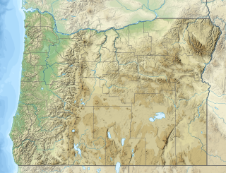
Willow Creek is a tributary, about 26 miles (42 km) long, of the Deschutes River in central Oregon in the United States. Arising near Foley Butte in the western Ochoco Mountains in Crook County, it flows generally northwest into Jefferson County and through the Crooked River National Grassland. The creek continues through the city of Madras and becomes the dividing line between two plateaus, Agency Plains and Little Agency Plains. It then enters the Deschutes above Pelton Dam and its impoundment, Lake Simtustus, about 105 miles (169 km) from the river's confluence with the Columbia River.
The East Swan River is a 24.2-mile-long (38.9 km) tributary of the Saint Louis River in St. Louis County, Minnesota, Minnesota, United States. As of 2021, there is an angling easement on the river, however trout fishing is considered marginal. Some efforts have been made in stocking the river with brown trout, however those efforts have been met with limited success.
Pine Creek is a 23.7-mile-long (38.1 km) tributary of the Mississippi River in Winona and Houston counties, Minnesota, United States. Pine Creek joins the Mississippi southeast of La Crescent, Minnesota, directly across from La Crosse, Wisconsin.

Crooked Creek is an unincorporated community and census-designated place (CDP) in Logan County, West Virginia, United States. The CDP was first drawn for the 2020 census.
Rush Creek is a stream in Fillmore and Winona counties, in the U.S. state of Minnesota. It is a tributary of the Root River, which it joins in Rushford, Minnesota.

Camp Creek is a stream in Fillmore County, in the U.S. state of Minnesota. It is a tributary of the South Branch Root River. Camp Creek was named from the fact pioneer settlers camped upon its banks.

Badger Creek is a stream in Houston County, in the U.S. state of Minnesota. It is a tributary of the South Fork Root River, which it meets east of Houston, Minnesota. Badger Creek was named for the badgers once common in the area.
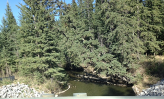
The Raven River or South Raven River is a major tributary of the Red Deer River located in Central-Western Alberta, Canada. The river is located in both the Clearwater County and Red Deer County.

New Hartford is an unincorporated community in New Hartford Township, Winona County, Minnesota, United States. The Pine Creek flows through New Hartford.
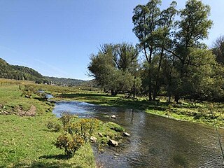
Pine Creek is a stream in Fillmore and Winona counties, in the U.S. state of Minnesota. It is a tributary of the Rush Creek, which is a tributary of the Root River. It joins the Rush Creek in the extreme north of Rushford, Minnesota. Tributaries of Pine Creek are Cooledge Creek and Hemmingway Creek.

